
Delamere Forest is a large wood in the village of Delamere in Cheshire, England. The woodland, which is managed by Forestry England, covers an area of 972 hectares making it the largest area of woodland in the county. It contains a mixture of deciduous and evergreen trees.

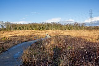
The Great Fen is a habitat restoration project being undertaken on The Fens in the county of Cambridgeshire in the United Kingdom. It is one of the largest restoration projects in the country, and aims to create a 3,700 hectare wetland and aims to connect Woodwalton Fen National Nature Reserve (NNR), Holme Fen NNR and other nature reserves to create a larger site with conservation benefits for wildlife and socio-economic benefits for people.
Lindow Common is a Site of Special Scientific Interest (SSSI) located on the western edge of the town of Wilmslow, Cheshire, in the northwest of England. It is also designated a Local Nature Reserve.

Thurstaston Common is an area of almost 250 acres (100 ha) of parklands, wood and heath between Frankby and Thurstaston, on the Wirral Peninsula in North West England. The common is jointly owned by the National Trust and the Metropolitan Borough of Wirral. Royden Country Park is nearby and offers additional facilities.
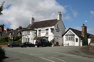
Wybunbury is a village and civil parish in the unitary authority of Cheshire East and the ceremonial county of Cheshire, England. The village lies 3¼ miles to the south east of Nantwich and 3¾ miles to the south of Crewe. The parish also includes the settlements of Clannor Heath, Daisy Hill, The Flag, Pinfold and parts of Blakelow, Haymoor Green and Howbeck Bank. Nearby villages include Hough, Shavington, Stapeley and Walgherton. The A51 runs east–west through the south-western corner of the parish.
Flanders Moss is an area of raised bog lying in the Carse of Forth in west Stirlingshire, Scotland. The villages of Thornhill and Port of Menteith lie to the north with the villages of Kippen and Buchlyvie lying to the south. The moss is a National Nature Reserve, managed by NatureScot. Formed on the Carse of Stirling over 8000 years ago, it is an internationally important habitat currently undergoing active restoration. The eastern part of Flanders Moss is the largest raised bog in Europe to remain in a predominantly near-natural state.
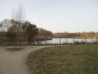
Hatchmere is a small mere and nature reserve in Delamere Forest, southeast of Frodsham, Cheshire, England. It is also the name of a hamlet near the village of Norley.
Sound Heath, also known as Sound Common, is an area of common land in Sound, near Nantwich in Cheshire, England, which includes heathland, grassland, scrub, woodland and wetland habitats. The majority of the area is designated a Site of Special Scientific Interest and a Local Nature Reserve.

Moorhouse and Cross Fell is a Site of Special Scientific Interest covering an extensive area of moorland in the Wear Valley district of west County Durham and the Eden district of Cumbria, England. It is contiguous with Upper Teesdale SSSI to the east and Appleby Fells SSSI to the south. The area covered extends roughly from an arc through the villages of Gamblesby, Leadgate and Garrigill southward as far as Milburn in the west and Cow Green Reservoir in the east. It includes the whole of Cross Fell, the summit of which, at 893 metres asl, is the highest point in the Pennines and in England outside the Lake District.

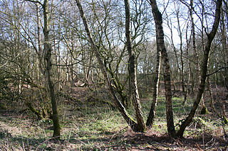
Abbotts Moss is a 12-hectare (30-acre) nature reserve near Delamere Forest, northwest of Winsford, Cheshire. It is managed by the Cheshire Wildlife Trust under lease from the Forestry Commission and lies within a larger Site of Special Scientific Interest (SSSI). The reserve is south of the A556 road near Sandiway and is divided in two by the Whitegate Way, a former railway line now used as a footpath and bridleway.

Black Lake is a nature reserve in Delamere Forest, Cheshire, England. It lies in the southwestern corner of the forest, just south of the Manchester–Chester railway. It is managed by the Cheshire Wildlife Trust (CWT) on behalf of the Forestry Commission, and as a Site of Special Scientific Interest (SSSI) is monitored by Natural England.
Danes Moss Nature Reserve is a 13.4-hectare (33-acre) nature reserve south of Macclesfield, Cheshire, England. A Site of Special Scientific Interest, it is managed by the Cheshire Wildlife Trust.

Upper Wye Gorge is a Site of Special Scientific Interest (SSSI), noted for its biological and geological characteristics, around Symonds Yat in the Upper Wye Valley on the Wales–England border. The site is listed in the 'Forest of Dean Local Plan Review' as a Key Wildlife Site (KWS).

Astridge Wood is a 19.42-hectare (48.0-acre) biological Site of Special Scientific Interest in Gloucestershire, England, notified in 1985. The site is listed in the 'Forest of Dean Local Plan Review' as a Key Wildlife Site (KWS).

Highbury Wood is a 50.74-hectare (125.4-acre) biological Site of Special Scientific Interest in Gloucestershire, notified in 1983.

Hartland Moor is a Site of Special Scientific Interest (SSSI) on the south side of Poole Harbour near the town of Wareham in Dorset, England. It consists of lowland heathland.

Moine Mhòr encompasses a large area of raised bog in the Kilmartin Glen area of Argyll and Bute, Scotland. As well as raised bog there are areas of saltmarsh, brackish grassland, alder carr, fen and woodland, and the variety of habitats at Moine Mhòr provide important habitats for a variety of animal and plant species. The area was declared a national nature reserve (NNR) in 1987, and is now owned and managed by NatureScot. According to NatureScot lowland raised bogs like Moine Mhòr are some of the rarest and most threatened natural wildlife habitats in Europe, due to removal of peat, afforestation and reclamation of farmland.

Hatherton Flush is a Site of Special Scientific Interest (SSSI) by the River Weaver in Hatherton, near Wybunbury, Cheshire, England. It is protected for its variety of wetland plants. Species found at the site include the locally rare plants marsh helleborine, marsh lousewort and tubular water dropwort. Hatherton Flush is the largest example of this kind of flush in the county. The site was assessed as being in an "unfavourable"/"recovering" condition in 2008.

