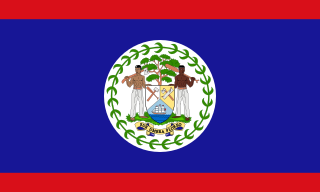
Belize is a country on the north-eastern coast of Central America. It is bordered by Mexico to the north, the Caribbean Sea to the east, and Guatemala to the west and south. It also shares a water boundary with Honduras to the southeast. It has an area of 22,970 square kilometres (8,867 sq mi) and a population of 441,471 (2022). Its mainland is about 290 km (180 mi) long and 110 km (68 mi) wide. It is the least populated and least densely populated country in Central America. Its population growth rate of 1.87% per year is the second-highest in the region and one of the highest in the Western Hemisphere. Its capital is Belmopan, and its largest city is the namesake city of Belize City. Belize is often thought of as a Caribbean country in Central America because it has a history similar to that of English-speaking Caribbean nations. Belize's institutions and official language reflect its history as a British colony.

In agriculture, a milpa is a field for growing food crops and a crop-growing system used throughout Mesoamerica, especially in the Yucatán peninsula, in Mexico. The word milpa derives from the Nahuatl phrase mil-pa. Based on the agronomy of the Maya and of other Mesoamerican peoples, the milpa system is used to produce crops of maize, beans, and squash without employing artificial pesticides and artificial fertilizers.

The hickatee or in Spanish tortuga blanca, also called the Central American river turtle, is the only living species in the family Dermatemydidae. The species is found in the Atlantic drainages of Central America, specifically Belize, Guatemala, southern Mexico and probably Honduras. It is a relatively large-bodied species, with records of 60 cm (24 in) straight carapace length and weights of 22 kg (49 lb); although most individuals are smaller. This is a herbivorous and almost completely aquatic turtle that does not even surface to bask. Bizarrely for reptiles, the eggs can remain viable even after being underwater for weeks -in the recent past, some scientists mistakenly claimed it nests underwater, likely due to visiting Central America during a frequent flood, when nests are often submerged.

The Maya are an ethnolinguistic group of indigenous peoples of Mesoamerica. The ancient Maya civilization was formed by members of this group, and today's Maya are generally descended from people who lived within that historical region. Today they inhabit southern Mexico, Guatemala, Belize, El Salvador, Nicaragua, and Honduras. "Maya" is a modern collective term for the peoples of the region; however, the term was not historically used by the indigenous populations themselves. There was no common sense of identity or political unity among the distinct populations, societies and ethnic groups because they each had their own particular traditions, cultures and historical identity.

The Lacandon Jungle is an area of rainforest which stretches from Chiapas, Mexico, into Guatemala. The heart of this rainforest is located in the Montes Azules Biosphere Reserve in Chiapas near the border with Guatemala in the Montañas del Oriente region of the state. Although much of the jungle outside the reserve has been cleared, the Lacandon is still one of the largest montane rainforests in Mexico. It contains 1,500 tree species, 33% of all Mexican bird species, 25% of all Mexican animal species, 56% of all Mexican diurnal butterflies and 16% of all Mexico's fish species.

The Calakmul Biosphere Reserve is located at the base of the Yucatán Peninsula in Mexico, in Calakmul Municipality in the state of Campeche, bordering the Guatemalan department of El Petén to the south. It occupies 7,231 km2 (2,792 sq mi) and includes about 12% of the subperennial jungles of Mexico. The Reserve, which was established in 1989, is one of the largest protected areas in Mexico, covering more than 14% of the state. The important pre-Columbian Maya civilization archaeological site of Calakmul, one of the largest-known Maya sites, is located in the Biosphere Reserve.

The Maya Biosphere Reserve is a nature reserve in Guatemala managed by Guatemala's National Council of Protected Areas (CONAP). The Maya Biosphere Reserve covers an area of 21,602 km², one-fifth of the country's total land area.
The flora of Belize is highly diverse by regional standards, given the country's small geographical extent. Situated on the Caribbean coast of northern Central America the flora and vegetation have been intimately intertwined with Belize's history. The nation itself grew out of British timber extraction activities from the 17th century onwards, at first for logwood and later for mahogany, fondly called "red gold" because of its high cost and was much sought after by European aristocracy. Central America generally is thought to have gained much of it characteristic flora during the "Great American interchange" during which time South American elements migrated north after the geological closure of the isthmus of Panama. Few Amazonian elements penetrate as far north as Belize and in species composition the forests of Belize are most similar to the forests of the Petén (Guatemala) and the Yucatán (Mexico).

The Mirador Basin is a hypothesized geological depression found in the remote rainforest of the northern department of Petén, Guatemala. Mirador Basin consists of two true basins, consisting of shallowly sloping terrain dominated by low-lying swamps called bajos; one draining into the San Pedro River and the other into the Candelaria River. The basin is surrounded by rugged karstic limestone hills on the east and south, forming a triangular geographical "trough" covering more than 2,169 km2 (837 sq mi). The geological formation of the landscape, as well as the significance of the formation, are the subject of some controversy in Northern Guatemala. NASA Shuttle Radar Topography Mission (SRTM) data indicate no depression in the area.
Sierra de las Minas is a mountain range in eastern Guatemala, extending 130 km west of the Lake Izabal. It is 15–30 km wide and bordered by the valleys of the rivers Polochic in the north and the Motagua in the south. Its western border is marked by the Salamá River valley which separates it from the Chuacús mountain range. The highest peak is Cerro Raxón at 3,015 m. The Sierra's rich deposits of jade and marble have been mined throughout the past centuries. These small scale mining activities also explain the name of the mountain range.

The Petén–Veracruz moist forests is an ecoregion of the tropical and subtropical moist broadleaf forest biome found in Belize, Guatemala, and Mexico.
Chiquibul National Park is Belize's largest national park. It is 1,073 km2 (414 sq mi) in size. The park is located in Belize's Cayo District. The national park surrounds Caracol, a Mayan city. Caracol has been designated as an archaeological reserve and is not included within the park's total area. Chiquibul Forest Reserve is adjacent to the park.

Chamaedorea elegans, the neanthe bella palm or parlour palm, is a species of small palm tree native to the rainforests in Southern Mexico and Guatemala. The parlor palm is one of the most extensively sold houseplant palms in the world. It is one of several species with leaves that are harvested as xate.

Qʼeqchiʼ are a Maya people of Guatemala and Belize. Their indigenous language is the Qʼeqchiʼ language.

Mapastepec is a town and municipality in the Mexican state of Chiapas in southern Mexico. Its name derives from the place name mapachtepec, "Hill of the Raccoon", a compound of the Nahuatl words mapachi ("raccoon") and tepetl ("mountain").
The Rio Bravo Conservation and Management Area is a nature reserve located in northwestern Belize. Rio Bravo, as it is known, was established by Programme for Belize in 1988 with the purchase of 110,044 acres of land from Gallon Jug Agroindustries. With logging encroachment imminent in 1989, the Nature Conservancy joined Programme for Belize to protect the land. Additional land donations from Coca-Cola Foods, Inc. and purchases from New River Enterprises Ltd. enlarged the protected area to 230,875 acres (934.32 km2). Rio Bravo is the largest terrestrial conservation area in Belize, comprising 4% of the country's total land area.

The National Council for Protected Areas is the government agency of that has as its mission the conservation and the sustainable use of the biological diversity and protected areas of Guatemala. CONAP was created by Decree 4-89, or the Law of Protected Areas gave jurisdiction to over the System of Protected Areas of Guatemala, which is the conglomeration of all protected areas, and those under special protection in the country.
The Chiquibul Forest Reserve (CFR) lies within Belize's Greater Mayan Mountains. The Forest Reserve lies adjacent to the Belize-Guatemalan border and as such had been the focus of illegal harvesting of Xate by Guatemalan Xateros. The Chiquibul forest reserve consists of 59,822 hectares. The Chiquibul Forest Reserve is bordered to the southwest, east, and south by the hiquibul National Park, on the northwest edge by the w:Caracol Archaeological ReserveCaracol Archaeological Reserve (CAR), and on the north side by the Mountain Pine Ridge. The Chiquibul Forest Reserve along with the Chiquibul Park and the Caracol Archeological Reserve compose the Chiquibul Forest.

La Sepultura is a biosphere reserve in southern Mexico. It protects a portion of the Sierra Madre de Chiapas range in the state of Chiapas.

The Maya Forest is a tropical moist broadleaf forest that covers much of the Yucatan Peninsula, thereby encompassing Belize, northern Guatemala, and southeastern Mexico. It is deemed the second largest tropical rainforest in the Americas, after the Amazon, with an area of circa 15 million hectares, of which at least 3 million lie within protected areas.


