Xeyrimli | |
|---|---|
 Xeyrimli | |
| Coordinates: 41°03′07″N45°06′34″E / 41.05194°N 45.10944°E | |
| Country | |
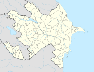
| District | Qazakh |
| Population (2024) | |
• Total | 0 |
| Time zone | UTC+4 (AZT) |
Xeyrimli (Kheyrimli) is an abandoned village in the Qazakh District of Azerbaijan.
Xeyrimli | |
|---|---|
| Xeyrimli | |
| Coordinates: 41°03′07″N45°06′34″E / 41.05194°N 45.10944°E | |
| Country | |
| District | Qazakh |
| Population (2024) | |
• Total | 0 |
| Time zone | UTC+4 (AZT) |
Xeyrimli (Kheyrimli) is an abandoned village in the Qazakh District of Azerbaijan.
Xeyrimli was controlled by Armenia and administered as part of its Tavush Province from the First Nagorno-Karabakh War in the early 1990s until 2024.
On April 19, 2024, as part of the border demarcation agreement, Armenia agreed to return Xeyrimli to Azerbaijan, [1] which happened on May 24, 2024. [2]
| | This Qazakh Rayon location article is a stub. You can help Wikipedia by expanding it. |
