In archaeology, a ring ditch is a trench of circular or penannular plan, cut into bedrock. They are usually identified through aerial photography either as soil marks or cropmarks. When excavated, ring ditches are usually found to be the ploughed‐out remains of a round barrow where the barrow mound has completely disappeared, leaving only the infilled former quarry ditch. Both Neolithic and Bronze Age ring ditches have been discovered.

The Yacuma River is a river in Bolivia, which feeds into the Mamoré River and ultimately into the Amazon. The headwaters of the Yacuma are within the Pilón Lajas Biosphere Reserve and Communal Lands.

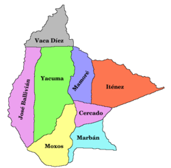
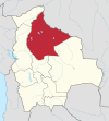
José Ballivián is a province of the Beni Department in northern Bolivia. It is named for José Ballivián, a general and former president of Bolivia who lived from 1805 until 1852. The province has a north-south extent. To the west the province is bounded by the Beni River, to the east it borders on the Yacuma Province of the Beni Department.
Rápulo River also Ráputo River is a river in Beni Department, Bolivia. It is a tributary of the Yacuma River in the Amazon Basin. It joins the Yacuma just below the town of Santa Ana del Yacuma.
Rogagua Lake is a lake in the pampas area in the northern Bolivia, in the José Ballivián Province of the Beni Department.

Rogaguado Lake is a tropical fresh water in the northern Bolivia, in the Yacuma Province of the Beni Department. It is close to the Rogagua Lake. The lake is 25,40 km long and 18,53 km wide, and it has an area of 315 km², making it one of the biggest lakes in Bolivia. It contains six islands, the biggest ones of 1 km² and the smaller ones of 0,65 km², located at the north side of the lake.
Exaltación may refer to several places in Bolivia:
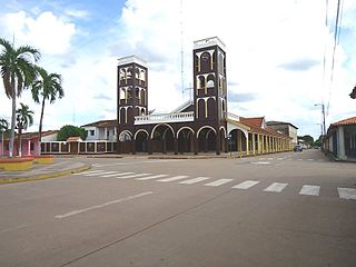
Exaltación is a town in Yacuma Province in the Beni Department of northern Bolivia.
Santa Ana del Yacuma is a town in the Beni Department in north-eastern Bolivia.
Santa Rosa de Yacuma or Santa Rosa del Yacuma is a small town in the Amazon pampas of the Bolivian Beni Department.
Santa Ana del Yacuma Airport is an airport serving the town of Santa Ana del Yacuma in the Beni Department of Bolivia. The runway is just south of the town.

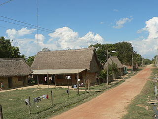
Puerto Teresa Río Yata is a newly built community located in the northeast region of the Beni Department on the Bolivian Pacific – Atlantic highway and at the Yata River, a tributary of the Beni River. It is part of the community of Santa Rosa de Yacuma in the José Ballivián Province of the Beni Department. It was founded on September 17, 1991.

Beni Biological Station Biosphere Reserve is a protected area in Bolivia located in the Beni Department, in the José Ballivián Province and Yacuma Province.
Huaytunas Lake is a lake in the Yacuma Province, Beni Department, Bolivia. At an elevation of 146 m, its surface area is 329.5 km².
GuachunaLake is a lake in the Yacuma Province, Beni Department, Bolivia. At an elevation of 150 m, its surface area is 102.8 km².
Laguna La Porfía is a lake in the Yacuma Province, Beni Department, Bolivia. Its surface area is 58.5 km2.
Laguna Bravo is a seasonal lake in the Yacuma Province, Beni Department, Bolivia. At an elevation of 167 m, its surface area is 25.7 km².
Santa Ana Municipality or Santa Ana del Yacuma Municipality is a municipality of the Beni Department, Bolivia.
Santa Rosa or Santa Rosa de(l) Yacuma is a municipality of the José Ballivián Province in the Beni Department of Bolivia. The seat of the municipality is the town of Santa Rosa de Yacuma.
Bathelium mirabile is a species of corticolous (bark-dwelling) lichen in the family Trypetheliaceae. Found in Bolivia, it was formally described as a new species in 2016 by lichenologists Adam Flakus, Martin Kukwa, and André Aptroot. The type specimen was collected near the biological station in the Beni Biological Station Biosphere Reserve at an altitude of 175 m (574 ft); there, it was found growing on bark in an island of Amazon forest surrounded by Beni savanna. It is only known to occur in this and similar habitats in Bolivia. The species epithet mirabile makes reference to the "unusual combination of pigments in the pseudostromata".