Yankton Treaty

Last updated
German settlers recorded Yankton land extended east into Minnesota to the Jeffers Petroglyphs Sioux01.png
German settlers recorded Yankton land extended east into Minnesota to the Jeffers Petroglyphs
Treaty of 1858 monument in Charles Mix County, South Dakota Yankton Treaty of 1858 monument 1.JPG
Treaty of 1858 monument in Charles Mix County, South Dakota

The Yankton Treaty was a treaty signed in 1858 between the United States Government and the Yankton Sioux Tribe (Western Dakota), that ceded most of eastern South Dakota (11 million acres) to the U.S. Government. [1] The treaty was signed in April 1858, and ratified by the United States Congress on February 16, 1859.

Contents

Background

The 1851 Treaty of Traverse des Sioux, which ceded vast tracts of Sioux land to the U.S. government, was signed only by representatives of the Sisseton and Mdewakanton bands. The Yankton and Yanktonai tribes were not consulted. [2] Governor Ramsey used the Nicollet map of the Upper Mississippi River basin from 1840 to draw the boundaries. He saw the Big Sioux River as a geographic feature separating the Sisseton and Yankton and Yanktonai tribes [3] . Chief Waanata 1 of the Yanktonai claimed from Granite Falls to the Missouri River. [4] Chief Struck-by-the-Ree of the Yankton claimed the land into Minnesota to the Jeffers Petroglyphs [ citation needed ]. The Yankton made their objections known. The Government realized the Yankton claim was so strong that the Yankton treaty was drawn up. As the Government felt it did not have free and clear title to the land for the statehood of Minnesota. Paragraph 1 of the 1858 Yankton treaty addresses these claims immediately. However, Struck-by-the-Ree would not sign without a provision for the Pipestone quarry. Article 8 was added giving the Yankton a one mile square Reservation at Pipestone. Struck-by-the-Ree signed and one month later Minnesota gained statehood. The Yanktonai being more remote failed to have their objections considered. The 1858 treaty immediately opened this territory up for settlement, resulting in the establishment of an unofficial local government not recognized by Washington.[ citation needed ] The treaty also created the primary 430,000 acre Yankton Sioux Reservation, now located in Charles Mix County in South Dakota. [5]

Negotiations

Smutty Bear (Ma-to-sa-be-che-a), a Yankton chief, was opposed the treaty because he felt it would only bring further white intrusions as they pushed to settle the open prairie with no obvious impediments. Strike-the-Ree (Pa-le-ne-a-pa-pe, also known as "The Man that Struck the Ree"), the elder Yankton Sioux chief, also felt that too many whites were settling there, but decided that opposing them was futile, and he signed the treaty. Charles F. Picotte, speculator, entrepreneur, and translator was compensated with a 640-acre land grant in the newly incorporated territory. That parcel later became a major portion of the city of Yankton, South Dakota. [6]

Terms

The terms of the treaty [7] can be summarized as follows:

Date and Parties

The treaty was signed on April 19, 1858, in Washington, D.C., by Charles E. Mix, representing the United States government, and various chiefs and delegates of the Yankton tribe of Sioux or Dacotah Indians.

Article 1 - Lands Ceded

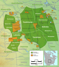
The Yankton tribe ceded and relinquished all their lands except for 400,000 acres, which were specified in detail. They also abandoned all claims and complaints related to previous treaties, including those negotiated by other Indians, except for their annuity rights under the Treaty of Laramie of September 17, 1851.

Article 2 - Boundaries of Ceded Land

The ceded land was described by specific geographic boundaries, including the Missouri River, various rivers, lakes, and other natural features.

Article 3 - Reservation and Roads

The United States was granted permission to construct roads across the Yankton reservation with consent from the Secretary of the Interior. The Yankton tribe agreed to settle on the reservation within a year, and until then, they were guaranteed undisturbed possession of their current settlements.

Article 4 - Agreements by the United States

The U.S. agreed to protect the Yankton tribe on their reserved land and pay annuities totaling $1,600,000 over 50 years, with varying amounts for different periods. Additional funds were allocated for subsistence, schools, and other improvements.

Article 5 - Mills, Mechanic Shops, and Property

The U.S. agreed to provide mills, mechanic shops, and dwelling houses for the benefit of the Yankton tribe. The Yankton tribe pledged not to damage or destroy these properties, and upon meeting certain conditions, they would gain ownership of the houses and property.

Article 6 - Payment of Debts

The Yankton chiefs could authorize the payment of up to $150,000 from their annuities to settle debts, subject to approval by the agent and Secretary of the Interior.

Article 7 - Land Grants and Entry for Non-Indians

Certain individuals, including Charles F. Picotte and Zephyr Rencontre, were granted land. Non-Indians residing in the ceded territory could purchase land at a specified rate.

Article 8 - Use of Pipestone Quarry

The Yankton tribe was guaranteed access to the red pipestone quarry, with the U.S. responsible for surveying and marking the area.

Article 9 - Military Posts and Indian Agencies

The U.S. had the right to establish military posts, roads, and Indian agencies within the Yankton reservation, with compensation provided for any property taken.

Article 10 - Restrictions on Trade and Land Alienation

Only licensed individuals could trade with the Yankton tribe, and non-Indians were prohibited from residing or making settlements on the reservation. Land could only be alienated to the U.S., and the Secretary of the Interior would determine land divisions among the tribe.

Article 11 - Friendly Relations and Surrender of Offenders

The Yankton tribe pledged to maintain friendly relations with the United States and other tribes, surrender offenders, and submit disputes to the President of the United States.

Article 12 - Punishment for Intemperance

Annuitants who engaged in or provided intoxicating liquor would have their annuities withheld for at least a year.

Article 13 - Protection of Annuities from Debts

Annuities could not be used to pay debts except as stipulated in the agreement or under U.S. trade and intercourse laws.

Article 14 - Release of Demands

The Yankton tribe released the United States from all demands except those specified in the treaty.

Article 15 - Appointment of Indian Agent

The U.S. agreed to appoint an agent to reside on the Yankton reservation, with land allocated for their use.

Article 16 - Expenses

The United States would bear all expenses related to the treaty, including surveying the reservation and pipestone quarry.

Article 17 - Effective Date

The treaty would take effect upon ratification by the Senate and the President of the United States.

Aftermath

In 1863 when Congress annulled the treaties of the eastern Dakota tribes and confiscated their Reservations, the Yankton were not included. The Yankton Reservation at Pipestone remained untouched.

See also

Related Research Articles

<span class="mw-page-title-main">Lakota people</span> Indigenous people of the Great Plains

The Lakota are a Native American people. Also known as the Teton Sioux, they are one of the three prominent subcultures of the Sioux people, with the Eastern Dakota (Santee) and Western Dakota (Wičhíyena). Their current lands are in North and South Dakota. They speak Lakȟótiyapi—the Lakota language, the westernmost of three closely related languages that belong to the Siouan language family.

<span class="mw-page-title-main">Sioux</span> Native American and First Nations ethnic groups

The Sioux or Oceti Sakowin are groups of Native American tribes and First Nations people from the Great Plains of North America. The Sioux have two major linguistic divisions: the Dakota and Lakota peoples. Collectively, they are the Očhéthi Šakówiŋ, or "Seven Council Fires". The term "Sioux", an exonym from a French transcription ("Nadouessioux") of the Ojibwe term "Nadowessi", can refer to any ethnic group within the Great Sioux Nation or to any of the nation's many language dialects.

<span class="mw-page-title-main">Treaty of Fort Laramie (1868)</span> US-Sioux treaty ending Red Clouds War

The Treaty of Fort Laramie is an agreement between the United States and the Oglala, Miniconjou, and Brulé bands of Lakota people, Yanktonai Dakota, and Arapaho Nation, following the failure of the first Fort Laramie treaty, signed in 1851.

<span class="mw-page-title-main">Pipestone National Monument</span> United States historic place

Pipestone National Monument is located in southwestern Minnesota, just north of the city of Pipestone, Minnesota. It is located along the highways of U.S. Route 75, Minnesota State Highway 23 and Minnesota State Highway 30. The quarries are culturally significant to 23 tribal nations of North America. Those known to actually occupied the site chronologically are the Yankton Dakota, Iowa, and Omaha peoples. The Quarries were considered a neutral territory in the historic past where all tribal nations could quarry stone for ceremonial pipes. The catlinite, or "pipestone", is traditionally used to make ceremonial pipes. They are vitally important to Plains Indian traditional practices. Archeologists believe the site has been in use for over 3000 years with Minnesota pipestone having been found in ancient North American burial mounds across a large geographic area.

Nakota is the endonym used by those Native peoples of North America who usually go by the name of Assiniboine, in the United States, and of Stoney, in Canada.

The Mdewakanton or Mdewakantonwan are one of the sub-tribes of the Isanti (Santee) Dakota (Sioux). Their historic home is Mille Lacs Lake in central Minnesota. Together with the Wahpekute, they form the so-called Upper Council of the Dakota or Santee Sioux. Today their descendants are members of federally recognized tribes in Minnesota, South Dakota and Nebraska of the United States, and First Nations in Manitoba, Canada.

<span class="mw-page-title-main">Hunkpapa</span> Traditional tribal grouping within the Lakota people

The Hunkpapa are a Native American group, one of the seven council fires of the Lakota tribe. The name Húŋkpapȟa is a Lakota word, meaning "Head of the Circle". By tradition, the Húŋkpapȟa set up their lodges at the entryway to the circle of the Great Council when the Sioux met in convocation. They speak Lakȟóta, one of the three dialects of the Sioux language.

<span class="mw-page-title-main">Struck by the Ree</span> Yankton Sioux chief (d. 1888)

Struck by the Ree, also known as Strikes the Ree and alternatively Palaneapape, Padani Apapi and Pa-Da-Ni-A-Ha-Hi in Sioux language was a chief of the Native American Yankton Sioux tribe.

<span class="mw-page-title-main">Joseph LaFlesche</span>

Joseph LaFlesche, also known as E-sta-mah-za or Iron Eye, was the last recognized head chief of the Omaha tribe of Native Americans who was selected according to the traditional tribal rituals. The head chief Big Elk had adopted LaFlesche as an adult into the Omaha and designated him in 1843 as his successor. LaFlesche was of Ponca and French Canadian ancestry; he became a chief in 1853, after Big Elk's death. An 1889 account said that he had been the only chief among the Omaha to have known European ancestry.

<span class="mw-page-title-main">Spirit Lake Tribe</span> Native American tribal organization in North Dakota

The Spirit Lake Tribe is a federally recognized tribe based on the Spirit Lake Dakota Reservation located in east-central North Dakota on the southern shores of Devils Lake. It is made up of people of the Pabaksa (Iháŋkthuŋwaŋna), Sisseton (Sisíthuŋwaŋ) and Wahpeton (Waȟpéthuŋwaŋ) bands of the Dakota tribe. Established in 1867 in a treaty between Sisseton-Wahpeton Bands and the United States government, the reservation, at 47°54′38″N98°53′01″W, consists of 1,283.777 square kilometres (495.669 sq mi) of land area, primarily in Benson and Eddy counties. Smaller areas extend into Ramsey, Wells and Nelson counties.

<span class="mw-page-title-main">Yankton Indian Reservation</span> Indian reservation in United States, Yankton Sioux

The Yankton Indian Reservation is the homeland of the Yankton Sioux Tribe of the Dakota tribe.

<span class="mw-page-title-main">Treaty of Traverse des Sioux</span> Upper Dakota land cession treaty of 1851 with United States

The Treaty of Traverse des Sioux was signed on July 23, 1851, at Traverse des Sioux in Minnesota Territory between the United States government and the Upper Dakota Sioux bands. In this land cession treaty, the Sisseton and Wahpeton Dakota bands sold 21 million acres of land in present-day Iowa, Minnesota and South Dakota to the U.S. for $1,665,000.

<span class="mw-page-title-main">Dakota people</span> Native American people in the mid northern U.S. and mid southern Canada

The Dakota are a Native American tribe and First Nations band government in North America. They compose two of the three main subcultures of the Sioux people, and are typically divided into the Eastern Dakota and the Western Dakota.

<span class="mw-page-title-main">Sisseton Wahpeton Oyate</span> Native American tribal organization in South Dakota and North Dakota

The Sisseton Wahpeton Oyate of the Lake Traverse Reservation, formerly Sisseton-Wahpeton Sioux Tribe/Dakota Nation, is a federally recognized tribe comprising two bands and two subdivisions of the Isanti or Santee Dakota people. They are on the Lake Traverse Reservation in northeast South Dakota.

<span class="mw-page-title-main">Lower Brule Indian Reservation</span> Reservation in South Dakota, United States

The Lower Brulé Indian Reservation is an Indian reservation that belongs to the Lower Brulé Lakota Tribe. It is located on the west bank of the Missouri River in Lyman and Stanley counties in central South Dakota in the United States. It is adjacent to the Crow Creek Indian Reservation on the east bank of the river. The Kul Wicasa Oyate, the Lower Brulé Sioux, are members of the Sicangu, one of the bands of the Lakota Tribe. Tribal headquarters is in Lower Brule.

<span class="mw-page-title-main">Yankton Sioux Tribe</span> Federally recognized tribe in South Dakota, U.S.

The Yankton Sioux Tribe of South Dakota is a federally recognized tribe of Yankton Western Dakota people, located in South Dakota. Their Dakota name is Ihaƞktoƞwaƞ Dakota Oyate, meaning "People of the End Village" which comes from the period when the tribe lived at the end of Spirit Lake just north of Mille Lacs Lake.

This timeline of South Dakota is a list of events in the history of South Dakota by year.

The fourth Treaty of Prairie du Chien was negotiated between the United States and the Sac and Fox, the Mdewakanton, Wahpekute and Sisseton Sioux, Omaha, Ioway, Otoe and Missouria tribes. The treaty was signed on July 15, 1830, with William Clark and Willoughby Morgan representing the United States. Through additional negotiations conducted in St. Louis on October 13, 1830, Yankton Sioux and Santee Sioux agreed to abide by the 1830 Treaty of Prairie du Chien. The US government announced the treaty and its numerous adherents on February 24, 1831.

<span class="mw-page-title-main">Early Indian treaty territories in North Dakota</span>

Native Americans from various tribes lived in North Dakota before the arrival of settlers. With time, a number of treaties and agreements were signed between the Indians and the newcomers. Many of the treaties defined the domain of a specific group of Indians. The three maps below show the treaty territories of different Indians living in North Dakota and how the territories changed and diminished over time in the 19th century.

<span class="mw-page-title-main">Eagle Woman</span> American peace activist (1820–1888)

Eagle Woman That All Look At was a Lakota activist, diplomat, trader, and translator, who was known for her efforts mediating the conflicts between white settlers, the United States government, and the Sioux. She is credited with being the only woman recognized as a chief among the Sioux.

References

  1. Indian Affairs: Laws and Treaties, Compiled and Edited by Charles J. Kappler, Oklahoma State University (OSU) Library Electronic Publishing Center.
  2. "Treaty with the Sioux-Sisseton and Wahpeton Bands, 1851". treaties.okstate.edu. Retrieved 2024-02-15.
  3. "Map of the Upper Mississippi River basin, 1843 | MNopedia". www.mnopedia.org. Retrieved 2024-02-15.
  4. "The History and Cultore of the Mni Wakan Oyate (Spirit Lake Nation)" (PDF).
  5. Minnesota Historical Society - 1858 "TREATY OF WASHINGTON"
  6. Karolevitz, Robert F. (1972). Yankton: A Pioneer Past - North Plains Press - 1972 - pp. 2-4. U.S. Library of Congress Number 72-88949
  7. "Treaty with the Yankton Sioux, 1858". treaties.okstate.edu. Retrieved 2024-02-15.