
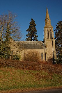
Pembridge is a village and civil parish in Arrow valley in Herefordshire, England. The village is on the A44 road about 6 miles (10 km) east of Kington and 7 miles (11 km) west of Leominster. The civil parish includes the hamlets of Bearwood, Lower Bearwood, Lower Broxwood, Marston, Moorcot and Weston. The 2011 Census recorded the parish population as 1,056.

Alton is a civil parish in Wiltshire, England. The parish includes the adjacent villages of Alton Barnes and Alton Priors, and the nearby hamlet of Honeystreet on the Kennet and Avon Canal. It lies in the Vale of Pewsey about 6 miles (10 km) east of Devizes.

Theddlethorpe consists of two adjacent civil parishes – Theddlethorpe All Saints and Theddlethorpe St Helen – in the East Lindsey district of the county of Lincolnshire, England. The villages lie about 3 miles (5 km) north of Mablethorpe on the North Sea coast. The National Grid-owned Theddlethorpe Gas Terminal processes natural gas extracted from the North Sea. Some seashore belongs to the Saltfleetby-Theddlethorpe Dunes National Nature Reserve, consisting of sea dunes and saltwater and freshwater marshes. It is one of five UK locations where the natterjack toad can be found.

Biddestone is a village and civil parish in northwest Wiltshire, England, about 3 miles (5 km) west of Chippenham and 2 miles (3.2 km) north of Corsham. The parish includes the smaller settlement of Slaughterford.

Warburton is a village and civil parish within the Metropolitan Borough of Trafford in Greater Manchester, England. Historically in Cheshire, Warburton lies on the south bank of the River Mersey between the borough of Warrington and Greater Manchester. In the 21st century, the village remains predominantly rural. Altrincham is the nearest town. According to the 2001 census, the parish had a population of 286.

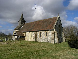
Tichborne is a village and civil parish 4 miles (6.4 km) east of Winchester in Hampshire, England.
Yazor is a small village and civil parish in the English county of Herefordshire. The parish includes the hamlet of Yarsop about 1 mile (2 km) to the north. Yazor is some 8 miles (13 km) north west of the city of Hereford on the A480 road and about 1 mile (2 km) east of Offa's Dyke. It was formerly served by Moorhampton railway station located in the parish. The population of the parish at the 2011 Census was 122.

Leigh Delamere is a small village in the civil parish of Grittleton in the English county of Wiltshire, about 4 miles (6 km) northwest of the town of Chippenham. The M4 motorway passes some 250 metres to the south, and the motorway's Leigh Delamere services lie to the east of the village.

Elston is a small village and civil parish in Nottinghamshire, England, to the south-west of Newark, and a mile from the A46 Fosse Way. The population of the civil parish taken at the 2011 Census was 631. The parish of Elston lies between the rivers Trent and Devon, with "the village itself set amongst trees and farmland less than a mile from the A46. The historic market town of Newark is just five miles to the north, with the cities of Lincoln and Nottingham some 18 miles north and south-west respectively."

Grittleton is a village and civil parish in Wiltshire, England, 6 miles (10 km) northwest of Chippenham. The parish includes the hamlets of Foscote, Leigh Delamere, Littleton Drew and Sevington, and part of the hamlet of The Gibb.

Yatton Keynell is a village and civil parish in Wiltshire, England. The village is on the B4039 road near Castle Combe, about 4 miles (6 km) northwest of Chippenham, and about the same distance to the east of the county border with South Gloucestershire.

East Huntspill is a village and civil parish on the Huntspill Level, near Highbridge, Somerset, England. The civil parish includes Cote, Hackness and Bason Bridge.

Blackford is a village and former civil parish in the county of Somerset, England, beside the A303 road, 4 miles (6.4 km) south west of Wincanton in the South Somerset district. There are two other places called Blackford in Somerset: one is a village near Wedmore, the other a tiny hamlet in Selworthy parish between Porlock and Minehead.
Colemore is a hamlet and former village in the Hampshire Downs about 5 miles (8 km) northwest of Petersfield. It was united with Priors Dean to form the civil parish of Colemore and Priors Dean in 1932.

Yatton Chapel is a redundant Anglican church in Yatton, south-east Herefordshire, England. It is recorded in the National Heritage List for England as a designated Grade II* listed building, and is under the care of the Churches Conservation Trust. It stands at the end of a winding track adjacent to Chapel Farmhouse.
Low Toynton is a hamlet and civil parish in the East Lindsey district of Lincolnshire, England. The population of the civil parish was 187 at the 2011 census. It is situated about 1 mile (1.6 km) north-east from the town of Horncastle, and in the Lincolnshire Wolds, a designated Area of Outstanding Natural Beauty.

Dormington is a village and civil parish in Herefordshire, in the West Midlands of England. Dormington village is at the north of its parish, 5 miles (8 km) east from the centre of the city and county town of Hereford, and 8 miles (13 km) west-northwest from the town of Ledbury. The parish is a significant traditional centre for hop growing.

Marstow is a hamlet and civil parish in south eastern Herefordshire, England. Most of the parish is within the Wye Valley Area of Outstanding Natural Beauty.

Croft and Yarpole is a civil parish in the county of Herefordshire, England, and is 17 miles (27 km) north from the city and county town of Hereford. The closest large town is the market town of Leominster, 4.5 miles (7 km) to the south. Within the parish is the National Trust property of Croft Castle and Parkland.

