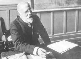
Charles Simon Clermont-Ganneau was a noted French Orientalist and archaeologist.
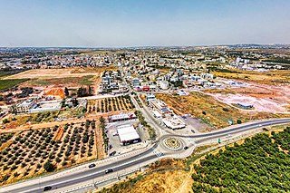
Jaljulia, officially also spelled Jaljulye, is an Arab town in Israel near Kfar Saba. In 2021 it had a population of 10,480.

Minat al-Qal'a is a medieval coastal fort protecting the port known as Ashdod-Yam, which was historically separate from Ashdod proper but whose archaeological remains are today located on the southern beach of the sprawling modern city of Ashdod. The fort was built by the Umayyads and later restored by the Crusaders.

Daughters of Jacob Bridge is a bridge that spans the last natural ford of the Jordan River at the southern end of the Hula Basin between the Korazim Plateau and the Golan Heights. It has been a crossing point for thousands of years.
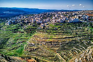
Beit Iksa is a Palestinian village in the Jerusalem Governorate, located northwest of Jerusalem in the West Bank.
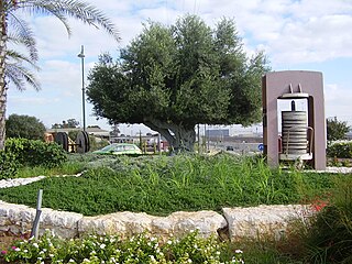
Bnei Darom is a religious moshav shitufi in central Israel. Located near the Mediterranean coast, it falls under the jurisdiction of Hevel Yavne Regional Council. In 2021 it had a population of 950.

Al-Nabi Rubin was a Palestinian village in central Palestine region, what is now Israel, located 14.5 kilometers (9.0 mi) west of Ramla, just northeast of Yibna and 18 kilometers (11 mi) south of Jaffa. The village was situated on the southern banks of Wadi al-Sarar, known in Hebrew as Sorek Stream, at an elevation of 25 meters (82 ft) above sea level. Nabi Rubin is named after a shrine in the village, believed by Muslims to be the tomb of Reuben, first son of Jacob. It was captured by the Israel Defense Forces during the 1948 Arab-Israeli War, and the inhabitants were expelled.

'Arab Suqrir was a Palestinian Arab village in the Gaza Subdistrict, located 38 kilometers (24 mi) northeast of Gaza in a flat area with an elevation of 25 meters (82 ft) along the coastal plain just north of Isdud. The total land area of the village was 40,224 dunams, of which 12,270 was Arab-owned, while the remainder was public property. In 1931, it had a population of 530, decreasing to 390 in 1945. It was destroyed and depopulated during the 1948 Arab-Israeli War.
Muhammad (Mehmet) Abu Nabbut Agha was the governor of Jaffa and Gaza in the early 19th century on behalf of the Ottoman Empire, from 1807 to 1818, as well as the governor of Thessaloniki from 1819 to 1827 during the Greek War of Independence.

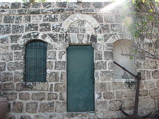
Sabil Abu Nabbut also known as Tabitha's Well is a public fountain ("sabil") in Jaffa, Israel, built in 1815/16 CE during the Ottoman period in Palestine. Its main purpose was to facilitate the journey between Jaffa and Jerusalem.
Khirbat al-Tannur, also known as Allar al-Sifla, was a Palestinian Arab hamlet in the Jerusalem Subdistrict, near Allar. It was depopulated during the 1948 Arab–Israeli War on October 21, 1948, under Operation Ha-Har. It was located 18.5 km west of Jerusalem.

Bir Ma'in was a Palestinian Arab village in the Ramle Subdistrict. It was depopulated during the 1948 Arab-Israeli War on July 15, 1948 during the second phase of Operation Danny by the First and Second Battalions of the Yiftach Brigade. It was located 14 km east of Ramla. The village was defended by the Jordanian Army.
Khulda, also Khuldeh, was a Palestinian Arab village located 12 kilometers (7.5 mi) south of Ramla in the Mandatory Palestine. Known as Huldre to the Crusaders, it is also mentioned in documents dating to the periods of Mamluk, Ottoman, and Mandatory rule over Palestine. During the 1948 war, the village was depopulated as part of Operation Nachshon and was subsequently destroyed. The Israeli kibbutz of Mishmar David was established that same year on land belonging to the village.

Khirbat Zakariyya was a Palestinian village in the Ramle Subdistrict of Mandatory Palestine. It was depopulated during the 1948 Arab–Israeli War on July 12, 1948, under the second stage of Operation Dani. It was located 9 km (5.6 mi) east of Ramla.

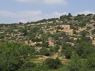
The mausoleum of Abu Hurayra, or Rabban Gamaliel's Tomb, is a maqām and synagogue located in HaSanhedrin Park in Yavne, Israel, formerly belonging to the depopulated Palestinian village of Yibna. It has been described as "one of the finest domed mausoleums in Palestine."

Jisr Jindas, Arabic for "Jindas Bridge", also known as Baybars Bridge, was built in 1273 CE. It crosses a small wadi, known in Hebrew as the Ayalon River, on the old road leading south to Lod and Ramla. The bridge is named after the village of Jindas, which until 1948 stood east of the bridge and may have been the Crusader-period "casal of Gendas" mentioned in a Latin charter dated 1129 CE. It is the most famous of the several bridges erected by Sultan Baybars in Palestine, which include the Yibna and the Isdud bridges.

Jisr ed-Damiye, known in English as Damiyah Bridge, as Prince Muhammad Bridge in Jordan, and as Gesher Adam in Israel, stretches over the Jordan River between the Palestinian territories and the Balqa Governorate of Jordan.

Jisr el-Majami or Jisr al-Mujamieh is an ancient stone bridge, possibly of Roman origin, over the Jordan River on the border between Israel and Jordan. The name is derived from the bridge's location 200 m (660 ft) south of the confluence of the Yarmouk and Jordan rivers.

Jisr Isdud or Isdud Bridge, also known as the Ad Halom Bridge, was a 13th century Mamluk bridge built over the Lakhish River. It is located approximately 1.5 km north of the Ad Halom junction. The bridge is similar in style and history to the nearby Jisr Jindas and Yibna Bridge.


