
William Hyde Wollaston was an English chemist and physicist who is famous for discovering the chemical elements palladium and rhodium. He also developed a way to process platinum ore into malleable ingots.
Northeast Greenland National Park is the world's largest national park and the 10th largest protected area. Established in 1974, the Northeast Greenland national park expanded to its present size in 1988. It protects 972,000 km2 (375,000 sq mi) of the interior and northeastern coast of Greenland and is larger than the area of Tanzania, but smaller than that of Egypt. This means that the national park is bigger than 166 of the world's 195 countries. It was the first national park to be created in the Kingdom of Denmark and remains Greenland's only national park. It is the northernmost national park in the world and the second-largest by area of any second-level subdivision of any country in the world, trailing only the Qikiqtaaluk Region in Nunavut, Canada.

Daneborg is a station on the south coast of Wollaston Foreland peninsula of northeast Greenland, at the mouth of Young Sund emptying into Greenland Sea. Daneborg serves as the headquarters for the Sirius Patrol, the dog sled patrollers of the Northeast Greenland National Park, the largest national park in the world. The number of persons at the station is few and varies considerably from summer to winter. Daneborg is the most populated of stations in the park, with an over-wintering population of 12. Daneborg has an approximately 400 metres (1,300 ft) long airstrip.

A foreland basin is a structural basin that develops adjacent and parallel to a mountain belt. Foreland basins form because the immense mass created by crustal thickening associated with the evolution of a mountain belt causes the lithosphere to bend, by a process known as lithospheric flexure. The width and depth of the foreland basin is determined by the flexural rigidity of the underlying lithosphere, and the characteristics of the mountain belt. The foreland basin receives sediment that is eroded off the adjacent mountain belt, filling with thick sedimentary successions that thin away from the mountain belt. Foreland basins represent an endmember basin type, the other being rift basins. Space for sediments is provided by loading and downflexure to form foreland basins, in contrast to rift basins, where accommodation space is generated by lithospheric extension.

Clavering Island is a large island in eastern Greenland off Gael Hamke Bay, to the south of Wollaston Foreland.
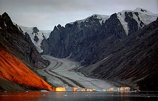
Wollaston Foreland is a peninsula in King Christian X Land, East Greenland. Administratively it belongs to the NE Greenland National Park area.
Sabine Island is an island to the northeast of Wollaston Foreland, previously known as Inner Pendulum Island. It is in the Northeast Greenland National Park area.
Hochstetter Bay is a broad bay in northeastern Greenland. It is part of the Northeast Greenland National Park area.

Zackenberg, or Zackenberg Research Station, is an ecosystem research station and monitoring facility situated in the Northeast Greenland National Park in northeastern Greenland. The station is owned by the Greenland Self-Government and was run by the Danish Arctic Institute until 2008. In 2009 the running of the Station was transferred to the Dept of Arctic Environment at the Danish National Environmental Research Institute
Gael Hamke Bay is a large bay in King Christian X Land, East Greenland. Administratively it is part of the Northeast Greenland National Park zone.
Barnett Glacier is a large glacier in the Anare Mountains that flows east along the south side of Tapsell Foreland into Smith Inlet, northern Victoria Land, Antarctica.

King Christian X Land is an area of northeastern Greenland.
Thorland is a peninsula in the King Frederick VI Coast, southeastern Greenland. It is a part of the Sermersooq municipality.

Mount Paatusoq, also known as 'Mount Patuersoq', is the highest mountain in the Kujalleq municipality, SE Greenland.
Petermann Peak,, also known as Petermann Fjeld, Petermanns Topp and Petermann Point is a mountain in King Christian X Land, Northeast Greenland. Administratively it is part of the Northeast Greenland National Park zone.

Queen Margrethe II Land is a peninsula in the northern limit of King Christian X Land, northeastern Greenland. Administratively it belongs to the NE Greenland National Park area.
Kayser Mountain is a mountain in Hall Land, NW Greenland. Administratively it is part of the Northeast Greenland National Park. This peak was named after German geologist and paleontologist Emanuel Kayser.
Newman Bay or Newman Fjord is a fjord in northern Greenland. To the northwest, the fjord opens into the Robeson Channel of the Lincoln Sea. It is a part of the Northeast Greenland National Park.
Young Sound is a marine channel with a fjord structure in King Christian X Land, East Greenland. Administratively it is part of the Northeast Greenland National Park zone.

