Unnao is a city in the Indian state of Uttar Pradesh. It is the administrative headquarters of Unnao district and a part of Lucknow division, between Kanpur and Lucknow. Unnao is a large industrial city with three industrial suburbs around it. Unnao has the country's largest leather Export in the UPSIDC.

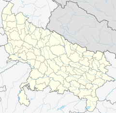
Ghazipur is a city in the state of Uttar Pradesh, India. Ghazipur city is the administrative headquarters of the Ghazipur district, one of the four districts that form the Varanasi division of Uttar Pradesh. The city of Ghazipur also constitutes one of the seven distinct tehsils, or subdivisions, of the Ghazipur district.

Ghazipur district is a district of Uttar Pradesh state in northern India. The city of Ghazipur is the district headquarters. The district is part of Varanasi Division. The region of Ghazipur is famous mainly for the production of its unique rose-scented Spray called Gulab Jal, and for the tomb of the Governor General of British India, Lord Cornwallis, who died here. His tomb is situated in Western part of City, and is conserved by Archaeological Survey of India.

The Indira Gandhi Canal is the longest canal in India. It starts at the Harike Barrage near Harike, a few kilometers downriver from the confluence of the Satluj and Beas rivers in Punjab state, and ends in irrigation facilities in the Thar Desert in the northwest of Rajasthan state. Previously known as the Rajasthan Canal, it was renamed the Indira Gandhi Canal on 2 November 1984 following the assassination of Prime Minister Indira Gandhi.
Zamania is a town in the Indian state of Uttar Pradesh. Its municipal council is subordinate to the Ghazipur District.
Reotipur is a village located in the Ghazipur district of Uttar Pradesh, India. With a population of 28833, it is the largest village in Seorai Tehsil of the Ghazipur district.
Dildarnagar Kamsar or Kamsaar, is a Pargana or a region of 32 places around Karamnasa river in Ghazipur district, and Kaimur District of Uttar Pradesh, and Bihar, India. Of whom main mouzas being 19. It is a large settlement of pathans mostly Khanzada Pathans and Afghan Pathans.
Dildarnagar Gaon also known as Deendarnagar is a neighbourhood in Dildarnagar Town of Kamsaar in Ghazipur District, India. It is 4.5 km from Phooli and 11 km from Zamania. It was the capital of Dildarnagar estate.

Saraila is a village in Kamsaar in the Indian state of Uttar Pradesh.Saraila is a village in Seorai Tehsil in Ghazipur District of Uttar Pradesh, India. It belongs to Varanasi Division. It is located 30 km to the south of District headquarters Ghazipur. 11 km from Seorai. 372 km from State capital Lucknow. The village was also a part of Daudpur Estate which had its capital at Dewaitha.
Gaighat is an Indian village in the town of Zamania within the Ghazipur district of Uttar Pradesh.
Bhurkura is a village in Jakhanian tehsil of Ghazipur district. of Uttar Pradesh, India. It belongs to Varanasi Division.
Western Yamuna Canal is canal in river Yamuna that was dug out and renovated in 1335 CE by Firoz Shah Tughlaq. In 1750 CE, excessive silting caused it to stop flowing. The British raj undertook a three-year renovation in 1817 by Captain GR Blane of the Bengal Engineer Group. In 1832-33 Tajewala Barrage dam at Yamunanagar was also built to regulate the flow of water, and later Pathrala barrage at Dadupur,Yamuna Nagar and Somb river dam downstream of canal were constructed in 1875-76. In 1889-95 the largest branch of the canal Sirsa branch was constructed. The modern Hathni Kund Barrage was built in 1999 to handle the problem of silting to replace the older Tajewala Barrage.
Mapatpur is a small village in Nuaon Tehsil in Ramgarh Block in Kaimur district of the Indian state of Bihar. It comes under the Panchayat raj political system and belongs to the Patna Division.
Seorai is a Tahsil in region of Ghazipur District of Uttar Pradesh, India. Seorai is the headquarter of Seorai Tehsil. The Seorai tehsil was made a tehsil of the Ghazipur District in year 2016. It consists of 142 villages and one town. Seorai main village has a total area of 878.02 hectares and a population of 20000 but its total area is 1,082.83 hectares and a population of 20,530 which also includes Bhadaura. Seorai tehsil has the total area of 366.62 km2 (141.55 sq mi). Seorai also served as the capital of Kamsaar estate from 1602 to 1620s.
Nawali is a village in Seorai tehsil of Ghazipur District, Uttar Pradesh, India.
Mednipur is the largest village by area in Zamania tehsil of Ghazipur District, Uttar Pradesh, India. There are two more villages along, one Kalupr and second Tari or Tarighat. All three are separate panchayats.
Karmanasa Canal is a Canal located in Kaimur District of Bihar, India. It arises from Kohira River in Chainpur tehsil and ends in Ramgarh Tehsil of Kaimur at Durgawati River. The Karmanasa Canal also have so many Minors arising from it. Its average width is 80ft.
Durgavati Canal also known as Kudra Wier Canal or Kudra Project Canal, is a canal located in Kaimur District of Bihar, India. During the British Raj, after Punjab and Agra and Uttarakhand, the government focused on the regions of Buxar, Ghazipur, and Kaimur, which grew the most crops in Bihar, and Uttar Pradesh. The British and Indian governments built many canals in the 1870s-1950s to increase the irrigation of these regions, especially the parganas of Kamsar, Zamania, Sherpur, Ramgarh, Durgawati, Chainpur, Bhabua, Kudra, Kochas, Buxar and Chausa. In these regions mostly Kamsaar Raj and later Chainpur estate and Jagdishpur estate existed. These places also made up the pargana of the Nawab of Ghazipur. These regions had 20 rivers, so irrigation was easy and many canals and tributaries were built to support and improve agriculture there.
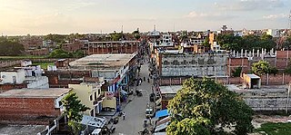
Dildarnagar is a municipality in Kamsaar of Ghazipur District, Uttar Pradesh, India. Dildarnagar is a fast-developing town. It is located 34 km from Ghazipur. It is also known as the heart of the Kamsaar-o-bar region. The total area of Dildarnagar includes Fatehpur Bazar, Dildarnagar Gao, and Nirahukapura. These four neighbourhoods form the town of Dildarnagar. As of the 2011 census, the population of Dildarnagar was 28,913 and the town had an area of 1,995.95 hectares. Dildarnagar is on the road from Varanasi to Buxar. It was also the capital of Dildarnagar Estate.

Dewaitha is a village in Dildarnagar Kamsar, Ghazipur, India, on the banks of the Karmanasa River. The village had a population of 7,706 as of the 2011 Census of India and a land area of 1,043 acres. Most of the people living in the village are Kamsar Pathan.