Zrinski Bridge

Last updated

Zrinski Bridge / Zrinyi Bridge
Coordinates 46°24′44″N16°42′04″E / 46.41215°N 16.701021°E / 46.41215; 16.701021 Coordinates: 46°24′44″N16°42′04″E / 46.41215°N 16.701021°E / 46.41215; 16.701021
Carries road vehicles
Crosses Mura River
Locale Northern Croatia, southwest Hungary
Official name Zrinski most / Zrínyi híd
Maintained by Hrvatske autoceste
Állami Autópálya Kezelő Zrt.
Characteristics
Design Box girder bridge
Total length 216 m (709 ft)
Width 2 × 15 m (49 ft)
Longest span 48 m (157 ft)
History
Opened 2008
Statistics
Toll not tolled

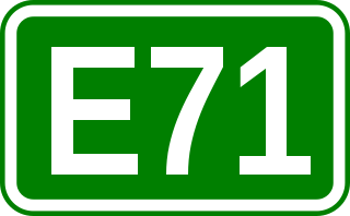
The Zrinski Bridge or Zrínyi Bridge (Croatian : Zrinski most, Hungarian : Zrínyi híd) connects the Croatian A4 and the Hungarian M7 motorways, spanning the Mura River. As it also spans Hungarian–Croatian border, a joint border checkpoint is located north of the bridge. The bridge is located between Goričan interchange of the A4 motorway and the M70 motorway interchange of the M7. The bridge is a part of a major north–south transportation corridor in Croatia and Hungary and a part of European routes E65 and E71 as well as the Pan-European corridor Vb.

Croatian language South Slavic language

Croatian is the standardized variety of the Serbo-Croatian language used by Croats, principally in Croatia, Bosnia and Herzegovina, the Serbian province of Vojvodina and other neighboring countries. It is the official and literary standard of Croatia and one of the official languages of the European Union. Croatian is also one of the official languages of Bosnia and Herzegovina and a recognized minority language in Serbia and neighboring countries.

Hungarian language language spoken in and around Hungary

Hungarian is a Finno-Ugric language spoken in Hungary and several neighbouring countries. It is the official language of Hungary and one of the 24 official languages of the European Union. Outside Hungary it is also spoken by communities of Hungarians in the countries that today make up Slovakia, western Ukraine (Subcarpathia), central and western Romania (Transylvania), northern Serbia (Vojvodina), northern Croatia, and northern Slovenia. It is also spoken by Hungarian diaspora communities worldwide, especially in North America and in Israel. Like Finnish and Estonian, Hungarian belongs to the Uralic language family. With 13 million speakers, it is its largest member in terms of speakers.

A4 (Croatia) motorway in Croatia

The A4 motorway is a motorway in Croatia spanning 97.0 kilometres (60.3 mi). It connects the nation's capital, Zagreb, to the city of Varaždin and to Budapest, Hungary via the Goričan border crossing. The motorway represents a major north–south transportation corridor in Croatia and is a part of European routes E65 and E71. The A4 motorway route also follows Pan-European corridor Vb.

Contents

The bridge is a composite continuous girder structure executed across five spans, 216 meters (709 feet) long overall. It consists of two 15-meter (49 ft) parallel structures, each carrying one carriageway, set 80 centimeters (31 inches) apart. Construction and naming of the bridge was announced in 2007 by Croatian and Hungarian governments following a joint session, and ceremonially opened on 22 October 2008 as the last piece of the motorway route connecting the Hungarian capital, Budapest, to the Croatian capital, Zagreb, and the Port of Rijeka after 40 years of construction.

Budapest Capital city in Hungary

Budapest is the capital and the most populous city of Hungary, and the tenth-largest city in the European Union by population within city limits. The city had an estimated population of 1,752,704 in 2016 distributed over a land area of about 525 square kilometres. Budapest is both a city and county, and forms the centre of the Budapest metropolitan area, which has an area of 7,626 square kilometres and a population of 3,303,786, comprising 33 percent of the population of Hungary.

Zagreb City in City of Zagreb, Croatia

Zagreb is the capital and the largest city of Croatia. It is located in the northwest of the country, along the Sava river, at the southern slopes of the Medvednica mountain. Zagreb lies at an elevation of approximately 122 m (400 ft) above sea level. The estimated population of the city in 2018 is 810,003. The population of the Zagreb urban agglomeration is about 1.1 million, approximately a quarter of the total population of Croatia.

The Port of Rijeka is a seaport in Rijeka, Croatia, located on the shore of the Kvarner Gulf in the Adriatic Sea. The first records of the port date to 1281. It was the main port of the Kingdom of Hungary in the 19th century and the beginning of the 20th century, of Yugoslavia between World War II and 1991, and of Croatia after its independence. Today, it is the largest port in Croatia with a cargo throughput of 11.2 million tonnes (2016), mostly oil, general cargo and bulk cargo, and 214,348 Twenty-foot equivalent units (TEUs).

The bridge was designed by Uvaterv and built by Hidroelektra-Niskogradnja at a cost of 8 million kuna (1.08 million euro). The cost was shared equally by Croatia and Hungary. The bridge is maintained by Hrvatske autoceste and Állami Autópálya Kezelő Zrt.

Croatian kuna currency of Croatia

The kuna is the currency of Croatia, in use since 1994. It is subdivided into 100 lipa. The kuna is issued by the Croatian National Bank and the coins are minted by the Croatian Monetary Institute.

Hrvatske autoceste (HAC) or Croatian Motorways Ltd is a Croatian state-owned limited liability company tasked with management, construction and maintenance of motorways in Croatia pursuant to provisions of the Croatian Public Roads Act (Croatian: Zakon o javnim cestama enacted by the Parliament of the Republic of Croatia. Tasks of the company are defined by Public Roads Act and its Founding Declaration, and the principal task of the company is management, construction and maintenance of the motorways. In practice, Hrvatske autoceste is responsible for management or development the following motorway sections:

Description

Gorican/Letenye border crossing adjacent to the Zrinski Bridge Hataratkelo Letenye M7.jpg
Goričan/Letenye border crossing adjacent to the Zrinski Bridge

The Zrinski Bridge/Zrínyi Bridge connects the Croatian A4 and the Hungarian M7 motorways, spanning the river Mura. As it also spans Hungarian–Croatian border, a border checkpoint is situated adjacent to the bridge, on the north bank. [1] The bridge is located between Goričan interchange of the A4 motorway and the M70 motorway interchange of the M7. [2] The bridge is a part of a major north–south transportation corridor in Croatia and Hungary and a part of European routes E65 and E71 as well as the Pan-European corridor Vb. [3] [4]

M7 motorway (Hungary) road in Hungary

The M7 motorway is a Hungarian motorway which runs from Budapest towards the Croatian border at Letenye, reaching Székesfehérvár, then Siófok, a town on Lake Balaton, and the city of Nagykanizsa in the southwest of the country.

Goričan Municipality in Međimurje, Croatia

Goričan is a municipality in Međimurje County, Croatia.

International E-road network numbering system for roads in Europe

The international E-road network is a numbering system for roads in Europe developed by the United Nations Economic Commission for Europe (UNECE). The network is numbered from E 1 up and its roads cross national borders. It also reaches Central Asian countries like Kyrgyzstan, since they are members of the UNECE.

Structure

The A4/M7 motorway route follows a 2,000-meter (6,600 ft) radius horizontal curve and a 18,000-meter (59,000 ft) radius vertical convex curve at the site of the bridge, intersecting the watercourse at an angle of 75 degrees. The bridge consists of dual structures, one for each of the motorway carriageways, executed as composite, continuous structures. Each of the structures comprises two 2.1-meter (6 ft 11 in) × 2.0-meter (6 ft 7 in) box steel girders made composite with deck slab of variable depth (23 centimeters (9.1 inches) at mid-span), concreted in situ. Since the river is up to 200 meters (660 feet) wide and only 3 to 4 meters (9.8 to 13.1 feet) deep on average, a five span structure was selected for construction of the bridge: 36 meters (118 feet) + 3 × 48 meters (157 feet) + 36 meters (118 feet). [5] The bridge is 216 meters (709 feet) overall and each of the two parallel structures is 15 meters (49 feet) wide, spaced 80 centimeters (31 inches) apart. [6]

Concrete bridge piers consist of two 4.0-meter (13.1 ft) × 2.0-meter (6 ft 7 in) columns each, executed atop driven, prefabricated concrete piles. Bridge abutments are also made of concrete and supported by the same type of piles. All the piles are 8.6 to 11.3 meters (28 to 37 feet) long and comprise diameter of 50 centimeters (20 inches). The substructure is protected against scouring using gabions placed on the river bed. The bridge is fitted with electric lighting, electronic surveillance of unauthorized access to maintenance openings, as well as frost and wind-speed control devices. [5]

Gabion

A gabion is a cage, cylinder, or box filled with rocks, concrete, or sometimes sand and soil for use in civil engineering, road building, military applications and landscaping.

Traffic volume

Volume of traffic using the Zrinski Bridge/Zrínyi Bridge is not reported regularly by Hrvatske ceste in their annual bulletins on Croatian road traffic volume, even though it is a part of the A4 motorway where the traffic volume is normally measured. Still, such a measurement is available for the adjacent section of the A4, where average annual daily traffic volume of 2,188 vehicles was observed in 2010. Since the route comprising the bridge is used by substantial number of tourists traveling between Hungary and Adriatic Sea resorts, the traffic volume increases during July–August period—to 7,247 vehicles in 2010. [7]

History

Originally, construction of the bridge was planned by Hrvatske autoceste to start in 2006, along with a 1.4-kilometer (0.87 mi) connector to the A4 motorway completed by that time and a 1-kilometer (0.62 mi) M7 connector. Initially, the works were planned to be completed by 2007. [8] Actual commencement of the construction works was announced in May 2007 during a joint session of the Government of Croatia and the Government of Hungary. At the same time, it was declared that the bridge shall be called Zrinski Bridge, after the House of Zrinski. [9] The press continued to refer to the bridge under the generic name "Mura" (after the river) even after it was opened. [6] [10] [11]

The prefabricated piles, manufactured by Tvornica Betonskih Stupova – TBS in Jastrebarsko, and sections of the steel structural elements, manufactured by Đuro Đaković in Slavonski Brod, were delivered to the construction site by trucks. The steel structure was assembled on the northern (Hungarian) bank of the river followed by incremental launching of the superstructure. [5] The bridge design was developed by Hungarian company Uvaterv, and the bridge construction works were performed by Croatian Hidroelektra-Niskogradnja. Bridge equipment was installed by Dalekovod. Total cost of the bridge construction works was 8 million kuna (1.08 million euro). The cost was shared equally by Croatia and Hungary. Additional 50 million kuna (6.7 million euro) was required to build the connecting motorway section north of Goričan interchange. [6]

The bridge was completed and opened for traffic on 22 October 2008 by Croatian and Hungarian transport ministers. Opening of the bridge signified completion of the motorway route spanning Budapest and Rijeka via Zagreb after 40 years of construction. [12] At the occasion a joint border crossing checkpoint was opened. It was completed in October 2007, and funded by the European Union. [6] [9] Completion of the bridge was greeted with expectation of advances in areas of tourism, transportation safety and economic development, as the bridge represented the first modern motorway link between the countries. [11] The bridge is maintained by Hrvatske autoceste and Állami Autópálya Kezelő Zrt, companies maintaining the motorways connecting on the bridge. [13] [14]

See also

Related Research Articles

European route E73 road in Europe

The European route E 73 is a Class-A north-south European route that connects the central part of the continent, specifically Hungary and eastern Croatia to Bosnia and Herzegovina and the Adriatic Sea in the area of the port of Ploče. This 702-kilometre (436 mi) route is also designated as the Pan-European Corridor Vc, a branch of the fifth Pan-European corridor. The route largely consists of two-lane roads with at-grade intersections, although in 2000s, approximately one third of the route was upgraded to motorway standards. The remainder of the route is currently being upgraded in all the countries spanned. The longest part of this corridor goes through Bosnia and Herzegovina and is widely touted as a road instrumental to the development of the country. The road also serves as the shortest connection of the eastern and southern parts of Croatia.

A1 (Croatia) motorway in Croatia

The A1 motorway is the longest motorway in Croatia, spanning 476.3 kilometers (296.0 mi). As it connects Zagreb, the nation's capital, to Split, the second largest city in the country and the largest city in Dalmatia, the motorway represents a major north–south transportation corridor in Croatia and a significant part of the Adriatic–Ionian motorway. Apart from Zagreb and Split, the A1 motorway runs near a number of major Croatian cities, provides access to several national parks or nature parks, world heritage sites, and numerous resorts, especially along the Adriatic Coast. National significance of the motorway is reflected through its positive economic impact on the cities and towns it connects as well as its importance to tourism in Croatia.

A3 (Croatia) motorway in Croatia

The A3 motorway is a major motorway in Croatia spanning 306.5 kilometres (190.5 mi). The motorway connects Zagreb, the nation's capital, to the Slavonia region and a number of cities along the Sava River. It represents a major east–west transportation corridor in Croatia and a significant part of the Pan-European Corridor X, serving as a transit route between the European Union states and the Balkans. Apart from Zagreb, where the A3 motorway comprises a considerable part of the Zagreb bypass, the motorway runs near a number of significant Croatian cities. The motorway has a positive economic impact on the cities and towns it connects, and is an important route within Croatia.

A5 (Croatia) road

The A5 motorway is a motorway in Croatia spanning 55.5 kilometres (34.5 mi). It connects Osijek, the largest city in Slavonia region, to the Croatian motorway network at the Sredanci interchange of the A3 motorway. The A5 represents a significant north–south transportation corridor in Croatia and is a part of the European route E73. The A5 motorway route also follows Pan-European corridor Vc. In addition to Osijek, the A5 motorway also passes near Đakovo.

A6 (Croatia) controlled-access highway

The A6 motorway is a motorway in Croatia spanning 80.2 kilometres (49.8 mi). It connects the nation's capital, Zagreb, via the A1, to the seaport of Rijeka. The motorway forms a major north–south transportation corridor in Croatia and is a part of European route E65 Nagykanizsa–Zagreb–Rijeka–Zadar–Split–Dubrovnik–Podgorica. The A6 motorway route also follows Pan-European corridor Vb.

A10 (Croatia) motorway in Croatia

The A10 motorway is a motorway in southern Croatia extending from the border with Bosnia and Herzegovina to the Croatian A1 motorway Ploče interchange. The motorway includes the Nova Sela border crossing. It connects to the A1 motorway in Bosnia and Herzegovina. The motorway is 8.8 km (5.5 mi) long. It is the shortest motorway in Croatia, but still important as a part of the Pan-European Corridor Vc.

A9 (Croatia) motorway in Croatia

The A9 motorway is a north–south motorway in Croatia, with a length of 78.3 kilometres. Beginning in Pula, the largest city on the Istrian peninsula, it runs north to the Croatian motorway and expressway network at the Kanfanar interchange. Here it meets the A8 motorway, forming the Istrian Y road system. The A9 continues north from here to the Kaštel and Plovanija border crossings into Slovenia. The motorway represents a significant north–south transportation corridor in Croatia and is a part of the European route E751. The motorway's national significance is reflected in the positive economic impact on the cities and towns it connects, as well as its importance to tourism in Croatia. Importance of the motorway for tourism is particularly high during summer tourist seasons, when traffic volume increases by more than 80%.

A11 (Croatia) road in Croatia

The A11 motorway is an incomplete motorway in Croatia, 30 kilometres long. It connects the Jakuševec interchange of the Zagreb bypass, to the south of Zagreb, to Velika Gorica and onwards to Sisak, but currently reaches only the Lekenik exit, as of the planned 42-kilometre (26 mi) route, 30 km (19 mi) are completed. The motorway is planned as a north–south transportation corridor for commuter traffic between the cities.

European route E71 road in Europe

European route E 71 is a north-south Class-A intermediate European road route. It begins in Košice, Slovakia, passes through Budapest in Hungary, Zagreb in Croatia and Bihać in Bosnia and Herzegovina, and ends at Split in Croatia on the Adriatic Sea coast. The total length of the route is 1,016 km (631 mi). The E71 mostly consists of motorways, but considerable sections are either expressways or two-lane roads with at-grade intersections. Nearly all motorway sections of the E71 are tolled, using various toll collection systems including Electronic toll collection (ETC) and ticket systems. Individual segments of the E71 route are shared with several other European routes. The E71 section between Karlovac and Split is inconsistently physically signposted or marked on maps and route planning software. The E71 route has gradually been upgraded from a regular two-lane road to motorway standards since the 1970s; upgrades are still being carried out in some areas.

D425 road road in Croatia

D425 is a state road in Croatia, connecting the outskirts of Ploče with the A1 motorway connector at the Karamatići toll station. Its main purpose is a connection from the motorway to the Port of Ploče. The road is 8.8 km (5.5 mi) long.

Krka Bridge

The Krka Bridge is located in Croatia, between the Skradin and Šibenik interchanges. It is a 391 metres (1,283 ft) long concrete arch bridge spanning the Krka River at a height of 65 metres (213 ft). It carries the A1 motorway route south of Skradin, in immediate vicinity of Krka National Park.

The Gacka Bridge is located between Žuta Lokva and Ličko Lešće. It is 466 metres (1,529 ft) long, and it comprises four traffic lanes and two emergency lanes. Speed limit enforced on the bridge is 130 km/h. The contract value of the bridge was 94.3 million Croatian kuna without VAT.

Drežnik Viaduct

The Drežnik Viaduct is located in Karlovac, Croatia, immediately to the south of the Karlovac interchange on the A1 motorway. It is the longest viaduct in Croatia, spanning 2,485 metres (8,153 ft). It is executed in seven segments, separated by expansion joints. The viaduct was constructed by Konstruktor, Split, as the main contractor, and Viadukt and Hidroelektra of Zagreb as subcontractors in 2000 and 2001.

The Dabar Bridge is located between the Šibenik and Vrpolje interchanges of the A1 motorway in the Dalmatia region of Croatia. It is a 330 metres (1,080 ft) long concrete girder bridge spanning the Dabar flash flood gully at a height of 60 metres (200 ft).

Golubinjak Vidauct is 588-metre (1,929 ft) viaduct located between the Delnice and Vrata interchanges of the A6 motorway in Gorski Kotar, Croatia. The viaduct is tolled within the A6 motorway ticket system and there are no separate toll plazas associated with use of the viaduct. It is 579 metres (1,900 ft) long. The viaduct consists of two parallel structures: The first one was completed in 2004, and the second one in 2008. The viaduct was designed by Inženjerski projektni zavod and constructed by Hidroelektra.

Hreljin Vidauct is located between the Vrata and Oštrovica interchanges of the A6 motorway in Primorje-Gorski Kotar County, Croatia, just to the west of Tuhobić Tunnel. It is 544.85 metres (1,787.6 ft) long. The viaduct consists of two parallel structures: The first one was completed in 1995 by Hidroelektra, and the second one in 2008 by Konstruktor. The viaduct is tolled within the A6 motorway ticket system and there are no separate toll plazas associated with use of the viaduct. The viaduct was designed by Hidroelektra.

D10 road (Croatia) road in Croatia

The D10 expressway is a partially built expressway in the central Croatia northeast from Zagreb extending towards the city of Križevci. It is currently executed as a 35 km long expressway that spans from the A4 motorway Sveta Helena interchange via Vrbovec, to the city of Križevci. The D10 expressway represents the western arm of the so-called Podravina Y, as the eastern arm is planned to be the D12 expressway.

References

  1. "Karta Carinarnica RH" [Map of border crossings and customs office areas](PDF) (in Croatian). Customs Administration of the Republic of Croatia. Retrieved 5 October 2011.
  2. "Pravilnik o označavanju autocesta, njihove stacionaže, brojeva izlaza i prometnih čvorišta te naziva izlaza, prometnih čvorišta i odmorišta" [Regulation on motorway markings, chainage, interchange/exit/rest area numbers and names]. Narodne novine (in Croatian). 6 May 2003. Retrieved 5 October 2011.
  3. "European Agreement on main international traffic arteries (AGR) (with annexes and list of roads). Concluded at Geneva on 15 November 1975" (PDF). United Nations. Retrieved 29 July 2011.
  4. "Transport : launch of the Italy-Turkey pan-European Corridor through Albania, Bulgaria, Former Yugoslav Republic of Macedonia and Greece". European Union. 9 September 2002. Retrieved 6 September 2010.
  5. 1 2 3 "Autocestovni most preko Mure kod Goričana" [Motorway Bridge Across Mura at Goričan] (in Croatian). Gradimo.hr. 29 July 2009. Retrieved 5 October 2011.
  6. 1 2 3 4 "Ministri prometa Hrvatske i Mađarske otvorili most Muru s pristupnim cestama" [Croatian and Hungarian Transport Ministers Open the Mura Bridge and new Access Roads] (in Croatian). Ministry of the Sea, Transport and Infrastructure (Croatia). 22 October 2008. Retrieved 5 October 2011.
  7. "Brojenje prometa na cestama Republike Hrvatske – sažetak" [Traffic counting on the roadways of the Republic of Croatia – digest](PDF) (in Croatian). Hrvatske ceste. May 2011. Retrieved 5 October 2011.
  8. "PLAN GRAĐENJA I ODRŽAVANJA AUTOCESTA za 2006. godinu" [Motorway construction and maintenance plan – year 2006] (in Croatian). Hrvatske autoceste. October 2005. Retrieved 5 October 2011.
  9. 1 2 "Priopćenje 22. listopada 2008" [Press release 22 October 2008] (in Croatian). Ministry of Foreign Affairs and European Integration (Croatia) . Retrieved 5 October 2011.
  10. "Otvoren most 'Mura' i dionica Goričan – Letenye" [Mura Bridge and Goričan – Letenye section open] (in Croatian). Nova TV. 22 October 2008. Retrieved 7 October 2010.
  11. 1 2 "Otvoren most Mura i dionica Goričan – Letenye" [Mura Bridge and Goričan – Letenye Section Open] (in Croatian). Limun.hr. 22 October 2008. Retrieved 5 October 2011.
  12. Dragan Grdić (20 August 2008). "Hidroelektra dovršava most Goričan-Letenye" [Hidroelektra Completes Goričan-Letenye Bridge] (in Croatian). Poslovni dnevnik . Retrieved 5 October 2011.
  13. "Zakon o javnim cestama" [Public Roads Act]. Narodne Novine (in Croatian). 14 December 2004. Retrieved 5 October 2011.
  14. "ROAD NETWORK". Állami Autópálya Kezelő Zrt. Retrieved 5 October 2011.