Bristol is a city, ceremonial county and unitary authority in England. Situated on the River Avon, it is bordered by the ceremonial counties of Gloucestershire to the north and Somerset to the south. Bristol is the most populous city in South West England. The wider Bristol Built-up Area is the eleventh most populous urban area in the United Kingdom.

The University of Bristol is a red brick Russell Group research university in Bristol, England. It received its royal charter in 1909, although it can trace its roots to a Merchant Venturers' school founded in 1595 and University College, Bristol, which had been in existence since 1876.

Yate is a town and civil parish in South Gloucestershire, England. It lies just to the southwest of the Cotswold Hills and is 12 miles northeast of Bristol city centre and 11 miles from the centre of Bath, with regular rail services to Bristol and Gloucester.

Keynsham is a town and civil parish located between Bristol and Bath in Somerset, England. It has a population of 19,000. It was listed in the Domesday Book as Cainesham, which is believed to mean the home of Saint Keyne.
Severn Beach is a village on the Severn Estuary in South Gloucestershire, England. The eastern portal of the Severn Tunnel is on the outskirts of the village. The Severn footpath – on the sea wall – is part of the Severn Way that leads from Gloucester, Slimbridge and the Second Severn Crossing. Extensive sea defences have been constructed and this provides a popular walkway along its length. Originally, the Severn Way finished at Severn Beach, but it has been extended to Bristol.
Bishop's Cleeve is a large village and civil parish in the Borough of Tewkesbury in the ceremonial county of Gloucestershire, England. The village lies at the foot of Cleeve Hill, the highest point in the Cotswolds. Bishop's Cleeve had a population of 10,612 in 2011, which has increased to 14,068 in the 2021 Census. The village is located 99 miles (159 km) from London, 13 miles (21 km) from Gloucester, 57 miles (92 km) from Birmingham and 44 miles (71 km) from Oxford. The village is also close to the towns of Cheltenham, Tewkesbury, Stratford-upon-Avon and Evesham.

Chew Magna is a village and civil parish within the Chew Valley in the unitary authority of Bath and North East Somerset, in the ceremonial county of Somerset, England. The parish has a population of 1,149.
Bishopston is a suburb of the city of Bristol in south west England. Bishopston is around Gloucester Road (A38), the main northern arterial road in the city and Bishop Road.

Midsomer Norton is a town near the Mendip Hills in Bath and North East Somerset, England, 10 miles (16 km) south-west of Bath, 10 miles (16 km) north-east of Wells, 10 miles (16 km) north-west of Frome, 12 miles (19 km) west of Trowbridge and 16 miles (26 km) south-east of Bristol. It has a population of around 13,000. Along with Radstock and Westfield it used to be part of the conurbation and large civil parish of Norton Radstock, but is now a town council in its own right. It is also part of the unitary authority of Bath and North East Somerset.
Stoke Gifford is a village and parish in South Gloucestershire, England, in the northern suburbs of Bristol. It had around 11,000 residents at the 2001 census, increasing to 15,494 at the 2011 census. It is home to Bristol Parkway station and Stoke Gifford depot, on the London-South Wales railway line, and the Bristol offices of Aviva which took over Friends Life in 2015, Hewlett Packard and the University of the West of England. The parish includes neighbouring Little Stoke, Harry Stoke and Stoke Park. The parish borders Filton, to the south-west, Patchway to the north west, Bradley Stoke to the north and Winterbourne and Hambrook to the east. To the south Stoke Gifford is served by the Bristol Ring Road, south of this a large green area known as the 'Green Lung' stretches to the inner city area of St Werburghs.

Henbury is a suburb of Bristol, England, approximately 5 miles (8.0 km) north west of the city centre. It was formerly a village in Gloucestershire and is now bordered by Westbury-on-Trym to the south; Brentry to the east and the Blaise Castle Estate, Blaise Hamlet and Lawrence Weston to the west. To the north lie the South Gloucestershire village of Hallen and the entertainment/retail park Cribbs Causeway.

Bedminster is a district of Bristol, England, on the south side of the city. It is also the name of a council ward which includes the central part of the district.

Redland is a neighbourhood in Bristol, England. The neighbourhood is situated between Clifton, Cotham, Bishopston and Westbury Park. The boundaries of the district are not precisely defined, but are generally taken to be Whiteladies Road in the west, the Severn Beach railway line in the south and Cranbrook Road in the east.

Stoke Bishop is a medium-sized outer city suburb in the north-west of Bristol, located in between Westbury-on-Trym, Sneyd Park, and Sea Mills. Although relatively low, Stoke Bishop's population has increased due to substantial infilling on the Smelting Works sports ground and The Grove which used to belong to Clifton High school. The population of Stoke Bishop varies throughout the year because of the influx of students to the large campus of Bristol University halls of residence situated on the edge of the suburb and the Downs during term time.

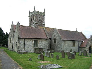
Bishop Sutton is a village on the northern slopes of the Mendip Hills, within the affluent Chew Valley in Somerset. It lies east of Chew Valley Lake and north east of the Mendip Hills, approximately ten miles south of Bristol on the A368, Weston-super-Mare to Bath road between West Harptree and Chelwood. Bishop Sutton and the neighbouring village of Stowey form the civil parish of Stowey Sutton.
Monks Park is a northern suburb of the city of Bristol, England and is the highest point within the city. Monks Park stretches westward, towards Southmead, from the A38 trunk road. Filton Park lies directly north, on the South Gloucestershire side of the city boundary. Horfield lies to the east of the A38 and also to the south.

Newbridge is a largely residential electoral ward on the western edge of Bath, England.

Wookey is a village and civil parish 2 miles (3.2 km) west of Wells, on the River Axe in the Mendip district of Somerset, England. The parish includes the village of Henton and the nearby hamlets of Yarley and Bleadney where the River Axe travels the length of the village. There used to be a port at Bleadney on the river in the 8th century which allowed goods to be brought to within 3 miles (5 km) of Wells. Wookey is often confused with its sister village Wookey Hole, site of the Wookey Hole Caves.

Bristol Free School (BFS) is a Secondary Academy which opened in Southmead, Bristol, England, in September 2011.
