CM postcode area

Last updated

Postcode district boundaries:

KML is from Wikidata
Chelmsford
United Kingdom adm location map.svg
Red pog.svg
CM
Coordinates: 51°45′14″N0°23′56″E / 51.754°N 0.399°E / 51.754; 0.399
CountryUnited Kingdom
Postcode area
CM
Postcode area name
Chelmsford
Post towns 16
Postcode districts 28
Postcode sectors103
Postcodes (live)17,864
Postcodes (total)27,233
Statistics as at May 2020 [1]

The CM postcode area, also known as the Chelmsford postcode area, [2] is a group of 25 postcode districts in England, within 16 post towns. These cover central Essex (including Chelmsford, Harlow, Brentwood, Billericay, Braintree, Burnham-on-Crouch, Dunmow, Epping, Ingatestone, Maldon, Ongar, Southminster, Stansted and Witham), plus a small part of east Hertfordshire (including Bishop's Stortford and Sawbridgeworth) and a very small part of the London Borough of Havering.

Contents

The southern part of the CM7 district for Braintree was recoded to CM77 in 2002. [3]

Coverage

The Stansted post town (CM24) is entirely surrounded by the Bishop's Stortford post town (CM22 and CM23). [2] The approximate coverage of the postcode districts:

Postcode district Post town CoverageLocal authority area(s)
CM0SOUTHMINSTER Southminster, Bradwell, Tillingham, Asheldham, Dengie Maldon
BURNHAM-ON-CROUCH Burnham-on-Crouch, Tillingham
CM1CHELMSFORD Chelmsford, Writtle Chelmsford, Uttlesford
CM2CHELMSFORDChelmsfordChelmsford
CM3CHELMSFORD Hatfield Peverel, South Woodham Ferrers, North Fambridge, Cold Norton, Boreham, Maylandsea Chelmsford, Maldon, Braintree, Uttlesford
CM4INGATESTONE Blackmore, Fryerning, Ingatestone, Margaretting, Stock Brentwood, Chelmsford, Epping Forest
CM5ONGAR Chipping Ongar, High Ongar, Bobbingworth, Moreton, The Lavers, The Rodings Epping Forest
CM6DUNMOW Great Dunmow, Felsted Uttlesford, Chelmsford
CM7BRAINTREE Braintree, Finchingfield, Great Bardfield Braintree, Uttlesford
CM8WITHAM Witham Braintree, Maldon
CM9MALDON Maldon, Tollesbury, Tolleshunt D'Arcy, Tolleshunt Knights Maldon, Colchester
CM11BILLERICAY Billericay (East), Great Burstead Basildon, Chelmsford
CM12BILLERICAYBillericay (West), Little Burstead Basildon, Brentwood
CM13BRENTWOOD Brentwood, East Horndon, Great Warley, Herongate, Hutton, Ingrave, Little Warley, West Horndon Brentwood, Basildon, Havering
CM14BRENTWOODBrentwood, Warley Brentwood, Havering
CM15BRENTWOODBrentwood, Doddinghurst, Kelvedon Hatch, Mountnessing, Shenfield, Stondon Massey, Pilgrims Hatch Brentwood
CM16EPPING Epping, Theydon Bois, North Weald Epping Forest
CM17HARLOW Harlow, Old Harlow, Matching, Matching Tye, Matching Green, Church Langley Harlow, Epping Forest, Uttlesford
CM18HARLOWHarlowHarlow, Epping Forest
CM19HARLOWHarlow, Roydon Harlow, Epping Forest
CM20HARLOWHarlow, Gilston Harlow, East Hertfordshire
CM21SAWBRIDGEWORTH Sawbridgeworth East Hertfordshire, Epping Forest
CM22BISHOP'S STORTFORD Bishop's Stortford, Sheering Uttlesford, East Hertfordshire, Epping Forest
CM23BISHOP'S STORTFORDBishop's Stortford, Thorley, Manuden East Hertfordshire, Uttlesford
CM24STANSTED Stansted Mountfitchet, Stansted Airport Uttlesford
CM77BRAINTREE Braintree, Great Notley, Rayne Braintree, Uttlesford
CM92CHELMSFORD Shop Direct non-geographic [4]
CM98CHELMSFORD Department for Work and Pensions non-geographic [4]
CM99CHELMSFORDSelectapost, International Financial Data Services Groupnon-geographic [4]

Map

KML file (edithelp)
    KML is from Wikidata
    CM postcode area map, showing postcode districts in red and post towns in grey text, with links to nearby CB, CO, E, EN, IG, RM, SG and SS postcode areas. CM postcode area map.svg
    CM postcode area map, showing postcode districts in red and post towns in grey text, with links to nearby CB, CO, E, EN, IG, RM, SG and SS postcode areas.

    See also

    Related Research Articles

    UB postcode area Postcode area within the United Kingdom

    The UB postcode area, also known as the Southall postcode area, is a group of eleven postcode districts in England, within six post towns. These cover parts of western and north-western Greater London, plus a very small part of Buckinghamshire. The letters in the postcodes are the phonemic abbreviation of Uxbridge.

    BN postcode area Postcode area within the United Kingdom

    The BN postcode area, also known as the Brighton postcode area, is a group of 30 postcode districts in South East England, within 18 post towns. These cover settlements on or near the coast in West Sussex and East Sussex. The main sorting office is outside the area, at the Gatwick Mail Centre in Crawley.

    CO postcode area Postcode area within the United Kingdom

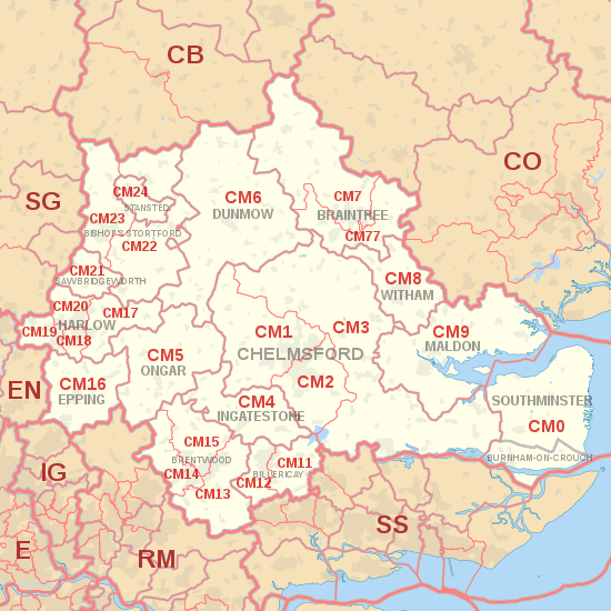
    The CO postcode area, also known as the Colchester postcode area, is a group of sixteen postcode districts in the east of England, within nine post towns. These cover northeast Essex and a small part of south Suffolk. The main sorting office is in Colchester.

    HP postcode area Postcode area within the United Kingdom

    The HP postcode area, also known as the Hemel Hempstead postcode area, is a group of twenty-four postcode districts in England, within eleven post towns. These cover north-west Hertfordshire and central Buckinghamshire.

    SG postcode area Postcode area within the United Kingdom

    The SG postcode area, also known as the Stevenage postcode area, is a group of nineteen postcode districts in England, within fifteen post towns. These cover north Hertfordshire and east Bedfordshire, plus a small part of south-west Cambridgeshire and a very small part of Essex.

    YO postcode area Postcode area within the United Kingdom

    The YO postcode area, also known as the York postcode area, is a group of 30 postcode districts in Yorkshire, England, within ten post towns. These cover most of North Yorkshire and the northern part of the East Riding of Yorkshire.

    BA postcode area Postcode area within the United Kingdom

    The BA postcode area, also known as the Bath postcode area, is a group of nineteen postcode districts in South West England, within sixteen post towns. These cover east Somerset and west Wiltshire, plus a very small part of north-west Dorset.

    SK postcode area Postcode area within the United Kingdom

    The SK postcode area, also known as the Stockport postcode area, is a group of nineteen postcode districts in England, within eleven post towns. These cover south-east Greater Manchester, parts of east Cheshire, north-west Derbyshire and a small part of north Staffordshire.

    NR postcode area Postcode area for Norfolk, England

    The NR postcode area, also known as the Norwich postcode area, is a group of 35 postcode districts in the east of England, within 16 post towns. These cover central and eastern Norfolk and part of north-east Suffolk.

    DL postcode area Postcode area within the United Kingdom

    The DL postcode area, also known as the Darlington postcode area, is a group of seventeen postcode districts in England, which are subdivisions of fourteen post towns. These districts cover central County Durham, northern North Yorkshire and a very small part of Cumbria.

    DH postcode area Postcode area within the United Kingdom

    The DH postcode area, also known as the Durham postcode area, is a group of twelve postcode districts in north-east England, which are subdivisions of five post towns. These districts cover northern County Durham and south-west Tyne and Wear, plus a very small part of Northumberland.

    LA postcode area Postcode area within the United Kingdom

    The LA postcode area, also known as the Lancaster postcode area, is a group of 23 postcode districts in north-west England, within 17 post towns. These cover north Lancashire, south Cumbria and a small part of North Yorkshire.

    TQ postcode area Postcode area within the United Kingdom

    The TQ postcode area, also known as the Torquay postcode area, is a group of fourteen postcode districts in South West England, within eleven post towns. These cover much of south Devon, including Torquay, Paignton, Newton Abbot, Brixham, Ashburton, Buckfastleigh, Dartmouth, Kingsbridge, Salcombe, South Brent, Teignmouth and Totnes.

    SN postcode area Postcode area within the United Kingdom

    The SN postcode area, also known as the Swindon postcode area, is a group of eighteen postcode districts in England, within ten post towns. These cover north Wiltshire, plus a small part of south-west Oxfordshire and a very small part of Gloucestershire.

    GL postcode area Postcode area within the United Kingdom

    The GL postcode area, also known as the Gloucester postcode area, is a group of 26 postcode districts covering 28 post towns: Badminton, Berkeley, Blakeney, Cheltenham, Chipping Campden, Cinderford, Cirencester, Coleford, Drybrook, Dursley, Dymock, Fairford, Gloucester, Lechlade, Longhope, Lydbrook, Lydney, Mitcheldean, Moreton-in-Marsh, Newent, Newnham, Ruardean, Stonehouse, Stroud, Tetbury, Tewkesbury, Westbury-on-Severn and Wotton-under-Edge. The main series has a hiatus after GL20, resuming at GL50 for Cheltenham and areas immediately around and to its east, ceasing with GL56.

    WR postcode area Postcode area within the United Kingdom

    The WR postcode area, also known as the Worcester postcode area, is a group of fifteen postcode districts in England, within seven post towns. These cover central and southern Worcestershire, plus very small parts of Herefordshire, Shropshire, Warwickshire and Gloucestershire.

    PR postcode area Postcode area within the United Kingdom

    The PR postcode area, also known as the Preston postcode area, is a group of eleven postcode districts in North West England, within four post towns. These cover south-west Lancashire and north Merseyside.

    TF postcode area Postcode area within the United Kingdom

    The TF postcode area, also known as the Telford postcode area, is a group of thirteen postcode districts in England, within six post towns. These cover north-east Shropshire, including Telford, Broseley, Market Drayton, Much Wenlock, Newport and Shifnal, plus a small part of west Staffordshire.

    SY postcode area Postcode area within the United Kingdom

    The SY postcode area, also known as the Shrewsbury postcode area, is a group of 26 postcode districts in England and Wales, within 32 post towns. These cover most of Shropshire, north Powys, and north Ceredigion, plus small parts of south Cheshire and north Herefordshire, and very small parts of Gwynedd and Wrexham County Borough.

    L postcode area Postcode area within the United Kingdom

    The L postcode area, also known as the Liverpool postcode area, is a group of postcode districts in north-west England, which are subdivisions of four post towns. These cover most of Merseyside, part of west Lancashire and a small part of north-west Cheshire.

    References

    1. "ONS Postcode Directory Version Notes" (ZIP). National Statistics Postcode Products. Office for National Statistics. May 2020. Table 2. Retrieved 19 June 2020. Coordinates from mean of unit postcode points, "Code-Point Open". OS OpenData. Ordnance Survey. February 2012. Retrieved 21 April 2012.
    2. 1 2 Royal Mail, Address Management Guide, (2004)
    3. "Royal Mail Update 34". Beacon Dodsworth. Retrieved 23 August 2015.
    4. 1 2 3 "Non Geographic Codes" (PDF). Royal Mail Address Management Unit. July 2012. Archived from the original (PDF) on 16 September 2012. Retrieved 20 December 2012.