
Lampeter is a town, community and electoral ward in Ceredigion, Wales, at the confluence of the Afon Dulas with the River Teifi. It is the third largest urban area in Ceredigion, after Aberystwyth and Cardigan, and has a campus of the University of Wales Trinity Saint David. At the 2011 Census, the population was 2,970. Lampeter is the smallest university town in the United Kingdom. The university adds approximately 1,000 people to the town's population during term time.

Cilgerran is both a village, a parish, and also a community, situated on the south bank of the River Teifi in Pembrokeshire, Wales. It was formerly an incorporated market town.
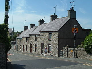
Pentraeth is a village and community on the island of Anglesey, North Wales, at grid reference SH523786. The Royal Mail postcode begins LL75. The community population taken at the 2011 census was 1,178. The village itself having a population of 557.

Peterston-super-Ely is a village and community situated on the River Ely in the county borough of the Vale of Glamorgan, Wales. The community population at the 2011 census was 874.

Moelfre is a village, a community and until 2012 an electoral ward on the north-east coast of the Isle of Anglesey in Wales. The community area covers the village and harbour, and several smaller, dispersed settlements. It includes six scheduled Iron Age hut groups and many other sites of archaeological interest. The harbour was formerly a local fishing port; a lifeboat station has been based here since 1854. Among many shipwrecks off the coast was that of the Royal Charter in 1859. Near the modernised lifeboat station is the RNLI Seawatch Centre. The coastline includes a rocky headland north of the village and a large sandy beach at Lligwy Bay, both traversed by the Anglesey Coastal Path. The 2011 census measured the village population as 710. It was estimated at 614 in 2019.

Penrhyndeudraeth is a small town and community in the Welsh county of Gwynedd. The town is close to the mouth of the River Dwyryd on the A487 nearly 3 miles (4.8 km) east of Porthmadog, and had a population of 2,150 at the 2011 census, increased from 2,031 in 2001. The community includes Minffordd and Portmeirion.

Aberangell is a village in Gwynedd, Wales.

The Afon Clarach is a small river discharging into Cardigan Bay north of Aberystwyth. It flows through a largely agricultural and forested landscape except in its lowest reaches where its banks are crowded with holiday developments. The Clarach is formed at the confluence of the Afon Stewi and Nant Seilo at Penrhyncoch, with both their headwaters originating in low hills at the edge of the Plynlimon range. The course of the river takes it past the Institute of Biological, Environmental and Rural Sciences, and the village of Bow Street. Between Bow Street and Llangorwen, the river is joined by the Bow Street Brook.

Chwilog is a village in Eifionydd on the Llŷn Peninsula in the Welsh county of Gwynedd. It forms part of the community of Llanystumdwy. The name means 'abounding in beetles' and was perhaps transferred from an earlier name of the river.

Llanbadarn Fawr is an urbanised village and community in Ceredigion, Wales. It is on the outskirts of Aberystwyth next to Penparcau and Southgate. It forms the eastern part of the continually built-up area of Aberystwyth. It holds two electoral wards, Padarn and Sulien which elect a Ceredigion County Councillor each and several Llanbadarn Fawr Community Councillors. At the 2001 census its population as a community was recorded at 2,899, increasing to 3,380 at the 2011 census.

Rowen is a village on the western slopes of the Conwy valley in the parish of Caerhun and the former County of Caernarvonshire in Wales. It lies off the B5106 road, between Tal y Bont and The Groes Inn. Buildings of Gwynedd 2009 refers to the River Roe probably following the Roman route from Caerhun to Abergwyngregyn. Rowen has won tidiest village awards several times.

Llangynog is a small rural community located in Carmarthenshire, Wales the main settlement of which was once called ‘Ebenezer’village. It is bordered by the communities of: Newchurch and Merthyr; Carmarthen; Llangain; Llansteffan; Laugharne Township; and St Clears, all being in Carmarthenshire. The population at the 2011 census was 492.
Tal-y-bont is a village in Ceredigion, Wales, located on the A487 road about halfway between Aberystwyth and Machynlleth. At the 2011 census the population was 662 with 63% born in Wales. Tal-y-bont is in the community of Ceulanamaesmawr.

Bow Street is a large village in the Tirymynach district of Ceredigion, Wales, approximately 3.5 miles (5.6 km) north-east of Aberystwyth. As well as Bow Street itself, it is now often considered to include the neighbouring smaller village of Pen-y-garn and the hamlet of Rhydypennau. All three places stretch in a long narrow strip along the main Aberystwyth to Machynlleth road, the (A487).

Dylife is a former mining settlement in Powys, Wales, located at the head of Afon Twymyn in the Cambrian Mountains, one mile west of the road between Llanidloes and Llanbrynmair (B4518). It is in the historic county of Montgomeryshire. The nearby lead mines intermittently sustained mining communities from Roman times until the early 20th century. During the late 19th century, as mining declined after the 1860s so did Dylife's population. The remaining buildings are two former chapels converted into homes and the Star Inn.

Llandygai is a small village and community on the A5 road between Bangor and Tal-y-Bont in Gwynedd, Wales. It affords a view of the nearby Carneddau mountain range. The population of the community taken at the 2011 Census was 2,487. Llandygai community includes nearby Tregarth and Mynydd Llandygai and also the pass of Nant Ffrancon.

Trawsgoed is both a community and an estate in Ceredigion, Wales. The estate is 8 miles (13 km) southeast of Aberystwyth, and has been in the possession of the Vaughan family since 1200. The Vaughans are descended from Collwyn ap Tangno, founder of the fifth noble tribe of North Wales, Lord of Eifionydd, Ardudwy, and part of Llŷn, who had his residence on the site of Harlech Castle.

Cwm Cadnant is a community and former electoral ward in Anglesey, north Wales. Named after the local river, Afon Cadnant, which flows through it, the community takes in the area between the Menai Bridge and Beaumaris. The community includes the villages of Llandegfan, Hen Bentref Llandegfan and Llansadwrn and at the 2001 census it had a population of 2,222, increasing slightly to 2,254 at the 2011 census.

Trefeurig is a community in Mid and West Wales, situated around 4 miles (6.4 km) north-east of Aberystwyth. It is a site of particular prehistoric, Roman, and Iron Age interest, and has a long history as a mining area. In 2011 the local population was estimated at around 1,771 people.

Salem is a small Welsh village in Ceredigion, located between the Afon Stewi and Nant Seilo rivers. The closest village is Penrhyn-coch.

