
Ceredigion is a county in the west of Wales, corresponding to the historic county of Cardiganshire. During the second half of the first millennium Ceredigion was a minor kingdom. It has been administered as a county since 1282. Ceredigion is considered a centre of Welsh culture and just under half of the population can speak Welsh according to the 2011 Census. The county is mainly rural, with over 50 miles (80 km) of coastline and a mountainous hinterland. The numerous sandy beaches and the long-distance Ceredigion Coast Path provide views of Cardigan Bay.

Lampeter is a town, community and electoral ward in Ceredigion, Wales, at the confluence of the Afon Dulas with the River Teifi. It is the third largest urban area in Ceredigion, after Aberystwyth and Cardigan, and has a campus of the University of Wales Trinity Saint David. At the 2011 Census, the population was 2,970. Lampeter is the smallest university town in the United Kingdom. The university adds approximately 1,000 people to the town's population during term time.

Tregaron is an ancient market town in Ceredigion, Wales, astride the River Brenig, a tributary of the River Teifi. Tregaron is 11 miles (18 km) northeast of Lampeter. According to the 2011 Census, the population of the ward of Tregaron was 1,213 and 67% of the population could speak Welsh. Tregaron is a community covering 86 square kilometres (33 sq mi). Two-thirds of the population were born in Wales.

The River Teifi in Wales forms the boundary for most of its length between the counties of Ceredigion and Carmarthenshire, and for the final 3 miles (4.8 km) of its total length of 76 miles (122 km), the boundary between Ceredigion and Pembrokeshire. Its estuary is northwest of Cardigan. Teifi has formerly been anglicised as "Tivy".

Llanddewi Brefi is a village, parish and community of approximately 500 people in Ceredigion, Wales.

The A482 road is in Ceredigion and Carmarthenshire, Wales. It links Aberaeron at the junction with the A487 road with the A40 road at Llanwrda near Llandovery. It is 29 miles (47 km) long.
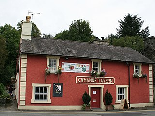
Cwmann is a small village in Wales near Lampeter, just on the Ceredigion border with Carmarthenshire, in the community of Pencarreg. Cwmann is on the Carmarthenshire side of the border. the population in 2011 was around 872.

Ystrad Aeron is a small village west of Felinfach on the A482 between Lampeter and Aberaeron, Ceredigion, Wales. It is part of the constituent community of Llanfihangel Ystrad.
Gorsgoch is a small rural village located on the B4338 road near Lampeter in the county of Ceredigion, Wales. The town of Lampeter is 7 miles away and the town of New Quay is 15 miles away
The Carmarthen–Aberystwyth line was originally a standard-gauge branch line of the Great Western Railway (GWR) in Wales, connecting Carmarthen and Aberystwyth.

The A475 road in Wales links Newcastle Emlyn in Carmarthenshire with Lampeter in Ceredigion; a distance of 19 miles (31 km).

Llanllwni is a village and community in Carmarthenshire, Wales, on the A485 road south-west of Llanybydder. To the south lies the mountain, Mynydd Llanllwni. The population of 638 recorded in the 2011 Census was estimated to be 692 in 2019.

The River Dulas is a tributary of the River Teifi and has its source near the village of Llangybi, Ceredigion, Wales. Its confluence with the Teifi is near Lampeter.

Llangybi is a village and parish in the south of Ceredigion, Wales. It is located on the A485 between Tregaron to the north and Lampeter to the south, a mile and a half north of the village of Betws Bledrws, which is in the wider community. Silian is another village located within the community.

Elenydd is an upland area of Mid Wales, extending across parts of northern and eastern Ceredigion and Powys between Aberystwyth and Rhayader. Elenydd is also a name given to the medieval commote of Cwmwd Deuddwr which covered approximately the same area.
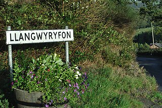
Llangwyryfon is a village and community in the county of Ceredigion, Wales. It lies on the B4576 about 8 miles to the south and east of Aberystwyth. The village lies in the valley of the River Wyre and contains the roadbridge where the B4576 crosses the Wyre downstream of which lies the confluence of the rivers Beidiog and the Wyre. The name Llangwyryfon derives from the tale of Saint Ursula to whom the village church is dedicated. Llan is Welsh for church and the gwyryddon are the 11,000 virgins who Ursula was martyred along with.
Bont Goch is a village in Ceredigion, Wales, 2 miles (3.2 km) northeast of Aberystwyth. With Talybont, it is in the community of Ceulanamaesmawr.
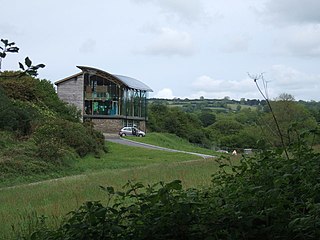
The Welsh Wildlife Centre is a wildlife reserve covering Teifi Marshes, near Cilgerran on the Pembrokeshire/Ceredigion border, Wales. The site is located close to the Cardigan-Cilgerran Offshoot of the Pembrokeshire Coastal Path.

The 2022 Ceredigion County Council election took place as of 5 May 2022 to elect 38 members to Ceredigion Council. On the same day, elections were held to the other 21 local authorities and to community councils in Wales as part of the 2022 Welsh local elections. The previous all-council election took place in May 2017 and future elections will take place every five years.

