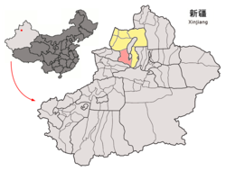
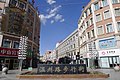
Altay is a county-level city in Altay Prefecture within Ili Kazakh Autonomous Prefecture, in far Northern Xinjiang, China. The city centre is located on the banks of Kelan River.

Changji is a county-level city situated about 40 km (25 mi) west of the regional capital, Ürümqi in Northern Xinjiang, China and has about 390,000 inhabitants. It is the seat of Changji Hui Autonomous Prefecture. At the northeast corner of the modern city are the walls and other archaeological remains of the Tang dynasty city, usually referred to as Ancient Changji.

Bole, also known by its Mongolian name Bortala, is a county-level city in Xinjiang, China. It is the seat of Bortala Mongol Autonomous Prefecture, which borders Kazakhstan. The city covers an area of 7,517 square kilometres (2,902 sq mi) and has a total population of 270,000 as of 2015. The Northern Xinjiang Railway runs through the city, as do highways to Ürümqi.
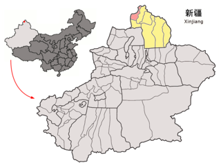
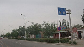
Habahe County as the official romanized name, also transliterated from Uyghur as Kaba County, is a county situated in the far north of the Xinjiang Uyghur Autonomous Region and is under the administration of the Altay Prefecture. It has an area of 8,179 km2 (3,158 sq mi) with a population of 80,000. The Postcode is 836700.

Jeminay County or Jimunai County, is a county situated in the north of the Xinjiang Uyghur Autonomous Region and is under the administration of the Altay Prefecture.

Yumin County as the official romanized name, also transliterated from Mongolian as Qagantokay County, is a county situated in the Xinjiang Uyghur Autonomous Region and is under the administration of the Tacheng Prefecture, bordering Kazakhstan's regions of East Kazakhstan and Almaty. It has an area of 6,090 km2 (2,350 sq mi) with a population of 50,000. The Postcode is 834800.

Shawan, also transliterated from Chinese to Uyghur as Savan, is a county-level city situated in the north of the Xinjiang Uyghur Autonomous Region under the administration of the Tacheng Prefecture. It has an area of 12,468 km2 (4,814 sq mi) with a population of 200,000. The Postcode is 832100.

Toli County is a county situated in the north of the Xinjiang Uyghur Autonomous Region and is under the administration of the Tacheng Prefecture. It has an area of 19,982 km2 (7,715 sq mi) with a population of 90,000. The Postcode is 834500.

Emin County, the official romanized name, also transliterated from Mongolian as Dörbiljin County, is a county situated in the north of the Xinjiang Uyghur Autonomous Region and is under the administration of the Tacheng Prefecture, bordering Kazakhstan's districts of Tarbagatay and Zaysan. It has an area of 9,092 km2 (3,510 sq mi) with a population of 200,000. The Postcode is 834600.

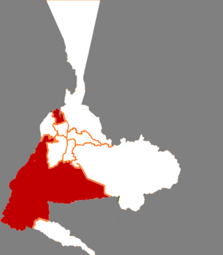
Hejing County is located in the central-southern part of the Tian Shan mountains of Xinjiang, in the north-west of Bayingolin Mongol Autonomous Prefecture. The northernmost county-level division of Bayingolin, it borders Ürümqi City to the north, from which it is 190 km (120 mi) as the crow flies, and Korla City to the south, which is 80 km (50 mi) away. It borders 15 cities and counties and is the most bordered county in the world.
Yuli County as the official Romanized name, also transliterated from Mongolian as Lopnur County, is a county in the Xinjiang Uyghur Autonomous Region and is under the administration of the Bayin'gholin Mongol Autonomous Prefecture. It contains an area of 59,399 km2 (22,934 sq mi). According to the 2002 census, it has a population of 100,000.

Hoxud County is a county in the Xinjiang Uyghur Autonomous Region and is under the administration of the Bayin'gholin Mongol Autonomous Prefecture. It contains an area of 12,753 km2 (4,924 sq mi). According to the 2002 census, it has a population of 60,000.

Manas County is a county in the Xinjiang Uyghur Autonomous Region under the administration of the Changji Hui Autonomous Prefecture. It covers an area of 9,174 square kilometres (3,542 sq mi) and as of the 2002 census it had a population of 170,000.

Hutubi County as the official romanized name, also transliterated from Uyghur as Kutubi County, is a county in the Xinjiang Uyghur Autonomous Region and is under the administration of the Changji Hui Autonomous Prefecture. It contains an area of 9,476 km2. According to the 2002 census, it has a population of 210,000.

Jinghe County as the official romanized name, also transliterated from Uyghur as Jing County, is a county of the Xinjiang Uyghur Autonomous Region and is under the administration of the Börtala Mongol Autonomous Prefecture. It contains an area of 11,181 square kilometres (4,317 sq mi). According to the 2002 census, it has a population of 120,000.
Wenquan County as the official romanized name, also transliterated from Mongolian as Arixang County, is a county in the northwest of the Xinjiang Uyghur Autonomous Region and is under the administration of the Börtala Mongol Autonomous Prefecture, bordering Kazakhstan's Almaty Region to the north and west. It contains an area of 5,900 km2 (2,300 sq mi). According to the 2002 census, it has a population of 70,000.
Ürümqi County is a county of Xinjiang Uyghur Autonomous Region, Northwest China, it is under the administration of the prefecture-level city of Ürümqi, the capital of Xinjiang. It contains an area of 4,601 km² and according to the 2002 census has a population of 80,000.

Yining County as the official romanized name, also transliterated from Uyghur as Gulja County, is a county within the Ili Kazakh Autonomous Prefecture of the Xinjiang Uyghur Autonomous Region of China. The county seat is in the town of Jëlilyüzi.

Zhaosu County, also known as Mongolküre County, is a county in northwestern Xinjiang, China. It is under the administration of Ili Kazakh Autonomous Prefecture and shares a border with Kazakhstan's Almaty Region to the west. It covers an area of 10,455 km2 (4,037 sq mi). According to the 2012 census, it had a population of 189,102.

Tekes County is a county within the Xinjiang Uyghur Autonomous Region and is under the administration of the Ili Kazakh Autonomous Prefecture. It contains an area of 8,067 km2. According to the 2002 census, it has a population of 150,000.