
The Oregon Trail was a 2,170-mile (3,490 km) east–west, large-wheeled wagon route and emigrant trail in the United States that connected the Missouri River to valleys in Oregon. The eastern part of the Oregon Trail spanned part of what is now the state of Kansas and nearly all of what are now the states of Nebraska and Wyoming. The western half of the trail spanned most of the current states of Idaho and Oregon.

Fort Bridger was originally a 19th-century fur trading outpost established in 1842, on Blacks Fork of the Green River, in what is now Uinta County, Wyoming, United States. It became a vital resupply point for wagon trains on the Oregon Trail, California Trail, and Mormon Trail. The Army established a military post here in 1858 during the Utah War, until it was finally closed in 1890. A small town, Fort Bridger, Wyoming, remains near the fort and takes its name from it.

A mountain man is an explorer who lives in the wilderness. Mountain men were most common in the North American Rocky Mountains from about 1810 through to the 1880s. They were instrumental in opening up the various emigrant trails allowing Americans in the east to settle the new territories of the far west by organized wagon trains traveling over roads explored and in many cases, physically improved by the mountain men and the big fur companies originally to serve the mule train based inland fur trade.

The Mormon Trail is the 1,300-mile (2,100 km) long route from Illinois to Utah that members of The Church of Jesus Christ of Latter-day Saints traveled for 3 months. Today, the Mormon Trail is a part of the United States National Trails System, known as the Mormon Pioneer National Historic Trail.

The California Trail was an emigrant trail of about 1,600 mi (2,600 km) across the western half of the North American continent from Missouri River towns to what is now the state of California. After it was established, the first half of the California Trail followed the same corridor of networked river valley trails as the Oregon Trail and the Mormon Trail, namely the valleys of the Platte, North Platte, and Sweetwater rivers to Wyoming. The trail has several splits and cutoffs for alternative routes around major landforms and to different destinations, with a combined length of over 5,000 mi (8,000 km).

Fort Laramie was a significant 19th-century trading post, diplomatic site, and military installation located at the confluence of the Laramie and the North Platte rivers. They joined in the upper Platte River Valley in the eastern part of the U.S. state of Wyoming. The fort was founded as a private trading post in the 1830s to service the overland fur trade; in 1849, it was purchased by the United States Army. It was located east of the long climb leading to the best and lowest crossing point of the Rocky Mountains at South Pass and became a popular stopping point for migrants on the Oregon Trail. Along with Bent's Fort on the Arkansas River, the trading post and its supporting industries and businesses were the most significant economic hub of commerce in the region.

The Bozeman Trail was an overland route in the western United States, connecting the gold rush territory of southern Montana to the Oregon Trail in eastern Wyoming. Its most important period was from 1863–68. Despite the fact that "the major part of the route in Wyoming used by all Bozeman Trail travelers in 1864 was pioneered by Allen Hurlbut", it was named after John Bozeman. Many miles of the Bozeman Trail in present Montana followed the tracks of Bridger Trail, opened by Jim Bridger in 1864.

The Laramie Plains is an arid highland at an elevation of approx. 8,000 feet (2,400 m) in south central Wyoming in the United States. The plains extend along the upper basin of the Laramie River on the east side of the Medicine Bow Range. The city of Laramie is the largest community in the valley. The plains are separated from the Great Plains to the east by the Laramie Mountains, a spur of the Front Range that extends northward from Larimer County, Colorado west of Cheyenne. The high altitude of the region makes for a cold climate and a relatively short growing season. Unsuitable to most cultivation, the plains have historically been used for livestock raising, primarily of sheep and cattle.

The Cherokee Trail was a historic overland trail through the present-day U.S. states of Oklahoma, Kansas, Colorado, and Wyoming that was used from the late 1840s up through the early 1890s. The route was established in 1849 by a wagon train headed to the gold fields in California. Among the members of the expedition were a group of Cherokee. When the train formed in Indian Territory, Lewis Evans of Evansville, Arkansas, was elected Captain. Thus, this expedition is sometimes written as the Evans/Cherokee Train. In 1850 four wagon trains turned west on the Laramie Plains, along Wyoming's southern border to Fort Bridger.
Piedmont is a ghost town located in Unita County, Wyoming, United States. It was once a thriving small railroad and timber town, but started to decline when Union Pacific opened a new line that bypassed the town.
The Central Overland Route was a transportation route from Salt Lake City, Utah south of the Great Salt Lake through the mountains of central Nevada to Carson City, Nevada. For a decade after 1859, until the first Transcontinental Railroad was completed in 1869, it served a vital role in the transport of emigrants, mail, freight, and passengers between California, Nevada, and Utah.
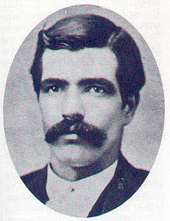
Thomas James Smith, also known as Tom "Bear River" Smith, was a lawman in the American Old West and briefly marshal of cattle town Abilene, Kansas. He was killed and nearly decapitated in the line of duty.

There is evidence of prehistoric human habitation in the region known today as the U.S. state of Wyoming stretching back roughly 13,000 years. Stone projectile points associated with the Clovis, Folsom and Plano cultures have been discovered throughout Wyoming. Evidence from what is now Yellowstone National Park indicates the presence of vast continental trading networks since around 1000 years ago. The Union Pacific Railroad played a central role in the European settlement of the area. Wyoming became a U.S. territory in 1868 and became the 44th U.S. state in 1890. It was the first state to grant women the right to vote, in 1869.

The path followed by the Oregon Trail, California Trail and Mormon Trail spans 400 miles (640 km) through the U.S. state of Wyoming. The trail entered from Nebraska on the eastern border of the state near the present day town of Torrington and exited on the western border near the towns of Cokeville and Afton. An estimated 350,000 to 400,000 settlers traveled on the trail through Wyoming between 1841 and 1868. All three trails follow the same path through most of the state. The Mormon Trail splits at Fort Bridger and enters Utah, while the Oregon and California Trails continue to Idaho.

The Great Platte River Road was a major overland travel corridor approximately following the course of the Platte River in present-day Nebraska and Wyoming that was shared by several popular emigrant trails during the 19th century, including the Trapper's Trail, the Oregon Trail, the Mormon Trail, the California Trail, the Pony Express route, and the military road connecting Fort Leavenworth and Fort Laramie. The road, which extended nearly 800 miles (1,300 km) from the Second Fort Kearny to Fort Laramie, was utilized primarily from 1841 to 1866. In modern times it is often regarded as a sort of superhighway of its era, and has been referred to as "the grand corridor of America's westward expansion".
The Overland Trail was a stagecoach and wagon trail in the American West during the 19th century. While portions of the route had been used by explorers and trappers since the 1820s, the Overland Trail was most heavily used in the 1860s as a route alternative to the Oregon, California, and Mormon trails through central Wyoming. The Overland Trail was famously used by the Overland Stage Company owned by Ben Holladay to run mail and passengers to Salt Lake City, Utah, via stagecoaches in the early 1860s. Starting from Atchison, Kansas, the trail descended into Colorado before looping back up to southern Wyoming and rejoining the Oregon Trail at Fort Bridger. The stage line operated until 1869 when the completion of the First Transcontinental Railroad eliminated the need for mail service via stagecoach.
Fort Halleck was a military outpost that existed in the 1860s along the Overland Trail and stage route in what was then the Territory of Idaho, now the U.S. state of Wyoming. The fort was established in 1862 to protect emigrant travelers and stages transporting mail between Kansas and Salt Lake City, Utah, and named for Major General Henry Wager Halleck, commander of the Department of the Missouri and later General-in-chief of the Union armies.
Bridger Valley is a landform of Uinta County, Wyoming, United States, where Fort Bridger was established in 1843 to service emigrant traffic. For the next century, the region served as a crossroads for the "California/Oregon Trail, the Mormon Trail, the Pony Express Route, the Transcontinental Railroad, and the Lincoln Highway. Today, the valley is a historic byway, incorporating the small towns of Fort Bridger, Urie, Mountain View, and Lyman". Bridger Valley Historic Byway is an approximately 20 miles (32 km) loop showcasing some of Wyoming's most treasured historical sites.
In the American Old West, overland trails were built by pioneers and immigrants throughout the 19th century and especially between 1829 and 1870 as an alternative to sea and railroad transport. These immigrants began to settle much of North America west of the Great Plains as part of the mass overland migrations of the mid-19th century. Settlers emigrating from the eastern United States were spurred by various motives, among them religious persecution and economic incentives, to move to destinations in the far west via routes including the Oregon Trail, California Trail, and Mormon Trail. After the end of the Mexican–American War in 1849, vast new American conquests again enticed mass immigration. Legislation like the Donation Land Claim Act and significant events like the California Gold Rush further lured people to travel overland to the west.
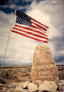
The historic 2,170-mile (3,490 km) Oregon Trail connected various towns along the Missouri River to Oregon's Willamette Valley. It was used during the 19th century by Great Plains pioneers who were seeking fertile land in the West and North.

