Brighton, Boston

Last updated

Brighton
BCreservoir2.jpg
The Chestnut Hill Reservoir is located in the Brighton neighborhood. (Boston College can be seen in the background).
Brighton Mass Town Seal.png
Nicknames: 
Little Cambridge, South Cambridge, Third Parish (all archaic)
CountryUnited States
State Massachusetts
County Suffolk
Neighborhood of Boston
Settled1630
IncorporatedFebruary 24, 1807
Annexed by BostonJanuary 5, 1874
Area
  Land2.78 sq mi (7.2 km2)
Population
  Total43,880
  Density15,784/sq mi (6,095/km2)
Time zone Eastern
  Summer (DST) Eastern
Zip Code
02135
Area code 617 / 857
Website Official website

Brighton is a former town and current neighborhood of Boston, Massachusetts, United States, [1] located in the northwestern corner of the city. It is named after the English city of Brighton. Initially Brighton was part of Cambridge, and known as "Little Cambridge". Brighton separated from Cambridge in 1807 after a bridge dispute, and was annexed to Boston in 1874. [2] For much of its early history, it was a rural town with a significant commercial center at its eastern end.

Contents

The neighborhood of Allston was also formerly part of the town of Brighton, but is now often considered to be separate, leading to the name Allston–Brighton for the combined area. This historic center of Brighton is the Brighton Center Historic District. The Aberdeen section of Brighton was designated as a local architectural conservation district by the Boston Landmarks Commission in 2001. [3]

History

The Old First Church of Brighton 1744-1811 Old FIrst Church of Brighton 1744-1811.png
The Old First Church of Brighton 1744–1811
1852 map of Boston area showing Brighton and rail lines 1852 Middlesex Canal (Massachusetts) map.jpg
1852 map of Boston area showing Brighton and rail lines

In 1630, land comprising present-day Allston–Brighton and Newton was assigned to Watertown. [4] In 1634, the Massachusetts Bay Colony transferred ownership of the south side of the Charles River, including present-day Allston–Brighton and Newton, from Watertown to Newtowne, [4] which was soon renamed Cambridge. In 1646, Reverend John Eliot established a "Praying Indian" village on the present Newton–Brighton boundary, where resided local natives converted to Christianity. The first permanent English settlement came as settlers crossed the Charles River from Cambridge, establishing Little Cambridge, the area's name before 1807.

Before the American Revolutionary War, Little Cambridge became a small, prosperous farming community with fewer than 300 residents. Its inhabitants included wealthy Boston merchants such as Benjamin Faneuil (after whom a street in Brighton is named). A key event in the history of Allston–Brighton was the establishment in 1775 of a cattle market to supply the Continental Army. Jonathan Winship I and Jonathan Winship II established the market, and in the post-war period that followed, the Winships became the largest meat packers in Massachusetts. The residents of Little Cambridge resolved to secede from Cambridge when the latter's government made decisions detrimental to the cattle industry and also failed to repair the Great Bridge linking Little Cambridge with Cambridge proper. Legislative approval for separation was obtained in 1807, and Little Cambridge renamed itself Brighton.

In 1820, the horticulture industry was introduced to the town. Over the next 20 years, Brighton blossomed as one of the most important gardening neighborhoods in the Boston area. Its businessmen did not neglect the cattle industry, however. In 1834, the Boston & Worcester Railroad was built, solidifying the community's hold on the cattle trade. By 1866, the town contained 41 slaughterhouses, which later were consolidated into the Brighton Stock Yards and Brighton Abattoir.

In October 1873, the Town of Brighton in Middlesex County voted to annex itself to the City of Boston in Suffolk County, and in January 1874 Brighton officially became part of the City of Boston. Allston–Brighton's population grew rapidly in the next 50 years, rising from 6,000 in 1875 to 47,000 by 1925. [5]

Transportation

Brighton is accessible via the B branch of the Massachusetts Bay Transportation Authority (MBTA)'s Green Line light rail service, which has 11 stops along Commonwealth Avenue in Brighton. Cleveland Circle on the C branch is located in the southern tip of Brighton, and the D branch is nearby. The former A branch of the Green Line, (discontinued in 1969), also served the community. Brighton is also served by MBTA bus routes 57, 57A, 64, 65, 66, 70, 86, 501, and 503, as well as Boston Landing station on the MBTA Commuter Rail Framingham/Worcester Line.

Geography

Cemetery and apartment houses along Commonwealth Avenue, Brighton, near Chandler's Pond Cemetery in Brighton Boston.jpg
Cemetery and apartment houses along Commonwealth Avenue, Brighton, near Chandler's Pond

Brighton is connected to the rest of Boston by the Allston neighborhood. It is otherwise surrounded by Cambridge, Watertown, Newton, and Brookline. The Charles River separates Brighton from Cambridge and Watertown. According to the Census Bureau, Brighton, defined by zip code 02135, has a population of 43,887 and a land area of 2.78 square miles (7.2 km2).

Brighton is administered jointly with the adjacent neighborhood of Allston (zip code 02134). The two are referred to together as "Allston–Brighton " (and by some as "Brighton–Allston"), and (also according to Census Bureau data) have a combined population of 65,276 and a land area of 4.12 square miles (10.7 km2). Brighton is generally to the west of Everett, Gordon and Kelton streets. As of 2020, the city councilor of Allston-Brighton is Liz Breadon. [6] Breadon's predecessor Mark Ciommo held this position from 2007 to 2019.

Demographics

As of 2020, the estimated population of Brighton is 48,330. [7] The population density is 15,784 per mi2, slightly lower than the citywide average of 16,686 per mi2. The median age is 29.3. The largest measured age cohort is 25–34, which comprises 36.4% of the population (note: depending on methodology, college students might not be counted). 60.7% of the population have never been married. [8]

The population was 65.5% white, 14.9% Asian American, 4.4% black or African American, and nearly 11.1% Hispanic of any race. [8]

65.5% of Brighton residents graduated from a four-year college. [8]

As of 2020, the median home price was $542,900 compared with $291,700 for the country as a whole, and the cost of living was 30% higher than the national average. [8] Brighton has a comparatively older housing stock. The median home age was 67 years and 39.8% of homes were built before 1939. [8]

Race and ancestry

Brighton (02135) Racial Breakdown of Population (2017) [9] [10]
RacePercentage of
02135
population
Percentage of
Massachusetts
population
Percentage of
United States
population
ZIP Code-to-State
Difference
ZIP Code-to-USA
Difference
White 72.2%81.3%76.6%–9.1%–4.4%
White (Non-Hispanic) 66.3%72.1%60.7%–5.8%+5.6%
Asian 15.8%6.9%5.8%+8.9%+10.0%
Hispanic 10.2%11.9%18.1%–1.7%–7.9%
Black 5.1%8.8%13.4%–3.7%–8.3%
Native Americans/Hawaiians 0.5%0.6%1.5%–0.1%–1.0%
Two or more races 2.6%2.4%2.7%+0.2%–0.1%

According to the 2012-2016 American Community Survey 5-Year Estimates, the largest ancestry groups in ZIP Code 02135 are: [11] [9]

AncestryPercentage of
02135
population
Percentage of
Massachusetts
population
Percentage of
United States
population
ZIP Code-to-State
Difference
ZIP Code-to-USA
Difference
Irish 20.35%21.16%10.39%–0.80%+9.97%
Italian 10.96%13.19%5.39%–2.23%+5.57%
Chinese 10.70%2.28%1.24%+8.42%+9.46%
English 7.72%9.77%7.67%–2.06%+0.05%
German 5.82%6.00%14.40%–0.19%–8.59%
Russian 4.37%1.65%0.88%+2.72%+3.49%
Polish 3.96%4.67%2.93%–0.71%+1.03%
Puerto Rican 2.85%4.52%1.66%–1.67%+1.19
American 2.51%4.26%6.89%–1.75%–4.39%
French 2.37%6.82%2.56%–4.45%–0.19%
French Canadian 1.98%3.91%0.65%–1.92%+1.33%
Mexican 1.79%0.67%11.96%+1.12%–10.17%
Sub-Saharan African 1.66%2.00%1.01%–0.34%+0.64%
Scottish 1.57%2.28%1.71%–0.72%–0.15%
Asian Indian 1.56%1.39%1.09%+0.17%+0.37%
Swedish 1.35%1.67%1.23%–0.32%+0.12%
Greek 1.32%1.22%0.40%+0.10%+0.82%
Portuguese 1.06%4.40%0.43%–3.34%+0.63%

Education

Brighton High School Brighton High School, Boston 2011-04-17 (1).jpg
Brighton High School

Brighton is home to many Boston Public Schools:

Elementary
Secondary

Brighton was home to many Catholic schools, many of which have closed: Our Lady of the Presentation in Oak Square (closed 2005), Saint Gabriel's, behind Saint Elizabeth Medical Center (closed 1970), Saint Sebastian's School in the Oak Square Heights (moved to Needham in 1977). Our Lady of Presentation School is currently under study for landmark status by the Boston Landmarks Commission. Remaining are Saint Columbkille's School on Arlington Street (K–8) and St. Joseph's Preparatory Academy (formerly Mount St. Joseph Academy), a co-educational high school located on Cambridge Street. The EF International Language School, an English and college preparatory school for international students, is located on Lake Street. The City of Boston leases the former Hamilton Elementary School building on Chestnut Hill Avenue to Bais Yaakov High School for Girls and Torah Academy of Brookline; Shaloh House Hebrew Day School is several blocks away.

The McMullen Museum of Art at Boston College The McMullen Museum of Art at Boston College, Brighton, MA.jpg
The McMullen Museum of Art at Boston College

Brighton is home to the Everest Institute, Saint John's Seminary and portions of Boston College. The area is also close to other colleges, including Boston University, and houses many of their students and faculty.

Notable people

Related Research Articles

<span class="mw-page-title-main">Cambridge, Massachusetts</span> City in the Commonwealth of Massachusetts

Cambridge is a city in Middlesex County, Massachusetts, in the United States. It is a suburb in the Greater Boston metropolitan area, located directly across the Charles River from Boston. The city's population as of the 2020 U.S. census was 118,403, making it the most populous city in the county, the fourth-largest in Massachusetts, behind Boston, Worcester, and Springfield, and ninth-most populous in New England. The city was named in honor of the University of Cambridge in Cambridge, England, which was an important center of the Puritan theology that was embraced by the town's founders.

<span class="mw-page-title-main">Waltham, Massachusetts</span> City in Massachusetts, United States

Waltham is a city in Middlesex County, Massachusetts, United States, and was an early center for the labor movement as well as a major contributor to the American Industrial Revolution. The original home of the Boston Manufacturing Company, the city was a prototype for 19th century industrial city planning, spawning what became known as the Waltham-Lowell system of labor and production. The city is now a center for research and higher education, home to Brandeis University and Bentley University as well as industrial powerhouse Raytheon Technologies. The population was 65,218 at the census in 2020.

<span class="mw-page-title-main">Middlesex County, Massachusetts</span> County in Massachusetts, United States

Middlesex County is located in the Commonwealth of Massachusetts, in the United States. As of the 2020 census, the population was 1,632,002, making it the most populous county in both Massachusetts and New England and the 22nd most populous county in the United States. Middlesex County is one of two U.S. counties to be amongst the top 25 counties with the highest household income and the 25 most populated counties. It is included in the Census Bureau's Boston–Cambridge–Newton, MA–NH Metropolitan Statistical Area. As part of the 2020 United States census, the Commonwealth's mean center of population for that year was geo-centered in Middlesex County, in the town of Natick.

<span class="mw-page-title-main">Suffolk County, Massachusetts</span> County in Massachusetts, United States

Suffolk County is located in the Commonwealth of Massachusetts, in the United States. As of the 2020 census, the population was 797,936, making it the fourth-most populous county in Massachusetts. The county comprises the cities of Boston, Chelsea, Revere, and Winthrop. The traditional county seat is Boston, the state capital and the largest city in Massachusetts. The county government was abolished in 1999, and so Suffolk County today functions only as an administrative subdivision of state government and a set of communities grouped together for some statistical purposes. Suffolk County is located at the core of the Boston-Cambridge-Newton, MA-NH Metropolitan Statistical Area as well as the greater Boston-Worcester-Providence, MA-RI-NH-CT Combined Statistical Area.

<span class="mw-page-title-main">Brookline, Massachusetts</span> Town in Massachusetts, United States

Brookline is a town in Norfolk County, Massachusetts, United States, and part of the Boston metropolitan area. Brookline borders six of Boston's neighborhoods: Brighton, Allston, Fenway–Kenmore, Mission Hill, Jamaica Plain, and West Roxbury. The city of Newton lies to the west of Brookline. Brookline was first settled in 1638 as a hamlet in Boston, known as Muddy River; it was incorporated as a separate town in 1705.

<span class="mw-page-title-main">Newton, Massachusetts</span> City in Massachusetts, United States

Newton is a city in Middlesex County, Massachusetts, United States. It is approximately 7 miles (11 km) west of downtown Boston, and comprises a patchwork of thirteen villages without a city center. It is home to the Charles River, Crystal Lake, and Heartbreak Hill, among other landmarks. It is served by several streets and highways, as well as the Green Line D branch run by the MBTA.

<span class="mw-page-title-main">Billerica, Massachusetts</span> Town in Massachusetts, United States

Billerica is a town in Middlesex County, Massachusetts, United States. The population was 42,119 according to the 2020 census. It takes its name from the town of Billericay in Essex, England.

<span class="mw-page-title-main">Watertown, Massachusetts</span> City in Massachusetts, United States

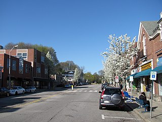
Watertown is a city in Middlesex County, Massachusetts, United States, part of Greater Boston. The population was 35,329 in the 2020 census. Its neighborhoods include Bemis, Coolidge Square, East Watertown, Watertown Square, and the West End.

<span class="mw-page-title-main">Weston, Massachusetts</span> Town in Massachusetts, United States

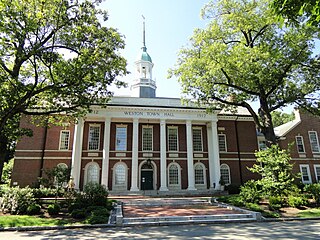
Weston is a town in Middlesex County, Massachusetts, about 15 miles west of Boston. At the time of the 2020 United States Census, the population of Weston was 11,851.

<span class="mw-page-title-main">Belmont, Massachusetts</span> Town in eastern Massachusetts

Belmont is a town in Middlesex County, Massachusetts, United States. It is a western suburb of Boston, Massachusetts, United States; and is part of the Greater Boston metropolitan area. At the 2020 U.S. census, its population was 27,295, up 10.4% from 2010.

<span class="mw-page-title-main">Greater Boston</span> Metropolitan area in the United States

Greater Boston is the metropolitan region of New England encompassing the municipality of Boston, the capital of the U.S. state of Massachusetts and the most populous city in New England, and its surrounding areas. The most stringent definition of the region consists of most of the eastern third of mainland Massachusetts, excluding the Merrimack Valley and most of Southeastern Massachusetts.

<span class="mw-page-title-main">Allston</span> Neighborhood of Boston in Suffolk, Massachusetts, United States

Allston is an officially recognized neighborhood within the City of Boston, Massachusetts. It was named after the American painter and poet Washington Allston. It comprises the land covered by the zip code 02134. For the most part, Allston is administered collectively with the adjacent neighborhood of Brighton. The two are often referred to together as Allston–Brighton. Boston Police Department District D-14 covers the Allston-Brighton area and a Boston Fire Department Allston station is located in Union Square which houses Engine 41 and Ladder 14. Engine 41 is nicknamed "The Bull" to commemorate the historic stockyards of Allston.

<span class="mw-page-title-main">Green Line B branch</span> Light rail line in Boston, Massachusetts

The B branch, also called the Commonwealth Avenue branch or Boston College branch, is a branch of the MBTA Green Line light rail system which operates on Commonwealth Avenue west of downtown Boston, Massachusetts. One of four branches of the Green Line, the B branch runs from Boston College station down the median of Commonwealth Avenue to Blandford Street. There, it enters Blandford Street portal into Kenmore station, where it merges with the C and D branches. The combined services run into the Boylston Street subway and Tremont Street subway to downtown Boston. B branch service has terminated at Government Center since October 2021. Unlike the other branches, the B branch runs solely through the city limits of Boston. The Green Line Rivalry between Boston College and Boston University is named in reference to the B branch, which runs to both universities.

<span class="mw-page-title-main">Green Line A branch</span> Former streetcar line in Massachusetts, US

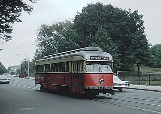
The A branch or Watertown Line was a streetcar line in the Boston, Massachusetts, area, operating as a branch of the Massachusetts Bay Transportation Authority Green Line. The line ran from Watertown through Newton Corner, Brighton, and Allston to Kenmore Square, then used the Boylston Street subway and Tremont Street subway to reach Park Street station.

Allston–Brighton is a set of two interlocking neighborhoods, Allston and Brighton, both part of the city of Boston, Massachusetts.

<span class="mw-page-title-main">Commonwealth Avenue (Boston)</span> Major street in Boston & Newton, Massachusetts

Commonwealth Avenue is a major street in the cities of Boston and Newton, Massachusetts. It begins at the western edge of the Boston Public Garden, and continues west through the neighborhoods of the Back Bay, Kenmore Square, Boston University, Allston, Brighton and Chestnut Hill. It continues as part of Route 30 through Newton until it crosses the Charles River at the border of the town of Weston.

<span class="mw-page-title-main">Union Square, Boston</span>

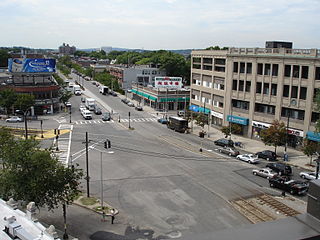
Union Square is a square in the Allston neighborhood of Boston, Massachusetts at the intersection of Cambridge Street and Brighton Avenue/North Beacon Street. Union Square is serviced by the MBTA 57, 64, 66, 501, and 503 buses. There is also a station for the Blue Bikes bicycle sharing system in Union Square.

<span class="mw-page-title-main">Boston Landing station</span> Railway station in Brighton, Massachusetts, US

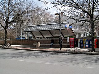
Boston Landing station is an MBTA Commuter Rail station in Boston, Massachusetts, United States. It serves the Framingham/Worcester Line. It is located in the Brighton neighborhood just west of the Everett Street bridge, next to the Massachusetts Turnpike. It serves the Allston-Brighton area as well as the Boston Landing development including Warrior Ice Arena. The station is fully accessible, with a single full-length high-level island platform. Elevators and stairs lead to Arthur Street and to the Everett Street bridge.

<span class="mw-page-title-main">Newton Corner station</span> Transit hub in Newton, Massachusetts, US

Newton Corner is an MBTA bus transfer point in the Newton Corner neighborhood of Newton, Massachusetts, located on the rotary where Washington Street crosses the Massachusetts Turnpike. The Newton Corner station, known simply as Newton for much of its lifetime, served commuters on the Worcester Line from 1834 to 1959. A streetcar stop, located on the surface streets, served a number of routes beginning in 1863, including the Green Line A branch until 1969. Newton Corner is now a stop and transfer point for MBTA routes 52, 57, 501, 504, 553, 554, 556, and 558, which include express routes to downtown Boston as well as local routes, with stops on the north and south sides of the rotary.

<span class="mw-page-title-main">Liz Breadon</span> American politician

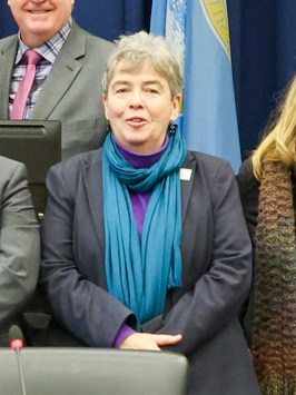
Elizabeth A. "Liz" Breadon is a Democratic member of the Boston City Council who serves the Allston and Brighton neighborhoods of Boston, Massachusetts. Having emigrated from Northern Ireland, she was the first openly LGBTQ woman elected to Boston City Council.

References

  1. "Boston's Neighborhoods: Allston/Brighton". Boston Redevelopment Authority (BRA). 2010. Retrieved August 17, 2010.
  2. "History of Brighton-Allston". Bahistory.org. Retrieved October 19, 2016.
  3. "Aberdeen Architectural Conservation District". July 13, 2016.
  4. 1 2 "History of Brighton-Allston". Bahistory.org. Retrieved January 29, 2008.
  5. "Archived Document". Archived from the original on February 20, 2012. Retrieved 2011-12-21.
  6. "LIZ BREADON City Councilor, District 9". City of Boston. January 7, 2020. Retrieved June 10, 2020.
  7. "2020 U.S. Census Redistricting Data Release". Boston Plans. Boston Plans. Retrieved October 20, 2022.
  8. 1 2 3 4 5 "Best Places" . Retrieved October 18, 2022.
  9. 1 2 "ACS DEMOGRAPHIC AND HOUSING ESTIMATES 2012-2016 American Community Survey 5-Year Estimates". U.S. Census Bureau . Retrieved August 25, 2018.
  10. "Massachusetts QuickFacts from the US Census Bureau". census.gov.
  11. "PEOPLE REPORTING ANCESTRY 2012-2016 American Community Survey 5-Year Estimates". U.S. Census Bureau. Retrieved August 25, 2018.

Further reading

42°21′N71°10′W / 42.35°N 71.16°W / 42.35; -71.16