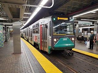
The Green Line is a semi-metro system run by the Massachusetts Bay Transportation Authority (MBTA) in the Boston, Massachusetts, metropolitan area. It is the oldest MBTA subway line, and with tunnel sections dating from 1897, the oldest subway in North America. It runs underground through downtown Boston, and on the surface into inner suburbs via six branches on radial boulevards and grade-separated alignments. With an average daily weekday ridership of 137,700 in 2019, it is the third-most heavily used light rail system in the country. The line was assigned the green color in 1967 during a systemwide rebranding because several branches pass through sections of the Emerald Necklace of Boston.
Downtown Crossing station is an underground Massachusetts Bay Transportation Authority (MBTA) rapid transit station located in the Downtown Crossing retail district in the downtown core of Boston, Massachusetts. It is served by the Orange Line and Red Line, and is one of four "hub stations" on the MBTA subway system. Downtown Crossing is also a major bus transfer location serving 13 MBTA bus routes, including one Silver Line route. It is the second busiest subway station in the MBTA network, with an average of 24,074 entries per weekday in FY2019.

Longwood station is a light rail station on the MBTA Green Line D branch, located on Chapel Street in Brookline, Massachusetts, on the border with Boston, just north of Longwood Avenue. It serves the Longwood Medical Area, the Colleges of the Fenway, and residential areas of Brookline. The station opened with the rest of the line on July 4, 1959. After renovation work completed in 2009, Longwood station is accessible from both Chapel Street and Riverway Park.

Reservoir station is a light rail station on the MBTA Green Line D branch, located in Brookline, Massachusetts, adjacent to the Cleveland Circle area of Brighton. The station is adjacent to Reservoir Yard and Carhouse, with the Cleveland Circle terminus of the C branch just a block away. With a daily ridership of 3,395, Reservoir is the second-busiest surface stop on the D branch.

Coolidge Corner station is a light rail stop on the MBTA Green Line C branch, located at the intersection of Beacon Street and Harvard Street in the Coolidge Corner neighborhood of Brookline, Massachusetts. With 3,440 daily boardings by a 2011 count, it had more than twice the ridership of any other surface station on the branch.

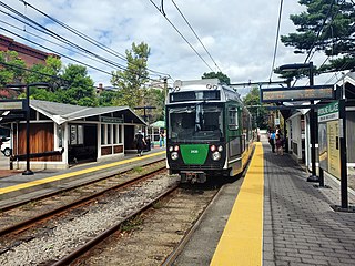
The Green Line D branch is a light rail line in Boston, Brookline, Cambridge, Newton, and Somerville, Massachusetts, operating as part of the Massachusetts Bay Transportation Authority (MBTA) Green Line. The line runs on a grade separated surface right-of-way for 9 miles (14 km) from Riverside station to Fenway station. The line merges into the C branch tunnel west of Kenmore, then follows the Boylston Street subway and Tremont Street subway to North Station. It is the longest and busiest of the four Green Line branches. As of February 2023, service operates on 8 to 9-minute headways at weekday peak hours and 8 to 11-minute headways at other times, using 13 to 19 trains.

Museum of Fine Arts is a surface-level light rail stop on the MBTA Green Line E branch, located the median of Huntington Avenue in Boston, Massachusetts, between Museum Road and Ruggles Street. The station is named after the adjacent Museum of Fine Arts, although it also provides access to Northeastern University, Wentworth Institute of Technology, and the Isabella Stewart Gardner Museum. Museum of Fine Arts station is accessible.

Waban station is a surface-level light rail station on the Massachusetts Bay Transportation Authority's Green Line D branch, located just south of Beacon Street at Waban Square in the Waban section of Newton, Massachusetts. The station is located below grade; access to both platforms is via Wyman Street on the outbound side of the tracks or a stairway from Beacon Street. Waban is not accessible.

Fenway station is a light rail stop on the MBTA Green Line D branch, located under Park Drive near the Riverway in the Fenway–Kenmore neighborhood of Boston, Massachusetts. It opened along with the rest of the D branch on July 4, 1959, when trolleys replaced Highland branch commuter rail service. The station is fully accessible from Park Drive via the Landmark Center parking lot, as well as from Miner Street. Named after the Fenway parkway rather than Fenway Park, it is further from the stadium than Kenmore, though still used during events.

Back of the Hill station is a surface stop on the light rail MBTA Green Line E branch, located in the Mission Hill neighborhood of Boston, Massachusetts. It is named after, and primarily serves, the adjacent Back of the Hill apartment complex, a Section 8 development for elderly and disabled residents. Back of the Hill is located on the street running section of the E branch on South Huntington Avenue. The station has no platforms; passengers wait in bus shelters on the sidewalks and cross a traffic lane to reach Green Line trains.
Brookline Village station is a light rail station on the MBTA Green Line D branch, located in the Brookline Village neighborhood of Brookline, Massachusetts, United States. It was originally a commuter rail station on the Boston and Albany Railroad's Highland branch; it closed with the rest of the line in 1958 and reopened on July 4, 1959 as a light rail station. With 3,230 daily boardings, it is the third-busiest surface station on the D branch and the sixth-busiest surface station overall. Brookline Village station has raised platforms for accessibility with low-floor light rail vehicles.

Beaconsfield is an MBTA light rail station in Brookline, Massachusetts. It serves the Green Line D branch. It is located off Dean Road and Beaconsfield Road just south of Beacon Street. Like the other stops on the line, it was a commuter rail station on the Boston and Albany Railroad's Highland branch until 1958, when the line was closed and converted to a branch of what is now the Green Line. The station reopened along with the rest of the line in 1959.

St. Mary's Street station is a surface light rail stop on the MBTA Green Line C branch, located just west of the intersection of Beacon Street and Park Drive in the northeastern tip of Brookline, Massachusetts. Like all surface stops on the line, St Mary's Street has two side platforms serving two tracks. The station is accessible. With just over 1,500 daily boardings by a 2011 count, St. Mary's Street is the second-busiest stop on the C branch, behind only Coolidge Corner.

Newton Centre station is a light rail station on the MBTA Green Line D branch, located in the Newton Centre village of Newton, Massachusetts. A former commuter rail station, it was converted for light rail use and reopened on July 4, 1959, along with the rest of the line. The 1891-built station and express office are part of the Newton Railroad Stations Historic District, which was placed on the National Register of Historic Places in 1976.

Washington Square station is a surface light rail stop on the MBTA Green Line C branch, located in the median of Beacon Street in the Washington Square neighborhood of Brookline, Massachusetts. Washington Square is the 4th-busiest surface stop on the line, with 1,091 daily boardings by a 2011 count. The station has two side platforms serving two tracks.

Woodland station is a light rail stop on the MBTA Green Line D branch, located off Washington Street (MA-16) between the Newton Lower Falls and Auburndale villages of Newton, Massachusetts, United States. It serves as access to the Newton-Wellesley Hospital, as well as a park and ride station for nearby Route 128.

Wellesley Square station is a commuter rail station on the MBTA Commuter Rail Framingham/Worcester Line, located just north of the MA 16-MA 135 intersection in downtown Wellesley, Massachusetts. It serves both walk-up and park-and-ride commuters, with a 224-space parking lot for the latter group. The station has low-level platforms and is not accessible.

Chestnut Hill station is a light rail station on the MBTA Green Line D branch, located off Hammond Street north of Massachusetts Route 9 in the Chestnut Hill neighborhood of Newton, Massachusetts. The station has two side platforms serving the line's two tracks. Chestnut Hill station is not accessible, but renovations are planned.

Boston University Central station is a surface-level light rail station on the MBTA Green Line B branch, located the center median of Commonwealth Avenue west of St. Marys Street in Boston, Massachusetts, surrounded by the Boston University campus. It consists of two side platforms, which serve the B branch's two tracks. The station is accessible, with raised platforms to allow level boarding onto low-floor trams and a high platform on the inbound side to serve high-floor light rail vehicles.

Washington Street station is a surface stop on the Massachusetts Bay Transportation Authority (MBTA)'s Green Line B branch, located in Brighton, Boston. The station is located in the median of Commonwealth Avenue northeast of Washington Street. Washington Street station consists of two side platforms, which serve the B branch's two tracks. The station is fully accessible.


