
Escambia County is the westernmost and oldest county in the U.S. state of Florida. It is in the state's northwestern corner. At the 2020 census, the population was 321,905. Its county seat and largest city is Pensacola. Escambia County is included within the Pensacola-Ferry Pass-Brent, Florida, Metropolitan Statistical Area. The county population has continued to increase as the suburbs of Pensacola have developed.

Santa Rosa County is a county located in the northwestern portion of the U.S. state of Florida. As of 2020, the population is 188,000. The county seat is Milton, which lies in the geographic center of the county. Other major communities within Santa Rosa County are Navarre, Pace, and Gulf Breeze. Navarre is the most populated community with a population of approximately 45,000 residents. Santa Rosa County is included in the Pensacola Metropolitan Statistical Area, which also includes Escambia County.

Escambia County is a county located in the south central portion of the U.S. state of Alabama. As of the 2020 census, the population was 36,757. Its county seat is Brewton.

Flomaton is a town in Escambia County, Alabama, United States. At the 2010 census the town's population was 1,440. It is located next to the Alabama / Florida state line.

Bellview is a census-designated place (CDP) in Escambia County, Florida. It is considered to be a community within Pensacola. The population was 23,355 at the 2010 census. It is part of the Pensacola–Ferry Pass–Brent Metropolitan Statistical Area.

Brent is a census-designated place (CDP) in Escambia County, Florida. It is considered to be a community within Pensacola. The population was 21,804 at the 2010 census. It is a principal area of the Pensacola-Ferry Pass-Brent Metropolitan Statistical Area. The community is named after Francis Celestino Brent, who played an integral role in the development of Pensacola.

Century is a town in Escambia County, Florida, United States. Per the 2020 census, the population was 1,713. It is part of the Pensacola–Ferry Pass–Brent Metropolitan Statistical Area.

Ensley is a census-designated place (CDP) in Escambia County, Florida. It is a community in Pensacola, and is located northwest of Pensacola City Limits. As of the 2010 United States Census, the population was 20,602. It is part of the Pensacola–Ferry Pass–Brent Metropolitan Statistical Area. Ensley is a transportation corridor for the Pensacola Area, with US-90 ALT, US-29, and Interstate 10 running through Ensley.

Ferry Pass is a census-designated place (CDP) in Escambia County, Florida. It is a community in Pensacola, and is located north of Pensacola City Limits. As of the 2010 United States Census, the population was 28,921. The University of West Florida, located in Ferry Pass, is the only university located in the Pensacola Metropolitan Area.

Gonzalez is a census-designated place (CDP) in Escambia County, Florida. Gonzalez is located north of Pensacola, and is considered to be within Cantonment. Tate High School, the largest public school in Escambia County, is located in the Gonzalez area. As of the 2020 United States Census, the population was 14,586.
Goulding is a census-designated place (CDP) in Escambia County, Florida, United States. The population was 4,102 at the 2010 census. It is part of the Pensacola–Ferry Pass–Brent Metropolitan Statistical Area.

Myrtle Grove is a census-designated place (CDP) in Escambia County, Florida, United States. It is considered to be a community within Pensacola. The population was 15,870 at the 2010 census. It is part of the Pensacola–Ferry Pass–Brent Metropolitan Statistical Area.

Warrington is a census-designated place (CDP) in Escambia County, Florida, United States. Warrington is located between downtown Pensacola and the state line with Alabama; it is 6 miles (10 km) away from both.
West Pensacola is a census-designated place (CDP) in Escambia County, Florida. It is considered to be a community within Pensacola. The population was 21,339 at the 2010 census. It is part of the Pensacola–Ferry Pass–Brent Metropolitan Statistical Area. The CDP area includes the community of Brownsville.

The Escambia County School District (ECSD) is the organization responsible for the administration of public schools in all of Escambia County, Florida, in the United States. The district currently administers 35 elementary schools, nine middle schools, and seven high schools, as well as a number of specialized centers.

The Pensacola metropolitan area is the metropolitan area centered on Pensacola, Florida. It is also known as the Pensacola-Ferry Pass-Brent Metropolitan Statistical Area, a metropolitan statistical area (MSA) used for statistical purposes by the United States Census Bureau and other agencies. The Pensacola Standard Metropolitan Statistical Area was first defined after the 1960 United States Census, with Pensacola as the principal city, and included Escambia and Santa Rosa counties. Ferry Pass and Brent, which are unincorporated census-designated places in Escambia County, were added as principal cities after the 2000 Census. The population of the MSA in the 2020 census was 511,502.
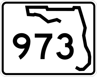
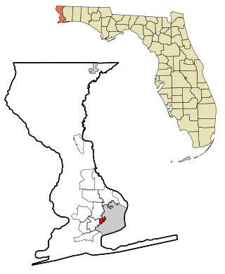
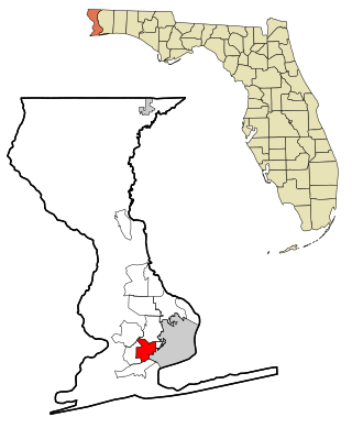
Galloway Road, also known as West 87th Avenue, is a north–south route through the western areas of suburban Miami-Dade County, Florida, from the Black Point area south of Cutler Bay almost to the Broward County line north of Miami Lakes. It exists in seven different unconnected segments that total 27.5 miles (44.3 km) in length, acting as connecting roads, neighborhood streets, and arterial routes. Approximately 9.5 miles (15.3 km) of Galloway Road, between Pinecrest and Doral, is designated as State Road 973.

U.S. Route 29 in the State of Florida is the westernmost south-to-north U.S. route in the state. It runs 43.6 miles (70.2 km) from downtown Pensacola north to the Alabama state line entirely within Escambia County. US 29 runs as a four-lane highway through much of the panhandle, becoming six lanes through and near several towns. The highway's hidden state road designation is entirely State Road 95.

State Road 298, known locally as Lillian Highway, is a mostly east–west thoroughfare in Pensacola, Florida. It runs from its intersection with U.S. Highway 98 and Dog Track Road, skirting Perdido Bay on its way east to its terminus at the West Pensacola spur of SR 295. SR 298 passes under the mainline of SR 295 without an interchange. It serves as a major route through the communities of Myrtle Grove and West Pensacola.
Brownsville-Brent-Goulding was a Census-designated place in Escambia County, Florida during the 1950 United States Census, which consists of the communities of Brent, Brownsville, Goulding and West Pensacola. The population in 1950 was 20,269.


