Canterbury Road

Last updated

The wall on the north side of Canterbury Road at the western end near Woodstock Road. Canterbury Road wall, Oxford.JPG
The wall on the north side of Canterbury Road at the western end near Woodstock Road.
The ornamental gates at the rear of St Hugh's College, on the north side of Canterbury Road at the junction with Winchester Road. St Hugh's College, Oxford - rear gates.JPG
The ornamental gates at the rear of St Hugh's College, on the north side of Canterbury Road at the junction with Winchester Road.
The Orthodox Church of the Holy Trinity and the Annunciation at 1 Canterbury Road. The Orthodox Church of the Annunciation - geograph.org.uk - 718199.jpg
The Orthodox Church of the Holy Trinity and the Annunciation at 1 Canterbury Road.

Canterbury Road is a road in North Oxford, England. [2] It runs between Woodstock Road to the west and Banbury Road to the east. Winchester Road leads south from halfway along Canterbury Road, linking with Bevington Road that runs parallel to the south. Also to the south are North Parade and Church Walk.

To the north is St Hugh's College, one of the former women's colleges of the University of Oxford (now mixed), fronting onto St Margaret's Road to the north and also stretching between Woodstock Road and Banbury Road. There are some modern ornamental iron gates opposite the junction with Winchester Road, giving access to the college grounds.

The Eastern Orthodox Church of the Holy Trinity and the Annunciation, built in 1973, is at 1 Canterbury Road. [1]

The area was formerly part of the estate of St John's College, Oxford, [2] and the road is named after the city of Canterbury in honour of the former Archbishops of Canterbury who were also Presidents of the College (William Laud and William Juxon).

The road contains large expensive brick-built Gothic-style detached residences. [3] They were designed by Frederick Codd in the 1870s and leased between 1873 and 1884. [2] These houses have been described as "Codd at his best" by Pevsner. [4]

Related Research Articles

North Oxford Human settlement in England

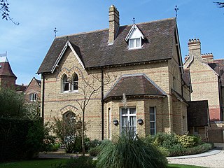
North Oxford is a suburban part of the city of Oxford in England. It was owned for many centuries largely by St John's College, Oxford and many of the area's Victorian houses were initially sold on leasehold by the College.

<span class="mw-page-title-main">Summertown, Oxford</span> Human settlement in England

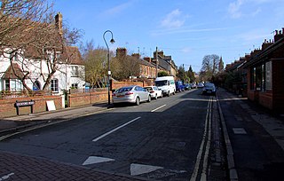
Summertown in North Oxford is a suburb of Oxford, England. Summertown is a one-mile square residential area, north of St Giles, the boulevard leading out of Oxford's city centre. Summertown is home to several independent schools and the city's most expensive houses. On both sides of Banbury Road are Summertown's popular shops. There is also a smaller street of shops and restaurants, South Parade, that links Banbury Road and Woodstock Road. Summertown is home to much of Oxford's broadcast media. BBC Radio Oxford and the BBC Television's Oxford studios are on Banbury Road. Start-ups also have an increasing presence on the parade, such as Brainomix and Passle. The studios for JACK FM, Glide FM, and Six TV Oxford are on Woodstock Road.

<span class="mw-page-title-main">Keble Road</span> Road in central Oxford, England

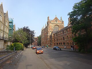
Keble Road is a short road running east–west in central Oxford, England. To the west is the southern end of the Banbury Road with St Giles' Church opposite. To the east is Parks Road with the University Parks opposite. Blackhall Road leads off the road to the south near the western end.

<span class="mw-page-title-main">Linton Road</span> Road in North Oxford, England

Linton Road is a road in North Oxford, England.

<span class="mw-page-title-main">Bevington Road</span> Residential road in North Oxford, England

Bevington Road is a residential road in central North Oxford, England.

<span class="mw-page-title-main">Winchester Road, Oxford</span> Road in North Oxford, England

Winchester Road is a road in North Oxford, England. It runs north–south between and roughly parallel with Woodstock Road to the west and Banbury Road to the east. It is in a desirable area with high house prices.

St Margarets Road Road in North Oxford, England

St Margaret's Road is a road in North Oxford, England.

<span class="mw-page-title-main">Leckford Road</span> Road in North Oxford, England

Leckford Road is a road in North Oxford, England. It runs between Kingston Road to the west and Woodstock Road to the east.

St Giles Church, Oxford Church in Oxford, United Kingdom

St. Giles' Church is a church in North Oxford, England. It is at the northern end of the wide thoroughfare of St Giles', at the point where it meets Woodstock Road and Banbury Road. It stands between where Little Clarendon Street joins Woodstock Road and Keble Road joins Banbury Road.

Shipton-on-Cherwell Human settlement in England

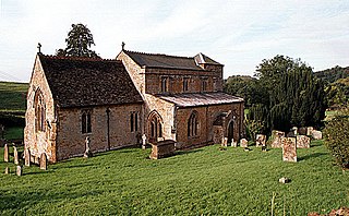
Shipton-on-Cherwell is a village on the River Cherwell about 2 miles (3 km) north of Kidlington in Oxfordshire, England. The village is part of the civil parish of Shipton-on-Cherwell and Thrupp.

Norham Manor Human settlement in England

The Norham Manor estate is a residential suburb in Oxford, England. It is part of central North Oxford. To the north is Park Town with its crescents, to the east is the River Cherwell, to the south are the University Parks and to the west is Walton Manor, on the other side of Banbury Road.

Drayton, Cherwell Human settlement in England

Drayton is a village and civil parish in the valley of the Sor Brook in Oxfordshire, about 2 miles (3 km) northwest of Banbury. The 2011 Census recorded the parish's population as 242.

Hempton, Oxfordshire Human settlement in England

Hempton is a village in Deddington civil parish about 5 miles (8 km) south of Banbury in Oxfordshire. Hempton is on the B4031 road between Deddington and Chipping Norton, which was a turnpike from 1770 until 1871.

<span class="mw-page-title-main">Chalfont Road</span> Road in North Oxford, England

Chalfont Road is a road in Walton Manor, North Oxford, England.

<span class="mw-page-title-main">Norham Road</span> Road in North Oxford, England

Norham Road is a road which lies east of the Banbury Road in central North Oxford, a suburb in the city of Oxford, England.

Rawlinson Road

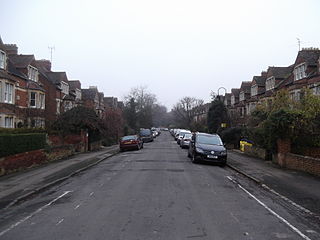
Rawlinson Road is a residential road in North Oxford, England.

<span class="mw-page-title-main">Staverton Road</span> Street in North Oxford, England

Staverton Road is a residential road in North Oxford, England.

<span class="mw-page-title-main">Observatory Street</span> Street in North Oxford, England

Observatory Street is a street in Oxford, England. It links at the eastern end Woodstock Road in central North Oxford and at the western end Walton Street and the Jericho area of Oxford, England.

<span class="mw-page-title-main">Bradmore Road</span> Road in North Oxford, England

Bradmore Road is a residential road in North Oxford, England.

<span class="mw-page-title-main">Frederick Codd</span>

Frederick Codd was a British Gothic Revival architect and speculative builder who designed and built many Victorian houses in North Oxford, England.

References

  1. 1 2 "The Greek Orthodox Community of the Holy Trinity". Oxford, UK. Retrieved 15 September 2012.
  2. 1 2 3 Hinchcliffe, Tanis (1992). North Oxford. New Haven & London: Yale University Press. pp. 26, 52, 55, 109, 220–221. ISBN   0-14-071045-0.
  3. "Canterbury Road, Oxford". UK: Zoopla . Retrieved 15 September 2012.
  4. Sherwood, Jennifer; Pevsner, Nikolaus (1974). The Buildings of England: Oxfordshire. Penguin Books. p. 320. ISBN   0-14-071045-0.

Coordinates: 51°45′55″N1°15′44″W / 51.76537°N 1.26212°W / 51.76537; -1.26212