Cobb County, Georgia

Last updated

Cobb County
Blackjack Mountain (Cobb County, Georgia) from Kennesaw Mtn Drive, April 2017.jpg
From top: Blackjack Mountain
SealofCobbCountyGA.png
Map of Georgia highlighting Cobb County.svg
Location within the U.S. state of Georgia
Georgia in United States.svg
Georgia's location within the U.S.
Coordinates: 33°56′N84°35′W / 33.94°N 84.58°W / 33.94; -84.58
CountryFlag of the United States.svg United States
StateFlag of Georgia (U.S. state).svg  Georgia
FoundedDecember 2, 1832;192 years ago (1832)
Named for Thomas W. Cobb
Seat Marietta
Largest city Mableton
Area
  Total345 sq mi (890 km2)
  Land340 sq mi (900 km2)
  Water5.0 sq mi (13 km2)  1.4%
Population
  Estimate 
(2023)
776,743
  Density2,203/sq mi (851/km2)
Time zone UTC−5 (Eastern)
  Summer (DST) UTC−4 (EDT)
Congressional districts 6th, 11th, 13th, 14th
Website cobbcounty.org

Cobb County is a county in the U.S. state of Georgia, located in the Atlanta metropolitan area in the north central portion of the state. As of 2020 Census, the population was 766,149. It is the state's third most populous county, after Fulton and Gwinnett counties. [1] Its county seat is Marietta; its largest city is Mableton. [2]

Contents

Along with several adjoining counties, Cobb County was established on December 3, 1832, by the Georgia General Assembly from the large Cherokee County territory—land northwest of the Chattahoochee River which the state acquired from the Cherokee Nation and redistributed to settlers via lottery, following the passage of the federal Indian Removal Act. [3] The county was named for Thomas Willis Cobb, a U.S. representative and senator from Georgia. It is believed that Marietta was named for his wife, Mary. [4] Cobb County is included in the Atlanta metropolitan area and is situated immediately to the northwest of Atlanta's city limits. Its Cumberland District, an edge city, has over 24 million square feet (2,200,000 m2) of office space. Major League Baseball's Atlanta Braves have played home games at Truist Park in Cumberland since 2017. [5]

In 2003, the U.S. Census Bureau ranked Cobb County as the most educated in the state of Georgia and 12th-most in the United States. [6] It has ranked among the top 100 highest-income counties in the United States. [7] In October 2017, Cobb was ranked as the "Least Obese County in Georgia." Cobb County is one of the fastest growing counties in Georgia according to the 2020 US Census. [8]

History

Cobb County was one of nine Georgia counties carved out of the disputed territory of the Cherokee Nation in 1832. [9] It was the 81st county in Georgia and named for Judge Thomas Willis Cobb, who served as a U.S. Senator, state representative, and superior court judge. It is believed that the county seat of Marietta was named for Judge Cobb's wife, Mary. [10] The state started acquiring right-of-way for the Western & Atlantic Railroad in 1836. A train began running between Marietta and Marthasville (modern day Atlanta) in 1845. [11]

An 1891 lithograph of the Battle of Kennesaw Mountain by Kurz & Allison Battle of Kenesaw Mountian.png
An 1891 lithograph of the Battle of Kennesaw Mountain by Kurz & Allison

During the American Civil War, some Confederate troops were trained at a camp in Big Shanty (now Kennesaw), where the Andrews Raid occurred, starting the Great Locomotive Chase. [11] There were battles of New Hope Church May 25, 1864, Pickett's Mill May 27, and Dallas May 28. These were followed by the prolonged series of battles through most of June 1864 until very early July: the Battle of Marietta and the Battle of Noonday Creek. [12] The Battle of Allatoona Pass on October 5, 1864, occurred as Sherman was starting his march through Georgia. Union forces burnt most houses and confiscated or burnt crops. [13] The Battle of Kennesaw Mountain on June 27, 1864, was the site of the only major Confederate victory in General William T. Sherman's invasion of Georgia. Despite the victory, Union forces outflanked the Confederates.[ citation needed ] In 1915, Leo Frank, the Jewish supervisor of an Atlanta pencil factory who was convicted of murdering one of his workers, thirteen-year-old Mary Phagan, was kidnapped from his jail cell and brought to Frey's Gin, two miles (3.2 km) east of Marietta, where he was lynched.

Cotton workers in Mableton, around 1900 Cotton Workers in Mableton, around 1900.jpg
Cotton workers in Mableton, around 1900

Cotton farming in the area peaked from the 1890s through the 1920s. Low prices during the Great Depression resulted in the cessation of cotton farming throughout Cobb County. [14] The price of cotton went from 16¢ per pound (35¢/kg) in 1920 to 9½¢ (21¢/kg) in 1930. This resulted in a cotton bust for the county, which had stopped growing the product but was milling it. This bust was followed by the Great Depression. [11] [15] [ clarification needed ] To help combat the bust, the state started work on a road in 1922 that would later become U.S. 41, later replaced by Cobb Parkway in the late 1940s and early 1950s.

F-47 Thunderbolt - 128th Fighter Squadron - Marietta Army Airfield, 1946 128th Fighter Squadron P-47 Thunderbolt Marietta GA May 1946.jpg
F-47 Thunderbolt128th Fighter SquadronMarietta Army Airfield, 1946

In 1942, Bell Aircraft opened a Marietta plant to manufacture B-29 bombers and Marietta Army Airfield was founded. Both were closed after World War II, but reopened during the Korean War, when the air field was acquired by the Air Force, renamed Dobbins AFB, and the plant by Lockheed. During the Korean and Vietnam Wars, Lockheed Marietta was the leading manufacturer of military transport planes, including the C-130 Hercules and the C-5 Galaxy. "In Cobb County and other sprawling Cold War suburbs from Orange County to Norfolk/Hampton Roads, the direct link between federal defense spending and local economic prosperity structured a bipartisan political culture of hawkish conservatism and material self-interest on issues of national security." [16]

Kennesaw State University Kennesaw State Spaceship Earth and Social Science.JPG
Kennesaw State University

When county home rule was enacted statewide by amendment to the Georgia state constitution in the early 1960s, Ernest W. Barrett became the first chairman of the new county commission. The county courthouse, built in 1888, was demolished, spurring a law that now prevents counties from doing so without a referendum. In the 1960s and 1970s, Cobb transformed from rural to suburban, as integration spurred white flight from the city of Atlanta, which by 1970 was majority-African-American. Real-estate booms drew rural white southerners and Rust Belt transplants, both groups mostly first-generation white-collar workers. Cobb County was the home of former segregationist and Georgia governor Lester Maddox (1966–71). In 1975, Cobb voters elected John Birch Society leader Larry McDonald to Congress, running in opposition to desegregation busing. A conservative Democrat, McDonald called for investigations into alleged plots by the Rockefellers and the Soviet Union to impose "socialist-one-world-government" and co-founded the Western Goals Foundation. In 1983, McDonald died aboard Korean Air Lines Flight 007, shot down by a Soviet fighter jet over restricted airspace. I-75 through the county is now named for him.

Glover Park Bell, on the square in Marietta Glover Park Bell.JPG
Glover Park Bell, on the square in Marietta

In 1990, Republican Congressmen Newt Gingrich became Representative of a new district centered around Cobb County. In 1994, as Republicans took control of the U.S. House of Representatives for the first time in almost fifty years, Gingrich became Speaker of the House, thrusting Cobb County into the national spotlight.

In 1993, county commissioners passed a resolution condemning homosexuality and cut off funding for the arts after complaints about a community theater. [17] After protests from gay rights organizations, organizers of the 1996 Summer Olympics pulled events out of Cobb County, including the Olympic Torch Relay. The county's inns were nevertheless filled at 100% of capacity for two months during the event. [11]

In the 1990s and 2000s, Cobb's demographics changed. As Atlanta's gentrification reversed decades of white flight, middle-class African-Americans and Russian, Bosnian, Chinese, Indian, Brazilian, Mexican and Central American immigrants moved to older suburbs in south and southwest Cobb. In 2010, African-American Democrat David Scott was elected to Georgia's 13th congressional district, which included many of those suburbs. Cobb became the first Georgia county to participate in the Immigration and Nationality Act Section 287(g) enabling local law officers to enforce immigration law.[ citation needed ]

Geography

Union Trenches at Kennesaw Mountain, 1864 UnionTrenchesKennesawMtn1864.jpg
Union Trenches at Kennesaw Mountain, 1864
Chattahoochee River National Recreation Area East Palisades.JPG
Chattahoochee River National Recreation Area

According to the U.S. Census Bureau, the county has a total area of 345 square miles (890 km2), of which 340 square miles (880 km2) is land and 4.0 square miles (10 km2) (1.4%) is water. [18] The county is located in the upper Piedmont region of the state, with a few mountains located within the county, considered to be part of the southernmost extensions of the Appalachian Mountains.

The county is divided between two major basins. Most runoff flows into the Middle Chattahoochee-Lake Harding and Upper Chattahoochee River sub-basins of the ACF River Basin (Apalachicola-Chattahoochee-Flint River Basin) along the southeastern border, directly via Willeo Creek, Sope Creek (Sewell Creek), Rottenwood Creek (Powers Creek, Poorhouse Creek, Poplar Creek), Nickajack Creek and others.[ citation needed ] The large Sweetwater Creek is the other major stream, carrying the waters of Noses Creek (Ward Creek, Olley Creek, Mud Creek), Powder Springs Creek (Rakestraw Creek, Mill Creek) and others into the Chattahoochee. A ridge from Lost Mountain in the west, to Kennesaw Mountain in the north-central, to Sweat Mountain in the extreme northeast, divides the far north-northwest of the county into the Etowah River sub-basin of the ACT River Basin (Coosa-Tallapoosa River Basin), which includes Lake Allatoona. Noonday Creek (Little Noonday Creek) flows northward into the lake, as does Allatoona Creek, which forms a major arm of the lake. Proctor Creek forms the much older Lake Acworth, which in turn empties directly into Lake Allatoona under the Lake Acworth Drive (Georgia 92) bridge.[ citation needed ] North Cobb is in the Coosa River basin.[ citation needed ]

There are several high points in Cobb County.

Adjacent counties

Metro Atlanta Metro atlanta.jpg
Metro Atlanta

Addressing

Despite the lack of a grid system of city blocks though the county, all street addresses have their numeric origin at the southwest corner of the town square in Marietta.[ citation needed ]

Geocodes and world's largest toll-free calling area

Cobb Energy Performing Arts Center CobbEnergyPerformingArtsCentre.jpg
Cobb Energy Performing Arts Center

Originally in area code 404, the county was moved into area code 770 in 1995, and overlaid by area code 678 in 1998. Prior to 1995, those with phones tied to the Woodstock telephone exchange (prefixes 924, 926, 928, later 516 and 591) could also call the Canton exchange (479, later 445, then 704) as a local call. This became moot, along with other dual-zone exchanges in metro Atlanta, when the exurban exchanges (including Canton) were fully made a part of what was already the world's largest toll-free calling zone. It is a zone spanning 7,162 square miles (18,549 km2), [19] with four active telephone area codes, and local calling extending into portions of two others.

Cobb's FIPS county code is 13067. Because the National Weather Service has not subdivided the county, its WRSAME code is 013067, for receiving targeted weather warnings from NOAA Weather Radio. The county is primarily within the broadcast range of one weather radio station: KEC80, on 162.550 MHz, [20] transmitted to all of metro Atlanta and broadcast from NWSFO Peachtree City. The secondary station is the much newer WWH23 on 162.425 from Buchanan, which also transmits warnings for Cobb but has reception mainly in the western part of the county. [21]

Demographics

Historical population
CensusPop.Note
1840 7,539
1850 13,84383.6%
1860 14,2422.9%
1870 13,814−3.0%
1880 20,74850.2%
1890 22,2867.4%
1900 24,66410.7%
1910 28,39715.1%
1920 30,4377.2%
1930 35,40816.3%
1940 38,2728.1%
1950 61,83061.6%
1960 114,17484.7%
1970 196,79372.4%
1980 297,71851.3%
1990 447,74550.4%
2000 607,75135.7%
2010 688,07813.2%
2020 766,14911.3%
2023 (est.)776,743 [22] 1.4%
U.S. Decennial Census [23]
1790-1880 [24] 1890-1910 [25]
1920-1930 [26] 1930-1940 [27]
1940-1950 [28] 1960-1980 [29]
1980-2000 [30] 2010 [31] 2020 [31]

2020 census

Cobb County, Georgia – Racial and ethnic composition
(NH = Non-Hispanic)
Note: the US Census treats Hispanic/Latino as an ethnic category. This table excludes Latinos from the racial categories and assigns them to a separate category. Hispanics/Latinos may be of any race.
Race / EthnicityPop 2000 [32] Pop 2010 [31] Pop 2020 [33] % 2000% 2010% 2020
White alone (NH)417,947387,438369,18268.77%56.31%48.19%
Black or African American alone (NH)112,924168,053200,07218.58%24.42%26.11%
Native American or Alaska Native alone (NH)1,1561,3321,2890.19%0.19%0.17%
Asian alone (NH)18,41730,43242,5333.03%4.42%5.55%
Pacific Islander alone (NH)1922672930.03%0.04%0.04%
Other race alone (NH)1,7062,9617,3820.28%0.43%0.96%
Mixed race or Multiracial (NH)8,44513,26534,1581.39%1.93%4.46%
Hispanic or Latino (any race)46,96484,330111,2407.73%12.26%14.52%
Total607,751688,078766,149100.00%100.00%100.00%

As of the 2020 United States census, there were 766,149 people, 286,952 households, and 191,533 families residing in the county.

2010 Census

As of the 2010 United States Census, there were 688,078 people, 260,056 households, and 175,357 families residing in the county. [34] The population density was 2,026.4 inhabitants per square mile (782.4/km2). There were 286,490 housing units at an average density of 843.7 per square mile (325.8/km2). [35] The racial makeup of the county was 62.21% white, 24.96% black or African American, 4.46% Asian, 0.34% American Indian, 0.1% Pacific islander, 5.28% from other races, and 2.71% from two or more races. Those of Hispanic or Latino origin made up 12.26% of the population. [34] Regarding specific ethnic origins, 10.4% cited German, 10.0% English, 9.3% Irish, and 8.6% American ancestry. [36]

Of the 260,056 households, 36.7% had children under the age of 18 living with them, 50.2% were married couples living together, 13.0% had a female householder with no husband present, 32.6% were non-families, and 25.6% of all households were made up of individuals. The average household size was 2.61 and the average family size was 3.17. The median age was 35.4 years. [34]

The median income for a household in the county was $65,522 and the median income for a family was $78,920. Males had a median income of $55,200 versus $43,367 for females. The per capita income for the county was $33,110. About 7.6% of families and 10.6% of the population were below the poverty line, including 14.5% of those under age 18 and 7.2% of those age 65 or over. [37]

2000 Census

As of 2000, there were 697,553 people, 248,303 households, and 169,178 families residing in the county. The population density was 1,998 inhabitants per square mile (771/km2). There were 261,659 housing units at an average density of 770 per square mile (300/km2). The racial makeup of the county in 2000 was 72.4% White, 18.8% Black, [38] 0.3% Native American, 3.06% Asian, 0.0% Pacific Islander, 5.3% from other races, and 1.87% from two or more races. 7.73% of the population was Hispanic or Latino of any race. [39]

There were 248,303 households, out of which 35.80% had children under the age of 18 living with them, 54.30% were married couples living together, 10.70% had a female householder with no husband present, and 31.20% were non-families. 23.20% of all households were made up of individuals, and 4.10% had someone living alone who was 65 years of age or older. The average household size was 2.71 and the average family size was 3.25.

In the county, 26.10% of the population was under the age of 18, 9.00% from 18 to 24, 36.50% from 25 to 44, 21.50% from 45 to 64, and 6.90% was 65 years of age or older. The median age was 33 years. For every 100 females, there were 98.50 males. For every 100 females age 18 and over, there were 95.90 males.

As of 2007, the median income was $70,472. The per capita income for the county was $32,740. About 6.0% of families and 9.4% of the population were below the poverty line, including 9.1% of those under age 18 and 7.8% of those age 65 or over. [40]

Education

Public schools

Private schools

Colleges and universities

Libraries

Cobb County maintains the Cobb County Public Library System. [49] The libraries provide resources such as books, videos, internet access, printing, and computer classes. The libraries in the CCPLS are:

  • East Cobb Library
  • Gritters Library
  • Kemp Memorial Library
  • Lewis A. Ray Library
  • Mountain View Regional Library
  • North Cobb Regional Library
  • Powder Springs Library
  • Sewell Mill Library & Cultural Center
  • Sibley Library
  • South Cobb Regional Library
  • Joanne P. Stratton Library
  • Sweetwater Valley Library
  • Charles D. Switzer Library
  • Vinings Library
  • West Cobb Regional Library
  • Bookmobile

The Smyrna Public Library is a city-owned library in Smyrna, and is not part of the county system.

Government and elections

Under Georgia's home rule provision, county governments have free rein to legislate on all matters within the county, provided that such legislation does not conflict with state or federal laws or constitutions.

Cobb County is governed by a five-member board of commissioners, which has both legislative and executive authority within the county. The chairman of the board is elected county-wide. The other four commissioners are elected from single-member districts. The board hires a county manager who oversees day-to-day operations of the county's executive departments.

Cobb County Board of Commissioners

DistrictNamePartyFirst electedRegion Represented [50]
 At-Large (chair)Lisa Cupid Democratic 2020All
 1Keli Gambrill Republican 2018Northwest Cobb
 2Jerica Richardson Democratic 2020Southeast Cobb
 3JoAnn Birrell Republican 2010Northeast Cobb
 4Monique Sheffield Democratic 2020Southwest Cobb
Cobb County Government Building Cobb County, Georgia Government Building.jpg
Cobb County Government Building

County residents also elect a sheriff, district attorney, probate court judge, clerk of superior court, clerk of the state court, state court solicitor, chief magistrate judge (who then appoints other magistrate court judges), superior court judges, state court judges, tax commissioner, surveyor, and a seven-member board of education. In addition to the county sheriff, the constitutional chief law enforcement officer of the county, Cobb County has a separate police department under the authority of the Board of Commissioners. The sheriff oversees the jail, to which everyone arrested under state law is taken, regardless of the city or other area of the county where it happens, or which police department makes the arrest.

Each city has a separate police department, answerable to its governing council. Marietta, Smyrna, and Austell have separate fire departments, with the Cobb County Fire Department being the authority having jurisdiction over Kennesaw, Acworth, Powder Springs, and unincorporated areas. Cobb 911 covers unincorporated areas and the city of Marietta. Kennesaw and Acworth jointly operate a small 911 call center (PSAP) upstairs in Kennesaw city hall, dispatching the police departments in both cities, and forwarding fire calls to Cobb. Smyrna operates a separate PSAP while offering dispatch services to the city of Powder Springs. Austell operates its own separate 911 system.

The county retails potable water to much of the county, and wholesales it to various cities. [51]

The current County Manager is Jackie R. McMorris. [52]

Politics

From 1964 until 2012, the county was a Republican stronghold in presidential elections. The only time during this period that the county supported a Democrat was in 1976, when native son Jimmy Carter swept every county in the state. Before 1960, it was a typical "Solid South" Democratic county, except when Warren G. Harding came close to carrying it in 1920, and when Herbert Hoover won it by nine points due to anti-Catholic voting against Al Smith in 1928.

In the late 20th century, the county developed a reputation as a conservative stronghold. [53] However, due to rapid racial and ethnic demographic changes since the 1990s, along with population growth coming from blue northern states, the county has increasingly supported the Democratic Party. In 2016, when Hillary Clinton became the first Democrat to win Cobb County since Jimmy Carter in 1976, and the first non-Georgian Democrat since John F. Kennedy in 1960. The county then supported Joe Biden in 2020 by 14 points–the best showing for a Democrat since Kennedy in 1960. This was crucial to Biden winning the state for the Democrats for the first time since 1992.

In 2018, Stacey Abrams became the first Democrat to win Cobb County [54] [55] in a gubernatorial election since 1986, when Joe Frank Harris swept every county statewide.

United States presidential election results for Cobb County, Georgia [56]
Year Republican Democratic Third party
No.%No.%No.%
2020 165,43641.99%221,84756.30%6,7391.71%
2016 152,91245.77%160,12147.93%21,0256.29%
2012 171,72255.25%133,12442.83%5,9891.93%
2008 170,95754.08%141,21644.67%3,9511.25%
2004 173,46761.94%103,95537.12%2,6390.94%
2000 140,49459.78%86,67636.88%7,8573.34%
1996 114,18856.93%73,75036.77%12,6356.30%
1992 103,73452.62%63,96032.45%29,43714.93%
1988 106,62172.70%39,29726.79%7400.50%
1984 97,42977.42%28,41422.58%00.00%
1980 51,97754.25%39,15740.87%4,6824.89%
1976 34,32443.27%45,00256.73%00.00%
1972 43,97785.12%7,68814.88%00.00%
1968 18,64941.25%8,75519.37%17,80539.38%
1964 20,86355.62%16,64744.38%10.00%
1960 8,24038.97%12,90661.03%00.00%
1956 6,79836.76%11,69663.24%00.00%
1952 4,16329.02%10,18270.98%00.00%
1948 1,52421.47%4,76667.15%80811.38%
1944 1,34921.25%5,00078.75%00.00%
1940 99218.21%4,44781.63%90.17%
1936 70720.11%2,80279.72%60.17%
1932 2186.56%3,07992.71%240.72%
1928 1,71154.54%1,42645.46%00.00%
1924 36218.95%1,36071.20%1889.84%
1920 1,09547.55%1,20852.45%00.00%
1916 43418.70%1,75075.40%1375.90%
1912 30718.35%1,32979.44%372.21%
1908 54833.62%88954.54%19311.84%
1904 22012.85%1,17168.40%32118.75%
1900 31119.73%1,15673.35%1096.92%
1896 75833.87%1,38761.97%934.16%
1892 56419.63%1,79462.44%51517.93%
1888 39125.03%1,14373.18%281.79%
1884 53628.09%1,37271.91%00.00%
1880 55922.02%1,98077.98%00.00%

2020 voter suppression controversy

In 2020, in the turmoil surrounding the election defeat of Donald Trump, the chairman of the Cobb County Republicans and another person challenged the election results in an attempt to remove 16,024 Cobb County voters from eligibility to vote in the runoff election for both Georgia senators, scheduled for January 5, 2021. The county Board of Elections held a hearing to decide whether there was probable cause to move forward with hearings for each name on the list. The Board's attorney stated that there was not probable cause and gave reasons. After a brief discussion, the board voted unanimously to deny the challenge. [57] [58]

Taxes

In addition to the 4% statewide sales tax, Cobb County levies an additional 2% for special projects, each 1% subject to separate renewal every few years by countywide referendum (including within its cities). This funds mainly transportation and parks. Cobb levies a 1% tax to lower property taxes, but only for the public school budget, and not the additional 1% HOST homestead exemption for general funds. The county has also voted not to pay the extra 1% to join MARTA.

At the beginning of 2006, Cobb became the last county in the state to raise the tax to 6%, which also doubled the tax on food to 2%. The SPLOST barely passed by a 114 vote margin, or less than one-quarter of a percent, in a September 2005 referendum. The revenue was to go to a new county courthouse, expanded jail, various transportation projects, and the purchasing of property for parks and green space. [59] In 2008, the school tax was renewed for a third term, funding the Marietta and Cobb school systems.

Economy

The Cobb County School District is Cobb County's largest employer, employing over 15,000 people. [60]

Private corporations include:

Retail

Shopping centers in the county include:

Diplomatic missions

The Consulate-General of Costa Rica in Atlanta is located in Suite 100 at 1870 The Exchange in an unincorporated section of Cobb County. [70]

Transportation

Kennesaw Mountain National Battlefield Park Kennesaw Mountian Cannon.jpg
Kennesaw Mountain National Battlefield Park

Major highways

Airports

Rail

Until 1971, the Louisville & Nashville Railroad, running on tracks now owned by CSX, operated passenger trains through Marietta depot.

Mass transit

Recreation

Sope Creek Ruins Sope Creek pulp mill retaining wall ruin.jpg
Sope Creek Ruins
Silver Comet Trail and bike path SilverCometTrail.jpg
Silver Comet Trail and bike path

Venues

Communities

Cobb County landmark and reference point "The Big Chicken" Thebigchicken.jpg
Cobb County landmark and reference point "The Big Chicken"
Historic Downtown Marietta MariettaGeorgia.jpg
Historic Downtown Marietta

Cities

Census-designated places

Unincorporated communities

Notable people

Sister county

See also

Related Research Articles

<span class="mw-page-title-main">Fulton County, Georgia</span> County in Georgia, United States

Fulton County is a county in the north-central portion of the U.S. state of Georgia. As of the 2020 United States census, the population was 1,066,710, making it the state's most populous county and its only one with over one million inhabitants. Its county seat and most populous city is Atlanta, the state capital. About 90% of the City of Atlanta is within Fulton County; the remaining portion is in DeKalb County. Fulton County is part of the Atlanta–Sandy Springs–Roswell, GA Metropolitan Statistical Area.

<span class="mw-page-title-main">Cherokee County, Georgia</span> County in Georgia, United States

Cherokee County is located in the US state of Georgia. As of the 2020 Census, the population was 266,620. The county seat is Canton. The county Board of Commissioners is the governing body, with members elected to office. Cherokee County is included in the Atlanta Metropolitan Area.

<span class="mw-page-title-main">Acworth, Georgia</span> City in Georgia, United States

Acworth is a city in Cobb County, Georgia, United States. It is part of the Atlanta metropolitan area. As of the 2020 census, this city had a population of 22,440, up from 20,425 in 2010. Acworth is located in the foothills of the North Georgia mountains along the southeastern banks of Lake Acworth and Lake Allatoona on the Etowah River. Unincorporated areas known as Acworth extend into Bartow, Cherokee and Paulding counties.

<span class="mw-page-title-main">Kennesaw, Georgia</span> City in Georgia, United States

Kennesaw is a suburban city northwest of Atlanta in Cobb County, Georgia, United States, located within the greater Atlanta metropolitan area. Known from its original settlement in the 1830s until 1887 as Big Shanty, it became Kennesaw under its 1887 charter. According to the 2020 census, Kennesaw had a population of 33,036, a 10.9% increase in population over the preceding decade. Kennesaw has an important place in railroad history. During the Civil War, Kennesaw was the staging ground for the Great Locomotive Chase on April 12, 1862. Kennesaw is home to Kennesaw State University, an R2 research institution and the third largest public university in the state of Georgia.

<span class="mw-page-title-main">Mableton, Georgia</span> City in Georgia

Mableton is a city in Cobb County, Georgia, United States. Voters of the unincorporated area of Mableton approved a referendum to incorporate on November 8, 2022, and six council members were elected on March 21, 2023, with Michael Owens elected as mayor of Mableton in the 2023 Mableton mayoral election. According to the 2020 census, the census-designated area Mableton had a population of 37,115; the city has more. Upon Brookhaven's cityhood in December 2012, Mableton was previously the largest unincorporated CDP in Metro Atlanta. With boundaries described in Appendix A of House Bill 839, Mableton is the largest city in Cobb County in terms of population and includes historical Mableton, along with the Six Flags area, areas of unincorporated Smyrna, and parts of unincorporated South Cobb.

<span class="mw-page-title-main">Marietta, Georgia</span> City in Georgia, United States

Marietta is a city in and the county seat of Cobb County, Georgia, United States. At the 2020 census, the city had a population of 60,972. The 2019 estimate was 60,867, making it one of Atlanta's largest suburbs. Marietta is the fourth largest of the principal cities by population of the Atlanta metropolitan area.

<span class="mw-page-title-main">Roswell, Georgia</span> City in Georgia, United States

Roswell is a city in northern Fulton County, Georgia, United States. At the official 2020 census, the city had a population of 92,883, making Roswell the state's ninth largest city. A close suburb of Atlanta, Roswell has an affluent historic district.

CobbLinc is the bus public transit system in Cobb County, Georgia, one of metro Atlanta's three most populous suburban counties.

<span class="mw-page-title-main">Cobb County Public Library System</span> Public library system in Georgia, USA

The Cobb County Public Library System (CCPLS) is a system of 15 public libraries in Cobb County, Georgia, United States, excluding its second-largest city of Smyrna, which runs its own Smyrna Public Library. CobbCat.org is the online database of all CCPLS holdings.

<span class="mw-page-title-main">Ernest W. Barrett</span> American politician

Ernest W. Barrett was the chairman of the county commission in Cobb County, Georgia from 1965 to 1984. Barrett was also a former trustee of Kennesaw State University.

<span class="mw-page-title-main">Lake Allatoona</span> Reservoir in Georgia, United States

Lake Allatoona is a U.S. Army Corps of Engineers reservoir on the Etowah River in northwestern part of the State of Georgia. This reservoir is mostly in southeastern Bartow County and southwestern Cherokee County. A small portion is located in Cobb County near Acworth.

<span class="mw-page-title-main">Georgia State Route 120</span> State highway in Georgia

State Route 120 (SR 120) is a 90.7-mile-long (146.0 km) state highway that runs west-to-east through portions of Haralson, Paulding, Cobb, Fulton, and Gwinnett counties in northwestern part of the U.S. state of Georgia.

Chattahoochee Technical College is a public technical college in the U.S. state of Georgia. It is governed by the Technical College System of Georgia and has eight campuses in the north-northwest metro-Atlanta area, and another just outside the region. It is accredited by the Southern Association of Colleges and Schools Commission on Colleges (SACS) to award technical certificates of credit, diplomas, and associate degrees. The college was formed in 2009 as the result of the merger of Appalachian Technical College, Chattahoochee Technical College, and North Metro Technical College.

<i>Marietta Daily Journal</i> Newspaper in Marietta, Georgia

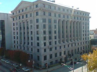
The Marietta Daily Journal (MDJ) is a daily newspaper published in Marietta, Georgia. It is the primary local newspaper of Cobb County, Georgia, second only to the Atlanta Journal-Constitution, which covers all of metro Atlanta, and previously most of north Georgia.

North Metro Technical College was a two-year state technical college located in the state of Georgia, and governed by the Technical College System of Georgia. The college was accredited by the Commission on Colleges of the Southern Association of Colleges and Schools to award associate degrees since 2006. Since the beginning of July 2009, it is now the North Metro campus of nearby Chattahoochee Technical College.

<span class="mw-page-title-main">Metro Atlanta</span> Combined Statistical Area in Georgia, United States of America

Metro Atlanta, designated by the United States Office of Management and Budget as the Atlanta–Sandy Springs–Roswell metropolitan statistical area, is the most populous metropolitan statistical area in the U.S. state of Georgia and the sixth-largest in the United States, based on the July 1, 2023 metropolitan area population estimates from the U.S. Census Bureau. Its economic, cultural, and demographic center is Atlanta, and its total population was 6,307,261 in the 2023 estimate from the U.S. Census Bureau.

<span class="mw-page-title-main">Allatoona High School</span> Public high school in Acworth, Cobb County, Georgia, United States

Allatoona High School is one of eighteen public high school in the Cobb County School District. The institution opened in the fall of 2008, and is currently the most recent high school in the district. It is located in suburban Acworth, Georgia, north of Atlanta, in the United States. The school is named after the nearby Lake Allatoona.

<span class="mw-page-title-main">East Cobb, Georgia</span> Unincorporated community in Georgia, United States

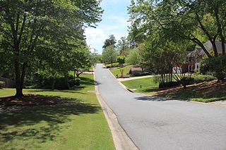
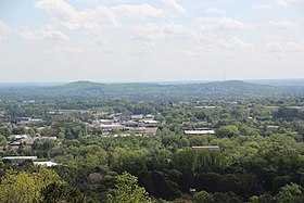
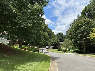
East Cobb is an unincorporated community in Cobb County, Georgia, United States, with a population of 164,055 people. It is an affluent northern suburb of Atlanta.

The September 2009 Southeastern United States floods were a group of floods that affected several counties throughout northern Georgia, Tennessee, Alabama, Mississippi, and Arkansas. The worst flooding occurred across the Atlanta metropolitan area. Continuous rain, spawned by moisture pulled from the Gulf of Mexico, fell faster than the local watersheds could drain the runoff.

<span class="mw-page-title-main">Cobb County School District</span> School district in Marietta, Georgia, United States

The Cobb County School District (CCSD) is the school district which operates public schools in Cobb County, Georgia, United States. The school district includes all of Cobb County except for the Marietta City Schools, though a number of schools in unincorporated parts of the county have Marietta addresses. It is the second-largest school system in Georgia and 23rd largest in the United States. The district is the county's largest employer and one of the largest in the US. All Cobb County schools are accredited by the Southern Association of Colleges and Schools (SACS), and the district is among the first to have earned district-wide accreditation. The superintendent of the school district is Chris Ragsdale.

References

  1. US 2020 Census Bureau report, Cobb County, Georgia
  2. "Find a County". National Association of Counties. Archived from the original on May 31, 2011. Retrieved June 7, 2011.
  3. "Cobb County, Georgia". Archived from the original on June 4, 2009. Retrieved January 7, 2008.
  4. "New Georgia Encyclopedia: Marietta". Georgiaencyclopedia.org. September 3, 2003. Archived from the original on October 5, 2009. Retrieved July 22, 2010.
  5. Martin, Jill. "Braves begin new chapter at SunTrust Park". CNN. Retrieved September 13, 2017.
  6. "ACS: Ranking Table – Percent of People With a Bachelor's Degree or More". October 4, 2003. Archived from the original on October 4, 2003. Retrieved September 13, 2017.
  7. "Census 2000 Demographic Profiles". July 1, 2011. Archived from the original on July 15, 2011. Retrieved July 13, 2020.
  8. "Least Obese County in Every State". MSN. September 8, 2017. Retrieved March 19, 2018.
  9. "New Georgia Encyclopedia: Cobb County". Georgiaencyclopedia.org. November 1, 2011. Archived from the original on January 17, 2013. Retrieved December 22, 2012.
  10. "Marietta | Georgia.gov". Marietta.georgia.gov. Archived from the original on April 25, 2012. Retrieved June 24, 2012.
  11. 1 2 3 4 "Cobb County, Georgia, History, Resources, Links, and Events". roadsidegeorgia.com. Retrieved March 7, 2018.
  12. "Research OnLine – 4th Michigan Volunteer Cavalry Regiment". www.researchonline.net. Retrieved July 13, 2020.
  13. Images of Acworth Society for Historic Preservation. Charleston, SC: Arcadia Publishing. 2006. p. 7. ISBN   0-7385-1479-9.
  14. Images of Acworth Society for Historic Preservation. Charleston, SC: Arcadia Publishing. 2006. p. 56. ISBN   0-7385-1479-9.
  15. "Textile World - the Roaring Twenties: Recession, Boom, Depression". Archived from the original on September 17, 2014. Retrieved September 16, 2014.
  16. Matthew Lassiter, "Big Government and Family Values: Political Culture in the Metropolitan Sunbelt", Sunbelt Rising: The Politics of Place, Space and Region (eds. Michelle Nickerson, Darren Dochuck), pg. 90.
  17. Applebome, Peter (August 2, 1993). "County's Anti-Gay Move Catches Few by Surprise". The New York Times.
  18. "US Gazetteer files: 2010, 2000, and 1990". United States Census Bureau. February 1, 2011. Retrieved April 23, 2011.
  19. "A Look at Atlanta" (PDF). Metro Atlanta Chamber of Commerce. May 2006. p. 11. Archived (PDF) from the original on June 25, 2008. Retrieved July 5, 2008.
  20. "NOAA Weather Radio KEC80". Nws.noaa.gov. May 1, 2009. Retrieved July 22, 2010.
  21. "NOAA Weather Radio WWH23". Nws.noaa.gov. May 1, 2009. Retrieved July 22, 2010.
  22. "Annual Estimates of the Resident Population for Counties: April 1, 2020 to July 1, 2023". United States Census Bureau. Retrieved March 14, 2024.
  23. "Decennial Census of Population and Housing by Decade". United States Census Bureau.
  24. "1880 Census Population by Counties 1790-1800" (PDF). United States Census Bureau. 1880.
  25. "1910 Census of Population - Georgia" (PDF). United States Census Bureau. 1910.
  26. "1930 Census of Population - Georgia" (PDF). United States Census Bureau. 1930.
  27. "1940 Census of Population - Georgia" (PDF). United States Census Bureau. 1940.
  28. "1950 Census of Population - Georgia -" (PDF). United States Census Bureau. 1950.
  29. "1980 Census of Population - Number of Inhabitants - Georgia" (PDF). United States Census Bureau. 1980.
  30. "2000 Census of Population - Population and Housing Unit Counts - Georgia" (PDF). United States Census Bureau. 2000.
  31. 1 2 3 "P2: Hispanic or Latino, and Not Hispanic or Latino by Race – 2010: DEC Redistricting Data (PL 94-171) - Cobb County, Georgia". United States Census Bureau.
  32. "P004 HISPANIC OR LATINO, AND NOT HISPANIC OR LATINO BY RACE – 2000: DEC Summary File 1 – Cobb County, Georgia". United States Census Bureau.
  33. "P2: Hispanic or Latino, and Not Hispanic or Latino by Race – 2020: DEC Redistricting Data (PL 94-171) - Cobb County, Georgia". United States Census Bureau.
  34. 1 2 3 "DP-1 Profile of General Population and Housing Characteristics: 2010 Demographic Profile Data". United States Census Bureau. Archived from the original on February 13, 2020. Retrieved December 27, 2015.
  35. "Population, Housing Units, Area, and Density: 2010 – County". United States Census Bureau. Archived from the original on February 13, 2020. Retrieved December 27, 2015.
  36. "DP02 SELECTED SOCIAL CHARACTERISTICS IN THE UNITED STATES – 2006–2010 American Community Survey 5-Year Estimates". United States Census Bureau. Archived from the original on February 13, 2020. Retrieved December 27, 2015.
  37. "DP03 SELECTED ECONOMIC CHARACTERISTICS – 2006–2010 American Community Survey 5-Year Estimates". United States Census Bureau. Archived from the original on February 13, 2020. Retrieved December 27, 2015.
  38. "Cobb County Census Viewer". United States Census.
  39. Data Access and Dissemination Systems. "U.S. Census website".
  40. "Population of Cobb County, Georgia". censusviewer. Retrieved November 17, 2018.
  41. "Cumberland School". Cumberland School. Retrieved November 17, 2018.
  42. School, Dominion Christian. "Dominion Christian School – Reston, Virginia". www.dominionschool.com.
  43. "Midway Covenant Christian School". Midway Covenant Christian School.
  44. "Home". www.mtparanschool.com.
  45. "North Cobb Christian School – Private School Open House – North Cobb Christian School". www.ncchristian.org. Archived from the original on November 17, 2018. Retrieved November 17, 2018.
  46. "GNIS Detail – The Walker School". geonames.usgs.gov. Retrieved September 23, 2017.
  47. "Our Campus – Whitefield Academy". www.whitefieldacademy.com.
  48. Kennesaw.com. "Kennesaw State, Southern Poly to Merge". www.kennesaw.com. Retrieved March 11, 2016.
  49. Cobb County Public Library System Archived May 17, 2011, at the Wayback Machine
  50. "Find Your Commissioner | Cobb County Georgia".
  51. "Cobb County Government". Water.cobbcountyga.gov. Archived from the original on December 31, 2012. Retrieved December 22, 2012.
  52. Abernathy, Kristina. "County Manager". cobbcounty.org. Retrieved February 3, 2016.
  53. Applebome, Peter (August 1, 1994). "A Suburban Eden Where the Right Rules". The New York Times . Retrieved March 7, 2021.
  54. Brasch, Ben. "Stacey Abrams won Cobb. But how did your neighbors vote?". The Atlanta Journal-Constitution. Retrieved October 26, 2021.
  55. "Stacey Abrams' resounding win in Georgia vaults her into national spotlight". ABC News. Retrieved October 26, 2021.
  56. Leip, David. "Dave Leip's Atlas of U.S. Presidential Elections". uselectionatlas.org. Retrieved September 13, 2017.
  57. Johnson, Larry Felton (December 17, 2020). "Breaking: Cobb Republicans attempt to get 16,024 Cobb County voters declared ineligible for voting in the runoffs". Cobb County Courier. Cobb County, Georgia. Retrieved December 24, 2020.
  58. Johnson, Larry Felton (December 19, 2020). "Disenfranchisement of Cobb County voters shot down by election board". Cobb County Courier. Cobb County, Georgia. Retrieved December 24, 2020.
  59. "Cobb Local Sales Tax for Public Safety and Transportation". Cobbcip.org. September 2, 2005. Archived from the original on November 7, 2010. Retrieved July 22, 2010.
  60. "Index". Cobb County School District. Archived from the original on May 30, 2009. Retrieved July 28, 2009.
  61. Corporate and Financial Overview Archived October 2, 2011, at the Wayback Machine . The Home Depot; retrieved April 24, 2009.
  62. "Video Submission Agreement Archived October 19, 2009, at the Wayback Machine ", The Weather Channel; retrieved on November 18, 2009.
  63. "Low Weekly Rates! Archived July 13, 2011, at the Wayback Machine , InTown Suites; retrieved November 18, 2009.
  64. "New Georgia Encyclopedia: Lockheed Martin". Georgiaencyclopedia.org. Archived from the original on February 14, 2007. Retrieved December 26, 2012.
  65. "Kool Smiles Main Contacts Archived February 2, 2012, at the Wayback Machine ", Kool Smiles; retrieved January 1, 2011.
    "Kool Smiles Patient Support Center 1090 Northchase Pkwy SE, Ste 290 Marietta, GA 30067-6407"
  66. Trubey, Scott. "Atlanta-based GE Power to cut 12,000 jobs worldwide". AJC. Retrieved January 2, 2022.
  67. "Papa John's bringing additional headquarters to The Battery Atlanta". 11Alive.com. November 17, 2020. Archived from the original on October 27, 2022. Retrieved October 27, 2022.
  68. "JLL Negotiates Sale of 335,190 SF Cobb Place Shopping Center in Metro Atlanta". November 2019.
  69. "Metro Atlanta Retail Center Changes Ownership". November 2019.
  70. "Consulates in the United States Archived October 22, 2008, at the Wayback Machine ", Embassy of Costa Rica; retrieved October 26, 2008.
  71. "MARTA".
  72. "Chattahoochee River National Recreation Area – Chattahoochee River National Recreation Area". Nps.gov. December 1, 2012. Retrieved December 26, 2012.
  73. "Kennesaw Mountain National Battlefield Park – Kennesaw Mountain National Battlefield Park". Nps.gov. August 7, 2012. Retrieved December 26, 2012.
  74. "Acworth Beach | Cauble Park, Acworth, Georgia". Allatoonalake.org. January 2, 2008. Retrieved December 26, 2012.
  75. "recreation area details – Allatoona Lake". Recreation.gov. Retrieved December 26, 2012.
  76. 1 2 "Arts Center". The Mable House. Archived from the original on January 6, 2013. Retrieved December 26, 2012.
  77. "Confederate Cemetery, Marietta, Georgia". Roadsidegeorgia.com. Archived from the original on January 7, 2013. Retrieved December 26, 2012.
  78. "Marietta Museum of History » Preserving the history of Marietta and Cobb County". Mariettahistory.org. Retrieved December 26, 2012.
  79. "MariettaCobb Museum of Art – Marietta/Cobb Museum of Art". Mariettacobbartmuseum.org. Retrieved December 26, 2012.
  80. National Cemetery Administration. "Cemeteries – Marietta National Cemetery – Burial and Memorial Benefits". Cem.va.gov. Retrieved December 26, 2012.
  81. "Cobb County Parks, Recreation, Cultural Affairs". Prca.cobbcountyga.gov. Archived from the original on March 2, 2013. Retrieved December 26, 2012.
  82. "The Southern Museum of Civil War and Locomotive History". Southernmuseum.org. Retrieved December 26, 2012.
  83. "civic center". Prca.cobbcountyga.gov. Archived from the original on December 15, 2012. Retrieved December 26, 2012.
  84. "Cobb Energy Performing Arts Centre website". Cobbenergycentre.com. Retrieved December 26, 2012.
  85. "Atlanta Braves announce plans to move to new stadium". USA Today.
  86. "Braves stadium officially renamed Truist Park". 11alive.
  87. Cook, James F. (2005). The Governors of Georgia, 1754–2004, 3rd Edition, Revised and Expanded. Macon, GA: Mercer University Press.
  88. "New Georgia Encyclopedia: Roy Barnes (b. 1948)". Georgiaencyclopedia.org. Retrieved August 29, 2010.
  89. "Wrestling – Big Boss Man's Theme Lyrics – MetroLyrics". Archived from the original on April 21, 2016.{{cite web}}: CS1 maint: unfit URL (link)
  90. "James V. Carmichael (1910–1972)". New Georgia Encyclopedia.
  91. "Cobb County Delegation Visits South Korea". Global Atlanta Works. Atlanta Regional Commission. Archived from the original on January 6, 2009. Retrieved October 26, 2008.

33°56′N84°35′W / 33.94°N 84.58°W / 33.94; -84.58