Cripley Meadow

Last updated

Cripley Meadow
Castle Mill from Castle Mill Stream, Port Meadow, Oxford.JPG
Location map United Kingdom Oxford.svg
Red pog.svg
Cripley Meadow
Oxfordshire UK location map.svg
Red pog.svg
Cripley Meadow
Location within Oxfordshire
District
Shire county
Region
Country England
Sovereign state United Kingdom
Post town Oxford
Postcode district OX2
Dialling code 01865
Police Thames Valley
Fire Oxfordshire
Ambulance South Central
UK Parliament
Website Cripley Meadow Allotments Association
List of places
UK
England
Oxfordshire
51°45′36″N1°16′26″W / 51.760°N 1.274°W / 51.760; -1.274 Coordinates: 51°45′36″N1°16′26″W / 51.760°N 1.274°W / 51.760; -1.274

Cripley Meadow lies between the Castle Mill Stream, a backwater of the River Thames, and the Cotswold Line railway to the east, and Fiddler's Island, on the main branch of the Thames to the west, in Oxford, England. [1] It is to the south of the better known Port Meadow, a large meadow of common land. To the south is Sheepwash Channel which connects the Oxford Canal with the River Thames.

Contents

History

Goldwin Smith, a 19th-century Regius Professor of Modern History at Oxford University, who organized opposition to planned GWR carriage-making workshops at Cripley Meadow. Goldwin Smith.jpg
Goldwin Smith, a 19th-century Regius Professor of Modern History at Oxford University, who organized opposition to planned GWR carriage-making workshops at Cripley Meadow.

In October 1554, John Wayte (later Mayor of Oxford) was appointed along with two others to travel to London to give instructions concerning Cripley Meadow and Port Meadow. [3]

In 1865, there was the possibility that the Great Western Railway (GWR) could become a major employer in Oxford since the company's railway carriage-making workshops, that were expected to provide 1,500 jobs, were to be sited in the city, moving from Paddington in London. [4] [5] The City of Oxford corporation, which thirty years earlier had opposed the railway, offered a lease on Cripley Meadow for the workshops. There was great enthusiasm for the initiative. [6] However, the University of Oxford opposed the proposal, led by Goldwin Smith, a historian at University College, Oxford whose father had also been a director of GWR. [2] A contract for the Cripley Meadow site was already in place, but a change in leadership at GWR meant that the workshops were built at Swindon instead.

The entrance to Cripley Meadow allotments. Cripley Meadow Allotments entrance, Oxford.JPG
The entrance to Cripley Meadow allotments.

Allotments

Before 1891, it is likely that Cripley Meadow was used for horse grazing, similar to Port Meadow, and also hay production. By March 1891, about 14 acres of the land was let to the North Oxford and Jericho Allotments Association for allotments. Over the following years, the city engineer organized the deposit of street refuse on the site to raise its level above the river.

Cripley Meadow Allotment Association is managed by an annually elected committee. Oxford City Council lease the land to the association and devolve its management to the committee. Since 2004 over 160 plots have been cleared and put back into use. It is now is a thriving site supporting over 200 members in growing local food and flowers.

Cripley Island Orchard has also been established. [7]

Development

Panoramic view of new Oxford University graduate housing on what was Cripley Meadow, looking south from Port Meadow across. Panorama of graduate housing from Port Meadow, Oxford.jpg
Panoramic view of new Oxford University graduate housing on what was Cripley Meadow, looking south from Port Meadow across.
St Barnabas Church campanile obscured by new Oxford University graduate accommodation, looking across Cripley Meadow at the southern end of Port Meadow. Obscured view of St Barnabas campanile from Port Meadow, Oxford.JPG
St Barnabas Church campanile obscured by new Oxford University graduate accommodation, looking across Cripley Meadow at the southern end of Port Meadow.

Since 2012, the Castle Mill site (400 m by 25 m) between the Cripley Meadow Allotments [8] and the railway tracks is being developed as extensive student accommodation for the Oxford University Estates Directorate by Longcross. [9] There is a badger run at the site. [10]

The development of Castle Mill has been controversial since the four- and five-storey blocks overlook Port Meadow. [11] Campaigners have warned of damage to views of Oxford. [12] [13] There has been an online petition [14] and concern has been raised by the Oxford Preservation Trust and the Green Party. [15] Anger has been caused even among members of Oxford University. [16] The development has been likened to building a "skyscraper beside Stonehenge". [17] In February 2013, Oxford City Council entered negotiations with Oxford University to reduce the height of the buildings by two storeys. [18]

See also

Related Research Articles

Cotswold Line Railway line between Oxford and Hereford

The Cotswold Line is an 86+12-mile (139.2 km) railway line between Oxford and Hereford in England.

Wolvercote Human settlement in England

Wolvercote is a village that is part of the City of Oxford, England. It is about 3 miles (5 km) northwest of the city centre, on the northern edge of Wolvercote Common, which is itself north of Port Meadow and adjoins the River Thames.

Port Meadow, Oxford Meadow in Oxford

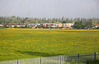
Port Meadow is a large meadow of open common land beside the River Thames to the north and west of Oxford, England.

Osney Human settlement in England

Osney or Osney Island is a riverside community in the west of the city of Oxford, England. In modern times the name is applied to a community also known as Osney Town astride Botley Road, just west of the city's main railway station, on an island surrounded by the River Thames, Osney Ditch and another backwater connecting the Thames to Osney Ditch.

Botley Road

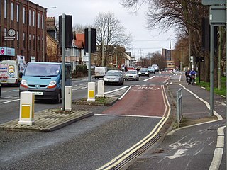
Botley Road is the main road into the centre of Oxford, England from the west. It stretches between Botley, on the Oxford Ring Road (A34) to the west of the city, and Frideswide Square at the junction with Oxford railway station, close to central Oxford.

Osney Lock lock on the River Thames in Oxfordshire, England

Osney Lock is a lock on the River Thames in Oxford, England, where the village or island of Osney is next to the river.

Fiddlers Island

Fiddler's Island is an island in the River Thames at Oxford in England. It is situated south of Port Meadow on the reach above Osney Lock.

Oxpens Road

Oxpens Road is a road in central Oxford, England, linking west and south Oxford. It is named after the marshy area of Oxpens, next to one of the branches of the River Thames in Oxford. It forms part of the A420 road.

Castle Mill Stream Stream in Oxfordshire, England

Castle Mill Stream is a backwater of the River Thames in the west of Oxford, England. It is 5.5 km long.

Radcliffe Observatory Quarter

The Radcliffe Observatory Quarter (ROQ) is a major University of Oxford development project in Oxford, England, in the estate of the old Radcliffe Infirmary hospital. The site, covering 10 acres is in central north Oxford. It is bounded by Observatory Street and Green Templeton College to the north, the Woodstock Road to the east, Somerville College to the south, and Walton Street to the west. The project and the new university area is named after the grade I listed Radcliffe Observatory to the north east of the site, now the centrepiece of Green Templeton College, which is intended to form the visual centrepiece of the project.

Walton Well Road

Walton Well Road is a road, about 400 metres long, near the centre of Oxford, England. It provides a link from central Oxford to Port Meadow.

Aristotle Lane

Aristotle Lane is a road in north Oxford, England.

Castle Mill

Castle Mill is a graduate housing complex of the University of Oxford in Oxford, England.

Sheepwash Channel

Sheepwash Channel connects the River Thames to the west and the Castle Mill Stream next to the Oxford Canal to the east, in west Oxford, England. To the north are Cripley Meadow and Fiddler's Island. To the south are Osney Island and the Botley Road.

Rewley Road Swing Bridge

Rewley Road Swing Bridge is a disused railway swing bridge over Sheepwash Channel in west Oxford, England. To the north are Cripley Meadow and Fiddler's Island and to the south are Osney Island and the Botley Road.

Sheepwash Channel Railway Bridge

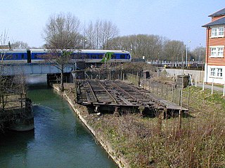
Sheepwash Channel Railway Bridge is a railway bridge over Sheepwash Channel in west Oxford, England, just north of Oxford railway station. To the north are Cripley Meadow and Fiddler's Island. To the south are Osney Island and the Botley Road.

Longcross (company) Former British construction company

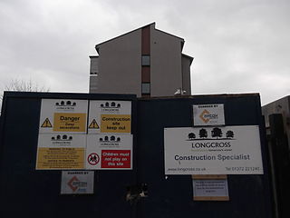
Longcross was a British construction company which entered into administration in June 2015. The head office was based in Ashtead, Surrey, England.

Wolvercote Common Human settlement in England

Wolvercote Common is an area of grassed common land north of Port Meadow in Oxford, England.

Oxford Down Carriage Sidings Train stabling point in Oxford, Oxfordshire

Oxford Down Carriage Sidings are located in Oxford, Oxfordshire, England, just north of Oxford station.

Trap Grounds Human settlement in England

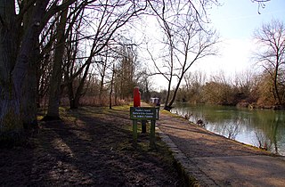
The Trap Grounds is a nature reserve in Oxford, Oxfordshire, England, owned by Oxford City Council.

References

  1. "Cripley Meadow Allotments (Oxford)". Wikimapia . Retrieved 22 October 2012.
  2. 1 2 Brock, M. G.; Curthoys, M. C., eds. (1998). The History of the University of Oxford. Vol. VI: Nineteenth-Century Oxford. Oxford University Press. p. 459. ISBN   978-0199510160.
  3. "John Wayte: Mayor of Oxford 1555/6 and 1561/2". Mayors & Lord Mayors. UK: Oxford History. Retrieved 22 October 2012.
  4. "History". UK: Cripley Meadow Allotments Association. Archived from the original on 6 June 2013. Retrieved 22 October 2012.
  5. MacKenzie, Norman H.; Phillips, Catherine (2008). Excursions in Hopkins. Saint Joseph's University Press. p. 36. ISBN   978-0916101763.
  6. Lemon, Mark; Mayhew, Henry; Taylor, Tom; Brooks, Shirley; Burnand, Sir Francis Cowley; Seaman, Owen (1865). "Triumph of the Great Western Railway". Punch . 48–49: 207.
  7. "Breaking new ground at the Cripley Meadow Allotments". Panoramio. Archived from the original on 30 December 2015. Retrieved 22 October 2012.
  8. "Planning issues: Cripley Road/ Roger Dudman Way development of Castle Mill Site". UK: Cripley Meadow Allotments. Archived from the original on 7 June 2013. Retrieved 18 April 2013.
  9. "Longcross at the University of Oxford, Castle Mill Phase 2 ∙ Innovation in action". Longcross]. Archived from the original on 24 February 2014. Retrieved 23 October 2012.
  10. "Longcross Secures Student Accommodation Project at Oxford University". Longcross]. July 2012. Archived from the original on 10 March 2013. Retrieved 23 October 2012.
  11. "City 'has to pay a price' to preserve Green Belt". The Oxford Times . 1 November 2012. pp. 1, 3.
  12. Little, Reg (2 November 2012). "Save our famous views for hideous developments". The Oxford Times. Retrieved 4 November 2012.
  13. Little, Reg (2 November 2012). "Save our famous views for hideous developments". Oxford Mail . Retrieved 4 November 2012.
  14. Dhall, Sushila (2012), "Port Meadow, Oxford. Damaged views", www.thepetitionsite.com/850/008/830/port-meadow-oxford-damaged-views/, Care2petitionsite
  15. Little, Reg (1 November 2012). "Planning: Controversy over student flats at Roger Rudman Way — The battle of Port Meadow". The Oxford Times. p. 10.
  16. "Tall storey". The Oxford Times. 1 November 2012. p. 32. Retrieved 4 November 2012.
  17. Little, Reg (7 February 2013). "Historian takes university to task over 'visual disaster' of Port Meadow flats". The Oxford Times. p. 3.
  18. Hughes, Pete (14 February 2013). "U-turn over meadow flats". The Oxford Times. p. 3.