Panoramio

Last updated

Panoramio
Panoramio logo.svg
Panoramio screenshot.png
Panoramio homepage
Type of site
Photo sharing
Available inMultilingual
Dissolved November 4, 2016;7 years ago (2016-11-04)
Owner Google
Created by
  • Joaquín Cuenca Abela (co-founder)
  • Eduardo Manchón (co-founder)
  • Jose Florido (co-founder)
URL www.panoramio.com OOjs UI icon edit-ltr-progressive.svg
CommercialYes
RegistrationFree
Users 4.1 million
LaunchedOctober 3, 2005;18 years ago (2005-10-03)
Current statusDefunct

Panoramio was a geo-located tagging, photo sharing mashup active between 2005 and 2016. Photos uploaded to the site were accessible as a layer in Google Earth and Google Maps. [1] [2] The site's goal was to allow Google Earth users to learn more about a given area by viewing the photos that other users had taken at that location. [1] Panoramio was acquired by Google in 2007. In 2009 the website was among the 1000 most popular websites worldwide. [3]

Contents

Panoramio was launched in 2005, and closed on November 4, 2016, [1] although the layer in Google Earth was available until January 2018. [2] [4] Image source URLs are still available. [1]

After the acquisition of Panoramio by Google, the headquarters were located in Zurich, [5] in the office building of Google Switzerland, but subsequently were moved to Mountain View, California, US.

History

Joaquin Cuenca and Eduardo Manchon, the creators of Panoramio. Joaquin Cuenca - Eduardo Manchon.jpg
Joaquín Cuenca and Eduardo Manchón, the creators of Panoramio.

Panoramio was started in the summer of 2005 by Spanish entrepreneurs Joaquín Cuenca Abela and Eduardo Manchón Aguilar. It was officially launched on October 3, 2005, and by March 19, 2007 it had archived over 1 million user submitted photographs. [6] Three months later, on June 27, 2007 the number of photos reached two million. [7] After a further four months, on October 25, 2007 the number of archived photos reached five million. [8]

In October 2006 Google began approaches to acquire the company, [9] but these were rebuffed. However, on May 30, 2007 Google announced plans to acquire the website, [10] and it was acquired by Google in July 2007. [11]

Manchón left the company in January 2010 to focus on a new project. [12] [13] He was replaced by Gerard Sanz Viñas. [14] Cuenca left the company in May 2010. [15]

In May 2015 the number of uploaded photos (including deleted objects) exceeded 120 million. [16] By October 8, 2016, 94,370,531 photos had been uploaded by 4,159,004 users, resulting in a total of 75,640,891,592 image views. [17]

Further developments

On September 16, 2014, Google announced that it intended to close Panoramio and migrate it to Google Maps Views. [18] During the migration, features such as comments, favorite photographers and groups would disappear. [19]

On September 23, 2014, Panoramio's founders launched a petition entitled "Google: Keep The Panoramio Community Alive", requesting that Google refrain from closing Panoramio. It received 10,512 supporters. [20] [21] [22] On June 2, 2015, Google announced that it would continue to operate Panoramio until a better solution could be developed. [23] The announcement, by Google's James Therrien, stated:

Among Google's geo-imagery efforts, we strive to balance what makes sense for you, the pro or enthusiast photographer, with the needs of consumers. Achieving this balance can be a challenge, especially when publishing tools are managed under separate products, such as Panoramio, Views, Google+ and Google Maps. So today, after listening to community feedback about the future of the platform, we're pleased to let you know that there won't be any immediate changes to Panoramio. Instead of aligning the community with Views, we've gone back to the drawing board to work on a more integrated solution that supports you and your content directly within Google Maps. We'll be taking the necessary time to get this right as we build a solution that strives to meet the majority of your needs. Thanks for your input, and for your patience in the year ahead.

On January 30, 2016 another petition was launched by Stuart Smith, a Panoramio user from Australia, to request Google to maintain the site. It received over 1,500 supporters.[ citation needed ] Despite the continuing popularity of the site and both petitions, Google announced on October 5, 2016 [24] [25] that they had decided to close Panoramio on November 4, 2016. Users were able to access their photos in Panoramio for a year, but were unable to add new photos, likes, or comments. [24]

Closure

On 4 November 2016, Google removed all user facilities from the site apart from the ability to delete photos, connect/disconnect with Google+, and delete an account. Google said it left uploaded images on display for 12 months before Panoramio was completely retired. [26]

Organization

Sample Panoramio page (of user 656563) exemplifying some of the mashup's options. Panoramio - strona uzytkownika 656563.jpg
Sample Panoramio page (of user 656563) exemplifying some of the mashup's options.

Panoramio asked users to organize images using tags (a form of metadata), which allow searchers to find images concerning a certain topic such as place name or subject matter. Panoramio was also an early website to implement tag clouds, which provided access to images tagged with the most popular keywords. The website also hosted a list of world-famous sites. As of February 2012, 1 million photos were uploaded to the site in about 20 days. [27]

Images that had (or were perceived to have had) as their central subject people, machines, vehicles or anything within the interiors of structures, or depict public events such as fairs or concerts, were excluded from the Google Earth layer, as were any potentially controversial images. No waivers were granted even if the images were historical or otherwise vintage in nature, since copyright had to be held by the uploader. Images judged to be too creative or artistic in concept, such as Photoshop constructions, were also excluded from Google Earth regardless of other requirements met. However a pervasive problem was thousands of misplaced photos, typically manifested by cities and towns seemingly located in the oceans, which required action on the part of the photographer before anything could be done. [28]

Users could create and join Google Groups. Photos could then be added to a group. This feature was removed as part of the winding down of the site.

Others

Panoramio had an official iPhone app, which was deprecated in June 2012. [29] Third party developers released a Windows Phone 7 version of Panoramio [30] that allowed users to browse through the various images posted to www.panoramio.com.

In response to the announcement that Panoramio would shut down, the photo-sharing service Mapillary set up a process for transferring one's Panoramio pictures to their service. [31] [32]

Data published in Panoramio has been used by scientists, local and governmental authorities as a proxy for the evaluation of aesthetic values, the appreciation of different landscape types and identifying hotspots – most often photographed objects, etc. [33]

See also

Related Research Articles

<span class="mw-page-title-main">Picasa</span> Image organizer and image viewer (2002–2016)

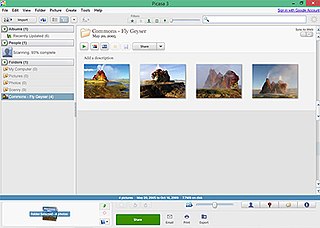
Picasa was a cross-platform image organizer and image viewer for organizing and editing digital photos, integrated with a now defunct photo-sharing website, originally created by a company named Lifescape in 2002. "Picasa" is a blend of the name of Spanish painter Pablo Picasso, the word casa and "pic" for pictures.

<span class="mw-page-title-main">Delicious (website)</span> Discontinued American social bookmarking web service

Delicious was a social bookmarking web service for storing, sharing, and discovering web bookmarks. The site was founded by Joshua Schachter and Peter Gadjokov in 2003 and acquired by Yahoo! in 2005. By the end of 2008, the service claimed more than 5.3 million users and 180 million unique bookmarked URLs. Yahoo sold Delicious to AVOS Systems in April 2011, and the site relaunched in a "back to beta" state on September 27 that year. In May 2014, AVOS sold the site to Science Inc. In January 2016 Delicious Media, a new alliance, reported it had assumed control of the service.

<span class="mw-page-title-main">Flickr</span> Image and video hosting website

Flickr is an image hosting and video hosting service, as well as an online community, founded in Canada and headquartered in the United States. It was created by Ludicorp in 2004 and was previously a common way for amateur and professional photographers to host high-resolution photos. It has changed ownership several times and has been owned by SmugMug since April 20, 2018.

<span class="mw-page-title-main">Image sharing</span> Publishing or transfer of photos online

Image sharing, or photo sharing, is the publishing or transfer of digital photos online. Image sharing websites offer services such as uploading, hosting, managing and sharing of photos. This function is provided through both websites and applications that facilitate the upload and display of images. The term can also be loosely applied to the use of online photo galleries that are set up and managed by individual users, including photoblogs. Sharing means that other users can view but not necessarily download images, and users can select different copyright options for their images.

<span class="mw-page-title-main">Google Maps</span> Googles web mapping service (launched 2005)

Google Maps is a web mapping platform and consumer application offered by Google. It offers satellite imagery, aerial photography, street maps, 360° interactive panoramic views of streets, real-time traffic conditions, and route planning for traveling by foot, car, bike, air and public transportation. As of 2020, Google Maps was being used by over one billion people every month around the world.

<span class="mw-page-title-main">Google Earth</span> 3D Internet global map program

Google Earth is a computer program that renders a 3D representation of Earth based primarily on satellite imagery. The program maps the Earth by superimposing satellite images, aerial photography, and GIS data onto a 3D globe, allowing users to see cities and landscapes from various angles. Users can explore the globe by entering addresses and coordinates, or by using a keyboard or mouse. The program can also be downloaded on a smartphone or tablet, using a touch screen or stylus to navigate. Users may use the program to add their own data using Keyhole Markup Language and upload them through various sources, such as forums or blogs. Google Earth is able to show various kinds of images overlaid on the surface of the Earth and is also a Web Map Service client. In 2019, Google revealed that Google Earth now covers more than 97 percent of the world, and has captured 10 million miles of Street View imagery.

<span class="mw-page-title-main">OpenStreetMap</span> Collaborative project to create a free editable map of the world

OpenStreetMap (OSM) is a free, open geographic database updated and maintained by a community of volunteers via open collaboration. Contributors collect data from surveys, trace from aerial imagery and also import from other freely licensed geodata sources. OpenStreetMap is freely licensed under the Open Database License and as a result commonly used to make electronic maps, inform turn-by-turn navigation, assist in humanitarian aid and data visualisation. OpenStreetMap uses its own topology to store geographical features which can then be exported into other GIS file formats. The OpenStreetMap website itself is an online map, geodata search engine and editor.

Picasa Web Albums (PWA) was an image hosting and sharing web service from Google, often compared to Flickr and similar sites. The service links with Google's photo organizing desktop program Picasa. It was discontinued in May 2016 and succeeded by Google Photos which does not support sharing photo albums on the public world wide web.

<span class="mw-page-title-main">Photosynth</span> Discontinued app and service

Photosynth is a discontinued app and service from Microsoft Live Labs and the University of Washington that analyzes digital photographs and generates a three-dimensional model of the photos and a point cloud of a photographed object. Pattern recognition components compare portions of images to create points, which are then compared to convert the image into a model. Users are able to view and generate their own models using a software tool available for download at the Photosynth website.

<span class="mw-page-title-main">Google Street View</span> Photos at street level

Google Street View is a technology featured in Google Maps and Google Earth that provides interactive panoramas from positions along many streets in the world. It was launched in 2007 in several cities in the United States, and has since expanded to include all of the country's major and minor cities, as well as cities and rural areas of many other countries worldwide. Streets with Street View imagery available are shown as blue lines on Google Maps.

Ipernity is a non-commercial photo sharing community which is financed exclusively by membership dues without any intention of making a profit. By means of the Ipernity Members Association (IMA), the community operates its own website for the protected private exchange of digital content such as photos, videos, audio files and blogs, as well as for the worldwide publication of selected content.

The following is a timeline for Google Street View, a technology implemented in Google Maps and Google Earth that provides ground-level interactive panoramas of cities. The service was first introduced in the United States on May 25, 2007, and initially covered only five cities: San Francisco, Las Vegas, Denver, Miami, and New York City. By the end of 2008, Street View had full coverage available for all of the major and minor cities in the continental United States, and had started expanding its scope to include some of the country's national parks, as well as cities elsewhere in the world. For the first year and a half of its existence, Street View featured camera icon markers, each representing at least one major city or area. By its 10th anniversary, the Street View service had provided imagery for more than 10 million miles' worth of roads across 83 countries worldwide.

<span class="mw-page-title-main">Google+</span> Defunct social network by Google

Google+ was a social network that was owned and operated by Google until it ceased operations in 2019. The network was launched on June 28, 2011, in an attempt to challenge other social networks, linking other Google products like Google Drive, Blogger and YouTube. The service, Google's fourth foray into social networking, experienced strong growth in its initial years, although usage statistics varied, depending on how the service was defined. Three Google executives oversaw the service, which underwent substantial changes that led to a redesign in November 2015.

Google Drive is a file storage and synchronization service developed by Google. Launched on April 24, 2012, Google Drive allows users to store files in the cloud, synchronize files across devices, and share files. In addition to a web interface, Google Drive offers apps with offline capabilities for Windows and macOS computers, and Android and iOS smartphones and tablets. Google Drive encompasses Google Docs, Google Sheets, and Google Slides, which are a part of the Google Docs Editors office suite that permits collaborative editing of documents, spreadsheets, presentations, drawings, forms, and more. Files created and edited through the Google Docs suite are saved in Google Drive.

<span class="mw-page-title-main">Mapillary</span> Swedish service for sharing crowdsourced geotagged photos

Mapillary is a service for sharing crowdsourced geotagged photos, developed by remote company Mapillary AB, based in Malmö, Sweden. Mapillary was launched in 2013 and acquired by Meta Platforms in 2020. It offers street level imagery similar to Google Street View.

<span class="mw-page-title-main">Google Street View in North America</span>

In North America, Google Street View is available in Canada, the United States, Mexico, Guatemala, Dominican Republic, Greenland, and limited coverage in some more areas.

<span class="mw-page-title-main">Google Photos</span> Photo storage service

Google Photos is a photo sharing and storage service developed by Google. It was announced in May 2015 and spun off from Google+, the company's former social network.

KartaView, formerly called OpenStreetView and OpenStreetCam, is a project to collect crowdsourced street-level photographs for improving OpenStreetMap operated by Grab Holdings. Collected imagery is published under a CC BY-SA license and while some of the project's code is released as open source, much of it still require proprietary software to function. This is one of the few alternative platforms that offer street view like Google.

References

  1. 1 2 3 4 Lardinois, Frederic (October 7, 2016). "Google shuts down Panoramio". TechCrunch . Retrieved October 8, 2016.
  2. 1 2 "Photos Layer of Google Earth and Google Maps Transition with Panoramio Closure". HikingMike.com. Blogspot. February 4, 2018. Retrieved February 12, 2018.
  3. "Panoramio: Photo-sharing community. Discover the world through photos". Rank2traffic.com. Retrieved February 12, 2018.
  4. "Panoramio no longer available after January 29, 2018". Local Guides Connect. January 26, 2018. Retrieved February 12, 2018.
  5. "Panoramio lived here". Panoramio. April 15, 2010. Archived from the original on September 6, 2017. Retrieved February 15, 2012.
  6. Manchón, Eduardo (March 19, 2007). "One million geolocated photos at Panoramio". Panoramio's Blog. Archived from the original on February 11, 2012. Retrieved August 10, 2007.
  7. Manchón, Eduardo (June 7, 2007). "2 million photos in Panoramio". Panoramio's Blog. Retrieved August 10, 2007.
  8. Manchón, Eduardo (October 25, 2007). "1 million registered users and 5 million photos uploaded". Panoramio's Blog. Retrieved October 28, 2007.
  9. "Panoramio: The day that we rejected an acquisition offer from Google". Novobrief.com. June 29, 2015. Retrieved March 7, 2019.
  10. Hanke, John (May 30, 2007). "A picture's worth a thousand clicks". The Official Google Blog. Retrieved August 10, 2007.
  11. "Panoramio's Team". Panoramio. Archived from the original on April 7, 2014. Retrieved June 1, 2008.
  12. "Askaro.com". Askaro.com. February 8, 2012. Archived from the original on January 26, 2012. Retrieved February 15, 2012.
  13. Manchón, Eduardo (January 20, 2010). "New Time". Panoramio's Blog. Retrieved January 20, 2010.
  14. Manchón, Eduardo (January 20, 2010). "Panoramio's Team: Gerard Sanz Viñas". Panoramio's Blog. Retrieved January 20, 2010.
  15. Cuenca, Joaquín (May 11, 2010). "Good Bye Joaquín!". Panoramio's Blog. Retrieved May 11, 2010.
  16. Nasipwondi1 (May 26, 2015). "120 millions photos in Panoramio". Panoramio. Archived from the original on July 5, 2017. Retrieved May 28, 2015.{{cite web}}: CS1 maint: numeric names: authors list (link)
  17. Kaiser. "Global stats". Panorank. Archived from the original on March 2, 2017. Retrieved October 8, 2016.
  18. Rapoport, Evan (September 16, 2014). "Important Panoramio Update". Google Groups.
  19. McClendon, Brian (September 19, 2014). "An update from Google on the future migration of Panoramio to Views". Google Groups.
  20. Shankland, Stephen (September 24, 2014). "Panoramio founders try persuading Google not to kill site". CNET.
  21. Greif, Björn (September 25, 2014). "Panoramio-Gründer wollen Schließung durch Google verhindern" [Panoramio founders want to prevent closure by Google]. ZDNet.de (in German).
  22. Álvarez, Francisco (September 25, 2014). "Campaña 'Salva a Panoramio' ante la decisión de Google de cerrarla" [Campaign 'Save Panoramio' before Google's decision to close it]. El Mundo (in Spanish).
  23. Therrien, James (June 2, 2015). "Announcement - Panoramio, Views and Google Maps". Google Groups.
  24. 1 2 "Panoramio no longer available after November 4, 2016". Panoramio. Archived from the original on October 5, 2016. Retrieved October 8, 2016.
  25. Grigonis, Hillary K. (October 10, 2016). "Photo-sharing site Panoramio falls off the map, discontinued in favor of Google Maps". Digital Trends . Retrieved October 30, 2023.
  26. "PANORAMIO is CLOSED". Google Groups. November 5, 2016. Retrieved February 12, 2018.
  27. Samaee (October 24, 2011). "Photo of Days to upload one Millions photos (61 M)". Panoramio. Archived from the original on September 5, 2013. Retrieved February 15, 2012.
  28. "Report misplaced pictures without new location information". Google Groups. May 24, 2010. Retrieved February 12, 2018.
  29. "Panoramio: Adjusting the focus". Panoramio Blog. June 5, 2012. Archived from the original on October 12, 2013. Retrieved July 16, 2013.
  30. Zwezdin, Sergey. "Phone app". Windowsphone.com. Retrieved July 16, 2013.
  31. "Migrating from Panoramio: A New Home for Geotagged Photos". Mapillary blog. October 10, 2016. Retrieved October 24, 2016.
  32. "Give Your Panoramio Photos a New Home". Mapillary. Archived from the original on October 24, 2016.
  33. Lieskovský, Juraj; Rusňák, Tomáš; Klimantová, Alexandra; Izsóff, Martin; Gašparovičová, Petra (November 22, 2017). "Appreciation of landscape aesthetic values in Slovakia assessed by social media photographs". Open Geosciences. 9 (1): 593–599. Bibcode:2017OGeo....9...44L. doi: 10.1515/geo-2017-0044 . ISSN   2391-5447.