This article needs additional citations for verification .(January 2015) |
Dholpur Dhaulpur | |
---|---|
City | |
Nickname: Dang | |
Coordinates: 26°42′N77°54′E / 26.7°N 77.9°E | |
Country | India |
State | Rajasthan |
District | Dholpur |
Founded by | Dhaval Dev in 11th century |
Area | |
• City | 33.3 km2 (12.9 sq mi) |
Elevation | 177 m (581 ft) |
Population (2021) [2] | |
• City | 246,489 |
• Density | 7,400/km2 (19,000/sq mi) |
• Metro | 133,229 |
Languages | |
• Official | Hindi |
Time zone | UTC+5:30 (IST) |
PIN | 328001 |
Telephone code | 05642 |
Vehicle registration | RJ-11 |
Sex ratio | 862 ♂/♀ |
Website | dholpur |
Dholpur is a city in the Dholpur district in Rajasthan state of India. It is situated on the left bank of the famous Chambal river. The city is the administrative headquarters of Dholpur District and was formerly seat of the Dholpur princely State of Jats.
Dhaulpur became a separate district in 1982 comprising Dholpur, Rajakhera, Saramathura, Bari and Baseri Tehsils. Dholpur district is a part of Bharatpur Division/Commissionerate. It is bordered by Bharatpur district of Rajasthan and Uttar Pradesh to the north, Madhya Pradesh to the south, Karauli district to the west and Uttar Pradesh and Madhya Pradesh to the east. Dhaulpur is famous for his Red Stone and ancient time temple. Here is Machkund temple and kund which is famous as "Tirthon ka Bhanja". Two famous shiv temple situated here 1.)Mahakaal Shiv Temple. 2.)Bhooteshwar Mahadev Temple. Bhooteshwar Mahadev Temple situated at Baseri Block of Dhaulpur. It is situated at bank of parvati river.It is very peaceful and beautiful temple in this district. Along with Mahakaal temple is also a very famous temple because of his color changing shivling which is situated at Dhaulpur district.This Mahakaal shivling change his color three times a day.
The city of Dholpur (Dhaulpur) lies on the left (north) bank of the Chambal River at 26° 42' 0" North, 77° 54' 0" East, [4] across the river, and provincial border, from Morena in Madhya Pradesh. It is located on old NH-3 and is a junction on the North Central Railway. The total area of Dholpur city is 33.3 square kilometres (12.9 sq mi). [1]
There were several rajput dynasties including Chauhans, Tomars and Jadauns who ruled over Dholpur for long period.
The earliest rajput dyanasty ruled Dholpur region were Chauhans in early 7th and 8th century, The discovery of a stone inscription at Dholpur has brought into light the existence of a Chahamana dynasty at Dhavalapuri. The inscription mentions Chuahan Prince Chandamahasena who was the contemporary of rajput pratihara emperor Bhojadev. The inscription mentions conflicts of Chuahan Prince with invading Arab armies. [5]
The rule of Dholpur region passed into the hands of Tomar rajput in 1004 AD, Dholpur or Dhawalpuri city was established by Rajput Raja Dholan Dev Tomar and most likely the name of city was changed to Dholpur after him. He resided 10 km (6.2 miles) southwest of Dholpur at a place called Bilpur near Chambal where a fort still exists. He was the ruler of the country between Chambal and Banganga. The Dholeshwar Mahadev Temple built by this Raja was washed away in Chambal floods of 1868 AD. [6]
The Tomars lost sovereignty to Jadaun rajput of Karauli. The fort at Dholpur was built by Dharmpal Jadaun in 1120 AD. [7]
After the battle of Panipat, Babar became the first Mughal ruler of Hindustan. His rule was not a bed of roses in the early years of his reign. Dholpur was taken by Sikandar Lodi in 1491, who handed it to a Muslim governor in 1504. After the death of Ibrahim Lodi, many states declared themselves independent. Talai Khan became the ruler of Gwalior.
After the Mughals, Dholpur was taken successively by the Jat ruler Maharaja Suraj Mal of Bharatpur; by Mirza Najaf Khan in 1775; by the Maratha Scindia ruler of Gwalior in 1782; and finally, by the British East India Company in 1803. It was restored by the British to the Scindias under the Treaty of Sarji Anjangaon, briefly, and was soon reoccupied by the British. In 1805, Dhaulpur came under the Jat ruler, Maharana Kirat Singh of Gohad, a princely state, a vassal of the British during the Raj.
According to the Babur Nama, Babur had a baori built in Dholpur on his last trip to Gwalior, to add to the charghar ("four-gardens") he had already had built there. [8]
During British Raj, it was part of the Rajputana Agency, till the Independence of India. The former mansion of the ruler of the erstwhile Dholpur State, Kesarbagh palace, now houses the Dholpur Military School, while its official residence in New Delhi, Dholpur House, is used by the Union Public Service Commission.
As of the [update] 2021 census, Dholpur municipality had a population of 246,489. [2]
As of the [update] 2011 census, Dholpur municipality had a population of 126,142 [9] and the urban agglomeration had a population of 133,229. [3] The municipality had a sex ratio of 862 females per 1,000 males and 13.6% of the population were under six years old. [9] Effective literacy was 76.56%; male literacy was 84.22% and female literacy was 67.74%. [9]
The local language is Rajasthani, Hindi, Brajbhasha. Dholpur is home to Hindu and Jain communities. [10]
Dholpur Military School is housed in Kesarbagh Palace, a magnificent mansion of the former ruler of the erstwhile Dholpur State. It is 10.5 kilometers away from Dholpur City and on Dholpur-Bari Road.
Govt PG College is located two kilometers away from the city towards the railway station. The only PG college in Dholpur city was established four decades ago after independence. Notable alumni include DP Sharma, International Digital Diplomat and National Brand Ambassador, Swachh Bharat Mission, India, and Manoj Rajoria, Member of Parliament, Republic of India.
Dholpur is reputed to be the location of the highest recorded temperature in India, at 50 °C on 3 June 2017. The hottest months are May and June, which mark the oppressive summer season. Temperatures in summers are normally higher than 40 °C. Coldest months are December and January where temperatures sometimes reach near-zero and subzero levels. The lowest recorded temperature is -4.3 °C on 29 January 2017. [11] Annual average rainfall is 860 mm.
Climate data for Dholpur (1981–2010, extremes 1955–2012) | |||||||||||||
---|---|---|---|---|---|---|---|---|---|---|---|---|---|
Month | Jan | Feb | Mar | Apr | May | Jun | Jul | Aug | Sep | Oct | Nov | Dec | Year |
Record high °C (°F) | 32.6 (90.7) | 36.8 (98.2) | 42.8 (109.0) | 47.3 (117.1) | 49.8 (121.6) | 50.0 (122.0) | 46.0 (114.8) | 42.2 (108.0) | 41.7 (107.1) | 41.8 (107.2) | 37.7 (99.9) | 32.6 (90.7) | 50.0 (122.0) |
Mean daily maximum °C (°F) | 22.8 (73.0) | 27.5 (81.5) | 33.9 (93.0) | 40.3 (104.5) | 43.1 (109.6) | 42.1 (107.8) | 36.3 (97.3) | 34.3 (93.7) | 35.1 (95.2) | 35.0 (95.0) | 30.5 (86.9) | 24.8 (76.6) | 33.8 (92.8) |
Mean daily minimum °C (°F) | 7.5 (45.5) | 10.7 (51.3) | 15.9 (60.6) | 22.3 (72.1) | 26.8 (80.2) | 28.4 (83.1) | 26.7 (80.1) | 25.3 (77.5) | 24.2 (75.6) | 18.8 (65.8) | 12.9 (55.2) | 9.0 (48.2) | 19.1 (66.4) |
Record low °C (°F) | −4.3 (24.3) | 0.2 (32.4) | 4.0 (39.2) | 11.0 (51.8) | 16.7 (62.1) | 18.4 (65.1) | 20.9 (69.6) | 17.4 (63.3) | 14.9 (58.8) | 8.9 (48.0) | 3.1 (37.6) | −3.3 (26.1) | −4.3 (24.3) |
Average rainfall mm (inches) | 5.6 (0.22) | 9.6 (0.38) | 6.3 (0.25) | 2.4 (0.09) | 12.6 (0.50) | 51.6 (2.03) | 165.3 (6.51) | 210.6 (8.29) | 112.8 (4.44) | 21.3 (0.84) | 6.6 (0.26) | 5.6 (0.22) | 610.2 (24.02) |
Average rainy days | 0.7 | 0.8 | 0.7 | 0.4 | 1.5 | 3.3 | 8.9 | 9.6 | 4.8 | 0.8 | 0.4 | 0.4 | 32.3 |
Average relative humidity (%) (at 17:30 IST) | 60 | 48 | 36 | 25 | 26 | 40 | 66 | 73 | 64 | 48 | 52 | 59 | 50 |
Source: India Meteorological Department [12] [11] |
Gwalior is a major city in the central Indian state of Madhya Pradesh; it lies in northern part of Madhya Pradesh and is one of the Counter-magnet cities. Located 343 kilometres (213 mi) south of Delhi, the capital city of India, 120 kilometres (75 mi) from Agra and 414 kilometres (257 mi) from Bhopal, the state capital, Gwalior occupies a strategic location in the Gird region of India. The historic city and its fortress have been ruled by several historic Indian kingdoms. From the Kachchhapaghatas in the 10th century, Tomars in the 13th century, it was passed on to the Mughal Empire, then to the Maratha in 1754, and the Scindia Dynasty of Maratha Empire in the 18th century. In April 2021, It was found that Gwalior had the best air quality index amongst the 4 major cities in Madhya Pradesh.
Etawah, also known as Ishtikapuri, is a city on the banks of Yamuna River in the state of Western Uttar Pradesh in India. It is the administrative headquarters of Etawah District. Etawah's population of 256,838 makes it the 180th most populous city in India. The city lies 300 km (190 mi) southeast of the national capital New Delhi, 230 km (140 mi) northwest of the state capital Lucknow, 120 km east of Agra and 140 km west of Kanpur. The city was an important centre for the Indian Rebellion of 1857. It is also the sangam or confluence of the Yamuna and Chambal rivers. It is the 26th most populous city in Uttar Pradesh.
The Rajputana Agency was a political office of the British Indian Empire dealing with a collection of native states in Rajputana, under the political charge of an Agent reporting directly to the Governor-General of India and residing at Mount Abu in the Aravalli Range. The total area of the states falling within the Rajputana Agency was 127,541 square miles (330,330 km2), with eighteen states and two estates or chiefships.
Chauhan, a name derived from the historical Chahamanas, a clan name associated with various ruling Rajput families in the present-day Indian state of Rajasthan from seventh century onwards.
Chanderi, is a town of historical importance in Ashoknagar District of the state Madhya Pradesh in India. It is situated at a distance of 127 km from Shivpuri, 37 km from Lalitpur, 55 km from Ashok Nagar and about 46 km from Isagarh. It is surrounded by hills southwest of the Betwa River. Chanderi is surrounded by hills, lakes and forests and is spotted with several monuments of the Bundela Rajputs and Malwa sultans. It is famous for ancient Jain Temples. Its population in 2011 was 33,081.
Hindaun is a city and municipality, near city of Karauli in Karauli district, Rajasthan, India. It has a population of 105690 and is governed by a municipal council.
Sawai Madhopur district is a district of Rajasthan state in north-west India. Sawai Madhopur is the chief town and district headquarters. Sawai Madhopur district comes under Bharatpur division.
Sheopur District is a district of Madhya Pradesh state in central India. The district is located in the north of the state and forms part of Chambal division. It is situated on the periphery of Rajasthan, which shows in the influence of Rajasthani culture in this district.
Bhind district is a district in the Chambal division of the Indian state of Madhya Pradesh. The town of Bhind is the district headquarters.Bhind District is situated in Chambal region in the northwest of the state.
Karauli District is a district of the state of Rajasthan in western India. It is located in the Braj Bhoomi region. The town of Karauli serves as the administrative headquarters of the district. Karauli district also comes under the Bharatpur Divisional Commissionerate.
Dholpur District is a district of Rajasthan state in Northern India. The town of Dholpur is the district headquarters. Dholpur District is a part of Bharatpur Divisional Commissionerate. It was carved out from the erstwhile Bharatpur District on 15 April 1982.
Ambah is a city and a municipality in Morena district in the state of Madhya Pradesh, India. It is the administrative headquarter of Ambah-Porsa Block. It was formerly known as Ambrish Nagari.Devendra Sakhwar (SC) of the Congress party is the present MLA from Ambah-Porsa Constituency.
Raghogarh-Ruthiyai or Raghogarh-Vijaypur is a town and municipality in Guna district in the Indian state of Madhya Pradesh.
Rajakhera is a city and a municipality situated near the banks of the Chambal River in Dholpur district in the Eastern part of the Indian state of Rajasthan. Its part of Braj region and the local language has Braj Bhasha dialect. The culture is fused with Rajasthan and its border states.
Sabalgarh is a municipality in Morena district in the Indian state of Madhya Pradesh.
Sarangpur is a city and tehsil in Rajgarh district in the Indian state of Madhya Pradesh. It is situated at the bank of the river Kali Sindh.
Gohad Fort is situated at Gohad city in Bhind district of Madhya Pradesh, India. The town is situated at a distance of 45 km from Gwalior. The fort was built in 1505 by Bamraulia Jat ruler Singhandev II of Gohad State.
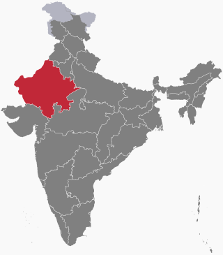
The history of human settlement in the western Indian state of Rajasthan dates back to about 100,000 years ago. Around 5000 to 2000 BCE many regions of Rajasthan belonged as the site of the Indus Valley Civilization. Kalibangan is the main Indus site of Rajasthan, here fire altars have been discovered, similar to those found at Lothal.
Karauli State was a princely state in the north eastern edge of modern day Rajasthan, India from 1348 to 1949. It is located in the cultural Braj region. Karauli city was the capital while Mandrayal or Mandrail was another important town.
Hindaun City Bus Depot is a Rajasthan Roadways Bus Depot in Hindaun, Rajasthan, India. It is the central bus stand for the Rajasthan State Road Transport Corporation. Buses are available for Jaipur, Kaila Devi, Gangapur City, Dausa, Sawai Madhopur, Ajmer, Udaipur, Etawah, Bharatpur, Dholpur, Alwar, Tonk, Churu, Jhunjhunu, Bikaner, Delhi, Haryana, Punjab, Uttarakhand, Gujarat, Uttar Pradesh, Madhya Pradesh and various other locations.