Ecology of Sydney

Last updated

Cumberland Plain Savanna.jpg
Sheldon Forest Australia.JPG
Royal National Park Coast Track - panoramio (4).jpg
Campbells Crater with Cabbage Tree Palm.jpg
Mallee Ku-ring-gai Chase National Park.JPG
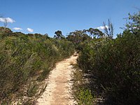
From top; left to right: Savannas, sclerophyll forests, coastal heaths, rainforests and scrublands

The ecology of Sydney, located in the state of New South Wales, Australia, is diverse for its size, [1] where it would mainly feature biomes such as grassy woodlands or savannas and some sclerophyll forests, with some pockets of mallee shrublands, riparian forests, heathlands, and wetlands, in addition to small temperate and subtropical rainforest fragments. [2] [3]

Contents

There are 79 vegetation communities in the Sydney metropolitan area that are identified, described and mapped. [4] The combination of climate, topography, moisture, and soil influence the dispersion of these ecological communities across a height gradient from 0 to 200 metres (0 to 700 ft). [5] There are many hiking trails, paved and unpaved roads for exploring the many different biomes and ecosystems. [6] [7] [8]

Savannas (or grassy woodlands), the most predominant biome in the Sydney region, [9] mainly occur in the Cumberland Plain west of Sydney CBD, which generally feature eucalyptus trees that are usually in open, dry sclerophyll woodland areas with shrubs (typically wattles, callistemons, grevilleas and banksias) and sparse grass in the understory, reminiscent of Mediterranean forests. [10] The plants in this community tend to have rough and spiky leaves, as they are grown in areas with low soil fertility.

Wet sclerophyll forests, which are part of Eastern Australian temperate forests, have narrow, relatively tall, dense trees with a lush, moist understory of fleecy shrubs and tree ferns. They are mainly found in the wetter areas, such as Forest District and the North Shore. [11]

It has been calculated that around 98,000 hectares of native vegetation remains in the Sydney metropolitan area, shaping the geography of Sydney, about half of what is likely to have been existing at the time of European arrival. [12]

Historical descriptions

General topographical descriptions

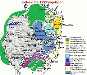
Sydney's vegetation prior to 1750 Sydney vegetation pre-1750.jpg
Sydney's vegetation prior to 1750

In 1787, the First Fleet personnel discovered a landscape that was alien to them, and unlike the green meadows and deciduous forests of England. Arthur Phillip expressed that: [13]

The coast, as well as the neighbouring country in general, is covered with wood...The necks of land that form the coves are mostly covered with timber, yet so rocky that it is not easy to comprehend how the trees could have sufficient nourishment to bring them to so considerable a magnitude.

This was a response to comparisons with the mostly deeper, fertile soils of the British Isles and how the rocky mountainous areas like the Scottish Highlands and Dartmoor lacked tree cover. [13]

The "neck of land" which separates the southern part of the harbour from the northern part was primarily sand. Between Sydney Cove and Botany Bay the first area is made up of woodland. The rest of the land consisted of heath, poor sand and several swamplands. Coastal areas featured mangroves in many inlets, estuaries at Port Jackson, in addition to decentralized areas of saltwater or freshwater marshes, and sheltered areas of subtropical rainforest along waterbody valleys. [13]

Most of the North Shore and inland areas featured sclerophyll forests and woodlands filled with eucalypts of many different species, ranging in different heights, and growing at immensely contrasting densities. Much of the wooded land had grass cover under the trees, but comparatively small understorey shrub or smaller tree growth. Cumberland Plain, which is inland, had sparser and fewer tree cover than the region near the coast. By May 1789 much of the thick forest around Port Jackson was cleared. [13]

Sydney Cove in 1792 View of Sydney Cove 1792.jpg
Sydney Cove in 1792

First Fleet surgeon George Worgan described the environment of Sydney, particularly its terrain: [13]

...We meet with, in many parts, a fine black soil; luxuriantly covered with grass, & the Trees at 30 or 40 yards [27–37 m] distant from each other, so as to resemble Meadow land, yet these spots are frequently interrupt[ed] in their Extent by either a rocky, or a sandy, or a swampy surface, crowded with large trees, and almost impenetrable from Brushwood which being the case will necessarily require much Time and Labour to cultivate any considerable space of land together.

In 1819, British settler William Wentworth described Sydney's vegetation and landform in great detail:

The colony of New South Wales possesses every variety of soil, from the sandy heath, and the cold hungry clay, to the fertile loam and the deep vegetable mould. For the distance of 5 mi (8.0 km) to 6 mi (9.7 km) from the coast, the land is in general extremely barren, being a poor hungry sand, thickly studded with rocks. A few miserable stunted gums, and a dwarf underwood, are the richest productions of the best part of it; while the rest never gives birth to a tree at all, and is only covered with low flowering shrubs, whose infinite diversity, however, and extraordinary beauty, render this wild heath the most interesting part of the country for the botanist, and make even the less scientific beholder forget the nakedness and sterility of the scene.

Beyond this barren waste, which thus forms a girdle to the coast, the country suddenly begins to improve. The soil changes to a thin layer of vegetable mould, resting on a stratum of yellow clay, which is again supported by a deep bed of schistus. The trees of the forest are here of the most stately dimensions. Full sized gums and iron barks, alongside of which the loftiest trees in this country would appear as pigmies, with the beefwood tree, or as it is generally termed, the forest oak, which is of much humbler growth, are the usual timber. The forest is extremely thick, but there is little or no underwood.

At this distance, however, the aspect of the country begins rapidly to improve. The forest is less thick, and the trees in general are of another description; the iron barks, yellow gums, and forest oaks disappearing, and the stringy barks, blue gums, and box trees, generally usurping their stead. When you have advanced about 4 mi (6.4 km) further into the interior, you are at length gratified with the appearance of a country truly beautiful. An endless variety of hill and dale, clothed in the most luxuriant herbage, and covered with bleating flocks and lowing herds, at length indicate that you are in regions fit to be inhabited by civilized man. The soil has no longer the stamp of barrenness. A rich loam resting on a substratum of fat red clay, several feet in depth, is found even on the tops of the highest hills, which in general do not yield in fertility to the valleys. The timber, strange as it may appear, is of inferior size, though still of the same nature, i. e. blue gum, box, and stringy bark. There is no underwood, and the number of trees upon an acre do not upon an average exceed thirty. They are, in fact, so thin, that a person may gallop without difficulty in every direction. [14]

Positive

Scrubby, arable meadowland in Lane Cove William Piguenit - A Spring Morning, Lane Cove, New South Wales.jpg
Scrubby, arable meadowland in Lane Cove

Early settlers compared the landscapes to the manicured parks of England which also featured well-spaced trees and a grassy understorey. [15] In 1787, Arthur Bowes Smyth from the First Fleet described the landscape in a favourable manner: [13]

...fresh terraced, lawns and grottos with distinct plantations of the tallest and most stately trees I ever saw in any nobleman's grounds in England, cannot excel in beauty those whose nature now presented to our view. The singing of the various birds among the trees, the flight of the numerous parraquets, lorrequets, cockatoos and macaws, made all around appear like an enchantment; the stupendous rocks from the summit of the hills and down to the very water's edge hang'g over in a most awful way from above, and form’g the most commodious quays by the water, beggard all description.

Grassy woodlands with well-spaced trees that dominated most of western Sydney (Liverpool Plains) Kangaroos c.1819 SLNSW FL8999009.jpg
Grassy woodlands with well-spaced trees that dominated most of western Sydney (Liverpool Plains)

Captain John Hunter, who criticised Sydney for having "poor, sterile soil, full of stones", had a more positive view of Rosehill's and Parramatta's landscape, which are further west, for having arable lands, stating: [13]

...But near, and at the head of the harbour, there is a very considerable extent of tolerable land, and which may be cultivated without waiting for its being cleared of wood; for the trees stand very wide of each other, and have no underwood: in short, the woods on the spot I am speaking of resemble a deer park… but the soil appears to me to be rather sandy and shallow, and will require much manure to improve it… however, there are people… who think it good land… The grass upon it is about 3 feet [nearly a metre] high, very close and thick; probably farther back there may be very extensive tracts of this kind of country…

Another First Fleet surgeon, Arthur Bowes Smyth, also acknowledged the beauty of scenery: [13]

The general face of the country is certainly pleasing, being diversified with gentle scents, and little winding vallies, covered for the most part with large spreading trees, which afford a succession of leaves in all seasons. In those places where trees are scarce, a variety of flowering shrubs abound, most of them entirely new to an European and surpassing in beauty, and number, all I ever saw in an uncultivated state.

In 1827, Peter Cunningham described the western plains of Sydney as "a fine timbered country, perfectly clear of bush...through which you might, generally speaking, drive a gig in all directions, without any impediment in the shape of rocks, scrub or close forest.". [16]

Negative

The rocky, sandy nature of the landscape (Botany Bay) H.M.S. Herald at the entrance to Botany Bay Wilson Nla.obj-134112064-1.jpg
The rocky, sandy nature of the landscape (Botany Bay)

After landing, the First Fleet thought that Botany Bay was an inhospitable, swampy piece of land which lacked a source of drinking water, in addition to the area featuring poor, sandy soils that did not have any substance. Arthur Phillips writes: [13]

The appearance of the place is picturesque and pleasing...but something more essential than beauty of appearance...must be sought in a place where the permanent residence of multitudes is to be established.

Regarding Phillips' statement, Australian environmentalist Tim Flannery wrote: "The vegetation the early Europeans found growing on the Sydney sandstone both delighted and appalled them...the hungry settlers realized in despair that this magnificent vegetation offered little sustenance". Moreover, the First Fleet's reaction to the Botany Bay area was so negative that Phillip and his crew almost instantly explored further north, towards Port Jackson and Broken Bay. [13]

Upon arriving in Port Jackson, First Fleet lieutenant David Blackburn wrote that Sydney Harbour was "either Immense Barren Rocks, tumbled together in Large Ridges which are almost Inaccessible to Goats, or A Dry Sandy Soil and A General Want of Water". First Fleet officer John Hunter also described Sydney Cove as "very bad, most of the ground being covered with rocks, or large stones". [13]

In July 1788, Lieutenant Ralph Clark, a member of the First Fleet, had a scathing view of Sydney's landscape, climate and as well its inhabitants, writing: [13]

The sandy, rugged landscape near rivers (Lane Cove) William Piguenit - Lane Cove from above the bridge, 1893.jpg
The sandy, rugged landscape near rivers (Lane Cove)

I shall only tell you that this is the poorest country in the world, which its inhabitance [sic] shows they are the most miserable set of wretches under the Sun… there is neither river or Spring in the country that we have been able to find… all the fresh water comes out of swamps which the country abounds with… the country is overrun with large trees not one Acre of clear ground to be seen… the Thunder and Lightning is the most Terrible I ever herd [sic], it is the opinion of every body here that the Government will remove the Settlement to some other place for if it remains here this country will not be able to maintain its self in 100 years...

In a 1793 commentary map by Watkin Tench, the overall notion was that most of Sydney agriculturally poor – The land around South Head was "exceedingly rocky, sandy & barren"; the area northwest of Botany Bay was "sandy barren swampy Country"; the coastline from Manly to Mona Vale was "sandy, rocky and very bad Country", the Ku-ring-gai Chase area was "very bad & rugged", the Cattai area was "very dreadful Country", and the southwest of Prospect Hill was a "bad Country frequently over-flowed". [13]

Biomes

Biomes
Browns Field rainforest NSW.jpg
Warm temperate rainforest in Wahroonga
Western Sydney parklands 18.jpg
Grassy woodland/savanna in the Cumberland Plain Woodland
Winifred Falls Track - panoramio (12).jpg
Heathland in Bundeena
Andrew Harvey - 20220108 135033.jpg
A wet sclerophyll forest in Hornsby
Botany Bay National Park - panoramio (32).jpg
Swamp Oak Forest.jpg
A swamp oak forest near Prospect Creek
Frerres Crossing (1).JPG
A river-flat eucalyptus forest in Georges River

Complete list

BiomesEco-communities
Rainforests
Wet Sclerophyll Forests
Grassy Woodlands
Coastal Grasslands
Dry Sclerophyll Forests
Heathlands
Freshwater Wetlands
Forested Wetlands
Saline Wetlands

Vegetation

Tree species
Lane Cove National Park Sydney red gum tree.jpg
Sydney red gum, a common woodland and forest tree of Eastern Australia
M. decoratree.jpg
White feather honeymyrtle, a paperbark tree with lance-shaped leaves that is covered with creamy-coloured flowers in summer
Gardenology.org-IMG 1046 rbgs10dec.jpg
Casuarina trees are the most widespread in Sydney after the eucalyptus.
Narrow-leaved Bottlebrush habit (8349169000).jpg
Narrow-leaved bottlebrush is a shrub which has a rigid point, and red flower spikes in late spring or early summer.
Starr 050722-2918 Ficus microcarpa.jpg
The curtain fig is one of the most common street trees in Sydney and is used as a shade tree.

The most widespread eucalyptus species in the Sydney region include: [34]

Non-eucalyptus tree species:

Common shrub species include, but are not limited to:

Introduced

Introduced shrubs and/or vines that are invasive species): [57]

Hardiness zone

Due to the microclimate, the plant hardiness zone in the Sydney area would range: [58]

Wildlife

Common bird species
Magpie samcem05.jpg
Commonly sighted in Sydney, Australian magpies are known for their distinctive, "gargling" calls.
Manorina melanocephala domain.jpg
Noisy miners are ubiquitous in urban, suburban and woodland areas.
Australian Raven Sydney University.jpg
Australian ravens are notable for their screechy, high pitched ah-ah-aaaah calls.
Pied Curawong444.jpg
The pied currawong is a common bird in the plain and is usually seen in urban forests and backyards.
Greybutcherbird.jpg
Grey butcherbirds, known for their frisky song, are found in woodlands, acacia shrublands and residential townships.
Crested Pigeon Nov09.jpg
Crested pigeons are usually found in the open grasslands and wooded areas of the plain.
Spotted Dove RWD4.jpg
The spotted dove is a small, long-tailed pigeon that was introduced in Australia in the 1860s.

The fauna of the Sydney area is diverse and its urban area is home to variety of bird and insect species, and also a few bat, arachnid and amphibian species. Introduced birds such as the house sparrow, common myna and feral pigeon are ubiquitous in the CBD areas of Sydney. [59] [60] Moreover, possums, bandicoots, rabbits, feral cats, lizards, snakes and frogs may also be present in the urban environment, albeit seldom in city centers. [61]

About 40 species of reptiles are found in the Sydney region and 30 bird species exist in the urban areas. [62] [63] [64] Sydney's outer suburbs, namely those adjacent to large parks, have a great diversity of wildlife. [65] Since European settlement and the subsequent bushland clearing for the increasing population, 60% of the original mammals are now considered endangered or vulnerable, and many reptile species are experiencing population diminution and are becoming elusive. [66]

Tetrapods

This list includes bird species that are widespread in the Sydney metropolitan area: [67]

Although not commonly spotted, these birds are also present in Sydney: [64]

This list includes mammal, reptile and amphibian species that are spotted in the Sydney urban area: [68] [69]

Arthropods

This list includes insect, spider and centipede species that are commonly present in Sydney: [70]

See also

Related Research Articles

<span class="mw-page-title-main">Royal National Park</span> Protected area in New South Wales, Australia

The Royal National Park is a protected national park that is located in Sutherland Shire local government area in the southern portion of Sydney, New South Wales, Australia.

<span class="mw-page-title-main">Sclerophyll</span> Type of plant

Sclerophyll is a type of vegetation that is adapted to long periods of dryness and heat. The plants feature hard leaves, short internodes and leaf orientation which is parallel or oblique to direct sunlight. The word comes from the Greek sklēros (hard) and phyllon (leaf). The term was coined by A.F.W. Schimper in 1898, originally as a synonym of xeromorph, but the two words were later differentiated.
<span class="mw-page-title-main">Geography of Sydney</span>

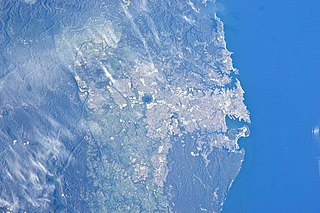
The geography of Sydney is characterised by its coastal location on a basin bordered by the Pacific Ocean to the east, the Blue Mountains to the west, the Hawkesbury River to the north and the Woronora Plateau to the south. Sydney lies on a submergent coastline on the east coast of New South Wales, where the ocean level has risen to flood deep river valleys (rias) carved in the Sydney sandstone. Port Jackson, better known as Sydney Harbour, is one such ria.

<span class="mw-page-title-main">Cumberland Plain</span> Plain in Australia

The Cumberland Plain, also known as Cumberland Basin, is a relatively flat region lying to the west of Sydney CBD in New South Wales, Australia. An IBRA biogeographic region, Cumberland Basin is the preferred physiographic and geological term for the low-lying plain of the Permian-Triassic Sydney Basin found between Sydney and the Blue Mountains, and it is a structural sub-basin of the Sydney Basin.

<i>Eucalyptus botryoides</i> Species of eucalyptus

Eucalyptus botryoides, commonly known as the bangalay, bastard jarrah, woollybutt or southern mahogany, is a small to tall tree native to southeastern Australia. Reaching up to 40 metres high, it has rough bark on its trunk and branches. It is found on sandstone- or shale-based soils in open woodland, or on more sandy soils behind sand dunes. The white flowers appear in summer and autumn. It reproduces by resprouting from its woody lignotuber or epicormic buds after bushfire. E. botryoides hybridises with the Sydney blue gum in the Sydney region. The hard, durable wood has been used for panelling and flooring.

<span class="mw-page-title-main">Sydney Turpentine-Ironbark Forest</span> Critically endangered forest in Australia

The Sydney Turpentine-Ironbark Forest (STIF) is a wet sclerophyll forest community of Sydney, New South Wales, Australia, that is typically found in the Inner West and Northern region of Sydney. It is also among the three of these plant communities which have been classified as Endangered, under the New South Wales government's Threatened Species Conservation Act 1995, with only around 0.5% of its original pre-settlement range remaining.
<span class="mw-page-title-main">Eastern Australian temperate forests</span> Ecoregion in Australia

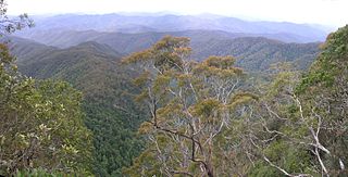
The Eastern Australian temperate forests is a broad ecoregion of open forest on uplands starting from the east coast of New South Wales in the South Coast to southern Queensland, Australia. Although dry sclerophyll and wet sclerophyll eucalyptus forests predominate within this ecoregion, a number of distinguishable rainforest communities are present as well.
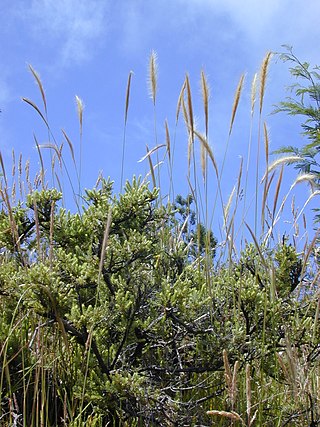
<i>Dichelachne crinita</i> Species of grass

Dichelachne crinita , commonly known as the longhair plume grass, is a type of grass found in Australia, New Zealand and islands of the Pacific Ocean. It is often seen on sandy soils near the sea as well as woodlands. The flowering panicles are open and feathery at maturity. The grass may grow up to 1.5 metres (5 ft) tall. Crinita, the specific epithet, is derived from Latin (hairy).

<span class="mw-page-title-main">Western Sydney Regional Park</span> Park in Sydney

Western Sydney Regional Park is a large urban park and a nature reserve situated in Western Sydney, Australia within the suburbs of Horsley Park and Abbotsbury. A precinct of Western Sydney Parklands, a park system, and situated within the heart of the Cumberland Plain Woodland, the regional park features several picnic areas, recreational facilities, equestrian trails, and walking paths within the Australian bush.

<span class="mw-page-title-main">Dharawal National Park</span> Protected area in New South Wales, Australia

The Dharawal National Park is a protected national park that is located in the Illawarra region of New South Wales, in eastern Australia. The 6,508-hectare (16,080-acre) national park is situated between the Illawarra Range and the Georges River and is approximately 45 kilometres (28 mi) south west of Sydney. There are three entry points to the park: from the east through Darkes Forest; from the north through Wedderburn; and from the south through Appin.

<span class="mw-page-title-main">Cooks River/Castlereagh Ironbark Forest</span>

The Cooks River/Castlereagh Ironbark Forest (CRCIF) is a scattered, dry sclerophyll, open-forest to low woodland and scrubland which occurs predominantly in the Cumberland subregion of the Sydney basin bioregion, between Castlereagh and Holsworthy, as well as around the headwaters of the Cooks River. The Cooks River Clay Plain Scrub Forest is a component of this ecological community, though both belong to a larger occurring community called the Temperate Eucalyptus fibrosa/Melaleuca decora woodland.

<span class="mw-page-title-main">Cumberland Plain Woodland</span> Indigenous woodland community in Sydney, Australia

The Cumberland Plain Woodland, also known as Cumberland Plain Bushland and Western Sydney woodland, is a grassy woodland community found predominantly in Western Sydney, New South Wales, Australia, that comprises an open tree canopy, a groundcover with grasses and herbs, usually with layers of shrubs and/or small trees.

<span class="mw-page-title-main">Sydney Sandstone Ridgetop Woodland</span> Indigenous forest communities of Sydney, Australia

The Sydney Sandstone Ridgetop Woodland, also known as Coastal Sandstone Ridgetop Woodland and Hornsby Enriched Sandstone Exposed Woodland, is a shrubby woodland and mallee community situated in northern parts of Sydney, Australia, where it is found predominantly on ridgetops and slopes of the Hornsby Plateau, Woronora Plateau and the lower Blue Mountains area. It is an area of high biodiversity, existing on poor sandstone soils, with regular wildfires, and moderate rainfall.

Wide Bay Military Reserve is a heritage-listed military installation at Tin Can Bay Road, Tin Can Bay, Queensland, Australia. The reserve supports a diverse range of plant communities from estuarine, strand, wetlands, heath, tall shrublands and woodlands, to the open forests of the sub-coastal hills and ranges. The total number of bird species recorded for the place totals 250, which is high by Australian standards. It was added to the Australian Commonwealth Heritage List on 22 June 2004.
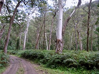
<span class="mw-page-title-main">Southeast Australia temperate forests</span> Terrestrial ecoregion in Australia

The Southeast Australia temperate forests is a temperate broadleaf and mixed forests ecoregion of south-eastern Australia. It includes the temperate lowland forests of southeastern Australia, at the southern end of the Great Dividing Range. Vegetation ranges from wet forests along the coast to dry forests and woodlands inland.

<span class="mw-page-title-main">Shale Sandstone Transition Forest</span> Indigenous woodland community in Sydney, Australia

The Shale Sandstone Transition Forest, also known as Cumberland Shale-Sandstone Ironbark Forest, is a transitory ecotone between the grassy woodlands of the Cumberland Plain Woodlands and the dry sclerophyll forests of the sandstone plateaus on the edges of the Cumberland Plain in Sydney, Australia.

<span class="mw-page-title-main">Eastern Suburbs Banksia Scrub</span> Indigenous woodland community in Sydney, Australia

The Eastern Suburbs Banksia Scrub, which also incorporates Sydney Coastal Heaths, is a remnant sclerophyll scrubland and heathland that is found in the eastern and southern regions of Sydney, New South Wales, Australia. Listed under the Environment Protection and Biodiversity Conservation Act 1999 as and endangered vegetation community and as 'critically endangered' under the NSW Biodiversity Conservation Act 2016, the Eastern Suburbs Banksia Scrub is found on ancient, nutrient poor sands either on dunes or on promontories. Sydney coastal heaths are a scrubby heathland found on exposed coastal sandstone plateau in the south.

<span class="mw-page-title-main">Castlereagh Scribbly Gum and Agnes Banks Woodlands</span> Indigenous woodland community in Sydney, Australia

The Castlereagh Scribbly Gum and Agnes Banks Woodlands is an endangered sclerophyll low-woodland and shrubland community found in western Sydney, New South Wales, Australia. Vegetation comprises low woodlands with sclerophyllous shrubs and an uneven ground layer of graminoids and forbs.

<span class="mw-page-title-main">Swan Coastal Plain Shrublands and Woodlands</span> Indigenous woodland community in Perth, Australia

The Swan Coastal Plain Shrublands and Woodlands is a sclerophyll-woodland vegetation community that stretch from Kalbarri in the north to Busselton in the south, passing through Perth, in Western Australia. Situated on the Swan Coastal Plain, it is listed as Endangered under the Commonwealth Environment Protection and Biodiversity Conservation Act 1999. The woodlands also incorporate Perth–Gingin Shrublands and Woodlands.

References

  1. Benson, D.H. and Howell, J. (2000) Sydney’s Bushland — More than Meets the Eye, Royal Botanic Gardens, Sydney.
  2. "The Native Vegetation of the Sydney Metropolitan Area Volume 2: Vegetation Community Profiles" (PDF). NSW Government Catchment Management Authority and Office of Environment & Heritage . Retrieved 30 January 2019.
  3. Fairley, A.; Waterhouse, D. (2005). West Sydney Wild – Exploring Nature in Sydney's Western Suburbs. Dural, NSW: Rosenberg Publishing Pty Ltd.
  4. The native vegetation of the Sydney metropolitan area by NSW Environment & Heritage. Retrieved 28 January 2023.
  5. French K, Pellow B and Henderson M 2000, Vegetation of the Holsworthy Military area. Cunninghamia 6(4): 893-939.
  6. SYDNEY WALKS by Sydney.com
  7. The best bushwalks in and around Sydney by The Daily Telegraph
  8. Sydney’s top 5 walks by NSW National Parks and Wildlife Service
  9. "Coastal Valley Grassy Woodlands". NSW Environment & Heritage. Retrieved 15 December 2019.
  10. "Dry sclerophyll forests (shrub/grass sub-formation)". NSW Environment & Heritage. Retrieved 15 October 2016.
  11. "Wet sclerophyll forests (grassy sub-formation)". NSW Environment & Heritage. Retrieved 16 March 2017.
  12. James, T. McDougall, L. and Benson, D.H. (1999) Rare Bushland Plants of Western Sydney, second edition, Royal Botanic Gardens, Sydney.
  13. 1 2 3 4 5 6 7 8 9 10 11 12 13 Graeme Aplin (2013). "A Strange Natural Environment: Colonists in Eighteenth-Century Sydney". Sydney Journal Vol 4, No 1. UTSePress and the author. Retrieved 7 June 2024.
  14. Statistical, Historical, and Political Description of NSW by William Charles Wentworth, 1819
  15. ABORIGINAL DESIGN PRINCIPLES DARUG COUNTRY SYDNEY HARBOUR BRIDGE CYCLEWAY ACCESS PROGRAM - NORTH. MARCH 2021. Retrieved 31 January 2023.
  16. Kohen, J. (September 1996). "The Impact of Fire: An Historical Perspective". Australian Plants Online. Society for Growing Australian Plants.
  17. Bell SAJ and Driscoll C 2007, Vegetation of the Cessnock-Kurri Region, Cessnock LGA, New South Wales: Survey, Classification and Mapping. Unpublished Report to Department of Environment and Climate Change. Eastcoast Flora Survey. November 2007.
  18. Tozer MG 2003, The native vegetation of the Cumberland Plain, western Sydney: systematic classification and field identification of communities. Cunninghamia 8:1-75.
  19. Young B and Young A 2006, Understanding the Scenery: The Royal National Park with Heathcote National Park. Envirobook, Annandale NSW.
  20. Biosphere Environmental Consultants Pty Ltd 2008, Ryde Flora and Fauna Study 2008. Unpublished report prepared for Ryde City Council.
  21. Bangalay Ecological and Bushfire and Eastcoast Flora Survey 2011, Pittwater Vegetation Classification, Vegetation Mapping, pre-1750 Vegetation Mapping and Vegetation Profiles’. Report prepared for Pittwater Council.
  22. Clarke PJ and Benson DH 1987, Vegetation Survey of Lane Cove River State Recreation Area. Royal Botanic Gardens, Sydney.
  23. "Sydney Blue Gum High Forest" (PDF). Nationally Threatened Species and Ecological Communities. Environment.gov.au. Archived from the original (PDF) on 18 June 2012. Retrieved 16 May 2012.
  24. 1 2 Auburn Council 2004, Auburn Council State of the Environment Report 2003-2004. Auburn Council, Auburn
  25. Bankstown City Council 2002, Bushland Plan of Management – Reserves at Lansdowne including Mirambeena Reserve, Lansdowne Reserve, Bogabilla Reserve and Amaroo Reserve. Unpublished report prepared for Bankstown City Council.
  26. Andrew, D. (2001). Post fire vertebrate fauna survey: Royal and Heathcote National Parks and Garawarra State Recreation Area.{{cite book}}: |work= ignored (help)
  27. "ENDANGERED ECOLOGICAL COMMUNITY INFORMATION: Sydney Turpentine-Ironbark Forest" (PDF). NSW Department of Environment & Climate Change . Ryde City Council. February 2004. Archived from the original (PDF) on 30 September 2007. Retrieved 2 July 2007.
  28. Fairley A and Waterhouse D 2005, West Sydney Wild – Exploring Nature in Sydney’s Western Suburbs. Rosenberg Publishing Pty Ltd, Dural, NSW.
  29. Baulkham Hills Shire Council 2007, The bushland of Hunts Creek Reserve and Seville Reserve. Baulkham Hills Shire Council, Sydney.
  30. Earth Resource Analysis PL 1998, Cumberland Plains Woodland: Trial Aerial Photographic interpretation of remnant woodlands, Sydney. Unpublished report prepared for NSW National Parks and Wildlife Service – Sydney Zone.
  31. 1 2 James, T. (1997). Native flora in Western Sydney: Urban Bushland Biodiversity Survey. NSW National Parks & Wildlife Service.
  32. Earth Resource Analysis PL (1998). Cumberland Plains Woodland: Trial Aerial Photographic interpretation of remnant woodlands, Sydney (Unpublished report).{{cite book}}: |work= ignored (help)
  33. Andrew D 2001, Post fire vertebrate fauna survey : Royal and Heathcote National Parks and Garawarra State Recreation Area . Report to NSW National Parks and Wildlife Service Sydney South Region.
  34. 1 2 "Sydney Coastal Dry Sclerophyll Forests". NSW Environment & Heritage. Retrieved 17 September 2012.
  35. Benson D and Howell J 1994b, Hawkesbury-Nepean Catchment Studies. Draft Explanatory Notes for the Wollongong 1:100 000 Map Sheet. Ecology Section, Royal Botanic Gardens, Sydney.
  36. Tozer, M. G. (2003). "The native vegetation of the Cumberland Plain, western Sydney: systematic classification and field identification of communities". Cunninghamia. 8: 1–75.
  37. Harden, G. J., ed. (2000–2002). The Flora of New South Wales. Vol. 1–2 (Revised ed.). University of New South Wales Press.
  38. DECC 2008a, Protecting and restoring the Cumberland Plain Woodland community at Campbell Hill West Reserve, Chester Hill. Department of Environment and Climate Change NSW, Sydney South
  39. Herbert C 1980, ‘Wianamatta Group and Mittagong Formation’ in C Herbert and R Helby (eds) A guide to the Sydney Basin. Department of Mineral Resources, Geological Survey of New South Wales Bulletin 26, 4-9.
  40. Anne Clements and Associates 2003, Flora Assessment: Proposed "Banksia Grove" residential subdivision, Bundock St, Randwick. Unpublished report prepared for Bowen and Gerathy Solicitors.
  41. 1 2 DEC 2004, Eastern Suburbs Banksia Scrub Endangered Ecological Community Recovery Plan. NSW Department of Environment and Conservation, Hurstville.
  42. Fullerton RN 1998, Community Structure of Cliff-Top Coastal Heathlands in Botany Bay National Park, Sydney. Submitted to the University of Technology, Sydney in partial fulfilment of the requirements for the degree of Doctor of Philosophy.
  43. Conservation Advice1 for the Elderslie Banksia by the Department of Agriculture, Water and the Environment. Retrieved 14 September 2022.
  44. Castlereagh Scribbly Gum and Agnes Banks Woodlands of the Sydney Basin Bioregion Department of the Environment (2022). Castlereagh Scribbly Gum and Agnes Banks Woodlands of the Sydney Basin Bioregion in Community and Species Profile and Threats Database, Department of the Environment, Canberra.
  45. "Sydney Sandstone Ridgetop Woodland". Northern Beaches Council. Retrieved 15 November 2018.
  46. "Urban Bushland in the Ryde LGA - Sydney Sandstone Ridgetop Woodland" (PDF). Ryde Council. Retrieved 15 November 2018.
  47. Coast and Wetlands Society 1982, Temporal Changes in the Estuarine Flora and Fauna of Towra Point, Botany Bay. Unpublished report prepared for the Coastal Council of NSW.
  48. Brunker RL and Rose G 1969, Sydney Basin, New South Wales, 1:500 000 geological sheet. Special edition., Geological Survey of New South Wales, 1vBryan, JH (1966), Sydney 1:250 000 Geological Sheet S1 56-5. Department of Mineral Resources Sydney NSW.
  49. Swamp Oak Floodplain Forest of the New South Wales North Coast, Sydney Basin and South East Corner Bioregions - profile NSW Environment & Heritage. Retrieved 13 September 2022.
  50. River-Flat Eucalypt Forest on Coastal Floodplains of the New South Wales North Coast, Sydney Basin and South East Corner Bioregions - profile by Office of Environment & Heritage (NSW Government)
  51. Keith DA and Myerscough PJ 1993, Floristics and soil relations of Upland Swamp vegetation near Sydney. Australian Journal of Ecology 18:325-344
  52. Harden GJ (ed.) 2000-2002, The Flora of New South Wales. Volume 1-2 (Revised Edition) New South Wales University Press.
  53. AGC Woodward-Clyde Pty Ltd 1996, Cronulla Sewerage Treatment Plant Upgrade Environmental Impact Statement. Unpublished report prepared for Sydney Water.
  54. Australian Littoral Society 1977, An Investigation of Management Options for Towra Point, Botany Bay. Australian National Parks and Wildlife Service, Canberra.
  55. Keith DA and Scott J 2005, Native vegetation of coastal floodplains – a diagnosis of the major plant communities in New South Wales. Pacific Conservation Biology 11: 81-104
  56. Adam P, Stricker P, Wiecek BM and Anderson DJ 1989, The vegetation of seacliffs and headlands in New South Wales, Australia. Australian Journal of Ecology 14, 515-547.
  57. Humphries, S.E., Groves, R.H., and Mitchell, D.S. (1991) 'Plant Invasions of Australian Ecosystems. Kowari 2'
  58. Australia Plant Hardiness Zone Map by PlantMaps
  59. Hindwood, K. A. and McCill, A. R., 1958. The Birds of Sydney (Cumberland Plain) New South Wales. Roy. Zool. Soc. New South Wales.
  60. "Sydney's flying foxes now Bundy's problem". North Queensland Register. 2 August 2012. Archived from the original on 30 December 2012. Retrieved 22 February 2014.
  61. Williams, J. et al. 2001. Biodiversity, Australia State of the Environment Report 2001 (Theme Report), CSIRO Publishing on behalf of the Department of the Environment and Heritage, Canberra. ISBN   0-643-06749-3
  62. Cogger, H.G. (2000). Reptiles and Amphibians of Australia. Reed New Holland.
  63. Green, D., 1973. -Re reptiles of the outer north-western suburbs of Sydney. Herpetofauna 6 (2): 2-5.
  64. 1 2 Australian Museum Online. "Crows and Ravens". Archived from the original on 1 September 2007. Retrieved 12 August 2007.
  65. Burton, Thomas C. (1993). "9. Family Microhylidae" (PDF). Fauna of Australia series, Environment Australia website. Canberra: Department of the Environment, Water, Heritage and the Arts, Australian Government. Archived from the original (PDF) on 20 March 2011. Retrieved 19 August 2010.
  66. Merriam, C. and Wagner, J., 1992. Local extinctions, habitat fragmentation and ecozones. Pp. 150-69 in Landscape Boundaries: Biodiversity and Ecologicy by A. J. Hanron and F. De Castri. Springer: New York.
  67. Dolby, Tim; Clarke, Rohan (2014). Finding Australian Birds. CSIRO Publishing. ISBN   9780643097667.
  68. Cogger, H. G. (2000). Reptiles and Amphibians of Australia. Reed New Holland.
  69. Green, D. (1973). "Re reptiles of the outer north-western suburbs of Sydney". Herpetofauna. 6 (2): 2–5.
  70. Lomov, B. (2005). Plant-insect interactions as indicators for restoration ecology (PhD thesis). Sydney: University of Sydney.
  71. Lowe, E.C.; Wilder, S.M.; Hochuli, D.F. (2016), "Persistence and survival of the spider Nephila plumipes in cities: do increased prey resources drive the success of an urban exploiter?", Urban Ecosyst, 19 (2): 705–720, Bibcode:2016UrbEc..19..705L, doi:10.1007/s11252-015-0518-9, S2CID   16169674