Elland

Last updated

Elland
Elland.JPG
A view of Elland
Calderdale UK location map.svg
Red pog.svg
Elland
West Yorkshire UK location map.svg
Red pog.svg
Elland
Location within West Yorkshire
Population11,676 (Ward at 2011 census) [1]
OS grid reference SE106208
Metropolitan borough
Metropolitan county
Region
Country England
Sovereign state United Kingdom
Post town ELLAND
Postcode district HX5
Dialling code 01422
Police West Yorkshire
Fire West Yorkshire
Ambulance Yorkshire
UK Parliament
List of places
UK
England
Yorkshire
53°40′59″N1°50′24″W / 53.683°N 1.840°W / 53.683; -1.840

Elland is a market town in Calderdale, in the county of West Yorkshire, England. It is situated south of Halifax, by the River Calder and the Calder and Hebble Navigation. Elland was recorded as Elant in the Domesday Book of 1086. It had a population in 2001 of 14,554, [2] with the ward being measured at 11,676 in the 2011 Census. [1]

Contents

Etymology

The name of Elland is attested in the 1086 Domesday Book as Elant. The name comes from the Old English words ēa ('river') and land ('land'); the name relates to the settlement's location on the south bank of the Calder. [3] [4] :44

History

The Fleece Inn The Fleece, Westgate, Elland.jpg
The Fleece Inn
Elland Town Hall Town Hall, Elland - geograph.org.uk - 1005458.jpg
Elland Town Hall

Elland retained continuity of tenure from before the Norman Conquest into the Middle Ages, as the Elland family were descended from Anglo-Saxon thegns. The Manor of Elland, with Greetland and Southowram, formed an exclave of the Honour of Pontefract in the surrounding Manor of Wakefield. In 1350 Sir John de Eland was murdered, as were his son and grandson in the following year, which extinguished the male line of the family and the manor passed to the Savile family. From this period, the manor house ceased to be the principal dwelling of a gentry family, as the Saviles had their seat at the moated manor of Thornhill. Elland manor house was never completely reconstructed and, when dismantled and excavated in 1975 by the West Yorkshire Archaeology Unit, it was found to incorporate a 13th-century solar wing – one of the earliest secular buildings in the county. The manor house stood on a knoll aligned with the bridge over the River Calder and was destroyed during the construction of Calderdale Way bypass. The farm buildings survive.

At the request of John de Warenne, 7th Earl of Surrey, Edward II granted a charter, to John de Eland, for a free market on Tuesday at his Manor of Elland, and two fairs.

The town became a centre of wool production. The decline of the woollen industry had a significant effect on the town and many mills were demolished or converted to residences.

Durable flagstones, Elland flags, were quarried near the town and after the canal was constructed, they could be transported economically all over the county. [5] [6] Elland housed the main factory of the manufacturer of Gannex products [7] and is the home of the Dobsons sweet factory, which produces traditional boiled sweets. Since 2001, Elland has been home to Suma Wholefoods, the largest workers' co-operative in the United Kingdom.

Governance

Elland was historically a township, with Greetland, in the large ancient parish of Halifax. [8] The township became a civil parish in 1866, but in 1894 Elland was separated from Greetland and became Elland Urban District (and civil parish). In 1937 Greetland and Stainland were added to the Urban District. [9] In 1974 the urban district and civil parish were abolished and merged into Calderdale Metropolitan Borough.

Landmarks

The church of St Mary the Virgin St Mary the Virgin, Elland - geograph.org.uk - 1573006.jpg
The church of St Mary the Virgin

Buildings of interest include the parish church of St Mary the Virgin, the former Rose and Crown Inn in Northgate, Elland Town Hall, Southgate Methodist Church, the reputedly haunted Fleece Inn at the top of Westgate, [10] the Rex Cinema and Waxman ceramics on Elland Lane. The remains of the medieval stocks can be found at the junction of Southgate and Elizabeth Street. The stocks, which are grade II listed, date from the late 17th, or early 18th century. [11]

Elland Power Station

Elland Power Station in 1991 Former Elland Power Station - geograph.org.uk - 203659.jpg
Elland Power Station in 1991

Elland Power Station was a coal-fired power station by the River Calder. It was decommissioned and closed in 1991, in keeping with the trend of generating power at fewer but larger power stations away from towns, and demolished in 1996. [12]

Transport

The Calder and Hebble Navigation opened in the late-18th century to serve the growing industrialisation of the Calder Valley. Elland railway station closed in 1962 but the line is still in use as a passenger service for the Caldervale Line. The station has been proposed for re-opening with direct services to Leeds, Bradford, Halifax and Huddersfield. [13]

As of March 2023 planning approval for the new station has been granted, with building work due to begin in 2024 and an estimated completion date of 2025. [14]

The A643 road begins in Leeds and ended in Elland. It passes Leeds United's football ground, Elland Road. It now ends at junction 23 of the M62 motorway. The Elland bypass started construction on 23 February 1976 to finish by the end of August 1978, costing £8.5 million, built by A. Monk. [15] [16] The steel construction was by Braithwaites. [17] It was opened at 11 am on Wednesday 13 December 1978 by Tom Batty, the chairman of West Yorkshire County Council. [18]

Media

Local news and television programmes are provided by BBC Yorkshire and ITV Yorkshire. Television signals are received from the Emley Moor and the local relay TV transmitters. [19] [20]

Local radio stations are BBC Radio Leeds, Heart Yorkshire, Capital Yorkshire, Pulse 1, Greatest Hits Radio West Yorkshire, and Phoenix Radio, a community based station. [21]

The local newspapers are the Halifax Courier, the Telegraph & Argus and the Huddersfield Daily Examiner .[ citation needed ]

Notable people

See also

Related Research Articles

<span class="mw-page-title-main">West Yorkshire</span> County of England

West Yorkshire is a ceremonial county in the Yorkshire and the Humber region of England. It borders North Yorkshire to the north and east, South Yorkshire and Derbyshire to the south, Greater Manchester to the south-west, and Lancashire to the west. The city of Leeds is the largest settlement.

<span class="mw-page-title-main">Brighouse</span> Town in West Yorkshire, England

Brighouse is a town within the metropolitan borough of Calderdale, in West Yorkshire, England. Historically within the West Riding of Yorkshire, it is situated on the River Calder, 4 miles (6.4 km) east of Halifax. It is served by Junction 25 of the M62 motorway and Brighouse railway station on the Caldervale Line and Huddersfield Line. In the town centre is a mooring basin on the Calder and Hebble Navigation. The United Kingdom Census 2001 gave the Brighouse / Rastrick subdivision of the West Yorkshire Urban Area a population of 32,360. The Brighouse ward of Calderdale Council gave a population of 11,195 at the 2011 Census. Brighouse has a HD6 postcode.

<span class="mw-page-title-main">Calder and Hebble Navigation</span> Inland waterway in West Yorkshire, England

The Calder and Hebble Navigation is a broad inland waterway, with locks and bridgeholes that are suitable for 14-foot-wide (4.3 m) boats, in West Yorkshire, England. Construction to improve the River Calder and the River Hebble began in 1759, and the initial scheme, which included 5.7 miles (9.2 km) of new cuts, was completed in 1770 and has remained navigable since it was opened. Significant improvements were made, including the Salterhebble branch to Halifax, opened in 1828, and ever-longer cuts to bypass river sections. Trade was assisted by the opening of the Rochdale Canal in 1804, which provided a through route from Sowerby Bridge to Manchester. There were plans to abandon the river sections completely in the 1830s, but these were modified as the needs of mill owners and other riparian landowners were recognised.

<span class="mw-page-title-main">Dewsbury</span> Market and minster town in West Yorkshire, England

Dewsbury is a minster and market town in the Metropolitan Borough of Kirklees in West Yorkshire, England. It lies on the River Calder and on an arm of the Calder and Hebble Navigation waterway. It is to the west of Wakefield, east of Huddersfield and south of Leeds.

<span class="mw-page-title-main">Greetland</span> Village in West Yorkshire, England.

Greetland is a village in the metropolitan borough of Calderdale in West Yorkshire, England. It lies in the Calderdale Ward of Greetland and Stainland. The population of this Ward at the 2011 Census was 11,389. It is located 1 mile (1.6 km) west of Elland and 2.5 miles (4.0 km) south of Halifax.

<span class="mw-page-title-main">Mytholmroyd</span> Village in Calderdale, West Yorkshire, England

Mytholmroyd is a large village and former civil parish, now in the parish of Hebden Royd, in the Calderdale district, in West Yorkshire, England, 2 miles (3 km) east of Hebden Bridge. It lies in the Upper Calder Valley, 10 miles (16 km) east of Burnley and 7 miles (11 km) west of Halifax. The village, which has a population of approximately 4,000 is in the Luddendenfoot Ward of Calderdale Council.

<span class="mw-page-title-main">Hebden Bridge</span> Town in West Yorkshire, England

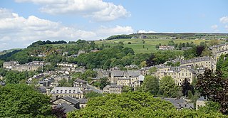
Hebden Bridge is a market town in the Calderdale district of West Yorkshire, England. It is in the Upper Calder Valley, 8 miles (13 km) west of Halifax and 14 miles (21 km) north-east of Rochdale, at the confluence of the River Calder and the Hebden Water. The town is the largest settlement in the civil parish of Hebden Royd.

<span class="mw-page-title-main">Rastrick</span> Village in West Yorkshire, England

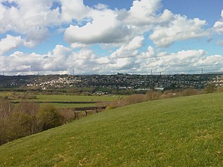
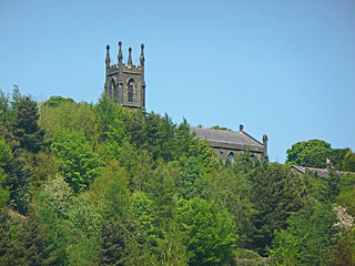
Rastrick is a village in the county of West Yorkshire, England, between Halifax, 5 miles (8 km) north-east and Huddersfield, 4 miles (7 km) south.

<span class="mw-page-title-main">Sowerby Bridge</span> Market town in West Yorkshire, England

Sowerby Bridge is a market town in the Upper Calder Valley in Calderdale in West Yorkshire, England. The Calderdale Council ward population at the 2011 census was 11,703.

<span class="mw-page-title-main">Calderdale</span> Metropolitan borough in West Yorkshire, England

Calderdale is a metropolitan borough of West Yorkshire, England, which had a population of 211,439. It takes its name from the River Calder, and dale, a word for valley. The name Calderdale usually refers to the borough through which the upper river flows, while the actual landform is known as the Calder Valley. Several small valleys contain tributaries of the River Calder. The main towns of the borough are Brighouse, Elland, Halifax, Hebden Bridge, Sowerby Bridge and Todmorden.

<span class="mw-page-title-main">Clifton, West Yorkshire</span> Village in West Yorkshire, England

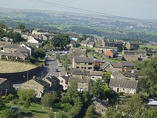
Clifton is a village on the eastern outskirts of Brighouse in the Calderdale district of West Yorkshire, England.

<span class="mw-page-title-main">Emley</span> Village in West Yorkshire, England

Emley is a village in the parish of Denby Dale, in the Kirklees district of West Yorkshire, England. It is between Huddersfield and Wakefield. In 2011 it has a population of 1,497. It is 6.4 miles (10 km) east of Huddersfield and 7.1 miles (11 km) west of Wakefield. The village dates from Anglo-Saxon times and is on high ground, close to the Emley Moor transmitting station.

<span class="mw-page-title-main">Team Pennine</span> Transdev-owned bus operator

Team Pennine operates both local and regional bus services in West Yorkshire, England. It is a subsidiary of Transdev Blazefield, which operates bus services across Greater Manchester, Lancashire, North Yorkshire and West Yorkshire.

<span class="mw-page-title-main">Halifax, West Yorkshire</span> Minster and market town in West Yorkshire, England

Halifax is a minster and market town in the metropolitan borough of Calderdale in West Yorkshire, England. It is the commercial, cultural and administrative centre of the borough, and the headquarters of Calderdale Council. In the 15th century, the town became an economic hub of the old West Riding of Yorkshire, primarily in woollen manufacture. Halifax is the largest town in the wider Calderdale borough. Halifax was a thriving mill town during the industrial revolution. In 2011 it had a population of 88,134.

<span class="mw-page-title-main">Stainland</span> Village in West Yorkshire, England

Stainland is a village in the civil parish of Stainland and District, in Calderdale, West Yorkshire, England. The village is part of the Greetland and Stainland ward of Calderdale Council and is approximately 2 miles (3 km) west of Elland, 3.5 miles (6 km) south of Halifax and 4.3 miles (7 km) north-west of Huddersfield.

<span class="mw-page-title-main">Barkisland</span> Village in West Yorkshire, England

Barkisland is a village in Calderdale, West Yorkshire, England. Historically part of the West Riding of Yorkshire, it is 1 mile (1.6 km) east of Ripponden, 2 miles (3.2 km) south of Sowerby Bridge and 4 miles (6.4 km) south-west of Halifax town centre.

<span class="mw-page-title-main">Sowood, West Yorkshire</span> Village in West Yorkshire, England

Sowood is a village in the civil parish of Stainland and District, in the Calderdale district, in the county of West Yorkshire, England. The village falls within the Greetland and Stainland ward of Calderdale Council. It is approximately 2.3 miles (3.7 km) south-west of Elland, 4.1 miles (6.6 km) north-west of Huddersfield and 4.2 miles (6.8 km) south of Halifax.

<span class="mw-page-title-main">River Calder, West Yorkshire</span> River in West Yorkshire, England

The River Calder is a river in West Yorkshire, in Northern England.

Elland is a town and an unparished area in the metropolitan borough of Calderdale, West Yorkshire, England. Elland ward contains 47 listed buildings that are recorded in the National Heritage List for England. Of these, two are listed at Grade I, the highest of the three grades, two are at Grade II*, the middle grade, and the others are at Grade II, the lowest grade. The ward contains the town of Elland, the hamlet of Blackley, and the surrounding area. The Calder and Hebble Navigation passes through the area, and the listed buildings associated with this are locks, a bridge, a milepost, a lock keeper's house, a warehouse, and an office. The other listed buildings include houses and cottages, churches and associated structures, public houses, a barn, a set of stocks, a mill warehouse, four milestones, a former town hall, a former bank, a war memorial, and two telephone kiosks.

<span class="mw-page-title-main">Stansfield, West Yorkshire</span> Human settlement in Todmorden, West Yorkshire, England

Stansfield is a place and township in the civil parish of Todmorden and Metropolitan Borough of Calderdale, in West Yorkshire, England, which gave its name to Stansfield Hall, Stansfield Hall Railway Station, and an electoral ward in Todmorden, Calderdale.

References

  1. 1 2 UK Census (2011). "Local Area Report – Elland Ward (as of 2011) (1237321034)". Nomis. Office for National Statistics . Retrieved 1 November 2018.
  2. Office for National Statistics : Census 2001 : Urban Areas : Table KS01 : Usual Resident Population Archived 8 February 2007 at the Wayback Machine Retrieved 26 August 2009
  3. Calderdale.gov.uk
  4. Parkin, Harry (2017). "Your City's Place-Names: Leeds". City-Names Series. 3. Nottingham: English Place-Name Society. p. 44.
  5. "Coal Measure Sandstones (Westphalian)". English Stone Forum. Retrieved 15 June 2010.
  6. "A guide to Elland". Information Britain. Retrieved 15 June 2010.
  7. Wainwright, Martin (20 March 2002). "Historic Gannex factory may make for a supermarket". The Guardian . Retrieved 15 June 2010.
  8. Imperial Gazetteer of England and Wales, 1870–72, at Vision of Britain website
  9. Vision of Britain: Elland UD
  10. "History of The Fleece Inn". Greater Elland Historical Society. Retrieved 15 June 2010.
  11. Historic England. "Stocks in Garden on Side of Municipal Offices (Grade II) (1313974)". National Heritage List for England . Retrieved 14 May 2020.
  12. Historic England. "Elland Power Station (1314424)". Research records (formerly PastScape). Retrieved 14 May 2020.
  13. Hirst, Ian (8 March 2019). "Overwhelming support for £20m Elland train station as hundreds back plan". Halifax Courier. Retrieved 14 May 2020.
  14. "Elland Railway Station gets planning go-ahead – here's when it could be built by". Halifax Courier. Retrieved 16 March 2023.
  15. Huddersfield Examiner Tuesday 18 January 1977, page 8
  16. Huddersfield Examiner Friday 11 August 1978, page 19
  17. Retford Times Friday 14 January 1977, page 1
  18. Huddersfield Examiner Tuesday 12 December 1978, page 5
  19. "Emley Moor (Kirklees, England) Full Freeview transmitter". UK Free TV. 1 May 2004. Retrieved 16 November 2023.
  20. "Freeview Light on the Elland (Calderdale, England) transmitter". UK Free TV. 1 May 2004. Retrieved 16 November 2023.
  21. "Phoenix FM" . Retrieved 16 November 2023.
  22. "First-Class Matches played by Thomas Thornton" . cricketarchive.com. Retrieved 14 May 2020.