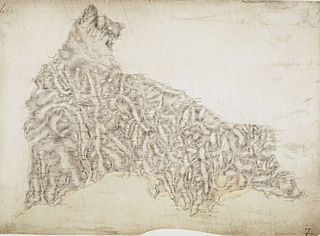
In modern mapping, a topographic map or topographic sheet is a type of map characterized by large-scale detail and quantitative representation of relief features, usually using contour lines, but historically using a variety of methods. Traditional definitions require a topographic map to show both natural and artificial features. A topographic survey is typically based upon a systematic observation and published as a map series, made up of two or more map sheets that combine to form the whole map. A topographic map series uses a common specification that includes the range of cartographic symbols employed, as well as a standard geodetic framework that defines the map projection, coordinate system, ellipsoid and geodetic datum. Official topographic maps also adopt a national grid referencing system.

Topography is the study of the forms and features of land surfaces. The topography of an area may refer to the land forms and features themselves, or a description or depiction in maps.

Photogrammetry is the science and technology of obtaining reliable information about physical objects and the environment through the process of recording, measuring and interpreting photographic images and patterns of electromagnetic radiant imagery and other phenomena.

An orthophoto, orthophotograph, orthoimage or orthoimagery is an aerial photograph or satellite imagery geometrically corrected ("orthorectified") such that the scale is uniform: the photo or image follows a given map projection. Unlike an uncorrected aerial photograph, an orthophoto can be used to measure true distances, because it is an accurate representation of the Earth's surface, having been adjusted for topographic relief, lens distortion, and camera tilt.

The Institut national de l’information géographique et forestière, previously Institut géographique national or IGN, is a French public state administrative establishment founded in 1940 to produce and maintain geographical information for France and its overseas departments and territories.

The Royal Australian Survey Corps was a Corps of the Australian Army, formed on 1 July 1915 and disbanded on 1 July 1996. As one of the principal military survey units in Australia, the role of the Royal Australian Survey Corps was to provide the maps, aeronautical charts, hydrographical charts and geodetic and control survey data required for land combat operations.

The International Cartographic Association (ICA), is an organization formed of national member organizations, to provide a forum for issues and techniques in cartography and geographic information science (GIScience). ICA was founded on June 9, 1959, in Bern, Switzerland. The first General Assembly was held in Paris in 1961. The mission of the International Cartographic Association is to promote the disciplines and professions of cartography and GIScience in an international context. To achieve these aims, the ICA works with national and international governmental and commercial bodies, and with other international scientific societies.

The Survey of Bangladesh (SOB) is the national mapping authority of Bangladesh. The agency functions under the Ministry of Defence and is headed by the Surveyor General of Bangladesh who is usually a Brigadier General rank officer from the Corps of Engineers of Bangladesh Army.
The American Society for Photogrammetry and Remote Sensing (ASPRS) is an American learned society devoted to photogrammetry and remote sensing. It is the United States' member organization of the International Society for Photogrammetry and Remote Sensing. Founded in 1934 as American Society of Photogrammetry and renamed in 1985, the ASPRS is a scientific association serving over 7,000 professional members around the world. As a professional body with oversight of specialists in the arts of imagery exploitation and photographic cartography. Its official journal is Photogrammetric Engineering & Remote Sensing (PE&RS), known as Photogrammetric Engineering between 1937 and 1975.

Law enforcement in Ethiopia is dealt with by the Ethiopian Federal Police at federal level and by regional police commissions in the Regions of Ethiopia. The Ethiopian Federal Police (EFP) was established in 1995 to serve the public, to ensure the observation of human and democratic rights and to maintain the safety and welfare of the public. Its stated duties are the enforcement of laws and safeguarding constitutional guarantees, the prevention, detection and investigation of crime, the coordination of national state police commissions and development of national policing standards. The EFP also has to provide operational support to regional police commissions.
However, local militias also provide local security largely independent of the police and the Ethiopian military. Corruption is a perennial problem, particularly among traffic police who solicited bribes.
The U.S. Department of State states that its contacts within the Ethiopian government report that the findings of investigations into abuses by local security forces, such as arbitrary detentions and beatings of civilians, are rarely made public. However, the Ethiopian government continued its efforts to train police and army recruits in human rights. During 2008 the government was seeking assistance from the International Committee of the Red Cross, the local non-governmental organization Prison Fellowship Ethiopia (JFA-PFE), and the Ethiopian Human Rights Commission to improve and professionalize its human rights training and curriculum. The JFA-PFE provided human rights training for police commissioners and members of the militia in 2008.

A national mapping agency is an organisation, usually publicly owned, that produces topographic maps and geographic information of a country. Some national mapping agencies also deal with cadastral matters.

The Ethiopia-United States Mapping Mission, also known as the Ethi-U.S. Mapping Mission, was an operation undertaken by the United States Army during the 1960s to provide up-to-date topographic map coverage of the entire country of Ethiopia. The soldiers who conducted the mapping operations on the ground during that time used the latest surveying and mapping techniques and were exposed to many hardships and dangers, but they completed their mission near the end of the decade. The maps that were created still serve as the base maps for the country of Ethiopia and are presently being updated and maintained by the Ethiopian Mapping Authority.

The United States Geological Survey (USGS), founded as the Geological Survey, is an agency of the United States government whose work spans the disciplines of biology, geography, geology, and hydrology. The agency was founded on March 3, 1879, to study the landscape of the United States, its natural resources, and the natural hazards that threaten it. The agency also makes maps of extraterrestrial planets and moons based on data from U.S. space probes.
The Ordnance Survey International or Ordnance Survey Overseas Directorate its predecessors built an archive of air photography, map and survey records for the United Kingdom from 1946 to 1999. The Ordnance Survey International Collection held mapping records that were acquired outside the UK.
The Military Geographic Service is a unit of the Bulgarian Armed Forces responsible for meeting the obligations of the Bulgarian Ministry of Defense in the field of cartography and geographic information. This includes the mapping and production of topographic maps of 1:25000 and lesser scale, maintaining the national geodetic network, and providing topographic and geographic data, digital products and information to the Armed Forces, government institutions and private users. According to the 2006 Law of Geodesy and Cartography, the areas subject to such mapping comprise the country’s territory as well as the area of the Bulgarian base in Antarctica.

Survey of Pakistan is the sole national mapping and land surveying government agency of Pakistan. Its head of department is titles as "Surveyor General of Pakistan".

Barry N. Haack is an American geographer and Emeritus Professor in the Department of Geography and Geoinformation Science at George Mason University in Fairfax, Virginia. He is an international authority on remote sensing, geographic information systems (GIS), and technology transfer from developed to developing nations. Haack is a visiting physical scientist at the United States Geological Survey and an elected Fellow in the American Society for Photogrammetry and Remote Sensing (ASPRS). Through education and collaboration, Haack has influenced the careers of scientists and decision makers from many United States federal agencies and in universities and agencies in nearly thirty countries. He has held formal arrangements with the United Nations, World Bank, Inter-American Development Bank, NASA, the European Space Agency, the National Geographic Society, and many other international organizations and country governmental agencies.

The Army Map Service (AMS) was the military cartographic agency of the United States Department of Defense from 1941 to 1968, subordinated to the United States Army Corps of Engineers. On September 1, 1968, the AMS was redesignated the U.S. Army Topographic Command (USATC) and continued as an independent organization until January 1, 1972, when it was merged into the new Defense Mapping Agency (DMA) and redesignated as the DMA Topographic Center (DMATC). On October 1, 1996, DMA was folded into the National Imagery and Mapping Agency (NIMA), which was redesignated as the National Geospatial-Intelligence Agency (NGA) in 2003.

The National Geographical Organization of Iran or National Geographical Organization of the Armed Forces of Iran is an Iranian government agency affiliated to the Ministry of Defence and Armed Forces Logistics of Iran, which has been established to prepare quick and accurate access spatial information of the country and other areas required by the Armed Forces of Iran.


