Land use

Last updated
Global distribution of land used for agriculture Global-land-use-graphic.png
Global distribution of land used for agriculture

Land use involves the management and modification of natural environment or wilderness into built environment such as settlements and semi-natural habitats such as arable fields, pastures, and managed woods. Land use by humans has a long history, first emerging more than 10,000 years ago. [1] [2] It has been defined as "the purposes and activities through which people interact with land and terrestrial ecosystems" [3] and as "the total of arrangements, activities, and inputs that people undertake in a certain land type." [4] Land use is one of the most important drivers of global environmental change. [3] [5]

Contents

History

Human tribes since prehistory have segregated land into territories to control the use of land. Today, the total arable land is 10.7% of the land surface, with 1.3% being permanent cropland. [6] [7]

Regulation

A land use map of Europe--major non-natural land uses include arable farmland (yellow) and pasture (light green). Europe land use map.png
A land use map of Europe—major non-natural land uses include arable farmland (yellow) and pasture (light green).

Land use practices vary considerably across the world. The United Nations' Food and Agriculture Organization Water Development Division explains that "Land use concerns the products and/or benefits obtained from use of the land as well as the land management actions (activities) carried out by humans to produce those products and benefits." [8] As of the early 1990s, about 13% of the Earth was considered arable land, with 26% in pasture, 32% forests and woodland, and 1.5% urban areas. Land change modeling can be used to predict and assess future shifts in land use.

As Albert Guttenberg (1959) wrote many years ago, "'Land use' is a key term in the language of city planning." [9] Commonly, political jurisdictions will undertake land-use planning and regulate the use of land in an attempt to avoid land-use conflicts. Land use plans are implemented through land division and use ordinances and regulations, such as zoning regulations. Management consulting firms and non-governmental organizations will frequently seek to influence these regulations before they are codified.

United States

Habitat fragmentation caused by numerous roads near the Indiana Dunes National Lakeshore Indiana Dunes Habitat Fragmentation.jpg
Habitat fragmentation caused by numerous roads near the Indiana Dunes National Lakeshore

In colonial America, few regulations were originally put into place regarding the usage of land. As society shifted from rural to urban, public land regulation became important, especially to city governments trying to control industry, commerce, and housing within their boundaries. The first zoning ordinance was passed in New York City in 1916, [10] [11] and, by the 1930s, most states had adopted zoning laws. In the 1970s, concerns about the environment and historic preservation led to further regulation.

Today, federal, state, and local governments regulate growth and development through statutory law. The majority of controls on land, however, stem from the actions of private developers and individuals. Three typical situations bringing such private entities into the court system are: suits brought by one neighbor against another; suits brought by a public official against a neighboring landowner on behalf of the public; and suits involving individuals who share ownership of a particular parcel of land. In these situations, judicial decisions and enforcement of private land-use arrangements can reinforce public regulation, and achieve forms and levels of control that regulatory zoning cannot. There is growing concern that land use regulation is a direct cause of housing segregation in the United States today. [12]

Two major federal laws passed in the 1960s limit the use of land significantly. These are the National Historic Preservation Act of 1966 (today embodied in 16 U.S.C. 461 et seq.) and the National Environmental Policy Act of 1969 (42 U.S.C. 4321 et seq.).

The US Department of Agriculture has identified six major types of land use in the US. Acreage statistics for each type of land use in the contiguous 48 states in 2017 were as follows: [13]

US land use (2017) [13]
Useacreage (M)km2 (M)% of total
Pasture/range 6542.64735
Forest 538.62.1828
Cropland 391.51.58421
Special use*168.80.6839
Miscellaneous*68.90.2794
Urban 69.40.2814
Total**1,8917.653100

Urban growth boundary

The urban growth boundary is one form of land-use regulation. For example, Portland, Oregon is required to have an urban growth boundary which contains at least 20,000 acres (81 km2) of vacant land. Additionally, Oregon restricts the development of farmland. The regulations are controversial, but an economic analysis concluded that farmland appreciated similarly to the other land. [14]

Environment

Nutritional value and environmental impact of animal products, compared to agriculture overall [15]
CategoriesContribution of farmed animal product [%]
Calories
18
Proteins
37
Land use
83
Greenhouse gases
58
Water pollution
57
Air pollution
56
Freshwater withdrawals
33
Mean land use of different foods [16]
Food TypesLand Use (m2year per 100g protein)
Lamb and Mutton
185
Beef
164
Cheese
41
Pork
11
Poultry
7.1
Eggs
5.7
Farmed Fish
3.7
Groundnuts
3.5
Peas
3.4
Tofu
2.2

Land use and land management practices have a major impact on natural resources including water, soil, nutrients, plants and animals. [17] [18] Land use information can be used to develop solutions for natural resource management issues such as salinity and water quality. For instance, water bodies in a region that has been deforested or having erosion will have different water quality than those in areas that are forested. Forest gardening, a plant-based food production system, is believed to be the oldest form of land use in the world. [19]

The major effect of land use on land cover since 1750 has been deforestation of temperate regions. [20] More recent significant effects of land use include urban sprawl, soil erosion, soil degradation, salinization, and desertification. [21] Land-use change, together with use of fossil fuels, are the major anthropogenic sources of carbon dioxide, a dominant greenhouse gas. [22]

According to a report by the United Nations' Food and Agriculture Organization, land degradation has been exacerbated where there has been an absence of any land use planning, or of its orderly execution, or the existence of financial or legal incentives that have led to the wrong land use decisions, or one-sided central planning leading to over-utilization of the land resources - for instance for immediate production at all costs. As a consequence the result has often been misery for large segments of the local population and destruction of valuable habitats and ecosystems.

Kastellet cph.jpg
The citadel of Kastellet, Copenhagen that has been converted into a park, showing multiple examples of suburban land use

Land use change

Imaging by NASA of the effects of deforestation on rainfall in Brazil, an example of land change science modeling Deforestationrainfall.jpg
Imaging by NASA of the effects of deforestation on rainfall in Brazil, an example of land change science modeling
Land change science refers to the interdisciplinary study of changes in climate, land use, and land cover. [23] Land change science specifically seeks to evaluate patterns, processes, and consequences in changes in land use and cover over time. The purpose of land change science is to contribute to existing knowledge of climate change and to the development of sustainable resource management and land use policy. The field is informed by a number of related disciplines, such as remote sensing, landscape ecology, and political ecology, and uses a broad range of methods to evaluate the patterns and processes that underlie land cover change. Land change science addresses land use as a coupled human-environment system to understand the impacts of interconnected environmental and social issues, including deforestation and urbanization.

See also

Related Research Articles

<span class="mw-page-title-main">Deforestation</span> Conversion of forest to non-forest for human use

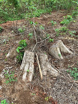
Deforestation or forest clearance is the removal and destruction of a forest or stand of trees from land that is then converted to non-forest use. Deforestation can involve conversion of forest land to farms, ranches, or urban use. About 31% of Earth's land surface is covered by forests at present. This is one-third less than the forest cover before the expansion of agriculture, with half of that loss occurring in the last century. Between 15 million to 18 million hectares of forest, an area the size of Bangladesh, are destroyed every year. On average 2,400 trees are cut down each minute. Estimates vary widely as to the extent of deforestation in the tropics. In 2019, nearly a third of the overall tree cover loss, or 3.8 million hectares, occurred within humid tropical primary forests. These are areas of mature rainforest that are especially important for biodiversity and carbon storage.

The following outline is provided as an overview of and topical guide to sustainable agriculture:

<span class="mw-page-title-main">Environmental degradation</span> Any change or disturbance to the environment perceived to be deleterious or undesirable

Environmental degradation is the deterioration of the environment through depletion of resources such as quality of air, water and soil; the destruction of ecosystems; habitat destruction; the extinction of wildlife; and pollution. It is defined as any change or disturbance to the environment perceived to be deleterious or undesirable. The environmental degradation process amplifies the impact of environmental issues which leave lasting impacts on the environment.

<span class="mw-page-title-main">Forestation</span>

Forestation is a vital ecological process where forests are established and grown through afforestation and reforestation efforts. Afforestation involves planting trees on previously non-forested lands, while reforestation focuses on replanting trees in areas that were once deforested. This process plays an important role in restoring degraded forests, enhancing ecosystems, promoting carbon sequestration, and biodiversity conservation.

<span class="mw-page-title-main">Land degradation</span> Gradual destruction of land

Land degradation is a process in which the value of the biophysical environment also known as biochemical environment is affected by a combination of human-induced processes acting upon the land. It is viewed as any change or disturbance to the land perceived to be deleterious or undesirable. Natural hazards are excluded as a cause; however human activities can indirectly affect phenomena such as floods and bush fires.

<span class="mw-page-title-main">Land development</span> Landscape alteration

Land development is the alteration of landscape in any number of ways such as:

<span class="mw-page-title-main">Habitat destruction</span> Process by which a natural habitat becomes incapable of supporting its native species

Habitat destruction occurs when a natural habitat is no longer able to support its native species. The organisms once living there have either moved to elsewhere or are dead, leading to a decrease in biodiversity and species numbers. Habitat destruction is in fact the leading cause of biodiversity loss and species extinction worldwide.

Environmental issues in Bolivia include deforestation caused by commercial agriculture, urbanization, and illegal logging, and biodiversity loss attributed to illegal wildlife trade, climate change, deforestation, and habitat destruction. Since 1990, Bolivia has experienced rapid urbanization raising concerns about air quality and water pollution.

Environmental issues in Pakistan include air pollution, water pollution, noise pollution, climate change, pesticide misuse, soil erosion, natural disasters, desertification and flooding. According to the 2020 edition of the environmental performance index (EPI) ranking released by Yale Center for Environmental Law & Policy, Pakistan ranks 142 with an EPI score of 33.1, an increase of 6.1 over a 10-year period. It ranked 180 in terms of air quality. The climatic changes and global warming are the most alarming issues risking millions of lives across the country. The major reasons of these environmental issues are carbon emissions, population explosion, and deforestation.

<span class="mw-page-title-main">Environmental issues in Africa</span>

African environmental issues are caused by human impacts on the natural environment and affect humans and nearly all forms of life. Issues include deforestation, soil degradation, air pollution, water pollution, garbage pollution, climate change and water scarcity. These issues result in environmental conflict and are connected to broader social struggles for democracy and sovereignty.

<span class="mw-page-title-main">Land clearing in Australia</span>

Land clearing in Australia describes the removal of native vegetation and deforestation in Australia. Land clearing involves the removal of native vegetation and habitats, including the bulldozing of native bushlands, forests, savannah, woodlands and native grasslands and the draining of natural wetlands for replacement with agriculture, urban and other land uses.

<span class="mw-page-title-main">Anthropogenic biome</span>

Anthropogenic biomes, also known as anthromes, human biomes or intensive land-use biome, describe the terrestrial biosphere (biomes) in its contemporary, human-altered form using global ecosystem units defined by global patterns of sustained direct human interaction with ecosystems. Anthromes are generally composed of heterogeneous mosaics of different land uses and land covers, including significant areas of fallow or regenerating habitats.

<span class="mw-page-title-main">Deforestation in Nigeria</span>

Deforestation in Nigeria refers to the extensive and rapid clearing of forests within the borders of Nigeria. This environmental issue has significant impacts on both local and global scales.

This page is an index of sustainability articles.

<span class="mw-page-title-main">Sustainable gardening</span>

Sustainable gardening includes the more specific sustainable landscapes, sustainable landscape design, sustainable landscaping, sustainable landscape architecture, resulting in sustainable sites. It comprises a disparate group of horticultural interests that can share the aims and objectives associated with the international post-1980s sustainable development and sustainability programs developed to address that humans are now using natural biophysical resources faster than they can be replenished by nature.

<span class="mw-page-title-main">Deforestation in Costa Rica</span>

Deforestation is a major threat to biodiversity and ecosystems in Costa Rica. The country has a rich biodiversity with some 12,000 species of plants, 1,239 species of butterflies, 838 species of birds, 440 species of reptiles and amphibians, and 232 species of mammals, which have been under threat from the effects of deforestation. Agricultural development, cattle ranching, and logging have caused major deforestation as more land is cleared for these activities. Despite government efforts to mitigate deforestation, it continues to cause harm to the environment of Costa Rica by impacting flooding, soil erosion, desertification, and loss of biodiversity.

The environmental impact of agriculture is the effect that different farming practices have on the ecosystems around them, and how those effects can be traced back to those practices. The environmental impact of agriculture varies widely based on practices employed by farmers and by the scale of practice. Farming communities that try to reduce environmental impacts through modifying their practices will adopt sustainable agriculture practices. The negative impact of agriculture is an old issue that remains a concern even as experts design innovative means to reduce destruction and enhance eco-efficiency. Though some pastoralism is environmentally positive, modern animal agriculture practices tend to be more environmentally destructive than agricultural practices focused on fruits, vegetables and other biomass. The emissions of ammonia from cattle waste continue to raise concerns over environmental pollution.

Akure Forest Reserve is a protected area in southwest Nigeria, covering 66 km2 (25 sq mi). The Akure Forest Reserve, established in 1948 and spanning approximately 32 hectares. It was created with the primary aim of safeguarding the genetic diversity of the forest ecosystem. About 11.73% is estimated to be cleared for cocoa farming and other food crops. Aponmu and Owena Yoruba speaking communities owned the forest, though, there are also minor settlements surrounding the forest. They include Ipogun, Kajola/ Aponmu, Kajola, Ago Petesi, Akika Camp, Owena Town, Ibutitan/Ilaro Camp, Elemo Igbara Oke Camp and Owena Water new Dam.

<span class="mw-page-title-main">Climate change in Indonesia</span> Emissions, impacts and responses of Indonesia

Due to its geographical and natural diversity, Indonesia is one of the countries most susceptible to the impacts of climate change. This is supported by the fact that Jakarta has been listed as the world's most vulnerable city, regarding climate change. It is also a major contributor as of the countries that has contributed most to greenhouse gas emissions due to its high rate of deforestation and reliance on coal power.

<span class="mw-page-title-main">Land change science</span> Interdisciplinary study of changes in climate, land use, and land cover

Land change science refers to the interdisciplinary study of changes in climate, land use, and land cover. Land change science specifically seeks to evaluate patterns, processes, and consequences in changes in land use and cover over time. The purpose of land change science is to contribute to existing knowledge of climate change and to the development of sustainable resource management and land use policy. The field is informed by a number of related disciplines, such as remote sensing, landscape ecology, and political ecology, and uses a broad range of methods to evaluate the patterns and processes that underlie land cover change. Land change science addresses land use as a coupled human-environment system to understand the impacts of interconnected environmental and social issues, including deforestation and urbanization.

References

  1. Ellis, Erle; Goldewijk, Kees Klein; Gaillard, Marie-José; Kaplan, Jed O.; Thornton, Alexa; Powell, Jeremy; Garcia, Santiago Munevar; Beaudoin, Ella; Zerboni, Andrea (2019-08-30). "Archaeological assessment reveals Earth's early transformation through land use". Science . 365 (6456): 897–902. Bibcode:2019Sci...365..897S. doi:10.1126/science.aax1192. hdl: 10150/634688 . ISSN   0036-8075. PMID   31467217. S2CID   201674203.
  2. Ellis, Erle C.; Gauthier, Nicolas; Goldewijk, Kees Klein; Bird, Rebecca Bliege; Boivin, Nicole; Díaz, Sandra; Fuller, Dorian Q.; Gill, Jacquelyn L.; Kaplan, Jed O.; Kingston, Naomi; Locke, Harvey (2021-04-27). "People have shaped most of terrestrial nature for at least 12,000 years". Proceedings of the National Academy of Sciences . 118 (17): e2023483118. Bibcode:2021PNAS..11823483E. doi: 10.1073/pnas.2023483118 . ISSN   0027-8424. PMC   8092386 . PMID   33875599.
  3. 1 2 Meyfroidt, P.; Roy Chowdhury, R.; de Bremond, A.; Ellis, E. C.; Erb, K. -H.; Filatova, T.; Garrett, R. D.; Grove, J. M.; Heinimann, A.; Kuemmerle, T.; Kull, C. A. (2018-11-01). "Middle-range theories of land system change" (PDF). Global Environmental Change . 53: 52–67. doi: 10.1016/j.gloenvcha.2018.08.006 . ISSN   0959-3780. S2CID   158366220.
  4. "Land Use, Land-Use Change and Forestry". www.grida.no. Archived from the original on December 6, 2017. Retrieved September 29, 2022.
  5. Ellis, Erle C. (2021-10-18). "Land Use and Ecological Change: A 12,000-Year History". Annual Review of Environment and Resources. 46 (1): 1–33. doi: 10.1146/annurev-environ-012220-010822 . ISSN   1543-5938. S2CID   244592514.
  6. "World Bank arable land". World Bank. Archived from the original on October 2, 2015. Retrieved October 19, 2015.
  7. "World Bank permanent cropland". World Bank. Archived from the original on July 13, 2015. Retrieved October 19, 2015.
  8. FAO Land and Water Division retrieved 14 September 2010
  9. JAPA 25:3
  10. Village of Euclid, Ohio v. Ambler Realty Co.
  11. Nolon, John R. (July–August 1992). "Local Land Use Control in New York: An Aging Citadel Under Siege". New York State Bar Journal : 38.
  12. Trounstine, Jessica (May 2020). "The Geography of Inequality: How Land Use Regulation Produces Segregation". American Political Science Review . 114 (2): 443. doi: 10.1017/S0003055419000844 . S2CID   213239635.
  13. 1 2 Merrill, Dave; Leatherby, Lauren (July 31, 2018). "Here's How America Uses Its Land". Bloomberg . Retrieved 2018-08-05.
  14. Jaeker WG, Plantinga AJ (2007). How have Land-use regulations Affected Property Values in Oregon? Archived 2012-07-22 at the Wayback Machine OSU Extension.
  15. Carrington, Damian (31 May 2018). "Avoiding meat and dairy is 'single biggest way' to reduce your impact on Earth". The Guardian . Retrieved 19 August 2018.
  16. Nemecek, T.; Poore, J. (2018-06-01). "Reducing food's environmental impacts through producers and consumers". Science . 360 (6392): 987–992. Bibcode:2018Sci...360..987P. doi: 10.1126/science.aaq0216 . ISSN   0036-8075. PMID   29853680.
  17. Ameztegui, Aitor; Coll, Lluis; Brotons, Lluis; Ninot, J.M. (2016). "Land-use legacies rather than climate change are driving the recent upward shift of the mountain tree line in the Pyrenees" (PDF). Global Ecology and Biogeography . 25 (3): 263–273. doi:10.1111/geb.12407. hdl: 10459.1/65151 . Archived (PDF) from the original on August 9, 2021. Retrieved September 8, 2022.
  18. "Chapter 1 - Meaning of Land" (PDF). Global Land Outlook (Report). United Nations Convention to Combat Desertification. 2017. p. 21. ISBN   978-92-95110-48-9. Archived (PDF) from the original on September 20, 2022. Retrieved September 18, 2022.
  19. Hart, Robert (1996). Forest Gardening. p. 124. ISBN   9781603580502 via Google Books. Forest gardening, in the sense of finding uses for and attempting to control the growth of wild plants, is undoubtedly the oldest form of land use in the world.
  20. "Changes in Atmospheric Constituents and in Radiative Forcing" (PDF). Intergovernmental Panel on Climate Change. Archived from the original (PDF) on December 15, 2007.
  21. UN Land Degradation and Land Use/Cover Data Sources ret. 26 June 2007
  22. "UN Report on Climate Change" (PDF). Archived from the original (PDF) on February 3, 2007. Retrieved June 25, 2007.
  23. "Land Change Science Program - Science". www.usgs.gov. Archived from the original on 2021-02-10. Retrieved 2021-02-09.