Transportation forecasting

Last updated
Road Space Requirements.png

Transportation forecasting is the attempt of estimating the number of vehicles or people that will use a specific transportation facility in the future. For instance, a forecast may estimate the number of vehicles on a planned road or bridge, the ridership on a railway line, the number of passengers visiting an airport, or the number of ships calling on a seaport. Traffic forecasting begins with the collection of data on current traffic. This traffic data is combined with other known data, such as population, employment, trip rates, travel costs, etc., to develop a traffic demand model for the current situation. Feeding it with predicted data for population, employment, etc. results in estimates of future traffic, typically estimated for each segment of the transportation infrastructure in question, e.g., for each roadway segment or railway station. The current technologies facilitate the access to dynamic data, big data, etc., providing the opportunity to develop new algorithms to improve greatly the predictability and accuracy of the current estimations. [1]

Contents

Traffic forecasts are used for several key purposes in transportation policy, planning, and engineering: to calculate the capacity of infrastructure, e.g., how many lanes a bridge should have; to estimate the financial and social viability of projects, e.g., using cost–benefit analysis and social impact assessment; and to calculate environmental impacts, e.g., air pollution and noise.

Four-step models

The Vicious Cycle of Predict and Provide The Vicious Cycle of Predict and Provide.png
The Vicious Cycle of Predict and Provide

Within the rational planning framework, transportation forecasts have traditionally followed the sequential four-step model or urban transportation planning (UTP) procedure, first implemented on mainframe computers in the 1950s at the Detroit Metropolitan Area Traffic Study and Chicago Area Transportation Study (CATS).

Land-use forecasting starts the process. Typically, forecasts are made for the region as a whole, e.g., of population growth. Such forecasts provide control totals for the local land use analysis. Typically, the region is divided into zones and by trend or regression analysis, the population and employment are determined for each.

The four steps of the classical urban transportation planning system model are:

After the classical model, there is an evaluation according to an agreed set of decision criteria and parameters. A typical criterion is cost–benefit analysis. Such analysis might be applied after the network assignment model identifies needed capacity: is such capacity worthwhile? In addition to identifying the forecasting and decision steps as additional steps in the process, it is important to note that forecasting and decision-making permeate each step in the UTP process. Planning deals with the future, and it is forecasting dependent.

Activity-based models

Activity-based models are another class of models that predict for individuals where and when specific activities (e.g. work, leisure, shopping, ...) are conducted.

The major premise behind activity-based models is that travel demand is derived from activities that people need or wish to perform, with travel decisions forming part of the scheduling decisions. Travel is then seen as just one of the attributes of a system. The travel model is therefore set within the context of an agenda, as a component of an activity scheduling decision.

Activity-based models offer other possibilities than four-step models, e.g. to model environmental issues such as emissions and exposure to air pollution. Although their obvious advantages for environmental purposes were recognized by Shiftan almost a decade ago, [3] applications to exposure models remain scarce. Activity-based models have recently been used to predict emissions [4] and air quality. [5] [6] They can also provide a better total estimate of exposure while also enabling the disaggregation of individual exposure over activities. [7] [8] They can therefore be used to reduce exposure misclassification and establish relationships between health impacts and air quality more precisely. [9] Policy makers can use activity-based models to devise strategies that reduce exposure by changing time activity patterns or that target specific groups in the population. [10] [11]

Integrated Transport - Land Use Models

These models are intended to forecast the effect of changes in the transport network and operations over the future location of activities, and then forecast the effect of these new locations over the transport demand.

Per-driver models

As data science and big data technologies become available to transport modelling, research is moving towards modelling and predicting behaviours of individual drivers in whole cities at the individual level. [12] This will involve understanding individual drivers' origins and destinations as well as their utility functions. This may be done by fusing per-driver data collected on road networks, such as my ANPR cameras, with other data on individuals, such as data from their social network profiles, store card purchase data, and search engine history. This will lead to more accurate predictions, enhanced ability to control traffic for customized prioritization of particular drivers, but also to ethical concerns as local and national governments use more data about identifiable individuals. While the integration of such partially personal data is tempting, there are considerable privacy concerns over the possibilities, related to the criticisms of mass surveillance.

Precursor steps

Although not identified as steps in the UTP process, a lot of data gathering is involved in the UTP analysis process. Census and land use data are obtained, along with home interview surveys and journey surveys. Home interview surveys, land use data, and special trip attraction surveys provide the information on which the UTP analysis tools are exercised.

Data collection, management, and processing; model estimation; and use of models to yield plans are much used techniques in the UTP process. In the early days, in the USA, census data was augmented that with data collection methods that had been developed by the Bureau of Public Roads (a predecessor of the Federal Highway Administration): traffic counting procedures, cordon "where are you coming from and where are you going" counts, and home interview techniques. Protocols for coding networks and the notion of analysis or traffic zones emerged at the CATS.

Model estimation used existing techniques, and plans were developed using whatever models had been developed in a study. The main difference between now and then is the development of some analytic resources specific to transportation planning, in addition to the BPR data acquisition techniques used in the early days.

Critique

The sequential and aggregate nature of transportation forecasting has come under much criticism. While improvements have been made, in particular giving an activity-base to travel demand, much remains to be done. In the 1990s, most federal investment in model research went to the Transims project at Los Alamos National Laboratory, developed by physicists. While the use of supercomputers and the detailed simulations may be an improvement on practice, they have yet to be shown to be better (more accurate) than conventional models. A commercial version was spun off to IBM, [13] and an open source version is also being actively maintained as TRANSIMS Open-Source. [14] [15]

A 2009 Government Accountability Office report noted that federal review of transportation modeling focused more on process requirements (for example, did the public have adequate opportunity to comment?) than on transportation outcomes (such as reducing travel times, or keeping pollutant or greenhouse gas emissions within national standards). [16]

One of the major oversights in the use of transportation models in practice is the absence of any feedback from transportation models on land use. Highways and transit investments not only respond to land use, they shape it as well. [17]

See also

Notes

  1. "Creation of one algorithm to manage traffic systems. [Social Impact]. ITS. The Intelligent Transportation Systems Centre and Testbed". SIOR, Social Impact Open Repository.
  2. Robinson, Darren, ed. (Nov 12, 2012). "6". Computer Modelling for Sustainable Urban Design: Physical Principles, Methods and Applications. Routledge. p. 157. ISBN   9781136539350 . Retrieved 6 October 2017.
  3. Shiftan Y. (2000). "The advantage of activity-based modelling for air-quality purposes: theory vs practice and future needs". Innovation. 13 (1): 95–110. doi:10.1080/135116100111685. S2CID   143098156.
  4. Beckx C, Arentze T, Int Panis L, Janssens D, Vankerkom J, Wets G (2009). "An integrated activity-based modelling framework to assess vehicle emissions: approach and application". Environment and Planning B: Planning and Design. 36 (6): 1086–1102. doi:10.1068/b35044. S2CID   62582857.
  5. Beckx C, Int Panis L, Van De Vel K, Arentze T, Janssens D, Wets G (2009). "The contribution of activity-based transport models to air quality modelling: a validation of the ALBATROSS - AURORA model chain". Science of the Total Environment. 407 (12): 3814–3822. Bibcode:2009ScTEn.407.3814B. doi:10.1016/j.scitotenv.2009.03.015. PMID   19344931.
  6. Hatzopoulou M, Miller E (2010). "Linking an activity-based travel demand model with traffic emission and dispersion models: Transport's contribution to air pollution in Toronto". Transportation Research Part D. 15 (6): 315–325. doi:10.1016/j.trd.2010.03.007.
  7. Dhondt; et al. (2012). "Health impact assessment of air pollution using a dynamic exposure profile: Implications for exposure and health impact estimates". Environmental Impact Assessment Review. 36: 42–51. doi:10.1016/j.eiar.2012.03.004.
  8. Beckx C (2009). "Disaggregation of nation-wide dynamic population exposure estimates in The Netherlands: applications of activity-based transport models". Atmospheric Environment. 43 (34): 5454–5462. Bibcode:2009AtmEn..43.5454B. doi:10.1016/j.atmosenv.2009.07.035.
  9. Int Panis L (2010). "New Directions: Air pollution epidemiology can benefit from activity-based models". Atmospheric Environment. 44 (7): 1003–1004. Bibcode:2010AtmEn..44.1003P. doi:10.1016/j.atmosenv.2009.10.047.
  10. Int Panis L, et al. (2009). "Socio-Economic Class and Exposure to NO2 Air Pollution in the Netherlands". Epidemiology. 20 (6): S19. doi:10.1097/01.ede.0000362234.56425.2c. S2CID   72144535.
  11. Int Panis L, et al. (2009). "Modelling Gender Specific Exposure to Air Pollution". Epidemiology. 20 (6): S19. doi:10.1097/01.ede.0000362233.79296.95. S2CID   72224225.
  12. Fox, Charles (2018-03-25). Data Science for Transport. Springer.
  13. Transims Archived 2008-09-19 at the Wayback Machine
  14. TRANSIMS Open-Source - Home
  15. Transportation Analysis and Simulation
  16. U.S. Government Accountability Office (Sep 9, 2009). "Metropolitan Planning Organizations: Options Exist to Enhance Transportation Planning Capacity and Federal Oversight". U.S. Government Accountability Office. U.S. Government Accountability Office. Retrieved 7 October 2017.
  17. van Wee, Bert (2015). "Viewpoint: Toward a new generation of land use transport interaction models". Journal of Transport and Land Use. 8 (3). Retrieved 7 October 2017.

Related Research Articles

Transportation engineering Academic discipline and occupational field

Transportation engineering or transport engineering is the application of technology and scientific principles to the planning, functional design, operation and management of facilities for any mode of transportation in order to provide for the safe, efficient, rapid, comfortable, convenient, economical, and environmentally compatible movement of people and goods transport.

Transport economics

Transport economics is a branch of economics founded in 1959 by American economist John R. Meyer that deals with the allocation of resources within the transport sector. It has strong links to civil engineering. Transport economics differs from some other branches of economics in that the assumption of a spaceless, instantaneous economy does not hold. People and goods flow over networks at certain speeds. Demands peak. Advance ticket purchase is often induced by lower fares. The networks themselves may or may not be competitive. A single trip may require the bundling of services provided by several firms, agencies and modes.

Transportation planning

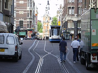
Transportation planning is the process of defining future policies, goals, investments, and designs to prepare for future needs to move people and goods to destinations. As practiced today, it is a collaborative process that incorporates the input of many stakeholders including various government agencies, the public and private businesses. Transportation planners apply a multi-modal and/or comprehensive approach to analyzing the wide range of alternatives and impacts on the transportation system to influence beneficial outcomes.

Travel behavior

Travel behavior is the study of what people do over space, and how people use transport.

Sustainable transport

Sustainable transport refers to the broad subject of transport that is sustainable in the senses of social, environmental and climate impacts. Components for evaluating sustainability include the particular vehicles used for road, water or air transport; the source of energy; and the infrastructure used to accommodate the transport. Transport operations and logistics as well as transit-oriented development are also involved in evaluation. Transportation sustainability is largely being measured by transportation system effectiveness and efficiency as well as the environmental and climate impacts of the system.

Trip generation is the first step in the conventional four-step transportation forecasting process, widely used for forecasting travel demands. It predicts the number of trips originating in or destined for a particular traffic analysis zone. Typically, trip generation analysis focuses on residences, and residential trip generation is thought of as a function of the social and economic attributes of households. At the level of the traffic analysis zone, residential land uses "produce" or generate trips. Traffic analysis zones are also destinations of trips, trip attractors. The analysis of attractors focuses on nonresidential land uses.

Trip distribution

Trip distribution is the second component in the traditional four-step transportation forecasting model. This step matches tripmakers’ origins and destinations to develop a “trip table”, a matrix that displays the number of trips going from each origin to each destination. Historically, this component has been the least developed component of the transportation planning model.

Land-use forecasting undertakes to project the distribution and intensity of trip generating activities in the urban area. In practice, land-use models are demand-driven, using as inputs the aggregate information on growth produced by an aggregate economic forecasting activity. Land-use estimates are inputs to the transportation planning process.

Roadway air dispersion modeling

Roadway air dispersion modeling is the study of air pollutant transport from a roadway or other linear emitter. Computer models are required to conduct this analysis, because of the complex variables involved, including vehicle emissions, vehicle speed, meteorology, and terrain geometry. Line source dispersion has been studied since at least the 1960s, when the regulatory framework in the United States began requiring quantitative analysis of the air pollution consequences of major roadway and airport projects. By the early 1970s this subset of atmospheric dispersion models were being applied to real world cases of highway planning, even including some controversial court cases.

Environmental impact of aviation Effect of emissions from aircraft engines

Like other emissions resulting from fossil fuel combustion, aircraft engines produce gases, noise, and particulates, raising environmental concerns over their global impact and their local air quality effect. Jet airliners contribute to climate change by emitting carbon dioxide, the best understood greenhouse gas, and, with less scientific understanding, nitrogen oxides, contrails and particulates. Their radiative forcing is estimated at 1.3–1.4 that of CO
2
alone, excluding induced cirrus cloud with a very low level of scientific understanding. In 2018, global commercial operations generated 2.4% of all CO
2
emissions.

Land transport Mode of transport

Land transport is the transport or movement of people, animals or goods from one location to another location on land. The two main forms of land transport can be considered to be rail transport and road transport.

Air pollution Harmful substances in the atmosphere

Air pollution is the presence of substances in the atmosphere that are harmful to the health of humans and other living beings, or cause damage to the climate or to materials. There are different types of air pollutants, such as gases, particulates, and biological molecules. Air pollution may cause diseases, allergies and even death to humans; it may also cause harm to other living organisms such as animals and food crops, and may damage the natural environment or built environment. Both human activity and natural processes can generate air pollution.

Walkability Measure of pedestrianism in an area

Walkability is a measure of how friendly an area is to walking. Walkability has health, environmental, and economic benefits. Factors influencing walkability include the presence or absence and quality of footpaths, sidewalks or other pedestrian rights-of-way, traffic and road conditions, land use patterns, building accessibility, and safety, among others. Walkability is an important concept in sustainable urban design. Project Drawdown describes making cities walkable as an important solution in the toolkit for adapting cities to climate change: it reduces carbon emissions, and improves quality of life.

Transport Human-directed movement of things or people between locations

Transport, or transportation, is the movement of humans, animals and goods from one location to another. In other words, the action of transport is defined as a particular movement of an organism or thing from a point A to a point B. Modes of transport include air, land, water, cable, pipeline and space. The field can be divided into infrastructure, vehicles and operations. Transport enables trade between people, which is essential for the development of civilizations.

Active mobility Unmotorised transport powered by activity

Active mobility, active travel, active transport or active transportation is the transport of people or goods, through non-motorized means, based around human physical activity. The best-known forms of active mobility are walking and cycling, though other modes include running, skateboarding, kick scooters and roller skates. Due to its prevalence, cycling is sometimes considered separately from the other forms of active mobility.

Aimsun Live

Aimsun Live is a simulation-based traffic forecasting solution, developed and marketed by Aimsun.

The environmental impact of transport is significant because transport is a major user of energy, and burns most of the world's petroleum. This creates air pollution, including nitrous oxides and particulates, and is a significant contributor to global warming through emission of carbon dioxide. Within the transport sector, road transport is the largest contributor to global warming.

Traffic simulation

Traffic simulation or the simulation of transportation systems is the mathematical modeling of transportation systems through the application of computer software to better help plan, design, and operate transportation systems. Simulation of transportation systems started over forty years ago, and is an important area of discipline in traffic engineering and transportation planning today. Various national and local transportation agencies, academic institutions and consulting firms use simulation to aid in their management of transportation networks.

UC Irvine Institute of Transportation Studies

The UC Irvine Institute of Transportation Studies (ITS), is a University of California organized research unit with sister branches at UC Davis, and UC Berkeley. ITS was established to foster research, education, and training in the field of transportation. UC Irvine ITS is located on the fourth floor of the Anteater Instruction and Research Building at University of California, Irvine's main Campus, and also houses the UC Irvine Transportation Science graduate studies program.

Impact of the COVID-19 pandemic on the environment Impact of coronavirus outbreak on environmental issues

The worldwide disruption caused by the COVID-19 pandemic has resulted in numerous effects on the environment and climate. The global reduction in modern human activity such as the considerable decline in planned travel was coined anthropause and has caused a large drop in air pollution and water pollution in many regions. In China, lockdowns and other measures resulted in a 25 percent reduction in carbon emissions and 50 percent reduction in nitrogen oxides emissions, which one Earth systems scientist estimated may have saved at least 77,000 lives over two months. Other positive effects on the environment include governance-system-controlled investments towards a sustainable energy transition and other goals related to environmental protection such as the European Union's seven-year €1 trillion budget proposal and €750 billion recovery plan "Next Generation EU" which seeks to reserve 25% of EU spending for climate-friendly expenditure.

References