Arthur Phillip was a British Royal Navy officer who served as the first governor of the Colony of New South Wales.

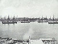
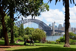
Port Jackson, consisting of the waters of Sydney Harbour, Middle Harbour, North Harbour and the Lane Cove and Parramatta Rivers, is the ria or natural harbour of Sydney, New South Wales, Australia. The harbour is an inlet of the Tasman Sea. It is the location of the Sydney Opera House and Sydney Harbour Bridge. The location of the first European settlement and colony on the Australian mainland, Port Jackson has continued to play a key role in the history and development of Sydney.

Sydney Cove is a bay on the southern shore of Sydney Harbour, one of several harbours in Port Jackson, on the coast of Sydney, New South Wales. Sydney Cove is a focal point for community celebrations, due to its central Sydney location between the Sydney Opera House and the Sydney Harbour Bridge.
The history of Sydney is the story of the peoples of the land that has become modern Sydney.

Admiralty House is the Sydney official residence of the governor-general of Australia. It is located in the suburb of Kirribilli, on the northern foreshore of Sydney Harbour. This large Victorian Regency and Italianate sandstone manor, completed in stages based on designs by James Barnet and Walter Liberty Vernon, occupies the tip of Kirribilli Point. Once known as "Wotonga", it has commanding views across Sydney Harbour to the Sydney Harbour Bridge and the Sydney Opera House.

Circular Quay is a harbour, former working port and now international passenger shipping port, public piazza and tourism precinct, heritage area, and transport node located in Sydney, New South Wales, Australia on the northern edge of the Sydney central business district on Sydney Cove, between Bennelong Point and The Rocks. It is part of the local government area of the City of Sydney.
Woolloomooloo is a harbourside, inner-city eastern suburb of Sydney, New South Wales, Australia. Woolloomooloo is 1.5 kilometres east of the Sydney central business district, in the local government area of the City of Sydney. It is in a low-lying, former docklands area at the head of Woolloomooloo Bay, on Sydney Harbour. The Domain sits to the west, the locality of East Sydney is near the south-west corner of the suburb and the locality of Kings Cross is near the south-east corner. Potts Point is immediately to the east.

Garden Island is an inner-city locality of Sydney, Australia, and the location of a major Royal Australian Navy (RAN) base. It is located to the north-east of the Sydney central business district and juts out into Port Jackson, immediately to the north of the suburb of Potts Point. Used for government and naval purposes since the earliest days of the colony of Sydney, it was originally a completely-detached island but was joined to the Potts Point shoreline by major land reclamation work during World War II.
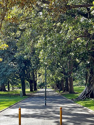
The Domain is a heritage-listed 34-hectare (84-acre) area of open space located on the eastern fringe of the Sydney central business district, in the City of Sydney local government area of New South Wales, Australia. Separating the central business district from Woolloomooloo, The Domain adjoins the Royal Botanic Gardens and is managed by the Royal Botanic Gardens Trust, a division of the NSW Office of Environment and Heritage, an agency of the Government of New South Wales. The Domain is used as a venue for outdoor concerts, open-air events, large political gatherings and rallies, as well as being used daily by the people of Sydney for exercise and relaxation. Along with the Royal Botanic Gardens, The Domain was added to the New South Wales State Heritage Register on 2 April 1999.
Lavender Bay is a harbourside suburb on the lower North Shore of Sydney, New South Wales, Australia. Lavender Bay is located 3 kilometres north of the Sydney central business district, in the local government area of North Sydney Council.

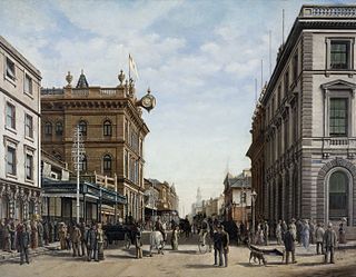
The Sydney central business district (CBD) is the historical and main commercial centre of Sydney. The CBD is Sydney's city centre, or Sydney City, and the two terms are used interchangeably. Colloquially, the CBD or city centre is often referred to simply as "Town" or "the City". The Sydney city centre extends southwards for about 3 km (2 mi) from Sydney Cove, the point of first European settlement in which the Sydney region was initially established.

The Royal Botanic Garden, Sydney is a heritage-listed major 30-hectare (74-acre) botanical garden, event venue and public recreation area located at Farm Cove on the eastern fringe of the Sydney central business district, in the City of Sydney local government area of New South Wales, Australia.

Elizabeth Bay is a harbourside inner city suburb in the Eastern suburbs of Sydney, in the state of New South Wales, Australia. Elizabeth Bay is located three kilometres east of the Sydney central business district and is part of the local government area of the City of Sydney.
The Gadigal, also spelled as Cadigal and Caddiegal, are a group of Aboriginal people whose traditional lands are located in Gadi, on Dharug country, the location of Sydney, New South Wales, Australia.

Cockle Bay is a small bay in inner-city Sydney, New South Wales, Australia. It is located on the western edge of the Sydney central business district.

HMQS Paluma was a flat-iron gunboat operated by the Queensland Maritime Defence Force and later the Royal Australian Navy. She entered service on 28 October 1884, was decommissioned in 1916 and then sold to the Victorian Ports and Harbours Department, who operated her under the name Rip until 1948 when she was retired. She was scrapped in 1950–51.

The State Dockyard was a ship building and maintenance facility operated by the Government of New South Wales in Carrington, Newcastle, New South Wales, Australia between 1942 and 1987.

Sydney Cove West Archaeological Precinct is a heritage-listed precinct that contains The Rocks police station, the Museum of Contemporary Art Australia, car park, parks, shops and roads located at 112–156 George Street, in the inner city Sydney suburb of The Rocks in the City of Sydney local government area of New South Wales, Australia. The precinct previously contained a commissariat store, Maritime Services Board offices, dockyard and Department of Labour & Industry offices. Buildings in the precinct were developed in various stages since 1797 to date, with heritage-listed buildings dating from 1797 to 1939. The precinct is also known as the Museum of Contemporary Art, Maritime Services Board, Colonial Government naval dockyard, Commissariat Stores, Colonial Hospital, Kings and Queens Wharf and First Fleet Park. The property is owned by Property NSW, an agency of the Government of New South Wales. It was added to the New South Wales State Heritage Register on 5 August 2011.

The Man O'War Steps is a heritage-listed jetty located at Farm Cove Crescent, in the Sydney central business district, in the City of Sydney local government area of New South Wales, Australia. It was built from 1810. The property is owned by Transport for NSW. It was added to the New South Wales State Heritage Register on 18 April 2000. The Steps are located on the eastern bank of Bennelong Point, adjacent to the Sydney Opera House and on the north-western boundary of the Royal Botanic Garden.
Tambourine Bay is a bay located in between the suburbs of Riverview and Longueville in the Lower North Shore of Sydney, NSW, Australia. The bay and its adjoining creek is a northern tributary of the Lane Cove River, a ria that joins Sydney harbour to Greenwich and Woolwich. The bay's foreshore and surrounding park areas are managed by the municipality of Lane Cove.