
Marble Hill is the northernmost neighborhood in the New York City borough of Manhattan. It is one of the few areas within the borough that is not located on Manhattan Island. Marble Hill was occupied as a Dutch colonial settlement in 1646, and gained its current name in 1891 because of Tuckahoe marble deposits underneath the neighborhood.

Throggs Neck is a neighborhood and peninsula in the south-eastern portion of the borough of the Bronx in New York City. It is bounded by the East River and Long Island Sound to the south and east, Westchester Creek on the west, and Baisley Avenue and the Bruckner Expressway on the north.
Hunts Point is a neighborhood located on a peninsula in the South Bronx of New York City. It is the location of one of the largest food distribution facilities in the world, the Hunts Point Cooperative Market. Its boundaries are the Bruckner Expressway to the west and north, the Bronx River to the east, and the East River to the south. Hunts Point Avenue is the primary street through Hunts Point.

Longwood is a mixed-use neighborhood geographically located in the southeast Bronx, New York City. Its boundaries, starting from the north and moving clockwise are East 167th Street to the north, the Bronx River and the Bruckner Expressway to east, East 149th Street to the south, and Prospect Avenue to the west. Southern Boulevard is the primary thoroughfare through Longwood.

Wakefield is a working-class and middle-class section of the northern borough of the Bronx in New York City. It is bounded by the city's border with Westchester County to the north, East 222nd Street to the south, and the Bronx River Parkway to the west.

Fordham Manor is a neighborhood located in the western Bronx, New York City. Fordham is roughly bordered by East 196th Street to the north, the Harlem River to the west, Fordham Road to the south, and Southern Boulevard to the east. The neighborhood's primary thoroughfares are Fordham Road and Grand Concourse.

Kingsbridge is a residential neighborhood in the northwest portion of the Bronx, New York City. Kingsbridge's boundaries are Manhattan College Parkway to the north, the Major Deegan Expressway or Bailey Avenue to the east, West 230th Street to the south, and Irwin Avenue to the west.

Melrose is a mostly residential neighborhood in the southwestern section of the New York City borough of the Bronx. It adjoins the business and one-time theater area known as The Hub. Melrose is rectangular-shaped, being bordered by Third Avenue on the east, 149th Street on the south, Park Avenue on the west and 161st Street to the north. Melrose Avenue and Third Avenue are the primary thoroughfares through Melrose.
Fort Apache may refer to:
Kingsbridge Heights is a residential neighborhood geographically located in the northwest Bronx, New York City. Its boundaries are Van Cortlandt Park to the north, Jerome Avenue to the east, Kingsbridge Road to the south, and the Major Deegan Expressway to the west. Sedgwick Avenue is the primary thoroughfare through Kingsbridge Heights.

Van Nest is a working-class neighborhood geographically located in the East Bronx section of the Bronx, New York City. Going clockwise, its boundaries are Bronxdale Avenue to the northeast, the Amtrak tracks to the southeast, and Bronx Park to the west. Van Nest predated Morris Park by 20 years and is considered the older of the two communities. Morris Park Avenue and White Plains Road are the primary commercial thoroughfares through Van Nest.
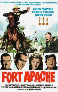
Fort Apache is a 1948 American Western film directed by John Ford and starring John Wayne and Henry Fonda. The film was the first of the director's "Cavalry Trilogy" and was followed by She Wore a Yellow Ribbon (1949) and Rio Grande (1950), both also starring Wayne. The screenplay was inspired by James Warner Bellah's short story "Massacre" (1947). The historical sources for "Massacre" have been attributed both to George Armstrong Custer and the Battle of Little Bighorn and to the Fetterman Fight.
Crime rates in New York City have been recorded since at least the 1800s. They have spiked ever since the post-war period. The highest crime totals were recorded in the late 1980s and early 1990s as the crack epidemic surged, and then declined continuously through the 2000s.
John Francis Timoney was an American policeman and law enforcement executive. He served as Chief of the Miami Police Department from 2003 to 2010. He was previously Commissioner of the Philadelphia Police Department (1998–2002) and held a variety of positions with the New York Police Department (1967–96), including its Chief of Department and First Deputy Commissioner. He worked for the Ministry of the Interior of Bahrain as a police consultant. Timoney drew both international praise and criticism for his handling of mass protests.

Castle Hill is a neighborhood located in the southeast section of the borough of the Bronx in New York City. Its boundaries are Waterbury Avenue and Westchester Avenue to the north, Westchester Creek to the east, the East River to the south, and White Plains Road to the west. Unionport is a subsection of Castle Hill, typically considered north of Lafayette Avenue.
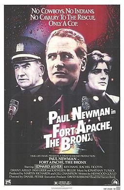
Fort Apache, The Bronx is a 1981 American crime drama film directed by Daniel Petrie. The film is about a hard-drinking, lonely veteran cop, Murphy, and his young partner Corelli, who work in a crime-ridden precinct in the Bronx. Although Murphy's life takes a good turn when he falls in love with Isabella, a young nurse, the arrival of a new, law-and-order-minded police captain commanding the precinct, Connoly threatens to tip the neighborhood's delicate balance into anarchy. Danny Aiello, Kathleen Beller, and Pam Grier play supporting roles. It was written by Heywood Gould and produced by Martin Richards and Thomas Fiorello, with David Susskind as executive producer.
Van Cortlandt Village is a subsection of the Kingsbridge neighborhood in the New York City borough of the Bronx. The neighborhood is part of Bronx Community Board 8. Named after Van Cortlandt Park, it is bordered by the Major Deegan Expressway to the west, the Jerome Park Reservoir to the east, West 238th Street to the south, and Van Cortlandt Park to the north. Its ZIP Code is 10463.
The Police Tapes is a 1977 documentary about a New York City police precinct in the South Bronx. The original ran ninety minutes and was produced for public television; a one-hour version later aired on ABC.

The New York City Police Department (NYPD) is structured into numerous bureaus and units. As a whole, the NYPD is headed by the Police Commissioner, a civilian administrator appointed by the Mayor, with the senior sworn uniformed officer of the service titled "Chief of Department". The Police Commissioner appoints the First Deputy Commissioner as the department's second-in-command and the Chief of Department as the department's highest ranking uniformed officer. The commissioner also appoints a number of deputy and assistant commissioners who do not have operational command and are solely for support and administrative function. The department is divided into twenty bureaus, six of which are enforcement bureaus. Each enforcement bureau is further subdivided into sections, divisions, and units, and into patrol boroughs, precincts, and detective squads. Each bureau is commanded by a bureau chief. There are also a number of specialized units that are not part of any of the bureaus and report to the Chief of the Department.

The South Bronx is an area of the New York City borough of the Bronx. The area comprises neighborhoods in the southern part of the Bronx, such as Concourse, Mott Haven, Melrose, and Port Morris.

