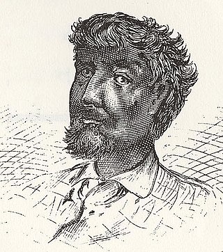
Jean Baptiste Point du Sable is regarded as the first permanent non-native settler of what would later become Chicago, Illinois. Recognized as the city's founder, the site where he settled near the mouth of the Chicago River around the 1780s is memorialized as a National Historic Landmark, now located in Pioneer Court.

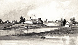
The Battle of Fort Dearborn was an engagement between United States troops and Potawatomi Native Americans that occurred on August 15, 1812, near Fort Dearborn in what is now Chicago, Illinois. The battle, which occurred during the War of 1812, followed the evacuation of the fort as ordered by the commander of the United States Army of the Northwest, William Hull. The battle lasted about 15 minutes and resulted in a complete victory for the Native Americans. After the battle, Fort Dearborn was burned down. Some of the soldiers and settlers who had been taken captive were later ransomed.

The Chicago River is a system of rivers and canals with a combined length of 156 miles (251 km) that runs through the city of Chicago, including its center. Though not especially long, the river is notable because it is one of the reasons for Chicago's geographic importance: the related Chicago Portage is a link between the Great Lakes and the Mississippi River Basin, and ultimately the Gulf of Mexico.
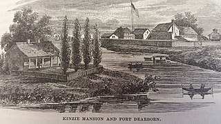
John Kinzie was a fur trader from Quebec who first operated in Detroit and what became the Northwest Territory of the United States. A partner of William Burnett from Canada, about 1802-1803 Kinzie moved with his wife and child to Chicago, where they were among the first permanent white non-indigenous settlers. Kinzie Street (400N) in Chicago is named for him. Their daughter Ellen Marion Kinzie, born in 1805, was not the first child of European descent born in the settlement because the first permanent non-indigenous settler, Jean Baptiste Pointe DuSable, was partially of European descent, specifically French from his father's side, while his mother was a descendant of Africa; his children, Jean Baptiste Pointe DuSable, Jr. and Suzanne, were born before her in 1776 and 1778, respectively.

The Potawatomi, also spelled Pottawatomi and Pottawatomie, are a Native American people of the Great Plains, upper Mississippi River, and western Great Lakes region. They traditionally speak the Potawatomi language, a member of the Algonquian family. The Potawatomi call themselves Neshnabé, a cognate of the word Anishinaabe. The Potawatomi are part of a long-term alliance, called the Council of Three Fires, with the Ojibway and Odawa (Ottawa). In the Council of Three Fires, the Potawatomi are considered the "youngest brother". Their people are referred to in this context as Bodéwadmi, a name that means "keepers of the fire" and refers to the council fire of three peoples.
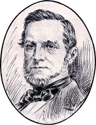
John Harris Kinzie was a prominent figure in Chicago politics during the 19th century. He served as the president of the Board of Trustees of Chicago when it was still a town and thrice unsuccessfully ran for Chicago's mayoralty once it was incorporated as a city.
Nathan Heald was an officer in the U.S. Army, during the War of 1812. He was in command of Fort Dearborn in Chicago during the Battle of Fort Dearborn.
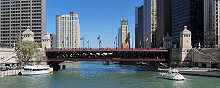
The DuSable Bridge is a bascule bridge that carries Michigan Avenue across the main stem of the Chicago River in downtown Chicago, Illinois, United States. The bridge was proposed in the early 20th century as part of a plan to link Grant Park (downtown) and Lincoln Park (uptown) with a grand boulevard. Construction of the bridge started in 1918, it opened to traffic in 1920, and decorative work was completed in 1928. The bridge provides passage for vehicles and pedestrians on two levels. An example of a fixed trunnion bascule bridge, it may be raised to allow tall ships and boats to pass underneath. The bridge is included in the Michigan–Wacker Historic District and has been designated as a Chicago Landmark.

Sauganash Hotel is a former hotel; regarded as the first hotel in Chicago, Illinois. Built in 1831, it was located at Wolf Point in the present day Loop community area at the intersection of the north, south and main branches of the Chicago River. The location at West Lake Street and North Wacker Drive was designated a Chicago Landmark on November 6, 2002. The hotel changed proprietors often in its twenty-year existence and briefly served as Chicago's first theater. It was named after Sauganash, an interpreter in the British Indian Department.

The Jean Baptiste Point Du Sable Homesite is the location where, around the 1780s, Jean Baptiste Point du Sable located his home and extensive trading post. This home is generally considered to be the first permanent, non-native, residence in Chicago, Illinois. The site of Point du Sable's home is now partially occupied by and commemorated in Pioneer Court at 401 N. Michigan Avenue in the Near North Side community area of Chicago, Illinois.

Fort Chécagou, or Fort Chicago, was a purported seventeenth-century fort that may have been located in what is now northeastern Illinois. The name has become associated with a myth that the French continuously maintained a military garrison at a fort near the mouth of the Chicago River, and the future site of the city of Chicago on the southwestern shore of Lake Michigan. Some sources mention that the fort was built in 1685, and that Henri de Tonti sent his aide, Pierre-Charles de Liette, as commander of the fort through 1702. Although this fort was marked on a number of eighteenth century maps of the area, there is no evidence that it ever existed at the described location, but may have instead actually been located at the mouth of the St. Joseph River, on the southeastern shore of Lake Michigan.

Black Partridge or Black Pheasant was a 19th-century Peoria Lake Potawatomi chieftain. Although a participant in the Northwest Indian War and the War of 1812, he was a friend to early American settlers and an advocate for peaceful relations with the United States. He and his brother Waubonsie both attempted to protect settlers during the Battle of Fort Dearborn after they were unsuccessful in preventing the attack.
Chief Gomo was a 19th-century Potawatomi chieftain. He and his brother Senachwine were among the more prominent war chiefs to fight alongside Black Partridge during the Peoria War.

The Michigan–Wacker Historic District is a National Register of Historic Places District that includes parts of the Chicago Loop and Near North Side community areas in Chicago, Illinois, United States. The district is known for the Chicago River, two bridges that cross it, and eleven high rise and skyscraper buildings erected in the 1920s. Among the contributing properties are the following Chicago Landmark structures:
Antoine Ouilmette was a fur trader and early resident of what is now Chicago, Illinois. He was of French Canadian and possibly Native American ancestry. The village of Wilmette, Illinois is named in his honor.

Ensign George Ronan was a commissioned officer of the United States Army. Educated at West Point and commissioned as an officer in the 1st Infantry Regiment in 1811, he was assigned to duty at Fort Dearborn, a frontier post at the mouth of the Chicago River. Just over one year later Ronan was killed in combat in the Battle of Fort Dearborn. He was the first member of the West Point Corps of Cadets to perish in battle.

Jean Baptiste Beaubien, a multi-lingual fur-trader born in Detroit, Michigan, became an early resident of what became Chicago, Illinois, as well as an early civic and militia leader in Cook County, Illinois during the Black Hawk War, before moving to Du Page County, Illinois in his final years.

Alexander Robinson, was a British-Ottawa chief born on Mackinac Island who became a fur trader and ultimately settled near what later became Chicago. Multilingual in Odawa, Potawatomi, Ojibwa, English and French, Robinson also helped evacuate survivors of the Fort Dearborn Massacre in 1812. In 1816, Robinson was a translator for native peoples during the Treaty of St. Louis. He became a Potawatomi chief in 1829 and in that year and in 1833, he and fellow Metis Billy Caldwell negotiated treaties on behalf of the United Nations of Ottawa, Chippewa, and Potawatomi with the United States. Although Robinson helped lead Native Americans across the Mississippi River in 1835, unlike Caldwell, Robinson returned to the Chicago area by 1840 and lived as a respected citizen in western Cook County until his death decades later.
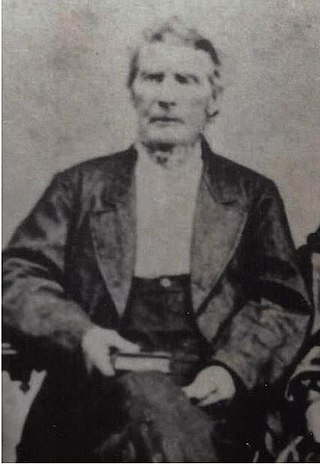
James Thompson was an American surveyor who created the first plat of Chicago. Born in South Carolina, Thompson moved to Kaskaskia in southern Illinois as a young man and lived in the area for the rest of his life, working primarily as a surveyor. He was hired to plat settlements at the ends of the proposed Illinois and Michigan Canal in northern Illinois; he completed the plat of Chicago, the settlement at the eastern end, on August 4, 1830. After completing his survey of Chicago he returned to the Kaskaskia area and declined an offer of land in Chicago in favor of a cash payment. In addition to his surveying work, he served in various positions such as probate judge, county commissioner, and officer in the Illinois militia during the Black Hawk War.

The 1833 Treaty of Chicago was an agreement between the United States government and the Chippewa, Odawa, and Potawatomi tribes. It required them to cede to the United States government their 5,000,000 acres (2,000,000 ha) of land in Illinois, the Wisconsin Territory, and the Michigan Territory and to move west of the Mississippi River. In return, the tribes were given promises of various cash payments and tracts of land west of the Mississippi River. The treaty was one of the removal treaties to come after the passage of the Indian Removal Act. It was the second treaty referred to as the "Treaty of Chicago," after the 1821 Treaty of Chicago.
