Related Research Articles

PostGIS is an open source software program that adds support for geographic objects to the PostgreSQL object-relational database. PostGIS follows the Simple Features for SQL specification from the Open Geospatial Consortium (OGC).

The Geography Markup Language (GML) is the XML grammar defined by the Open Geospatial Consortium (OGC) to express geographical features. GML serves as a modeling language for geographic systems as well as an open interchange format for geographic transactions on the Internet. Key to GML's utility is its ability to integrate all forms of geographic information, including not only conventional "vector" or discrete objects, but coverages and sensor data.
A coverage is the digital representation of some spatio-temporal phenomenon. ISO 19123 provides the definition:
A GIS file format is a standard for encoding geographical information into a computer file, as a specialized type of file format for use in geographic information systems (GIS) and other geospatial applications. Since the 1970s, dozens of formats have been created based on various data models for various purposes. They have been created by government mapping agencies, GIS software vendors, standards bodies such as the Open Geospatial Consortium, informal user communities, and even individual developers.
GeoTIFF is a public domain metadata standard which allows georeferencing information to be embedded within a TIFF file. The potential additional information includes map projection, coordinate systems, ellipsoids, datums, and everything else necessary to establish the exact spatial reference for the file. The GeoTIFF format is fully compliant with TIFF 6.0, so software incapable of reading and interpreting the specialized metadata will still be able to open a GeoTIFF format file.
A GIS software program is a computer program to support the use of a geographic information system, providing the ability to create, store, manage, query, analyze, and visualize geographic data, that is, data representing phenomena for which location is important. The GIS software industry encompasses a broad range of commercial and open-source products that provide some or all of these capabilities within various information technology architectures.
Simple Features is a set of standards that specify a common storage and access model of geographic features made of mostly two-dimensional geometries used by geographic databases and geographic information systems. It is formalized by both the Open Geospatial Consortium (OGC) and the International Organization for Standardization (ISO).
Catalogue Service for the Web (CSW), sometimes seen as Catalogue Service - Web, is a standard for exposing a catalogue of geospatial records in XML on the Internet. The catalogue is made up of records that describe geospatial data, geospatial services, and related resources.
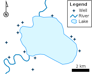
A spatial database is a general-purpose database that has been enhanced to include spatial data that represents objects defined in a geometric space, along with tools for querying and analyzing such data.
The Open Source Geospatial Foundation (OSGeo), is a non-profit non-governmental organization whose mission is to support and promote the collaborative development of open geospatial technologies and data. The foundation was formed in February 2006 to provide financial, organizational and legal support to the broader Libre/Free and open-source geospatial community. It also serves as an independent legal entity to which community members can contribute code, funding and other resources.

The Geospatial Data Abstraction Library (GDAL) is a computer software library for reading and writing raster and vector geospatial data formats, and is released under the permissive X/MIT style free software license by the Open Source Geospatial Foundation. As a library, it presents a single abstract data model to the calling application for all supported formats. It may also be built with a variety of useful command line interface utilities for data translation and processing. Projections and transformations are supported by the PROJ library.
Oracle Spatial and Graph, formerly Oracle Spatial, is a free option component of the Oracle Database. The spatial features in Oracle Spatial and Graph aid users in managing geographic and location-data in a native type within an Oracle database, potentially supporting a wide range of applications — from automated mapping, facilities management, and geographic information systems (AM/FM/GIS), to wireless location services and location-enabled e-business. The graph features in Oracle Spatial and Graph include Oracle Network Data Model (NDM) graphs used in traditional network applications in major transportation, telcos, utilities and energy organizations and RDF semantic graphs used in social networks and social interactions and in linking disparate data sets to address requirements from the research, health sciences, finance, media and intelligence communities.
Geospatial metadata is a type of metadata applicable to geographic data and information. Such objects may be stored in a geographic information system (GIS) or may simply be documents, data-sets, images or other objects, services, or related items that exist in some other native environment but whose features may be appropriate to describe in a (geographic) metadata catalog.
A Spatial Data Infrastructure (SDI), also called geospatial data infrastructure, is a data infrastructure implementing a framework of geographic data, metadata, users and tools that are interactively connected in order to use spatial data in an efficient and flexible way. Another definition is "the technology, policies, standards, human resources, and related activities necessary to acquire, process, distribute, use, maintain, and preserve spatial data".
The Open Geospatial Consortium Web Coverage Service Interface Standard (WCS) defines Web-based retrieval of coverages – that is, digital geospatial information representing space/time-varying phenomena.
A geographic data model, geospatial data model, or simply data model in the context of geographic information systems, is a mathematical and digital structure for representing phenomena over the Earth. Generally, such data models represent various aspects of these phenomena by means of geographic data, including spatial locations, attributes, change over time, and identity. For example, the vector data model represents geography as collections of points, lines, and polygons, and the raster data model represent geography as cell matrices that store numeric values. Data models are implemented throughout the GIS ecosystem, including the software tools for data management and spatial analysis, data stored in a variety of GIS file formats, specifications and standards, and specific designs for GIS installations.

SpatiaLite is a spatial extension to SQLite, providing vector geodatabase functionality. It is similar to PostGIS, Oracle Spatial, and SQL Server with spatial extensions, although SQLite/SpatiaLite aren't based on client-server architecture: they adopt a simpler personal architecture. i.e. the whole SQL engine is directly embedded within the application itself: a complete database simply is an ordinary file which can be freely copied and transferred from one computer/OS to a different one without any special precaution.
The Spatial Archive and Interchange Format was defined in the early 1990s as a self-describing, extensible format designed to support interoperability and storage of geospatial data.
GeoAPI is free software providing a set of Java interfaces for GIS applications. GeoAPI interfaces are derived from the abstract model and concrete specifications published collaboratively by the International Organization for Standardization (ISO) in its 19100 series of documents and the Open Geospatial Consortium (OGC) in its abstract and implementation specifications. GeoAPI provides an interpretation and adaptation of these standards to match the constraints and usages of the target programming language. The international standards translated to Java interfaces are:

The Open Geospatial Consortium (OGC), an international voluntary consensus standards organization for geospatial content and location-based services, sensor web and Internet of Things, GIS data processing and data sharing. It originated in 1994 and involves more than 500 commercial, governmental, nonprofit and research organizations in a consensus process encouraging development and implementation of open standards.
References
- ↑ Scott Simmons (10 August 2018). "GeoPackage". IANA Media Types. Retrieved 23 April 2021.
- ↑ "GeoPackage Encoding Standard". Open Geospatial Consortium. Retrieved 2024-05-15.
- ↑ Yasin, Rutrell (2015-08-17). "At the edge: Pushing geo data to "disadvantaged" troops". C4ISRNet. Retrieved 2024-05-15.
- ↑ "Implementations Listed by Specification". Open Geospatial Consortium. Retrieved 2024-05-15.
- ↑ "GeoPackage as Future Ubiquitous GIS Data Format: A Review". www.jurnalteknologi.utm.my. Archived from the original on 2015-12-22. Retrieved 2015-12-20.
- ↑ Singh, R.; Bermudez, L. E. (2013-12-01). "Emerging Geospatial Sharing Technologies in Earth and Space Science Informatics". AGU Fall Meeting Abstracts. 33: 08. Bibcode:2013AGUFMIN33C..08S.
- ↑ "The OGC Forms GeoPackage Standards Working Group". Open Geospatial Consortium. 2012-10-25. Retrieved 2024-05-15.
- ↑ "PR: OGC Adopts Important GeoPackage Standard for Mobile". GIS Resources. 2014-02-14. Retrieved 2024-05-15.
- 1 2 "OGC® GeoPackage Encoding Standard".
- ↑ "The OGC agrees on a standard for mobile exchange of geospatial data | UN-SPIDER Knowledge Portal". www.un-spider.org. Retrieved 2024-05-15.