Geography of the Czech Republic

Last updated

Geography of Czech Republic
Relief Map of Czech Republic.png
Continent Europe
Region Central Europe
Area Ranked 115th
  Total78,871 km2 (30,452 sq mi)
  Land97.88%
  Water2.12%
Coastline0 km (0 mi)
Borders2290.7 km [1]
Highest point Sněžka,
1603.3 m
Lowest point Hřensko,
115 m
Longest river Vltava,
433 km
Largest lake Černé,
18.4 ha
Climate temperate
Terrainhills and lowlands surrounded by low mountains
Natural resources kaolin, lithium, graphite, black coal, brown coal, uranium, timber

The Czech Republic is a landlocked country in Central Europe. It is bordered by Germany to the west, Austria to the south, Slovakia to the east and Poland to the north. It consists mostly of low hills and plateaus surrounded along the borders by low mountains. Two areas of lowlands follow the Elbe river and the Morava river. About a third of the area of the Czech Republic is covered by forests.

Contents

The Czech Republic also possesses Moldauhafen, a 30,000 m2 enclave in the middle of Hamburg docks in Germany, which was awarded to Czechoslovakia by Article 363 of the Treaty of Versailles to allow the landlocked country a place where goods transported down river could be transferred to seagoing ships. This territory reverts to Germany in 2028.

Physical geography

Climate

Koppen climate classification of the Czech Republic Czech Republic Koppen.svg
Köppen climate classification of the Czech Republic

The Czech Republic's climate is temperate, transitional between an oceanic climate and a continental climate. The summers are rather cool and dry, with average temperatures in most areas around 20 °C, the winters are fairly mild and wet with temperatures averaging around 0 °C in most areas. The relative humidity varies between 60% and 80%.

Examples

Climate data for Prague (1981–2010 normals, extremes 1775-present)
MonthJanFebMarAprMayJunJulAugSepOctNovDecYear
Record high °C (°F)17.4
(63.3)
19.2
(66.6)
22.5
(72.5)
28.8
(83.8)
32.5
(90.5)
37.9
(100.2)
37.8
(100.0)
37.4
(99.3)
33.1
(91.6)
27.0
(80.6)
19.5
(67.1)
17.4
(63.3)
37.9
(100.2)
Mean daily maximum °C (°F)2.6
(36.7)
4.4
(39.9)
9.1
(48.4)
15.1
(59.2)
20.3
(68.5)
22.8
(73.0)
25.3
(77.5)
25.1
(77.2)
19.9
(67.8)
14.2
(57.6)
7.2
(45.0)
3.4
(38.1)
14.1
(57.4)
Daily mean °C (°F)0.1
(32.2)
1.3
(34.3)
5.3
(41.5)
10.1
(50.2)
15.0
(59.0)
17.8
(64.0)
19.9
(67.8)
19.6
(67.3)
15.2
(59.4)
10.3
(50.5)
4.6
(40.3)
1.1
(34.0)
10.0
(50.0)
Mean daily minimum °C (°F)−2.4
(27.7)
−1.8
(28.8)
1.5
(34.7)
5.1
(41.2)
9.7
(49.5)
12.7
(54.9)
14.5
(58.1)
14.2
(57.6)
10.5
(50.9)
6.4
(43.5)
2.1
(35.8)
−1.1
(30.0)
6.0
(42.7)
Record low °C (°F)−27.5
(−17.5)
−27.1
(−16.8)
−27.6
(−17.7)
−8
(18)
−2.3
(27.9)
1.9
(35.4)
6.7
(44.1)
6.4
(43.5)
0.7
(33.3)
−7.5
(18.5)
−16.9
(1.6)
−24.8
(−12.6)
−27.6
(−17.7)
Average precipitation mm (inches)34
(1.3)
30
(1.2)
40
(1.6)
34
(1.3)
63
(2.5)
70
(2.8)
82
(3.2)
75
(3.0)
47
(1.9)
34
(1.3)
40
(1.6)
38
(1.5)
587
(23.1)
Average snowfall cm (inches)17.9
(7.0)
15.9
(6.3)
10.3
(4.1)
2.9
(1.1)
0.0
(0.0)
0.0
(0.0)
0.0
(0.0)
0.0
(0.0)
0.0
(0.0)
0.1
(0.0)
8.4
(3.3)
15.9
(6.3)
71.4
(28.1)
Average precipitation days5.75.26.65.88.59.48.98.47.35.57.15.984.3
Average relative humidity (%)86837769707170717681878877
Average dew point °C (°F)−4.6
(23.7)
−3.5
(25.7)
−1.1
(30.0)
2.0
(35.6)
7.0
(44.6)
10.3
(50.5)
11.6
(52.9)
11.5
(52.7)
9.1
(48.4)
5.1
(41.2)
0.6
(33.1)
−2.9
(26.8)
3.8
(38.8)
Mean monthly sunshine hours 50.072.4124.7167.6214.0218.3226.2212.3161.0120.853.946.71,667.9
Average ultraviolet index 1134676642114
Source: World Meteorological Organization (temperature and rainfall 1981–2010) [2] NOAA [3] and Weather Atlas [4]
Climate data for Prague (1991−2020 normals)
MonthJanFebMarAprMayJunJulAugSepOctNovDecYear
Mean daily maximum °C (°F)2.9
(37.2)
5.7
(42.3)
9.9
(49.8)
16.3
(61.3)
20.6
(69.1)
24.1
(75.4)
26.0
(78.8)
26.0
(78.8)
20.6
(69.1)
14.9
(58.8)
8.0
(46.4)
3.8
(38.8)
14.9
(58.8)
Daily mean °C (°F)0.4
(32.7)
2.4
(36.3)
5.6
(42.1)
10.8
(51.4)
15.0
(59.0)
18.6
(65.5)
20.4
(68.7)
20.2
(68.4)
15.6
(60.1)
10.8
(51.4)
5.3
(41.5)
1.5
(34.7)
10.5
(51.0)
Mean daily minimum °C (°F)−2.1
(28.2)
−1.0
(30.2)
1.4
(34.5)
5.3
(41.5)
9.5
(49.1)
13.1
(55.6)
14.7
(58.5)
14.4
(57.9)
10.5
(50.9)
6.6
(43.9)
2.6
(36.7)
−0.8
(30.6)
6.2
(43.1)
Average precipitation mm (inches)25.8
(1.02)
21.8
(0.86)
31.4
(1.24)
26.8
(1.06)
65.1
(2.56)
79.7
(3.14)
75.9
(2.99)
77.3
(3.04)
44.2
(1.74)
35.4
(1.39)
30.0
(1.18)
29.7
(1.17)
543.1
(21.39)
Mean monthly sunshine hours 53.182.9128.1192.5220.4230.0240.0227.6163.5109.948.943.31,740.2
Source: Meteostat [5]
Climate data for Brno (Brno–Tuřany Airport), 1981–2010 normals, extremes 1939-present
MonthJanFebMarAprMayJunJulAugSepOctNovDecYear
Record high °C (°F)16.0
(60.8)
17.6
(63.7)
24.0
(75.2)
29.5
(85.1)
31.8
(89.2)
36.6
(97.9)
36.4
(97.5)
37.8
(100.0)
32.2
(90.0)
27.7
(81.9)
19.3
(66.7)
19.0
(66.2)
37.8
(100.0)
Mean daily maximum °C (°F)1.1
(34.0)
3.6
(38.5)
8.7
(47.7)
15.1
(59.2)
20.1
(68.2)
23.0
(73.4)
25.6
(78.1)
25.4
(77.7)
20.0
(68.0)
13.8
(56.8)
6.9
(44.4)
2.0
(35.6)
13.8
(56.8)
Daily mean °C (°F)−2.5
(27.5)
−0.3
(31.5)
3.8
(38.8)
9.0
(48.2)
13.9
(57.0)
17.0
(62.6)
18.5
(65.3)
18.1
(64.6)
14.3
(57.7)
9.1
(48.4)
3.5
(38.3)
−0.6
(30.9)
8.7
(47.7)
Mean daily minimum °C (°F)−4.3
(24.3)
−3.3
(26.1)
0.2
(32.4)
4.5
(40.1)
9.3
(48.7)
12.1
(53.8)
14.0
(57.2)
13.8
(56.8)
10.0
(50.0)
5.7
(42.3)
1.1
(34.0)
−2.9
(26.8)
5.0
(41.0)
Record low °C (°F)−24.1
(−11.4)
−22.2
(−8.0)
−18.9
(−2.0)
−7
(19)
−2.8
(27.0)
0.0
(32.0)
1.1
(34.0)
2.8
(37.0)
−2.2
(28.0)
−6.5
(20.3)
−13
(9)
−21
(−6)
−24.1
(−11.4)
Average precipitation mm (inches)23.1
(0.91)
23.4
(0.92)
29.7
(1.17)
28.9
(1.14)
61.2
(2.41)
72.2
(2.84)
69.0
(2.72)
55.7
(2.19)
47.9
(1.89)
31.1
(1.22)
34.0
(1.34)
31.9
(1.26)
508.1
(20.00)
Average snowfall cm (inches)17.4
(6.9)
12.4
(4.9)
5.2
(2.0)
0.6
(0.2)
0.0
(0.0)
0.0
(0.0)
0.0
(0.0)
0.0
(0.0)
0.0
(0.0)
0.0
(0.0)
4.5
(1.8)
12.5
(4.9)
52.6
(20.7)
Average precipitation days5.85.36.45.78.18.69.17.46.56.37.17.583.8
Average relative humidity (%)84817365676967687378848575
Mean monthly sunshine hours 53.882.9137.5208.7226.4246.9245.7246.3175.5112.559.344.51,840
Average ultraviolet index 1134677642114
Source 1: World Meteorological Organization (UN) [6]
Source 2: NOAA [7]
Climate data for Ostrava (1981−2010 normals, extremes 1980−present)
MonthJanFebMarAprMayJunJulAugSepOctNovDecYear
Record high °C (°F)14.2
(57.6)
17.3
(63.1)
22.8
(73.0)
29.0
(84.2)
31.9
(89.4)
35.2
(95.4)
36.7
(98.1)
36.9
(98.4)
33.7
(92.7)
26.2
(79.2)
22.5
(72.5)
16.7
(62.1)
36.9
(98.4)
Mean daily maximum °C (°F)0.4
(32.7)
2.8
(37.0)
7.7
(45.9)
13.5
(56.3)
18.9
(66.0)
21.9
(71.4)
23.6
(74.5)
23.4
(74.1)
19.4
(66.9)
14.0
(57.2)
6.7
(44.1)
2.0
(35.6)
12.9
(55.1)
Mean daily minimum °C (°F)−5.6
(21.9)
−4.1
(24.6)
−0.8
(30.6)
3.0
(37.4)
7.3
(45.1)
10.6
(51.1)
11.9
(53.4)
11.6
(52.9)
8.7
(47.7)
4.7
(40.5)
0.9
(33.6)
−3.2
(26.2)
3.7
(38.7)
Record low °C (°F)−29.3
(−20.7)
−24.7
(−12.5)
−21.9
(−7.4)
−7.8
(18.0)
−3.0
(26.6)
1.2
(34.2)
4.2
(39.6)
3.8
(38.8)
−0.6
(30.9)
−7.6
(18.3)
−18.7
(−1.7)
−25.8
(−14.4)
−29.3
(−20.7)
Average precipitation mm (inches)26.7
(1.05)
30.2
(1.19)
34.0
(1.34)
52.4
(2.06)
91.2
(3.59)
104.4
(4.11)
91.1
(3.59)
91.8
(3.61)
58.8
(2.31)
42.3
(1.67)
44.6
(1.76)
34.3
(1.35)
701.8
(27.63)
Average precipitation days7778111111108798104
Source 1: World Meteorological Organisation (UN) [8]
Source 2: infoclimat.fr [9]

Geology

Most of the area of the Czech Republic belongs to the geographically stable Bohemian Massif. Only an area of the Western Carpathians in the east of the country is younger, lifted during the Tertiary. Igneous rocks make up the base of the Bohemian Massif. Sedimentary rocks are mostly found in the north-eastern part of Bohemia with significant areas of sandstone. Among the metamorphic rocks, the most commonly found is Gneiss.

Mountains

The most notable mountain ranges in the Czech Republic are all found along the borders of the country. In Bohemia it is the Bohemian Forest and Ore Mountains, both bordering Germany. Then the long region of Sudetes with several mountains ranges, including Giant Mountains with Sněžka – the highest peak of the Czech Republic. The last major mountain range is the Moravian-Silesian Beskids in the east.

Rivers

Drainage areas of the Elbe and the Morava rivers Povodi Labe Vltavy Moravy.PNG
Drainage areas of the Elbe and the Morava rivers

There are four major rivers in the Czech Republic. The Elbe (locally "Labe") flows from the Giant Mountains in the north east of Bohemia to the west and then through northern Germany all the way to the North Sea. The Morava River drains most of Moravia and flows to the south into the Danube and ultimately to the Black Sea. The Oder starts in the Moravian Silesia and flows north through Poland into the Baltic Sea. The fourth major river is the Vltava, which is the longest river of the Czech Republic and drains the southern part of Bohemia before flowing into the Elbe at Mělník.

Bodies of water

Natural occurring bodies of water are rather scarce; most of the significant bodies of water are man-made ponds and reservoirs. The largest pond is the Rožmberk Pond, which is one of the system of fish ponds built in the 16th century around Třeboň. The largest reservoir by area covered is the Lipno Reservoir (4,870 ha), built in the 1950s and the largest reservoir by volume is Orlík Reservoir (716 million m3), built around the same time. The largest and deepest natural lake is Černé jezero (18.4 ha).

Human geography

Population geography

Population density in the Czech Republic Population density in the Czech Republic.png
Population density in the Czech Republic
Natural resources: Metals are in blue: Fe -- iron ore, PY -- pyrite, PM - polymetal ores (Cu, Zn, Pb, etc.), U -- uranium. Fossil fuels are in red: C -- coal, L -- lignite, O - oil. Non-metallic minerals are in green: G -- graphite, KA -- kaolinite. Natural resources of the Czech Republic.png
Natural resources: Metals are in blue: Fe — iron ore, PY — pyrite, PM – polymetal ores (Cu, Zn, Pb, etc.), U — uranium. Fossil fuels are in red: C — coal, L — lignite, O – oil. Non-metallic minerals are in green: G — graphite, KA — kaolinite.

The population of the Czech Republic is estimated to be around 10.6 million. The highest population density is in the larger metropolitan area of Ostrava and of course in the area around the capital of Prague. The lowest population density is in the Czech-German and Czech-Austrian borderlands, mostly as a lasting result of the expulsion of Germans from Czechoslovakia after the World War II.

Political geography

The Czech Republic is divided into thirteen regions and one capital city with regional status. The older administrative units of seventy-six districts are still recognized and remain the seats of various branches of state administration. Historically, the Czech Republic can be split into three regions: Bohemia in the west, Moravia in the east and Czech Silesia in the north east.

Industry and agriculture

Areas affected the most by heavy industry are the Sokolov Basin and the Most Basin in the north-west of the Czech Republic. The extensive deposits of brown coal in those areas are mostly used for electricity production. It is estimated, that almost 40% of all electric power produced in the Czech Republic comes from burning brown coal mined in these areas. Plant agriculture is focused around the lowlands surrounding the Elbe and the Morava. Around 34% of the country is covered by forests and approximately 37% of land is arable. The estimated area of irrigated land is 385 km2, and freshwater withdrawal per capita is around 164 m3 every year.

See also

Related Research Articles

<span class="mw-page-title-main">Bohemia</span> Historical region in the Czech Republic

Bohemia is the westernmost and largest historical region of the Czech Republic. Bohemia can also refer to a wider area consisting of the historical Lands of the Bohemian Crown ruled by the Bohemian kings, including Moravia and Czech Silesia, in which case the smaller region is referred to as Bohemia proper as a means of distinction.

<span class="mw-page-title-main">Czech Republic</span> Country in Central Europe

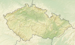
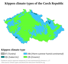
The Czech Republic, also known as Czechia, is a landlocked country in Central Europe. Historically known as Bohemia, it is bordered by Austria to the south, Germany to the west, Poland to the northeast, and Slovakia to the southeast. The Czech Republic has a hilly landscape that covers an area of 78,871 square kilometers (30,452 sq mi) with a mostly temperate continental and oceanic climate. The capital and largest city is Prague; other major cities and urban areas include Brno, Ostrava, Plzeň and Liberec.

<span class="mw-page-title-main">Moravia</span> Historical region in the Czech Republic

Moravia is a historical region in the east of the Czech Republic and one of three historical Czech lands, with Bohemia and Czech Silesia.

<span class="mw-page-title-main">Sudetes</span> Mountain range in Germany, Poland, and the Czech Republic

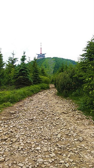
The Sudetes, commonly known as the Sudeten Mountains, is a geomorphological subprovince in Central Europe, shared by the Czech Republic, Poland, and Germany. They consist mainly of mountain ranges and are the highest part of Bohemian Massif. They stretch from the Saxon capital of Dresden in the northwest across to the region of Lower Silesia in Poland and to the Moravian Gate in the Czech Republic in the east. Geographically the Sudetes are a Mittelgebirge with some characteristics typical of high mountains. Its plateaus and subtle summit relief makes the Sudetes more akin to mountains of Northern Europe than to the Alps.

<span class="mw-page-title-main">South Bohemian Region</span> Region of the Czech Republic

The South Bohemian Region is an administrative unit (kraj) of the Czech Republic, located mostly in the southern part of its historical land of Bohemia, with a small part in southwestern Moravia. The western part of the South Bohemian Region is former Prácheňsko, a huge archaic region with distinctive features with its capital, Písek. In 2011, there were 624 municipalities in the region, whereof 54 had a status of a town.

<span class="mw-page-title-main">Moravian-Silesian Region</span> Region of the Czech Republic

The Moravian-Silesian Region is one of the 14 administrative regions of the Czech Republic. Before May 2001, it was called the Ostrava Region. The region is located in the north-eastern part of its historical region of Moravia and in most of the Czech part of the historical region of Silesia. The region borders the Olomouc Region to the west and the Zlín Region to the south. It also borders two other countries – Poland to the north and Slovakia to the east.

<span class="mw-page-title-main">Pardubice Region</span> Region of the Czech Republic

Pardubice Region is an administrative unit of the Czech Republic, located mainly in the eastern part of its historical region of Bohemia, with a small part in northwestern Moravia. It is named after its capital Pardubice. As an administrative unit, Pardubice Region has existed three times in the course of history. It was established for the first time in 1850, and extended from Český Brod to the Bohemian-Moravian border. In its second existence, it was one of 19 regions as they were set between 1949 and 1960. After 1960, Pardubice became the capital of Pardubice district, which was part of the Eastern Bohemian Region. The Pardubice Region, as it is now, was reestablished in 2000.

<span class="mw-page-title-main">Ústí nad Labem Region</span> Region of the Czech Republic

Ústí nad Labem Region or Ústecký Region is an administrative unit of the Czech Republic, located in the north-western part of the historical land of Bohemia, and named after the capital, Ústí nad Labem. It covers the majority of the former North Bohemia province and is part of the broader area of North Bohemia.

<span class="mw-page-title-main">Mělník</span> Town in Central Bohemian Region, Czech Republic

Mělník is a town in the Central Bohemian Region of the Czech Republic. It has about 20,000 inhabitants. The historic town centre is well preserved and is protected by law as an urban monument zone.

This article deals with historic administrative divisions of Czechoslovakia up to 1992, when the country was split into the Czech Republic and Slovakia.

<span class="mw-page-title-main">Děčín District</span> District in Ústí nad Labem, Czech Republic

Děčín District is a district in the Ústí nad Labem Region of the Czech Republic. Its capital is the city of Děčín.

<span class="mw-page-title-main">History of the Jews in the Czech lands</span> History of the Jews in Czechia

The history of the Jews in the Czech lands, historically the Lands of the Bohemian Crown, including the modern Czech Republic, goes back many centuries. There is evidence that Jews have lived in Moravia and Bohemia since as early as the 10th century. Jewish communities flourished here specifically in the 16th and 17th centuries, and again in the late 19th and early 20th centuries. Local Jews were mostly murdered in the Holocaust, or exiled at various points. As of 2021, there were only about 2,300 Jews estimated to be living in the Czech Republic.

<span class="mw-page-title-main">Most Basin</span> Geomorphological region in the Czech Republic

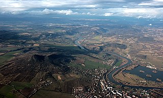
The Most Basin is a structural basin and geomorphological mesoregion of the Czech Republic. It is named after the city of Most. It forms the southwestern and central parts of the Ústí nad Labem Region. It is among the richest European deposits of lignite, which has been extracted here since the second half of 19th century, mostly by extensive surface mining.

<span class="mw-page-title-main">Margraviate of Moravia</span> Part of the Bohemian Crown from 1182 to 1918

The Margraviate of Moravia was one of the Lands of the Bohemian Crown within the Holy Roman Empire and then Austria-Hungary, existing from 1182 to 1918. It was officially administered by a margrave in cooperation with a provincial diet. It was variously a de facto independent state, and also subject to the Duchy, later the Kingdom of Bohemia. It comprised the historical region called Moravia, which lies within the present-day Czech Republic.

<span class="mw-page-title-main">Vyškov Gate</span>

The Vyškov Gate is a geomorphological feature in the Moravia. It is formed by the depression between the Western Carpathian Mountains in the east and the Bohemian massif in the west. The drainage divide between the upper River Haná to the River Morava of the Danube basin runs through it and Rakovec brook. The gate is between the Upper Morava Valley and the Dyje–Svratka Valley, all in Outer Subcarpathian depression.

In terms of geomorphological division, the Czech Republic is a very diverse territory, located in the territory of four geomorphological provinces within four geomorphological subsystems. The Bohemian Massif within the sub-system of Hercynian Forest forms three quarters of the country. The southeastern and eastern part of the Czech territory belongs to the Western Carpathians within the Carpathian Mountains. The remaining two provinces, Western Pannonian Basin within the Pannonian Basin and North European Plain within the European Plain, cover only a small part of the Czech territory in the southeast and the northeast.

<span class="mw-page-title-main">Nízký Jeseník</span>

Nízký Jeseník is a flat highland and geomorphological mesoregion of the Czech Republic. It is located in the east of the country in the Olomouc and Moravian-Silesian regions. Nízký Jeseník is the largest Czech geomorphological region, and is known for the former volcanic activity.

References

  1. "Základní informace o ČR" (in Czech). Ministry of Foreign Affairs of the Czech Republic . Retrieved 13 December 2023.
  2. "The Climate of Prague 1981–2010 (Temperatures, Humidity)" (in Czech). Czech Hydrometeorological Institute. Archived from the original on 18 January 2021. Retrieved 9 May 2016.
  3. "Praha Climate Normals 1961–1990 (Precipitation, Precipitation days, Snow, Sunhours)". National Oceanic and Atmospheric Administration. Retrieved 28 February 2013.
  4. "Prague, Czech Republic – Detailed climate information and monthly weather forecast". Weather Atlas. Yu Media Group. Archived from the original on 2 July 2019. Retrieved 2 July 2019.
  5. "Climate of Prague 1991-2020". Meteostat. Archived from the original on 17 April 2022. Retrieved 26 March 2022.
  6. "World Weather Information Service – Brno". World Meteorological Organization. May 2011. Archived from the original on 3 March 2016. Retrieved 28 February 2013.
  7. "Brno Climate Normals 1961–1990". National Oceanic and Atmospheric Administration. Retrieved 28 February 2013.
  8. "World Weather Information Service – Ostrava". United Nations. Retrieved 21 January 2011.
  9. "Normales et records pour la période 1991–2020 à Ostrava". infoclimat.fr. Retrieved 15 March 2022.

PD-icon.svg This article incorporates public domain material from The World Factbook. CIA.