Greater Accra Region

Last updated

Great Accra Region
The Aerial View of Accra, the capital town of Ghana.jpg
Aerial View of Accra
Ghana GreaterAccra.png
Location of Greater Accra Region in Ghana
Country Ghana
Capital Accra
Districts16
Government
   Regional Minister Henry Quartey
  MayorMohammed Adjei Sowah
Area
[1]
  Total3,245 km2 (1,253 sq mi)
  Rank Ranked 10th
Population
 (2021 Census) [1]
  Total5,455,692
  Rank Ranked 2nd
  Density1,700/km2 (4,400/sq mi)
GDP (PPP)
  Year2013
  Per capita$5,150
GDP (Nominal)
  Year2013
  Per capita$2,500
Time zone GMT
Area code 030
ISO 3166 code GH-AA
HDI (2021)Increase2.svg 0.707 [2]
high · 1st

The Greater Accra Region has the smallest area of Ghana's 16 administrative regions, occupying a total land surface of 3,245 square kilometres. [3] This is 1.4 per cent of the total land area of Ghana. It is the most populated region, with a population of 5,455,692 in 2021, accounting for 17.7 per cent of Ghana's total population. [4] [5]

Contents

The Greater Accra region is the most urbanized region in the country with 87.4% of its total population living in urban centres. [6] The capital city of Greater Accra Region is Accra which is at the same time the capital city of Ghana.

History

In 1960, Greater Accra, then referred to as Accra Capital District, was geographically part of the Eastern Region. It was, however, administered separately by the Minister responsible for local government. With effect from 23 July 1982, Greater Accra was created by the Greater Accra Region Law (PNDCL 26) as a legally separate region. [7]

Geography

Location and size

The Greater Accra Region is bordered on the north by the Eastern Region, on the east by the Volta Region, on the south by the Gulf of Guinea, and on the west by the Central Region. It is smallest region of Ghana in total area, and is made up of 16 administrative areas.

Tourism

Parks

Recreation areas

National monuments

National historic sites

Festivals

The Ga people celebrate the Homowo festival, which literally means "hooting at hunger." This festival originated several centuries ago. It is celebrated in remembrance of a great famine that hit the Ga people in the sixteenth century. It is mainly a food festival which celebrates the passing of that terrible period in Ga history. It takes place in August every year and is celebrated by all the Ga clans.

The Adangbe people from Ada celebrate the Asafotu festival, which is also called 'Asafotufiam', an annual warrior's festival celebrated by Ada people from the last Thursday of July to the first weekend of August commemorates the victories of the warriors in battle and is a memorial for those who fell on the battlefield. To re-enact these historic events, the warriors dress in traditional battle dress and stage a mock battle. This is also a time for male rites of passage, when young men are introduced to warfare. The festival also coincides with the harvest cycle, when these special customs and ceremonies are performed. These include purification ceremonies. The celebration reaches its climax with a durbar of chiefs, a colourful procession of the Chiefs in palanquins with their retinue. They are accompanied by traditional military groups called 'Asafo Companies' amidst drumming, singing and dancing through the streets and on the durbar grounds. At the durbar, greetings are exchanged between the chiefs, libations are poured and declarations of allegiance are made.

Other tourist attractions

Governance

Districts of the Greater Accra Region Districts of the Greater Accra Region (2012).svg
Districts of the Greater Accra Region

The political administration of the region is through the local government system. Under this administration system, the region is divided into 29 MMDA's (made up of 2 Metropolitan, 23 Municipal and 4 Ordinary Assemblies). [1] Each District, Municipal or Metropolitan Area and it's corresponding constituency, is administered by a Chief Executive and a Member of Parliamnet, representing the central government but deriving authority from an Assembly headed by a presiding member elected from among the members themselves. The MMDA's were increased from 3 to 5 in 1988; then from 5 to 6 in 2004; then from 6 to 10 in 2008; then from 10 to 16 in 2012; and recently from 16 to 29 in 2018. The number of constituencies increased/spread from 22 to 27 in 2004 making and 34 prior to the 2012 Ghanaian general election.The current list is as follows:

DistrictCapitalConstituencyMember of ParliamentParty
Ablekuma Central Municipal Lartebiokorshie Ablekuma Central Dan Abdul-latif NDC
Ablekuma North Municipal Darkuman Ablekuma North Sheila Bartels NPP
Ablekuma West Municipal Dansoman Ablekuma West Ursula G Owusu NPP
Accra Metropolitan Accra Ablekuma South Alfred Okoe Vanderpuije NDC
Odododiodio Edwin Nii Lante Vanderpuye NDC
Okaikwei Central Patrick Yaw Boamah NPP
Okaikwei South Dakoa Newman NPP
Ada East Ada Foah Ada Comfort Doyoe Cudjoe-Ghansah NDC
Ada West Sege Sege Christian Corleytey Otuteye NDC
Adenta Municipal Adenta Adenta Mohammed Adamu Ramadan NDC
Ashaiman Municipal Ashaiman Ashaiman Ashaiman NDC
Ayawaso Central Municipal Kokomlemle Ayawaso Central Henry Quartey NPP
Ayawaso East Municipal Nima Ayawaso East Naser Toure Mahama NDC
Ayawaso North Municipal Accra New Town Ayawaso North Yussif Issaka Jajah NDC
Ayawaso West Municipal Dzorwulu Ayawaso West Lydia Alhassan NPP
Ga Central Municipal Sowutuom Anyaa-Sowutuom Dickson Adomako Kissi NPP
Ga East Municipal Abokobi Dome-Kwabenya Sarah Adwoa Safo NPP
Ga North Municipal Amomole Trobu Moses Anim NPP
Ga South Municipal Ngleshie Amanfro Bortianor-Ngleshie-Amanfrom Sylvester Tetteh NPP
Domeabra-Obom Sophia Karen Edem Ackuaku NDC
Ga West Municipal Amasaman Amasaman Akwasi Owusu Afrifa-Mensah NPP
Korle Klottey Municipal Osu Korle Klottey Zanetor Agyeman-Rawlings NDC
Kpone Katamanso Municipal Kpone Kpone-Katamanso Joseph Akuerteh NDC
Krowor Municipal Nungua Krowor Agnes Naa Momo Lartey NDC
La Dade Kotopon Municipal La Dade Kotopon Rita Naa Odoley Sowah NDC
La Nkwantanang Madina Municipal Madina Abokobi-Madina Francis-Xavier Kojo Sosu NDC
Ledzokuku Municipal Teshie Ledzokuku Benjamin Ayiku Nartey NDC
Ningo Prampram Prampram Ningo-Prampram Samuel George Nartey NDC
Okaikwei North Municipal Tesano Okaikwei North Theresa Lardi Awuni NDC
Shai Osudoku Dodowa Shai-Osudoku Linda Obenewaa Akweley Ocloo NDC
Tema Metropolitan Tema Tema Central Yves Hanson-Nortey NPP
Tema East Isaac Ashai Odamtten NDC
Tema West Municipal Tema Community 18 Tema West Carlos Kingsley Ahenkora NPP
Weija Gbawe Municipal Weija Weija Tina Gifty Naa Ayeley Mensah NPP

Demographics

Population

The center of population of the Greater Accra region is located in the Greater Accra Metropolitan Area which comprises the Accra Metropolitan, Tema Metropolitan, Adenta Municipal, La Nkwantanang Madina Municipal District, Ashaiman Municipal, Ledzokuku-Krowor Municipal, Ga East Municipal, Ga West Municipal, and Ga South Municipal districts [9]

According to the 2010 census, the region had a population of 4,010,054, making it the second most populous (total number of people) region of Ghana behind the Ashanti Region. [4] Owing to in-migration and a high population growth rate, however, the region has the highest population density in the country.

Historical population
YearPop.±%
1984 1,431,099    
2000 2,905,726+103.0%
2010 4,010,054+38.0%
2021 5,455,692+36.1%
source: [10]

Ethnicity

The Ga sub-group of the Ga-Dangme people is the historical population of Accra. They form the largest ethnic sub-group in the Greater Accra Region, with 18.9% of the population. [11] [ circular reference ] The Ga peoples were organized into six independent towns (Accra (Ga Mashie), Osu, La, Teshie, Nungua, and Tema). Each town had a stool, which served as the central object of Ga ritual and war magic. Now, the town of La has a community bank which offers banking services to them. [12] Accra became the most prominent Ga-Dangme towns and is now the heartbeat and capital of Ghana.[4] The Ga people were originally farmers, but today fishing and trading in imported goods are the principal occupations. Trading is generally in the hands of women, and a husband has no control over his wife's money. Succession to most offices held by women and inheritance of women's property are by matrilineal descent. Inheritance of other property and succession to male-held public offices are by patrilineal descent. Men of the lineage live together in a men's compound, while women, even after marriage, live with their mothers and children in a women's compound. Each Ga town has a number of different cults and many gods, and there are a number of annual town festivals. The Adangme people occupy the coastal area of Ghana from Le Kpone to Ada, on the Volta River and South Atlantic Ocean along the Gulf of Guinea and inland along the Volta River. The Adangme People include the Ada, Le Kpone, Krobo, Ningo, Osuduku, Prampram, and Shai, all speaking Adangbe of the Kwa branch of the Niger-Congo family of languages. [5] The Adangme People have the largest Population among the two related Ga-Adangme People. About 70% of the Greater Accra Regional Land is owned by the Adangmes located in Dangme East and Dangme West Districts of Ghana.

Immigration

1.3% of the inhabitants of the Greater Accra Region are immigrants from outside Ghana.

The largest portion of the population of Accra is Akan, at 39.8% of the population. The next largest group is Ga-Dangme at 30.7% of the population. After this 18% of the population is Ewe. [13] The Ga sub-group of the Ga-Dangme people is the historical population of Accra. They form the largest ethnic sub-group in the Greater Accra Region, with 18.9% of the population. The Fante are the next largest ethnic sub-group, with 10% of the population.

Population growth

In 1960 the population of the Greater Accra Region was 491,817. In 2000 the population was 2,905,726. In 2010 the population was 4,010,054. [13] [4]

Religion

The religious affiliations of the people of the Greater Accra region are below: [1]

Transportation

The Greater Accra region is served by the Kotoka International Airport in Accra. The airport offers flight to destinations within Ghana, the African continent and to other continents.

Four National highways – N1, N2, N4 and N6 – and one Regional highway – R40 – pass through the Greater Accra region. N1 enters the region in Ada to the east and runs west, intersecting the N2 at Tema, the Ghana Road Network Tetteh Quarshie Interchange, and the N6 at Achimota. It passes through Kokrobite and exits the region at Weija where it continues on through the Central Region to Elubo in the Western region. The N2 crosses the Eastern Regional border into Asikuma and runs north entering the Upper East Region, ending at Kulungugu. The N4 heads north from the Tetteh Quarshie Interchange, while the N6 originates from Achimota. These highways cut through the northern part of the region and terminate at Kumasi in the Ashanti Region.

There is also an active railway line connecting Accra and Tema.

Education

Senior high schools

  • Christian Methodist Senior High School
  • Accra Academy
  • St. Martins Senior High School
  • Accra Girls Senior High School
  • Accra High School
  • Accra Wesley Girls' High School
  • Achimota Senior High School
  • Ebenezer Senior High School
  • Holy Trinity Cathedral Senior High School
  • Kaneshie Senior High School
  • Kinbu Senior High School
  • Presbyterian Senior High School, Osu
  • Wesley Grammar Senior High School
  • St. Mary's Senior High School
  • St. Margaret-Mary Senior High School
  • Sacred Heart Vocational Institute
  • Accra Technical Training Centre
  • Accra Wesley Girls' Senior High School
  • Chemu Senior High School
  • Manhean Senior High School
  • Tema Senior High School
  • Methodist Day Senior High School
  • Presbyterian Senior High School, Tema
  • Our Lady Of Mercy Senior High School
  • Tema Technical Institute
  • Labone Senior High School
  • Presbyterian Senior High Sch, La
  • St. Thomas Aquinas Senior High School
  • Armed Forces Senior High Technical
  • Amasaman Senior High Technical School
  • St. John's Grammar Senior High School
  • Odorgonno Senior High School
  • West African Senior High School
  • Presbyterian Boys' Senior High School, Legon
  • Ada Senior High School
  • Ada Technical Institute
  • Ada Senior High Technical School
  • Osudoku Senior High School
  • Ningo Senior High School
  • Prampram Senior High School
  • Ashaiman Senior High School
  • Don Bosco Senior High Technical School
  • Nungua Senior High School
  • O'reilly Senior High School
  • Presbyteian Senior High School, Teishie
  • Teishie Technical Training Centre
  • The Morning Star International High School, Dodowa
  • Kpone Community Day Senior High School
  • Kwabenya Community Day Senior High School
  • Frafraha Community Day Senior
  • Ghanata Senior High School

Higher education

Greater Accra has three public four-year institutions, the University of Ghana in Accra, Ghana Institute of Journalism and University of Professional Studies, East Legon, Accra. In addition, there a are number of private universities and university colleges spread through the region.

Shopping centres and their locations

Sports

Famous native and resident citizens

Famous native citizens of Greater Accra
#CitizenSettlement
1 Terry Darious N Gibson Nima/Korle Gono
2 Stonebwoy Ashaiman
3 Joselyn Canfor Dumas Accra
4 Azumah Nelson Accra
5 Arthur Wharton Accra
6 Nana Aba Anamoah Accra
7 Asamoah Gyan Accra
8 Leo Myles-Mills Accra
9 Shatta Wale Korle Gonno
10 Serwaa Amihere Accra
11 Samuel Darko Accra

Related Research Articles

<span class="mw-page-title-main">Accra</span> Capital and the largest city of Ghana

Accra is the capital and largest city of Ghana, located on the southern coast at the Gulf of Guinea, which is part of the Atlantic Ocean. As of 2021 census, the Accra Metropolitan District, 20.4 km2 (7.9 sq mi), had a population of 284,124 inhabitants, and the larger Greater Accra Region, 3,245 km2 (1,253 sq mi), had a population of 5,455,692 inhabitants. In common usage, the name "Accra" often refers to the territory of the Accra Metropolitan District as it existed before 2008, when it covered 199.4 km2 (77.0 sq mi). This territory has since been split into 13 local government districts: 12 independent municipal districts and the reduced Accra Metropolitan District (20.4 km2), which is the only district within the capital to be granted city status. This territory of 199.4 km2 contained 1,782,150 inhabitants at the 2021 census, and serves as the capital of Ghana, while the district under the jurisdiction of the Accra Metropolitan Assembly proper (20.4 km2) is distinguished from the rest of the capital as the "City of Accra".

The Dangme language, also Dangme or Adaŋgbi, is a Kwa language spoken in south-eastern Ghana by the Dangme People (Dangmeli). The Dangmeli are part of the larger Ga-Dangme ethnic group. Klogbi is a variant, spoken by the Kloli. Kropp Dakubu (1987) is the most thorough grammar of the language.

<span class="mw-page-title-main">Tema</span> City in Greater Accra Region, Ghana

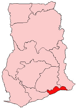
Tema is a city on the Bight of Benin and Atlantic coast of Ghana. It is located 25 kilometres (16 mi) east of the capital city; Accra, in the region of Greater Accra, and is the capital of the Tema Metropolitan District. As of 2013, Tema is the eleventh most populous settlement in Ghana, with a population of approximately 161,612 people – a marked decrease from its 2005 figure of 209,000. The Greenwich Meridian passes directly through the city. Tema is locally nicknamed the "Harbour City" because of its status as Ghana's largest seaport. It consists of 25 different communities which are numbered accordingly with each of them having easy access to the basic amenities.

The Ga-Dangbe, Ga-Dangme, Ga-Adangme or GaDangme are an ethnic group in Ghana, Togo and Benin. The Ga and Dangbe people are grouped respectively as part of the Ga–Dangme ethnolinguistic group. The Ga-Dangmes are one ethnic group that lives primarily in the Greater Accra region of Ghana. Ethnic Ga family names (surnames) include Nikoi, Amon, Kotey, Kotei, Adei, Adjei, Kutorkor, Oblitey, Lartey, Nortey, Aryee, Obodai, Oboshi, Torgbor, Torshii and Lante. The following are names derived from the ethnic Dangme and common among the Ningos Nartey, Tetteh, Kwei, Kweinor, Kwetey, Narteh, Narh, Dugbatey, Teye, Martey, Addo, Siaw, Saki, Amanor, Djangba. These are aligned to the ethnic Ga as well: Lomo, Lomotey, Tetteh, Ankrah, Tetteyfio, Laryea, Ayitey, Okai, Bortey, Quaye, Quaynor, Ashong, Kotei, Sowah, Odoi, Ablor, Adjetey, Dodoo, Darku and Quartey.

<span class="mw-page-title-main">Teshie</span> Town in Greater Accra Region, Ghana

Teshie is a coastal town in the Ledzokuku Municipal District, a district in the Greater Accra Region of southeastern Ghana. Teshie is the ninth most populous settlement in Ghana, with a population of 171,875 people.

<span class="mw-page-title-main">Accra Metropolitan District</span> City and metropolitan district in Ghana

The Accra Metropolitan District is one of the 254 Metropolitan, Municipal and Districts in Ghana, and among the 26 such districts in the Greater Accra Region with a population of 284,124 as of 2021. As of March 2018, it spans an area of approximately 60 km2 (23 sq mi) and encompasses the Ablekuma South, Ashiedu Keteke, and Okaikoi South sub-metropolitan district councils.

<span class="mw-page-title-main">Dangme East District</span> Former District in Ghana

Dangme East District is a former district that was located in Greater Accra Region, Ghana. Originally created as an ordinary district assembly in 1988, which was created from the former Dangme District Council. However on 28 June 2012, it was split off into two new districts: Ada East District and Ada West District. The district assembly was located in the eastern part of Greater Accra Region and had Ada Foah as its capital town.

<span class="mw-page-title-main">Languages of Ghana</span>

Ghana is a multilingual country in which about eighty languages are spoken. Of these, English, which was inherited from the colonial era, is the official language and lingua franca. Of the languages indigenous to Ghana, Akan is the most widely spoken in the south. Dagbani is most widely spoken in the north.

Articles related to Ghana include:

<span class="mw-page-title-main">Roman Catholic Archdiocese of Accra</span> Roman Catholic archdiocese in Ghana

The Roman Catholic Archdiocese of Accra covers the Greater Accra Region and parts of the Volta Region. There are 62 parishes and rectories. The Roman Catholic Archdiocese of Accra is the Metropolitan See for the ecclesiastical province of Accra in Ghana which includes the suffragan dioceses of Ho, Koforidua, Jasikan and Keta-Akatsi. The Latin title of the archdiocese is Archidioecesis Accraënsis, and the corporate title is Archdiocese of Accra. The cathedral parish for the archdiocese is the Holy Spirit Cathedral.

Sakumono is a small town before Nungua from Ashaiman. It is in the Tema Metropolitan district, a district in the Greater Accra Region of Ghana. It was originally a small fishing village on Sakumono Lagoon, but by 2008 was being swallowed up as the twin cities of Nungua and Tema were merging. Its elevation is 71m. Sakumono, also known as Community 13, is one of the interesting towns in the area, with the main township being close to the beach and the lagoon. It also has several sectors of Estate buildings and jurisdiction.

Pokuase, also spelled Pokoasi, is a suburb of Accra, the capital city of Ghana and spans the area from Pokuase, leading off the Accra-Kumasi motorway on the right coming from Accra central; and leading off the motorway at Pokuase Junction and rising to ‘Okai Kwei Hill’, on the left coming from town. It is a mixture of lively retail shopping areas, with local stores, bars or 'drinking spots', bus/taxi stations, and a market. It also has many hotels, guest houses and rental apartments- such as the eco-chic Legassi Gardens Apartments-, and 'high-end' developing residential estates, such as Ofankor Hills Estates and Franko Estates, amongst many others; as well as the long-established executive gated community of ACP Estates.; and HFS Estates which borders the erstwhile Gua Koo Sacred Grove in Pokuase.

Nungua is a town in Krowor Municipal District in the Greater Accra Region of southeastern Ghana near the coast. Nungua is the eighteenth most populous settlement in Ghana, in terms of population, with a population of 84,119 people.

<span class="mw-page-title-main">Ledzokuku-Krowor Municipal District</span> Former Municipal District in Ghana

Ledzokuku-Krowor Municipal District is a former district that was located in Greater Accra Region, Ghana. Originally it was formerly part of Accra Metropolitan District in 1988, until the far eastern portion of the district was split off to create Ledzokuku-Krowor Municipal District on 1 November 2007 ; thus the remaining part has been retained as Accra Metropolitan District. However on 15 March 2018, it was split off into two new municipal districts: Ledzokuku Municipal District and Krowor Municipal District. The municipality was located in the central part of Greater Accra Region and had Teshie-Nungua as its capital town.

<span class="mw-page-title-main">Old Ningo</span> Place in Greater Accra Region, Ghana

Old Ningo is a town in the Greater Accra Region of Ghana.

The Universal Merchant Bank, formerly known as Merchant Bank Ghana Limited, is a Ghanaian financial institution headquartered in Accra.

<span class="mw-page-title-main">Krobo people</span> Ethnic group in Ghana

The Krobo people are an ethnic group in Ghana. They are grouped as part of Ga-Adangbe ethnolinguistic group and they are also the largest group of the seven Dangme ethnic groups of Southeastern Ghana. The Krobo are a farming people who occupy Accra Plains, Akuapem Mountains and the Afram Basin.

Daniel Nii Kwartei Titus Glover is a Ghanaian politician and the Member of Parliament of Tema East constituency. He is a member of the New Patriotic Party and the Deputy Minister of Transport in Ghana.

<span class="mw-page-title-main">Weija Gbawe Municipal District</span> Municipal District in Ghana

Weija Gbawe Municipal District is one of the twenty-nine districts in Greater Accra Region, Ghana. Originally it was formerly part of the then-larger Ga West District in 2004, until the western part of the district was split off to create the first Ga South Municipal District on 29 February 2008, with Weija as its capital town; thus the remaining part was elevated to municipal district assembly status to become Ga West Municipal District. Later, a small portion of the district was split off to create Ga Central Municipal District on 28 June 2012; thus the remaining part has been retained as Ga South Municipal District. However on 15 March 2018, the northern part of the district was split off to create a new Ga South Municipal District, with Ngleshie Amanfro as its capital town; thus the remaining part has been renamed as Weija Gbawe Municipal District, with Weija as its capital town. The municipality is located in the western part of Greater Accra Region and has Weija as its capital town.

References

  1. 1 2 3 4 "Greater Accra Region". Ghanadistricts.com. Archived from the original on 27 June 2015. Retrieved 19 May 2015.
  2. "Sub-national HDI - Area Database - Global Data Lab". hdi.globaldatalab.org. Retrieved 13 September 2018.
  3. "About GAR – Greater Accra Region" . Retrieved 28 May 2023.
  4. 1 2 3 "Population & Housing Census 2010" (PDF). Ghana Statistical Service. Retrieved 31 December 2017.
  5. "Greater Accra - Government of Ghana". Government of Ghana. Retrieved 19 May 2019.
  6. Songsore, Jacob. "The Urban Transition in Ghana: Urbanization, National Development and Poverty Reduction" (PDF). Archived (PDF) from the original on 15 April 2016.
  7. "Greater Accra Region - Political Administration". Archived from the original on 2 November 2010. Retrieved 29 September 2010.
  8. "Lakeside Marina Park". BeautifulGhana. 20 February 2018. Retrieved 11 January 2020.
  9. "Environmental and Structural Inequalities in Greater Accra". The Journal of the International Institute. Retrieved 22 July 2010.
  10. Ghana population statistics
  11. Ga-Adangbe people
  12. "La Community Bank". Ghana Yello. Retrieved 19 April 2018.
  13. 1 2 "Greater Accra - Government of Ghana". Government of Ghana. Archived from the original on 23 February 2018. Retrieved 21 August 2016.