South Gloucestershire is a unitary authority area in the ceremonial county of Gloucestershire, South West England. Towns in the area include Yate, Chipping Sodbury, Kingswood, Thornbury, Filton, Patchway and Bradley Stoke. The southern part of its area falls within the Greater Bristol urban area surrounding the city of Bristol.
Catbrain Hill, simply known as Catbrain, is a small village in England north of the city of Bristol, within the county of South Gloucestershire. It is located near Cribbs Causeway, on a road that contains many car dealerships. A new housing estate has been recently constructed at Catbrain, with more developments nearby underway as of 2022. At the bottom of the hill lies the runway of the former Bristol Filton Airport.

Henbury is a suburb of Bristol, England, approximately 5 miles (8.0 km) north west of the city centre. It was formerly a village in Gloucestershire and is now bordered by Westbury-on-Trym to the south; Brentry to the east and the Blaise Castle Estate, Blaise Hamlet and Lawrence Weston to the west. To the north lie the South Gloucestershire village of Hallen and the entertainment/retail park Cribbs Causeway.
Cribbs Causeway is both a road in South Gloucestershire, England, running north of the city of Bristol, and the adjacent area which is notable for its out-of-town shopping and leisure facilities. The retail and leisure complex takes its name from the road, and includes retail parks, supermarkets, an enclosed shopping centre known as The Mall, an ice-rink, Vue, a cinema, Hollywood Bowl, a ten-pin bowling venue, and a gym.

Blaise Castle is a folly built in 1766 near Henbury in Bristol, England. The castle sits within the Blaise Castle Estate, which also includes Blaise Castle House, a Grade II* listed 18th-century mansion house. The folly castle is also Grade II* listed and ancillary buildings including the orangery and dairy also have listings. Along with Blaise Hamlet, a group of nine small cottages around a green built in 1811 for retired employees, and various subsidiary buildings, the parkland is listed Grade II* on the Register of Historic Parks and Gardens of special historic interest in England.

Bristol North West is a constituency represented in the House of Commons of the UK Parliament since 2017 by Darren Jones of the Labour Party.

Westbury on Trym is a suburb and council ward in the north of the City of Bristol, near the suburbs of Stoke Bishop, Westbury Park, Henleaze, Southmead and Henbury, in the southwest of England.

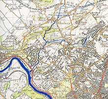
The River Trym is a short river, some 4.5 miles (7.2 km) in length, which rises in Filton, South Gloucestershire, England. The upper reaches are culverted, some underground, through mostly urban landscapes, but once it emerges into the open it flows through a nature reserve and city parks before joining the tidal River Avon at Sea Mills. 18th-century water mills near the mouth gave the area its name.

The A4018 is an A-road connecting the city centre of Bristol to the M5 motorway at Cribbs Causeway. It is one of the four principal roads which link central Bristol to the motorway network.
Sea Mills is a suburb of Bristol, England, 3.5 miles (6 km) north-west of the city centre, towards the seaward end of the Avon Gorge, between the former villages of Shirehampton to the west and Westbury-on-Trym and Stoke Bishop to the east, at the mouth of the River Trym where it joins the River Avon. Sea Mills was part of the city ward of Kingsweston. Following a Local Government Boundary Commission review in 2015, ward boundaries were redrawn and Sea Mills is now split between the Stoke Bishop ward and the Avonmouth and Lawrence Weston ward.

Coombe Dingle is a suburb of Bristol, England, centred near where the Hazel Brook tributary of the River Trym emerges from a limestone gorge bisecting the Blaise Castle Estate to join the main course of the Trym. Historically this area formed part of the parish of Westbury on Trym, Gloucestershire, and it is now part of Kingsweston ward of the city of Bristol. South of Coombe Dingle is Sea Mills; to the north is Kings Weston Hill; to the west are Kings Weston House and Shirehampton Park; and to the east, Henbury Golf Club and Westbury on Trym proper.
Charlton was the name of a small village or large hamlet in Gloucestershire, England with a Bethel Chapel and Sunday School. It was demolished in the late 1940s. Its site is occupied by part of the derelict runway and safety margins of the former Bristol Filton Airport. The village was located between Filton and what is today the Cribbs Causeway out-of-town commercial and retail area immediately north of Bristol. To the north of the village lay fields and Over Court Deer Park, which is today Bristol Golf Club.
Bristol is a city in south west England, near the Bristol Channel coast, approximately 106 miles (170 km) west of London. Several factors have influenced the development of its transport network. It is a major centre of employment, retail, culture and higher education, has many historic areas, and has a history of maritime industry. The city has a population of 450,000, with a metropolitan area of 650,000, and lies at the centre of the former County of Avon, which includes many dormitory towns, and has a population of one million.

The Henbury Loop Line, also known as the Filton to Avonmouth Line, is a railway line following the boundary between Bristol and South Gloucestershire between the Severn Beach Line at Hallen Marsh Junction, Avonmouth and the Cross Country Route/South Wales Main Line at Filton. It is currently only used for freight.
Westbury Park is a suburb of the city of Bristol, United Kingdom. It lies to the east of Durdham Down between the districts of Redland and Henleaze. The area is very similar in character to nearby Redland and comprises mainly Victorian and early twentieth-century architecture, along with a selection of Georgian buildings. Many of these buildings still have their original house names and many Victorian artifacts have been found in the gardens of Westbury Park.
Goram and Vincent are legendary giants in the folklore of the Bristol area, UK.
Kingsweston was a ward of the city of Bristol. The three districts in the ward were Coombe Dingle, Lawrence Weston and Sea Mills. The ward takes its name from the old district of Kings Weston, now generally considered part of Lawrence Weston. Following a Local Government Boundary Commission review in 2015 ward boundaries were redrawn and Kingsweston ward is now split between the Stoke Bishop ward and the Avonmouth and Lawrence Weston ward.

The Portway is a major road in the City of Bristol. It is part of the A4 and connects Bristol City Centre to the Avonmouth Docks and the M5 motorway via the Avon Gorge.

Cribbs Football Club is an English football club founded in 1958 and based at Cribbs Causeway, South Gloucestershire. They are currently members of Southern League Division One South and are affiliated to the Gloucestershire County FA.