
The River Parrett flows through the counties of Dorset and Somerset in South West England, from its source in the Thorney Mills springs in the hills around Chedington in Dorset. Flowing northwest through Somerset and the Somerset Levels to its mouth at Burnham-on-Sea, into the Bridgwater Bay nature reserve on the Bristol Channel, the Parrett and its tributaries drain an area of 660 square miles (1,700 km2) – about 50 per cent of Somerset's land area, with a population of 300,000.

The River Avon is an English river in the south west of the country. To distinguish it from a number of other rivers of the same name, this river is often also known as the Bristol Avon. The name ‘Avon’ is a cognate of the Welsh word afon, ‘river’.

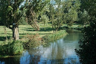
The River Goyt is a river in North West England. It is one of the tributaries of the River Mersey.

The River Rother flows for 35 miles (56 km) through the English counties of East Sussex and Kent. Its source is near Rotherfield in East Sussex, and its mouth is on Rye Bay, part of the English Channel. Prior to 1287, its mouth was further to the east at New Romney, but it changed its course after a great storm blocked its exit to the sea. It was known as the Limen until the sixteenth century. For the final 14 miles (23 km), the river bed is below the high tide level, and Scots Float sluice is used to control levels. It prevents salt water entering the river system at high tides, and retains water in the river during the summer months to ensure the health of the surrounding marsh habitat. Below the sluice, the river is tidal for 3.7 miles (6.0 km).

The River Leam, anciently Leame, etc, is a river in England which rises at Hellidon Hill in Northamptonshire then flows through Warwickshire, including the town of Leamington Spa, named after it. It then flows into the River Avon near Warwick, and thence into the River Severn. The name is first recorded in 956 as Limenan, and derives from British Lemanā, meaning "elm-tree river".

The River Ryton is a tributary of the River Idle. It rises close to the Chesterfield Canal near Kiveton Park, and is joined by a series of tributaries near Lindrick Common in the Metropolitan Borough of Rotherham, South Yorkshire, England. Most of its course is in Nottinghamshire, flowing through the town of Worksop. It meanders northwards to join the River Idle near the town of Bawtry on the South Yorkshire-Nottinghamshire border.

The name Rea Brook can refer to either of two brooks in Shropshire, England.

The River Allen is a river in the county of Dorset in South West England. It flows for 14 miles (23 km) and has its confluence with the River Stour in Wimborne Minster. It has two main tributaries, the Gussage Stream and the Crichel Stream.
The River Coln is a river in Gloucestershire, England. It rises to the north of Brockhampton, a village to the east of Cheltenham, and flows in a south/south-easterly direction through the Cotswold Hills via Andoversford, Withington, Fossebridge, Bibury, Coln St Aldwyns, Quenington and Fairford. It joins the River Thames to the south-west of Lechlade, where it shares a confluence with the Thames and Severn Canal, by The Round House Footbridge.

The River Perry is a river in Shropshire, England. It rises near Oswestry and flows south to meet the River Severn above Shrewsbury. Along its 24 miles (39 km) length, its level drops by some 320 feet (95 m). The channel has been heavily engineered, both to enable water mills to be powered by it, and to improve the drainage of the surrounding land. There were at least seven corn mills in the 1880s, and the last one remained operational until 1966. The middle section of the river crosses Baggy Moor, where major improvements were made in 1777 to drain the moor. The scheme was one of the largest to enclose and improve land in North Shropshire, and the quality of the reclaimed land justified the high cost. A section of the river bed was lowered in the 1980s, to continue the process.

The River Vyrnwy is a river which flows through northern Powys, Wales, and Shropshire, England. The name derives from Severn, the river of which it is a tributary.

The River Frome, once also known as the Stroudwater, is a small river in Gloucestershire, England. It is to be distinguished from another River Frome in Gloucestershire, the Bristol Frome, and the nearby River Frome, Herefordshire. The river is approximately 25 miles (40 km) long.

The River Evenlode is a river in England which is a tributary of the Thames in Oxfordshire. It rises near Moreton-in-Marsh, Gloucestershire in the Cotswold Hills and flows south-east passing near Stow-on-the-Wold, Charlbury, Bladon, and Cassington, and its valley provides the route of the southern part of the Cotswold Line. The river flows for 45 miles (72 km) from source to the River Thames.

The River Salwarpe is a 20.4 miles (32.8 km) long river in Worcestershire, England. It is a left bank tributary of the River Severn, which it joins near Hawford.

The River Wey is a tributary of the River Thames in south east England. Its two branches, one of which rises near Alton in Hampshire and the other in West Sussex to the south of Haslemere, join at Tilford in Surrey. Once combined the flow is eastwards then northwards via Godalming and Guildford to meet the Thames at Weybridge. Downstream the river forms the backdrop to Newark Priory and Brooklands. The Wey and Godalming Navigations were built in the 17th and 18th centuries, to create a navigable route from Godalming to the Thames.

The River Leadon is a river in Herefordshire and Gloucestershire, England, a tributary of the River Severn. It rises just south of the village of Acton Beauchamp, and flows south past Bosbury to the town of Ledbury, which takes its name from the river. It then flows south and east past Dymock, Upleadon and Highleadon to join the Severn at Over, just west of Gloucester. The river is approximately 32 miles (51 km) long.

Clayhill Brook is a small stream in southern England, in the county of Berkshire. It rises at Benham's Gulley in the far West of Burghfield Common and runs through the Northern edge of the Village, forming the border between Burghfield Parish and Sulhamstead Parish. The brook, running to the North East, passes through woodland, Omer's Gully, at the edge of the village. The woodland and the brook is a haven for local wildlife in the area, and is a particularly important resource in this respect. At the eastern end of Omer's Gulley, and to the North Eastern End of Burghfield Common, the brook is forded at Ash Lane. It continues North to Northeast past another woodland, Clayhill Copse, and then past Stud Farm and towards Burghfield Village. Along this course of the stream is a sewage treatment works which serves the local communities. Skirting between Burghfield Village and the hamlet of Trash Green, the brook continues Northeast, past Green Farm, under the M4 motorway, and past the gravel pits at Pingewood, running close by to Burghfield Mill. It joins the River Kennet just to the East of Burghfield Mill, no longer a working mill, but converted to residential apartments.

The River Dove is a river that extends through the Low Valley in Barnsley, England. It flows from Worsbrough Reservoir to its confluence with the River Dearne.

The River Worfe is a river in Shropshire, England. The name Worfe is said to derive from the Old English meaning to wander which the river is notable for in its middle section. Mapping indicates that the river begins at Cosford Bridge where the Cosford Brook and Albrighton Brook meet.

Pilhill Brook is a 9.9-kilometre-long (6.2 mi) tributary of the River Anton in Hampshire, England. It is a chalk stream, known for its trout fishing.

