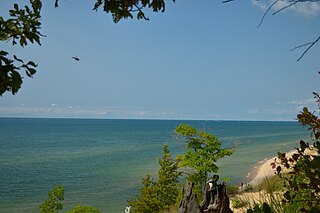
Heath Township, Michigan

Last updated

Heath Township, Michigan
USA Michigan location map.svg
Red pog.svg
Heath Township
Location within the state of Michigan
Coordinates: 42°38′58″N85°58′0″W / 42.64944°N 85.96667°W / 42.64944; -85.96667
Country United States
State Michigan
County Allegan
Area
  Total35.9 sq mi (93.0 km2)
  Land35.4 sq mi (91.6 km2)
  Water0.5 sq mi (1.4 km2)
Elevation
686 ft (209 m)
Population
 (2020)
  Total3,937
  Density111.3/sq mi (42.97/km2)
Time zone UTC-5 (Eastern (EST))
  Summer (DST) UTC-4 (EDT)
FIPS code 26-37460 [1]
GNIS feature ID1626459 [2]
Website www.heathtownship.net

Heath Township is a civil township of Allegan County in the U.S. state of Michigan. As of the 2020 census, the township population was 3,937. [3]

Contents

Communities

Dunningville is a historic locale in the southern part of the township at 42°36′46″N85°56′55″W / 42.61278°N 85.94861°W / 42.61278; -85.94861 . [4] Andrew Whistler built a sawmill here in 1855 that was operated by persons named Dunning and Hopkins. A station on the Chicago and West Michigan Railroad (later part of the Pere Marquette Railway) was named "Dunning", but the post office used the name Dunningville. [5]

Gilchrist was a station on the Michigan Lake Shore Railroad located between Dunningville and Hamilton in 1873 and on successor railways. [5] [6]

Hamilton is an unincorporated community in the northwest corner of the township, where M-40 crosses the Rabbit River at 42°40′38″N86°00′22″W / 42.67722°N 86.00611°W / 42.67722; -86.00611 . [7] The first white settler was Charles Butler, who purchased the entirety of section 6 in 1835. It was at first known as Rabbit River, with a post office operating from May 1851 to September 1852. Aaron Willards platted a village named Rabbit River in 1862, with a second post office opening in July 1864. The post office was renamed "Hamilton" in May 1870. The ZIP code is 49419 and serves much of the township and surrounding areas. [5]

Hamilton High School and Middle School are located in Hamilton.

Geography

According to the United States Census Bureau, the township has a total area of 35.9 square miles (93.0 km2), of which 35.4 square miles (91.6 km2) is land and 0.54 square miles (1.4 km2), or 1.51%, is water. [3]

Demographics

Historical population
CensusPop.Note
1960 1,283
1970 1,45013.0%
1980 1,96235.3%
1990 2,29717.1%
2000 3,10035.0%
2010 3,3177.0%
2020 3,93718.7%
Source: Census Bureau. Census 1960- 2000, 2010.

As of the census [1] of 2000, there were 3,100 people, 1,035 households, and 865 families residing in the township. The population density was 87.4 inhabitants per square mile (33.7/km2). There were 1,084 housing units at an average density of 30.6 per square mile (11.8/km2). The racial makeup of the township was 96.48% White, 0.32% African American, 0.16% Native American, 0.45% Asian, 0.03% Pacific Islander, 1.13% from other races, and 1.42% from two or more races. Hispanic or Latino of any race were 2.58% of the population.

There were 1,035 households, out of which 48.1% had children under the age of 18 living with them, 72.4% were married couples living together, 7.4% had a female householder with no husband present, and 16.4% were non-families. 13.9% of all households were made up of individuals, and 3.5% had someone living alone who was 65 years of age or older. The average household size was 2.99 and the average family size was 3.31.

In the township the population was spread out, with 32.8% under the age of 18, 8.0% from 18 to 24, 34.0% from 25 to 44, 19.9% from 45 to 64, and 5.4% who were 65 years of age or older. The median age was 32 years. For every 100 females, there were 104.6 males. For every 100 females age 18 and over, there were 104.3 males.

The median income for a household in the township was $54,545, and the median income for a family was $59,100. Males had a median income of $40,247 versus $26,864 for females. The per capita income for the township was $20,248. About 3.5% of families and 3.8% of the population were below the poverty line, including 4.6% of those under age 18 and 3.2% of those age 65 or over.

Related Research Articles

<span class="mw-page-title-main">Allegan County, Michigan</span> County in Michigan, United States

Allegan County is a county in the U.S. state of Michigan. As of the 2020 United States Census, the population was 120,502. The county seat is Allegan. The name was coined by Henry Rowe Schoolcraft to sound like a Native American word.

Allegan Township is a civil township of Allegan County in the U.S. state of Michigan. As of the 2020 census, the township population was 4,689.

Cheshire Township is a civil township of Allegan County in the U.S. state of Michigan. The population was 2,199 at the 2010 census.

Clyde Township is a civil township of Allegan County in the U.S. state of Michigan. The population was 2,084 at the 2010 census.

Dorr Township is a civil township of Allegan County in the southwest of the U.S. state of Michigan. The population was 7,922 at the 2020 census.

Fillmore Township is a civil township of Allegan County in the U.S. state of Michigan. The population was 2,778 at the 2020 census. It was established in 1849 by a division of Manlius Township.

Ganges Township is a civil township of Allegan County in the U.S. state of Michigan. The population was 2,574 at the 2020 census.

Gun Plain Charter Township is a charter township of Allegan County in the U.S. state of Michigan. As of the 2010 census, the township population was 5,895.
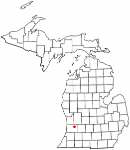
<span class="mw-page-title-main">Hopkins Township, Michigan</span> Township in Michigan, United States

Hopkins Township is a civil township of Allegan County in the U.S. state of Michigan. The population was 2,601 at the 2010 census. The township is named after Stephen Hopkins, a signer of the Declaration of Independence.

Laketown Township is a civil township of Allegan County in the U.S. state of Michigan. The population was 5,505 at the 2010 census.

Lee Township is a civil township of Allegan County in the U.S. state of Michigan. The population was 4,015 at the 2010 census.

Leighton Township is a civil township of Allegan County in the U.S. state of Michigan. The population was 7,001 at the 2020 census, up from 4,934 at the 2010 census.

<span class="mw-page-title-main">Manlius Township, Michigan</span> Township in Michigan, United States

Manlius Township is a civil township of Allegan County in the U.S. state of Michigan. The population was 3,312 at the 2020 census.

Overisel Township is a civil township of Allegan County in the U.S. state of Michigan. The population was 3,113 at the 2020 census.

Salem Township is a civil township of Allegan County in the U.S. state of Michigan. The population was 5,156 at the 2020 census, up from 3,486 at the 2000 census.

Trowbridge Township is a civil township of Allegan County in the U.S. state of Michigan. The population was 2,502 at the 2010 census.

Wayland Township is a civil township of Allegan County in the U.S. state of Michigan. The population was 3,088 at the 2010 census.
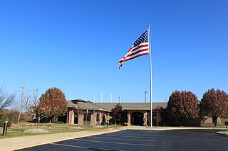
<span class="mw-page-title-main">Genoa Township, Michigan</span> Charter township in Michigan, United States

Genoa Charter Township is a charter township of Livingston County in the U.S. state of Michigan. As of the 2020 census, the township population was 20,692.

<span class="mw-page-title-main">Putnam Township, Michigan</span> Civil township in Michigan, United States

Putnam Township is a civil township of Livingston County in the U.S. state of Michigan. The population was 8,248 at the 2010 census, up from 7,500 at the 2000 census. The village of Pinckney is located within the township.

Denmark Township is a civil township of Tuscola County in the U.S. state of Michigan. The population was 3,068 at the 2010 Census.

References

  1. 1 2 "U.S. Census website". United States Census Bureau . Retrieved January 31, 2008.
  2. U.S. Geological Survey Geographic Names Information System: Heath Township, Michigan
  3. 1 2 "Geographic Identifiers: 2010 Demographic Profile Data (G001): Heath township, Allegan County, Michigan". U.S. Census Bureau, American Factfinder. Archived from the original on February 12, 2020. Retrieved June 6, 2013.
  4. U.S. Geological Survey Geographic Names Information System: Dunningville, Michigan
  5. 1 2 3 Romig, Walter (1986) [1973]. Michigan Place Names. Detroit, Michigan: Wayne State University Press. ISBN   0-8143-1838-X.
  6. Lake, D. J. (2005) [1873]. "Heath Township". Atlas of Allegan County Michigan. Ann Arbor, Mich.: University of Michigan Library. p. 23. Retrieved April 1, 2008.
  7. U.S. Geological Survey Geographic Names Information System: Hamilton, Michigan