Hopkins, Michigan | |
---|---|
Coordinates: 42°37′28″N85°45′44″W / 42.62444°N 85.76222°W | |
Country | United States |
State | Michigan |
County | Allegan |
Area | |
• Total | 0.48 sq mi (1.24 km2) |
• Land | 0.48 sq mi (1.24 km2) |
• Water | 0.00 sq mi (0.00 km2) |
Elevation | 709 ft (216 m) |
Population (2020) | |
• Total | 615 |
• Density | 1,283.92/sq mi (496.24/km2) |
Time zone | UTC-5 (Eastern (EST)) |
• Summer (DST) | UTC-4 (EDT) |
ZIP code | 49328 |
Area code | 269 |
FIPS code | 26-39180 [2] |
GNIS feature ID | 0628573 [3] |
Website | website |
Hopkins, formerly Hopkins Station, is a village within Hopkins Township in Allegan County in the U.S. state of Michigan. The population was 615 at the 2020 census. [4]
In 1854, John Hoffmaster settled here. On May 20, 1854, the Hopkins post office was opened with Erastus Congdon as its first postmaster. The Hopkins Station post office opened on March 28, 1870, with postmaster Henry F. Guyot. Hopkins Station was the name of the railroad depot opened in 1874. Hoffmaster became the first depot master and platted the village. On May 31, 1904, the Hopkins post office was closed. On June 6, 1906, the Hopkins Station post office was shortened to just Hopkins. [5]
Hopkins was incorporated as a village in 1920. On January 31, 1929, Claude B. Hoffmaster became postmaster. [5]
According to the United States Census Bureau, the village has a total area of 0.48 square miles (1.24 km2), all land. [6]
This climatic region is typified by large seasonal temperature differences, with warm to hot (and often humid) summers and cold (sometimes severely cold) winters. According to the Köppen Climate Classification system, Hopkins has a humid continental climate, abbreviated "Dfb" on climate maps. [7]
Census | Pop. | Note | %± |
---|---|---|---|
1930 | 384 | — | |
1940 | 455 | 18.5% | |
1950 | 531 | 16.7% | |
1960 | 556 | 4.7% | |
1970 | 566 | 1.8% | |
1980 | 536 | −5.3% | |
1990 | 546 | 1.9% | |
2000 | 592 | 8.4% | |
2010 | 610 | 3.0% | |
2020 | 615 | 0.8% | |
U.S. Decennial Census [8] |
As of the census [9] of 2010, there were 610 people, 227 households, and 166 families living in the village. The population density was 1,270.8 inhabitants per square mile (490.7/km2). There were 247 housing units at an average density of 514.6 per square mile (198.7/km2). The racial makeup of the village was 93.8% White, 1.3% Native American, 0.2% Asian, 1.6% from other races, and 3.1% from two or more races. Hispanic or Latino of any race were 3.9% of the population.
There were 227 households, of which 42.3% had children under the age of 18 living with them, 52.4% were married couples living together, 16.7% had a female householder with no husband present, 4.0% had a male householder with no wife present, and 26.9% were non-families. 23.8% of all households were made up of individuals, and 8.4% had someone living alone who was 65 years of age or older. The average household size was 2.69 and the average family size was 3.11.
The median age in the village was 32.7 years. 30.2% of residents were under the age of 18; 8.7% were between the ages of 18 and 24; 28.5% were from 25 to 44; 23.4% were from 45 to 64; and 9.2% were 65 years of age or older. The gender makeup of the village was 50.5% male and 49.5% female.
As of the census [2] of 2000, there were 592 people, 219 households, and 162 families living in the village. The population density was 1,137.1 inhabitants per square mile (439.0/km2). There were 229 housing units at an average density of 439.9 per square mile (169.8/km2). The racial makeup of the village was 94.09% White, 0.51% African American, 1.86% Native American, 1.18% Asian, 0.17% from other races, and 2.20% from two or more races. Hispanic or Latino of any race were 1.01% of the population.
There were 219 households, out of which 39.3% had children under the age of 18 living with them, 56.2% were married couples living together, 14.2% had a female householder with no husband present, and 26.0% were non-families. 23.3% of all households were made up of individuals, and 9.1% had someone living alone who was 65 years of age or older. The average household size was 2.70 and the average family size was 3.19.
In the village, the population was spread out, with 29.9% under the age of 18, 10.1% from 18 to 24, 28.5% from 25 to 44, 19.4% from 45 to 64, and 12.0% who were 65 years of age or older. The median age was 34 years. For every 100 females, there were 100.7 males. For every 100 females age 18 and over, there were 100.5 males.
The median income for a household in the village was $38,462, and the median income for a family was $39,583. Males had a median income of $31,500 versus $22,500 for females. The per capita income for the village was $16,667. About 8.5% of families and 8.9% of the population were below the poverty line, including 5.4% of those under age 18 and 8.5% of those age 65 or over.
As a village, Hopkins is provided assessing, counties and school districts tax collecting and elections administration for county, state and national by Hopkins Township. The village is responsible for local regulatory ordinances and to providing fire and police protection, public works, utilities and other local services. Cement City is a home rule village. Per its charter the village charter provides for a board of trustees of six. Trustees serve two year elected terms. One year term elected official are the president, clerk, treasurer and assessor. [10]
Farwell is a village in Clare County in the U.S. state of Michigan. The population was 880 at the 2020 census. The village is located within Surrey Township about 4.0 miles (6.4 km) west of the city of Clare.
Maple Rapids is a village in Clinton County in the U.S. state of Michigan. The population was 672 at the 2010 census. The village is located in Essex Township about 10 miles (16.1 km) northwest of St. Johns. A portion of the village is within the Maple River State Game Area.
Otisville is a village in Forest Township, Genesee County in the U.S. state of Michigan. The population was 864 at the 2010 census. It is located along M-15, just south of M-57. It is part of the Flint metropolitan area.
Webberville is a village in Ingham County in the U.S. state of Michigan. It is located within Leroy Township. The population was 1,288 at the 2020 census.
Blissfield is a village in Lenawee County in the U.S. state of Michigan. The population was 3,340 at the 2010 census. The village is mostly located within Blissfield Township with only very small portions extending west into Palmyra Township and south into Riga Township. The Blissfield post office first opened March 28, 1828. Hervey Bliss, who was the first white settler in 1824 and for whom the town is named, was the first postmaster.
Deerfield is a village in Lenawee County in the U.S. state of Michigan. The population was 901 at the 2020 census. The village is located within Deerfield Township.
Petersburg is a city in Monroe County in the U.S. state of Michigan. The population was 1,171 at the 2020 census.
McBride is a village in Montcalm County in the U.S. state of Michigan. The population was 189 at the 2020 census. The village is located within Day Township. The post office for the village, with ZIP code 48852, is named "McBrides" and provides P.O. box service to the village.
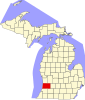
Stanton is a city in the U.S. state of Michigan. The population was 1,348 at the 2020 census. It is the county seat of Montcalm County.
Spring Lake is a village in Ottawa County in the U.S. state of Michigan. The population was 2,497 at the 2020 census. The village is located within Spring Lake Township; the two share a ZIP code.
Birch Run is a village in Saginaw County in the U.S. state of Michigan. The population was 1,553 at the 2010 census. The village is located within Birch Run Township.
Carsonville is a village in Sanilac County of the U.S. state of Michigan. The population was 527 at the 2010 census. The village is situated at 43°25′37″N82°40′17″W on the boundary between Bridgehampton Township and Washington Township, with about half the village in each.
Washington Township is a civil township of Sanilac County in the U.S. state of Michigan. The population was 1,524 at the 2020 census.
Wisner Township is a civil township of Tuscola County in the U.S. state of Michigan. The population was 604 at the 2020 census.
Mesick is a village in Wexford County in the U.S. state of Michigan. The population was 397 at the 2020 census. The majority of the village is located within Springville Township with a very small portion extending east into Antioch Township.
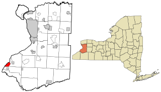
Lake Erie Beach is a hamlet and census-designated place (CDP) in the town of Evans, Erie County, New York, United States. The population was 3,872 at the 2010 census. It is part of the Buffalo–Niagara Falls Metropolitan Statistical Area.
Dillonvale is a village in southern Jefferson County, Ohio, United States. The population was 589 at the 2020 census. It is part of the Weirton–Steubenville metropolitan area. Charles Eberle was the first mayor of Dillonvale and was the first Postmaster as well.
Lennon is a village in the U.S. state of Michigan. The population was 511 at the 2010 census. The village is located along M-13 within Venice Township in Shiawassee County to the west and Clayton Township in Genesee County to the east.
Otter Lake is a village in the U.S. state of Michigan. The village is split between Marathon Township in Lapeer County to the east and Forest Township in Genesee County to the west. The population was 426 at the 2020 census.
Cement City is a village in the U.S. state of Michigan. The village is located within Woodstock Township in Lenawee County, with a small northern portion within Columbia Township in Jackson County. The population was 438 at the 2010 census.
{{cite book}}
: CS1 maint: location (link)