
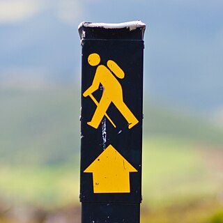
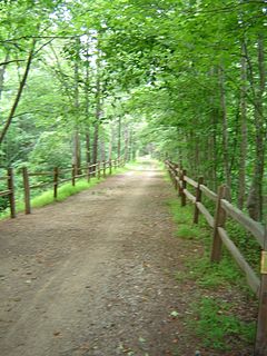
A trail is usually a path, track or unpaved lane or road. In the United Kingdom and the Republic of Ireland, path or footpath is the preferred term for a walking trail. The term is also applied in North America to routes along rivers, and sometimes to highways. In the US, the term was historically used for a route into or through wild territory used by emigrants. In the USA "trace" is a synonym for trail, as in Natchez Trace. Some trails are single use and can be used only for walking, cycling, horse riding, snowshoeing and cross-country skiing; others, as in the case of a bridleway in the UK, are multi-use, and can be used by walkers, cyclists and equestrians. There are also unpaved trails used by dirt bikes and other off-road vehicles, and in some places, like the Alps, trails are used for moving cattle and other livestock.

The Pembrokeshire Coast Path, often called the Pembrokeshire Coastal Path, is a designated National Trail in Pembrokeshire, southwest Wales. Established in 1970, it is a 186-mile (299 km) long-distance walking route, mostly at cliff-top level, with a total of 35,000 feet (11,000 m) of ascent and descent. At its highest point – Pen yr afr, on Cemaes Head – it reaches a height of 574 feet (175 m), and at its lowest point – Sandy Haven crossing, near Milford Haven – it is just 6 feet (2 m) above low water. Whilst most of the coastline faces west, it offers – at varying points – coastal views in every direction of the compass.
Gary Stewart Hume is an English artist. Hume's work is strongly identified with the YBA who came to prominence in the early 1990s. Hume lives and works in London and Accord, New York.
These are lists of long-distance trails in Ireland, and include recognised and maintained walking trails, pilgrim trails, cycling greenways, boardwalk-mountain trails, and interconnected national and international trail systems.
The East Coast Greenway is a 3,000-mile (4,800 km) rail trail linking the major cities of the Atlantic coast of the United States, from Calais, Maine, to Key West, Florida. The spine route and branching complementary routes are for non-motorized human transportation for everything from local commutes to long-distance trips.

The National Cycle Network (NCN) is the national cycling route network of the United Kingdom, which was established to encourage cycling and walking throughout Britain, as well as for the purposes of bicycle touring. It was created by the charity Sustrans who were aided by a £42.5 million National Lottery grant. In 2017, the Network was used for over 786 million cycling and walking trips.

The Greenwich Peninsula is an area of Greenwich in south-east London, England. It is bounded on three sides by a loop of the Thames, between the Isle of Dogs to the west and Silvertown to the east. To the south is the rest of Greenwich, to the south-east is Charlton.

Pembrokeshire Coast National Park is a national park along the Pembrokeshire coast in west Wales.
Walking is a popular recreational activity in London, despite traffic congestion. There are many streets that provide interesting walks, especially within historic central London, In addition there are attractive commons, parks, canals, and disused railway tracks that provide space for walks. This includes Wimbledon Common, Epping Forest, Hampstead Heath, and the eight Royal Parks: Hyde Park, Regent's Park, Richmond Park, etc. In recent years access to canals and rivers, including the Regent's Canal, and the River Thames has been greatly improved, and as well a number of long-distance walking routes have been created that link green spaces.

The Beara Way is a long-distance trail in the southwest of Ireland. It is a 206-kilometre (128-mile) long circular trail around the Beara Peninsula that begins and ends in Glengarriff, County Cork, also passing through parts of County Kerry. It is typically completed in nine days. It is designated as a National Waymarked Trail by the National Trails Office of the Irish Sports Council and is managed by the Beara Tourism and Development Association.

National Cycle Route 1 is a route of the National Cycle Network, running from Dover to Tain. The 1,022 km-long (635-mile) cycle-path is located in the United Kingdom.
Jon Thomson and Alison Craighead are London-based visual artists, who work with video, sound and the internet.
The Ridgeway is a 3.5-mile (5.6 km) "cycling permitted pedestrian priority" footpath owned by Thames Water in southeast London. It runs between Plumstead and Crossness on an embankment that covers the Joseph Bazalgette Southern Outfall Sewer.

The Miners' Way and Historical Trail is a long-distance trail in Ireland. It is a 118-kilometre (73-mile) long circular route that begins and ends in Arigna, County Roscommon. It is typically completed in five days. It is designated as a National Waymarked Trail by the National Trails Office of the Irish Sports Council and is managed by Roscommon Integrated Development Company, Roscommon County Council, Leitrim County Council and Sligo County Council. The trail was developed to encourage tourism in the area in the wake of the closure of the Arigna mines in 1990. The route was originally conceived by a local priest, Father Sean Tynan, and built with funding from the European Regional Development Fund. The trail was opened by broadcaster Donncha Ó Dúlaing in July 2000.
The Multeen Way is a long-distance trail in County Tipperary, Ireland. It is 23 kilometres long and begins in Tipperary Town and ends in Upperchurch. It is typically completed in one day. It is designated as a National Waymarked Trail by the National Trails Office of the Irish Sports Council.

Minneapolis is often considered one of the top biking and walking cities in the United States due to its vast network of trails and dedicated pedestrian areas. In 2020, Walk Score rated Minneapolis as 13th highest among cities over 200,000 people. Some bicycling ratings list Minneapolis at the top of all United States cities, while others list Minneapolis in the top ten. There are over 80 miles (130 km) of paved, protected pathways in Minneapolis for use as transportation and recreation. The city's Grand Rounds National Scenic Byway parkway system accounts for the vast majority of the city's shared-use paths at approximately 50 miles (80 km) of dedicated biking and walking areas. By 2008, other city, county, and park board areas accounted for approximately 30 miles (48 km) of additional trails, for a city-wide total of approximately 80 miles (130 km) of protected pathways. The network of shared biking and walking paths continued to grow into the late 2010s with the additions of the Hiawatha LRT Trail gap remediation, Min Hi Line pilot projects, and Samatar Crossing. The city also features several natural-surface hiking trails, mountain-biking paths, groomed cross-country ski trails in winter, and other pedestrian walkways.
The Line is a public sculpture trail in London's East End, opened in 2015, that very roughly follows the path of the Prime Meridian as it crosses the River Thames. It consists of a set of sculptures positioned on a 7.7 kilometres (4.8 mi) walking route starting at the London Stadium, passing down the Lea Valley, crossing the Thames via the Emirates Air Line, and ending at The O2 in Greenwich. The exhibition includes works by Anthony Gormley and Damien Hirst.

Liberty Grip is a 2008 sculpture in bronze by English artist Gary Hume. The sculpture is today situated on a riverside path on the east side of The O2 at North Greenwich in south-east London, where it forms part of The Line, a public sculpture trail that very roughly follows the path of the Prime Meridian as it crosses the River Thames.

