Blair's Bridge
| | This section is empty. You can help by adding to it. (July 2010) |
There were several historic bridges around the metro Atlanta, Georgia area, for which many of its current-day roads are named. Many of them originated as ferries, dating back to the 1820s and 1830s, and carrying travelers across the Chattahoochee River and several other smaller rivers. Several were also covered bridges, very few of which remain as historic sites.
Crossed the Chattahoochee River near present-day Johns Creek and Duluth. Abbotts Bridge Road exists today, carrying State Route 120 over the Chattahoochee River not far from Northview High School.
| | This section is empty. You can help by adding to it. (July 2010) |
Brown's Bridge was a covered bridge located between Cumming and Gainesville, over the Chattahoochee River. It was carried downstream but intact in 1946, by a major flood on February 7. Divers have reported it still intact under 120 feet or 36.5 meters of Lake Lanier, which filled the river a few years later. Browns Bridge Road (part of Georgia 369) still exists east of Georgia 9 at Coal Mountain. Just upstream of the original bridge location, a modern bridge carries the road over the lake. To see more information on the modern Browns Bridge, click Browns Bridge
A different Brown Bridge (not Browns) was located near Covington.
White settlers originally settled the corridor in the 1820s. Two of these early settlers were Napoleon and Jerome Cheshire, two brothers who owned farms on opposite sides of South Fork of Peachtree Creek. [1] They connected their farms by a bridge known as the Cheshire Bridge, giving the Cheshire Bridge Road its name. [2] [3]

The Concord Covered Bridge is still located on Covered Bridge Road (past Concord Road) west of Smyrna, and is part of the county historic district named for it. It still carries cars over Nickajack Creek, but is one lane at a time. The Silver Comet Trail also runs over the creek on a former railroad trestle very nearby. The East-West Connector, completed in 1997, was designed to protect the area by not connecting to Concord Road, thereby reducing potential traffic counts on the bridge.
Located over Vickery Creek (Big Creek) in Roswell, just north of the Chattahoochee River. Since July 2008, Grimes Bridge Road is closed until 2009 to replace the bridge.[ permanent dead link ]
Located near Alpharetta. Haynes Bridge Road exists today, carrying drivers from Johns Creek to Downtown Alpharetta, past North Point Mall near Georgia 400.
The Holcomb Bridge was over the Chattahoochee River, on what is now the edge of the city of Roswell. Holcomb Bridge Road carries State Route 140, becoming Crossville Road (State Route 92, as SR-140 turns north onto Alpharetta Highway to Houze Road) near downtown Roswell in the northwest, and turning left before crossing Peachtree Parkway/SR-141 and Peachtree Industrial Boulevard and ending at Buford Highway/US-23 in downtown Norcross. Because it is so heavily traveled and densely developed as an arterial road, it is probably the most well-known "bridge" road in the area, along with Cheshire Bridge Road. There is also Old Holcomb Bridge Road, a previous alignment of part of the road northwest of the interchange with Georgia 400, since the freeway was built in the late 1960s.
Unlike Howell Mills and Howell Ferry, located near exurban Canton.
Located near Stockbridge.

Formerly Jones Ferry[ citation needed ].Jones Bridge spanned the Chattahoochee River from 1904-1922, falling into disrepair in the 1930s. Most articles report that half of the bridge was "stolen" sometime in the 1940s; however, aerial photography appear to show that the theft occurred between 1955-1960. Both trusses were still visible in the 1955 aerial photograph but not in a 1960 aerial photograph. Neighbors didn't know the workers cutting the bridge were not authorized to do so until it was too late. There are no reports of the culprits having been identified or caught. The bridge finally collapsed into the Chattahoochee River on January 25, 2018.
The historic Jones Bridge is visible via 2 parks that are adjacent to that section of the Chattahoochee River or if traveling down the river by small boat, canoe or kayak.
Located near Gainesville, Keith's Bridge was a covered bridge over the Chestatee River. Burned in the late 1940s, it is also now submerged under Lake Lanier. Keith Bridge Road still exists today.
Located near Alpharetta.
Located between present-day Peachtree Corners and Johns Creek. Medlock Bridge Road exists today, beginning at the edge of Historic Norcross and traveling through Peachtree Corners and Johns Creek. The road carries State Route 141 over the Chattahoochee River and through Johns Creek. This road is discontinuous, as for approximately 1.5 miles between the intersection with SR 141 and the Chattahoochee River it is known as Peachtree Parkway.
Until around 1915, Piedmont Road was named Plaster’s Bridge Road. It was named for a bridge that Benjamin Plaster built over Peachtree Creek. It was about 300 feet (91 m) downstream from the current bridge spanning the creek on Piedmont Road just south of Lindbergh Drive. [4]
Located in Duluth, but still intact. Long closed to traffic, the bridge still carries a large pipe across the structure. It is adjacent to Chattapoochee Dog Park and divides namesake Rogers Bridge Road.
Located in Suwanee, and is now a unit of the Chattahoochee River National Recreation Area.
Was located in Cherokee County over Etowah River between Bells Ferry Road and Sutallee. Was submerged or removed as part of the construction of Lake Allatoona in 1950
Carrying Paper Mill Road over Sope Creek next to the Marietta Paper Mill, it was burned by arsonists in 1967.
State Bridge was located between Johns Creek and Duluth, over the Chattahoochee River and the Fulton/Gwinnett (originally Milton/Gwinnett) county line. It still carries (State Bridge Road / Pleasant Hill Road) over the river, very near State Bridge Crossing Elementary School on the Fulton side.
Located in Alpharetta.
Gwinnett County is located in the north central portion of the U.S. state of Georgia. It forms part of the Atlanta metropolitan area. In 2020, the population was 957,062, making it the second-most populous county in Georgia. Its county seat is Lawrenceville. The county is named for Button Gwinnett, one of the signatories of the Declaration of Independence.
Fulton County is a county in the north-central portion of the U.S. state of Georgia. As of the 2020 United States census, the population was 1,066,710, making it the state's most populous county and its only one with over one million inhabitants. Its county seat and largest city is Atlanta, the state capital. About 90% of the City of Atlanta is within Fulton County; the other 10% is in DeKalb County. Fulton County is part of the Atlanta-Sandy Springs-Alpharetta, GA Metropolitan Statistical Area.

Roswell is a city in northern Fulton County, Georgia, United States. At the official 2010 census, the city had a population of 88,346. The 2020 estimated population was 94,884, making Roswell the state's ninth largest city. A close suburb of Atlanta, Roswell has an affluent historic district.

Duluth is a city in Gwinnett County, Georgia, United States. Located north of Interstate 85, it is approximately 22 miles (35 km) northeast of Atlanta.

The Chattahoochee River forms the southern half of the Alabama and Georgia border, as well as a portion of the Florida and Georgia border. It is a tributary of the Apalachicola River, a relatively short river formed by the confluence of the Chattahoochee and Flint rivers and emptying from Florida into Apalachicola Bay in the Gulf of Mexico. The Chattahoochee River is about 430 miles (690 km) long. The Chattahoochee, Flint, and Apalachicola rivers together make up the Apalachicola–Chattahoochee–Flint River Basin. The Chattahoochee makes up the largest part of the ACF's drainage basin.
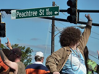
Peachtree Street is one of several major streets running through the city of Atlanta, Georgia, United States. Beginning at Five Points in downtown Atlanta, it runs North through Midtown; a few blocks after entering into Buckhead, the name changes to Peachtree Road at Deering Road. Much of the city's historic and noteworthy architecture is located along the street, and it is often used for annual parades,, as well as one-time parades celebrating events such as the 100th anniversary of Coca-Cola in 1986 and the Atlanta Braves' 1995 and 2021 World Series victories.

State Route 141 (SR 141) is a 34.1-mile-long (54.9 km) state highway that runs southwest-to-northeast in the northwest part of the U.S. state of Georgia. It connects the Buckhead area of Atlanta with Cumming. Its routing exists within portions of Fulton, DeKalb, Gwinnett, Forsyth counties.
There were several historic mills around the metro Atlanta area, for which many of its current-day roads are still named. Most of the mills date back to the 1820s and 1830s, and were built along the area's many streams. The locations of many of these mills are shown on a map of 1875 showing U. S. military operations around Atlanta in 1864. This map is now located in the U. S. Library of Congress but can be seen on the webpage linked here.
Historic ferries operated on rivers around Atlanta, Georgia area, and became namesakes for numerous current-day roads in north Georgia. Most of the ferries date to the early years of European-American settlement in the 1820s and 1830s, when parts of the region were still occupied by cherokee and other Native American communities.

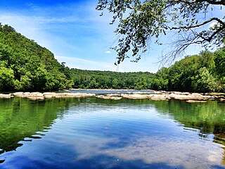
Sope Creek is an 11.6-mile-long (18.7 km) stream located in Cobb County, Georgia, United States. It is a significant tributary of the Chattahoochee River. It was known as Soap Creek during the 19th century. A section of Sope Creek runs through the Chattahoochee River National Recreation Area.
Through much of the 19th century, Pace's Ferry was an important ferry across the Chattahoochee River near Atlanta. Started in the early 1830s near Peachtree Creek, it was run by Hardy Pace, one of the city's founders. It was an important transportation link to northwestern Georgia, especially prior to the construction of the State Road to Chattanooga.

Peachtree Creek is a major stream in Atlanta. It flows for 7.5 miles (12.1 km) almost due west into the Chattahoochee River just south of Vinings.
Chattahoochee River National Recreation Area (CRNRA) preserves a series of sites between Atlanta and Lake Sidney Lanier along the Chattahoochee River in Georgia, U.S. The 48-mile (77 km) stretch of the river affords public recreation opportunities and access to historic sites. The national recreation area, a National Park Service unit, was established on August 15, 1978, by President Jimmy Carter.

State Route 140 (SR 140) is a 78.6-mile-long (126.5 km) state highway in the northwestern part of the U.S. state of Georgia. It connects the Armuchee and Peachtree Corners areas, within portions of Floyd, Bartow, Cherokee, Fulton, Gwinnett counties.

Johns Creek is a city in Fulton County, Georgia, United States. According to the 2020 census, the population was 82,453. The city is a northeastern suburb of Atlanta.

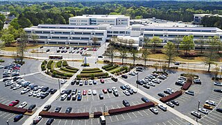
Peachtree Corners is a city in Gwinnett County, Georgia, United States. It is part of the Atlanta metropolitan area, and is the largest city in Gwinnett County with a population of 42,243 as of the 2020 US Census.

Metro Atlanta, designated by the United States Office of Management and Budget as the Atlanta–Sandy Springs–Roswell, GA Metropolitan Statistical Area, is the most populous metropolitan statistical area in the state of Georgia and the eighth-largest in the United States. Its economic, cultural, and demographic center is Atlanta, and its total population was 6,144,050 in the 2021 estimate from the U.S. Census Bureau.
The September 2009 Southeastern United States floods were a group of floods that affected several counties throughout northern Georgia, Tennessee, Alabama, Mississippi, and Arkansas. The worst flooding occurred across the Atlanta metropolitan area. Continuous rain, spawned by moisture pulled from the Gulf of Mexico, fell faster than the local watersheds could drain the runoff.

The Western Gwinnett Bikeway is a multi-use trail under construction along Peachtree Industrial Boulevard in Gwinnett County. The trail will be 10 feet to 14 feet wide and traverse the cities of Norcross, Peachtree Corners, Berkeley Lake, Duluth, Suwanee, Sugar Hill and Buford. It is intended to be the spine of West Gwinnett’s trails and greenways, connecting parks, trails, businesses, schools and neighborhoods to the urban core.

Rogers Bridge Park is a riverfront city park and dog park in Duluth, Georgia. It is a 16.98 acre park located in the northwestern quadrant of Duluth. The park is a few blocks north of Peachtree Industrial Boulevard on Rogers Bridge Road. Surrounding properties include an adjacent private event facility, a sand dredging facility, and single-family residential neighborhoods.