
Napa County is a county north of San Pablo Bay located in the northern portion of the U.S. state of California. As of the 2020 census, the population was 138,019. The county seat is the City of Napa. Napa County was one of the original counties of California, created in 1850 at the time of statehood. Parts of the county's territory were given to Lake County in 1861.

Ventura County is a county located in the southern part of the U.S. state of California. As of the 2020 census, the population was 843,843. The largest city is Oxnard, and the county seat is the city of Ventura.

Angwin is a census-designated place (CDP) in Napa County, California, best known as the site of Pacific Union College. It is part of the northern San Francisco Bay Area. The population was 3,051 at the 2010 census. Its area code is 707. Its two zip codes are 94508 and 94576. It is in the Pacific time zone.

Deer Park is a census-designated place (CDP) in Napa County, California, United States. The population was 1,267 at the 2010 census. It is part of the Napa, California Metropolitan Statistical Area. Its area code is 707. Its zip code is 94576. It is in the Pacific time zone. Deer Creek is where Elmshaven, a large Victorian home lived in by Ellen White in the early twentieth century, is located.

Napa is the largest city and county seat of Napa County and a principal city of Wine Country in Northern California, United States. Located in the North Bay region of the Bay Area, the city had a population of 77,480 as of the end of 2021. Napa is a major tourist destination in California, known for its wineries, restaurants, and arts culture.

Canyondam is a census-designated place (CDP) in Plumas County, California, United States. Canyondam is located near the dam that forms Lake Almanor, 6.25 miles (10.1 km) east-southeast of Almanor. The population was 31 as of the 2010 census, down from 37 as of the 2000 census. On August 6, 2021, the community was destroyed in the Dixie Fire.

Howell is a town located in the Blue Creek Valley in northeast Box Elder County, Utah, United States. The population was 245 at the 2010 census.

Bonny Doon is a census-designated place in Santa Cruz County, California. It is situated northwest of the city of Santa Cruz, considered part of the southern San Francisco Bay Area or northern Monterey Bay Area. Bonny Doon's population was 2,868, as reported by the 2020 census.

Pacific Union College (PUC) is a private Seventh-day Adventist liberal arts college in Angwin, California. It is the only four-year college in Napa County, and the twelfth oldest institution of higher education in California. As a coeducational residential college with an almost exclusively undergraduate student body, most of those who attend the college are four-year students living on campus.

Adin is a census-designated place in Modoc County, California. It is located 29 miles (47 km) southwest of Alturas, at an elevation of 4,203 feet (1,281 m). Its population is 205 as of the 2020 census, down from 272 from the 2010 census.

Berry Creek is a census-designated place about 25 miles (40 km) northeast of Oroville, California in hilly terrain at 2,000 feet (610 m) above mean sea level. The community is located along the Oroville-Quincy Highway on the shore of Madrone Lake. The community is home to Berry Creek Elementary School (K-8), 2 small mountain churches, 1 mini mart w/ gas, 1 small community park. Berry Creek is home to the annual Berry Festival which is held during August.

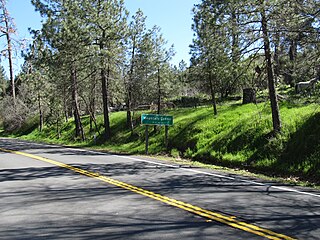
Pope Valley is an unincorporated community located in the small valley of the same name in the Vaca Mountains and northern Napa County, California.
Rutherford is a census-designated place (CDP) in Napa County, California, United States. The population was 164 at the 2010 census.
Virgil O. Parrett Field or Angwin Airport is a public use airport located one nautical mile (1.85 km) east of the central business district of Angwin, in Napa County, California, United States. It is owned by Pacific Union College. It is also known as Angwin–Parrett Field Airport. In 2006, a plan was floated for Pacific Union College to divest the field by selling it for $27 million to the County of Napa.
Mountain Center is an unincorporated community and census-designated place in the San Jacinto Mountains, within western central Riverside County, California.

The Vaca Mountains are a mountain range in Napa and Solano Counties, California that is one of the California Coast Ranges. They represent the easternmost of the Inner Coast Ranges in north−central California, and divide the Suisun Valley on their west, from the Sacramento Valley on their east.

Grizzly Flats is a census-designated place in El Dorado County, California. It is located southeast of Camino, at an elevation of 3868 feet (1179 m). Grizzly Flats is the town nearest to Baltic Peak, a small peak to the northwest. The population at the 2010 census was 1,066.
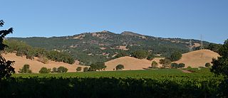
The Howell Mountains, which are also known as the Mt. George Range, are one of the California Coast Ranges. They divide the Suisun Valley on the east side, from Napa Valley on the west. Historically the southern part of the range has been referred to as both the Sierra de Suscol and as the Sierra de Napa.

The LNU Lightning Complex fires were a large complex of wildfires that burned during the 2020 California wildfire season across much of the Wine Country area of Northern California – Lake, Napa, Sonoma, Solano, and Yolo Counties, from August 17 to October 2, 2020. The complex was composed of numerous lightning-sparked fires, most of which were small. While they ignited separately from each other, the Hennessey Fire eventually grew to merge with the Gamble, Green, Markley, Spanish, and Morgan fires, scorching 192,000 acres (777 km2) by itself, for a total burn area of 363,220 acres (1,470 km2) in the complex. The fire, which burned in the hills surrounding several large cities, such as Fairfield, Napa, and Vacaville, destroyed 1,491 structures and damaged a further 232. In all, six people were killed and another five injured. The LNU Lightning Complex is the sixth-largest wildfire in the recorded history of California.

The August 2020 California lightning wildfires were a series of 650 wildfires that ignited across Northern California in mid-August 2020, due to a siege of dry lightning from rare, massive summer thunderstorms, which were caused by an unusual combination of very hot, dry air at the surface, dry fuels, and advection of moisture from the remains of Tropical Storm Fausto northward into the Bay Area. These fires burned between 1,500,000 acres (6,100 km2) to 2,100,000 acres (8,500 km2) within a 2–3 week period. The August 2020 lightning fires included three enormous wildfires: the SCU Lightning Complex, the August Complex, and the LNU Lightning Complex. On September 10, 2020, the August Complex set a record for the single-largest wildfire in the modern history of California, reaching a total area burned of 471,185 acres (1,907 km2). On September 11, the August Complex merged with the Elkhorn Fire, another massive wildfire of 255,039 acres (1,032 km2), turning the August Complex into a monster wildfire of 746,607 acres (3,021 km2).


