Borivali is a suburb and is located at the north-western end of Mumbai and has a large Gujarati population followed by others. Traditionally the tribals and East Indians lived in Borivali.

Thane district is a district in the Konkan Division of Maharashtra, India. At the 2011 Census it was the most populated district in the country, with 11,060,148 inhabitants; however, in August 2014 the district was split into two with the creation of a new Palghar district, leaving the reduced Thane district with a 2011 Census population of 8,070,032. The headquarters of the district is the city of Thane. Other major cities in the district are Navi Mumbai, Kalyan-Dombivli, Mira-Bhayander, Bhiwandi, Ulhasnagar, Ambarnath, Badlapur, Murbad and Shahapur.
Palghar is a town in the Konkan division of Maharashtra state, India and a municipal council. It is in the Mumbai Metropolitan Region, and since 2014 it has been the administrative capital of the Palghar district. Palghar lies on the Western Line of the Mumbai Suburban Railway in the busy Mumbai-Ahmedabad rail corridor. The town is located about 87 kilometers north of Mumbai, about 35 kilometers north of Virar and about 24 kilometers west of the Mumbai-Ahmedabad National Highway at Manor.
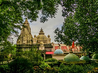
Nala Sopara or Nallasopara formerly known as Sopara or Supara, is a town within the Mumbai Metropolitan Region. The town lies in the Palghar district of Maharashtra, India and is governed by Vasai-Virar Municipal Corporation (VVMC). Nalla Sopara railway station is part of the Western Railway Zone.

Virar is a coastal city in taluka Vasai and district of Palghar, India. It is clubbed into Vasai-Virar city, administered by Vasai-Virar Municipal Corporation. It lies in south part of Palghar District in Vasai Taluka and north to the city of Mumbai. It is an important part of Palghar District, Because Palghar is the outermost part of northern side of Mumbai Metropolitan Region.

Osmanabad District is an administrative district in the Marathwada region in the Indian state of Maharashtra. The district headquarter is located at Osmanabad. The District of Osmanabad derives its name from the last ruler of Hyderabad, the 7th Nizam, Mir Osman Ali Khan, of which the region was a part till 1947. This region was earlier part of The Hyderabad State until Independence.This primarily rural district occupies an area of 7,569 km2 (2,922 sq mi) of which 241.4 km2 (93.2 sq mi) is urban and has a population of 1,657,576 of which 16.96% were urban.
Kudal is a census town in Sindhudurg district, Maharashtra, India. It is situated on River Karli in southwest Maharashtara. Kudal is the fourth largest town in Sindhudurg after Sawantwadi, Malvan and Kankavli. As of 2011, the population is 16,015. Kudal supports one MIDC area in the Konkan division. The Kudal railway station is located on the Konkan Railway route and connects the town with Mumbai (Bombay) metro situated in the Bombay, Baroda and Central India Railway of the north, and Mangalore on the south. It is a major stop for the Konkan Railway with many trains having a halt. The Deccan Odyssey train also stops in Kudal. National Highway 66 passes through Kudal. Apart from that, it also has two bus stations, a new one and old one. The old one is situated in market while the new one is just adjacent to the NH-66. Kudal is situated in centre of the Sindhudurg district and also considered one of the fastest-growing towns in the Konkan region. The Desai's were the original rulers of Kudal, who were tributaries of the Bijapur Sultanate, later the Marathas and then under the British.
Ambaji (Ambājī) is a census town in Banaskantha district in the state of Gujarat, India. It is known for its historical connections with sites of cultural heritage.

Dahanu is a coastal town and a municipal council in Palghar district of Maharashtra state in Konkan division. It is located 110 km from Mumbai city and hosts Adani Power’s thermal power station. It is the site of the currently stalled Wadhawan port project at Rewas.
Saphale is a town in Palghar Taluka in Palghar District in Maharashtra, India, north of the mouth of the Vaitarna River. According to Census 2011 information, the location code or village code of Saphale village is 552293. Pin code of saphale is 401102 post office : Umbarpada.It is situated 20 km away from sub-district headquarter Palghar. As per 2009 stats, Saphala is the gram panchayat of Saphale village. Gramin Shikshan Santha's Rajguru Hareshwar Mahadev Pandit Vidyalaya and Nikhil Rajan Gharat Mahavidyalaya, Late Chandraprabha Chittaranjan Shroff English medium school these are education firms in Saphale.
Vaijapur is a city and a municipal council in Aurangabad district in the Indian state of Maharashtra. It is bordered by the Nashik districts to the west, Kannad tehsil to the north, Gangapur tehsil to the east, and Ahmednagar districts to the south. Vaijapur is the headquarters of Vaijapur tehsil and also known as the Gateway of Marathwada.
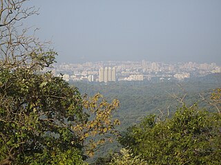
Vasai-Virar is an agglomeration of four previously governed municipal councils i.e. Vasai, Virar, Nala Sopara, and Navghar-Manikpur and a few villages on the west as well as the east of the congested city area. It lies in the Konkan division of Maharashtra, India.

Kshitij Thakur is an Indian politician, who is currently serving as a Member of Legislative Assembly from Bahujan Vikas Aghadi (BVA) representing Nalasopara constituency in the Maharashtra State Assembly, winning the seat third time consecutively since 2009.
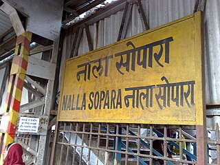
Nalla Sopara is a railway station on the Western line of the Mumbai Suburban Railway network, serving the town of Nala Sopara.
Vasai-Virar City Municipal Corporation (VVCMC) is the civic body that governs areas and villages in Vasai-Virar taluka in Maharashtra, India comprising the most populated part of Palghar district. According to the 2011 census, it is the fifth largest city in Maharashtra with a population of more than 1.3 million. The city is located 50 km north of Mumbai, on the north bank of Vasai Creek, part of the estuary of the Ulhas River. It was formed on 3 July 2010 by combining four municipal councils and 53 gram panchayats.
Boisar is the largest industrial suburb in the Mumbai Metropolitan Region in the Indian state of Maharashtra. It was originally a part of the Thane district before becoming a part of the Palghar district. It is approximately 111 kilometers away from the state capital Mumbai, and is 98 km (61 mi) from the union territory Daman. It is located in the district Palghar in Maharashtra.

Palghar District is a district in the state of Maharashtra in Konkan Division.
New Manor Town is an affordable housing project in the town of Manor, India. The housing complex is in close proximity to the industrial towns of Palghar and Boisar.

Tandulwadi Fort is located near Saphale, 104 km north of Mumbai. Tandulwadi is not a fully built up fort, but a series of structures spread over the top of the mountain. The fort dates back 800 years and was primarily used as a watch tower over the surrounding plains. At a height of 1524 feet, it has views of the surrounding towns of Saphale, the Zanzorli lake, and the confluence of the Surya and Vaitarna rivers.
The Delhi–Mumbai Expressway is a 1,350 km long, 8-lane wide under-construction access-controlled expressway connecting India's national capital New Delhi with its financial capital Mumbai. Foundation stone of the project was laid by union minister Nitin Gadkari in presence of Sushma Swaraj and Arun Jaitley on 8 March 2019. The total project value including the land acquisition cost is around ₹1,00,000 crores. An additional 31 km long spur will also be constructed by the NHAI from Noida International Airport in Jewar to Sector-65, Faridabad on this expressway.


