
Kivukoni is an administrative ward of the Ilala Municipical Council of the Dar es Salaam Region in Tanzania. Kivikoni's name come from the Swahili word meaning "a crossing place". The ward is bordered by Upanga East ward to the west, Kisutu ward to the southwest, and Kigamboni ward across the Kivukoni channel. The ward covers an area of 2.387 km2 (0.922 sq mi). Kivukoni ward is one of the most important wards in the country, as it is home to the Ikulu, which is the home of the president of Tanzania. Kivukoni ward is also home to the National Museum of Tanzania. According to the 2012 census, the ward had a total population of 6,742.

Kigogo is an administrative ward in Kinondoni District of the Dar es Salaam Region in Tanzania. Mburahati and Mabibo of Ubungo MC border the ward on the north and west, respectively. The ward is bordered to the east by the Mzimuni and Mchikichini of Ilala MC. The ward is bordered to the south by the wards of Ilala, Buguruni, and Tabata of Ilala MC. According to the 2012 census, the ward has a population of 57,613.
Msasani is an administrative ward in Kinondoni District of the Dar es Salaam Region in Tanzania. The ward is bordered to the north and east by the Indian Ocean. Kinondoni, Hananasif and Kivukoni ward of Ilala MC border the ward to the south. Lastly, Mikocheni and Kawe to the west. Msasani is named after Medieval Swahili settlement that used to exist in the ward. According to the 2012 census, the ward has a population of 48,920.

Gerezani is an administrative ward of the Ilala Municipical Council of the Dar es Salaam Region in Tanzania. The Kariakoo and Mchikichini wards border the ward on its northern side. The ward is bordered by Mchafukoge to the east. Ilala ward borders the ward to the west. The ward is bordered to the south by the Keko and Kurasini wards of the Temeke District. Before 1940, the Gerezani ward was constructed for Railways Corporation's White employees. The Mkuki Mall and the Jakaya M. Kiwete Youth Park are located in the Gerezani ward. According to the 2012 census, the ward has a total population of 7,276.

Ilala or Ilala Ward is an administrative ward of the Ilala District of the Dar es Salaam Region in Tanzania. The Kigogo ward of the Kinondoni District borders the ward to the north, and the Mchikichini and Gerezani wards to the east. The Temeke District wards of Keko, Chang'ombe, and Temeke border the ward to the south. Buguruni encircles the ward to the west. In 2016 the Tanzania National Bureau of Statistics report there were 38,923 people in the ward, from 31,083 in 2012.

Jangwani is an administrative ward of the Ilala Municipical Council of the Dar es Salaam Region in Tanzania. The Upanga East and Upanga West wards border the ward on its northern side. The ward is bordered by Mchafukoge and Kisutu to the east. Mchikichini ward borders the ward to the west. The ward is bordered to the south by the Kariakoo ward. According to the 2012 census, the ward has a total population of 17,647.

Kipawa is an administrative ward of the Ilala Municipical Council of the Dar es Salaam Region in Tanzania. Segerea and Kinyerezi border the ward on its northern border. The ward is bordered by Kiwalani to the east. By Kivule, Kitunda, and Yombo Vituka of Temeke MC to the south. Ukonga borders the ward on its western side. According to the 2012 census, the ward has a total population of 74,180.

Kisutu is an administrative ward of the Ilala Municipical Council of the Dar es Salaam Region in Tanzania. Upanga East ward and Kivukoni ward both border the ward to the north and north-east. The ward is bordered to the south by Mchafukoge ward and to the west by Jangwani ward. The ward hosts the Channel 10 Television Station formerly known as Dar es Salaam Television Station at Zaramo Street in Kisutu ward. In 2016 the Tanzania National Bureau of Statistics report there were 10,404 people in the ward, from 8,308 in 2012.

Kiwalani is an administrative ward of the Ilala Municipical Council of the Dar es Salaam Region in Tanzania. Vingunguti and Kipawa form the ward's northern and western boundaries, respectively. Temeke MC's Sandali to the east and Temeke MC's Kilakala and Yombo Vituka to the south encircle the ward. According to the 2012 census, the ward has a total population of 82,292.

Mchafukoge is an administrative ward and district capital of the Ilala district in the Dar es Salaam Region of Tanzania. Kisutu and Kivukoni wards form the ward's northern boundary. The Dar es Salaam Harbor forms its eastern border. The Temeke District wards of Kurasini and Keko border it on the south. Kariakoo and Jangwani wards border the ward to the west. The ward is home to the Uhuru Monument, the Central Railway Station, and the headquarters for Tanzania Revenue Authority at Mapato House. In 2016 the Tanzania National Bureau of Statistics reported there were 13,384 people in the ward, from 10,688 in 2012.

Mchikichini is an administrative ward of the Ilala Municipical Council of the Dar es Salaam Region in Tanzania. Upanga West forms the ward's northern boundary. Its eastern border is formed by Jangwani and Kariakoo. The ward is bordered to the south by the Gerezani and Ilala wards. The Kinondoni District wards of Kigogo, Magomeni, and Mzimuni border it on the west. The ward is home to the Karume Market, one of the largest markest in the city. According to the 2012 census, the ward has a total population of 25,510.
Upanga West is an administrative ward of the Ilala Municipical Council of the Dar es Salaam Region in Tanzania. Hananasif of Kinondoni is the northern boundary of the ward. Upanga East borders the ward on the east, and Mchikichini, Mzimuni, and Jangwani border it on the south. Magomeni of Kinondoni, borders the ward to the west. The ward is home to the largest hospital in the country, Muhimbili Hospital. The ward is also home of the Union Sports Club. According to the 2012 census, the ward has a total population of 13,476.

Vingunguti is an administrative ward of the Ilala Municipical Council of the Dar es Salaam Region in Tanzania. Kiwalani, Sandali, and Temeke, the latter two of which are in Temeke MC, form the ward's southern border. The ward is bounded by Tabata to the north and Buguruni to the east. Segerea and Kipawa wards border the ward on its western side. The largest tea producing facility in the nation, Chai Bora, is located within Vingunguti. According to the 2012 census, the ward has a total population of 106,946.

Charambe is an administrative ward in the Temeke district of the Dar es Salaam Region of Tanzania. North of the ward, Kuburugwa and Mbagala form its borders. Mianzini ward is to the east and south. Ilala MC's Kitunda Ward lies to the west together with Chamazi. According to the 2012 census, the ward has a total population of 101,933.
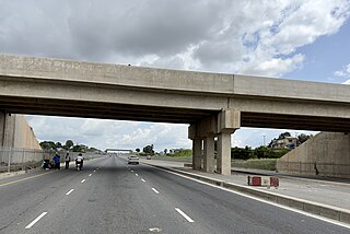
Vijibweni is an administrative ward in the Kigamboni district of the Dar es Salaam Region of Tanzania. The Tungi and Mjimwema form the ward's northern and eastern borders, respectively. In the Temeke District, it is bordered to the south by Kibada and to the west by Kijichi, Mtoni, and Kurasini. Kurasini is connected to Vijibweni by the iconic Nyerere Bridge. With seven major firms situated there, Vijibweni is home to the largest manufacturing industries in the entire District. In 2016 the Tanzania National Bureau of Statistics report there were 36,327 people in the ward, from 29,010 in 2012.

Gongolamboto or also Gongo la Mboto is an administrative ward of the Ilala Municipical Council of the Dar es Salaam Region in Tanzania. Kinyerezi ward encircles the ward on its northern side. Ukonga is to the east, and Majohe Ward is to the south. Pugu is to the west. The ward is unfortunately known for the 2011 Dar es Salaam explosions. In old colonial maps the area is spelled Kongoramboto. According to the 2012 census, the ward has a total population of 57,312.

Kimanga is an administrative ward of the Ilala Municipical Council of the Dar es Salaam Region in Tanzania. The wards of Ubungo MC are bordered to the north by the wards of Makuburi and Kimara. The ward is bordered by Segerea to the south and Tabata to the east. Kinyerezi borders the ward on its western side. According to the 2012 census, the ward has a total population of 78,557.

Kivule is an administrative ward of the Ilala Municipical Council of the Dar es Salaam Region in Tanzania. Ukonga and Kipawa border the ward's northern boundary. Kitunda borders the east of the ward. Chamazi and Msongola are in the south; the former is located in Temeke MC. Majohe is to the west. According to the 2012 census, the ward has a total population of 72,032.
Msigani is an administrative ward in Ubungo District of the Dar es Salaam Region in Tanzania. Mbezi forms the northern boundary of the ward. The ward is bordered with Saranga to the east. The Kinyerezi ward of Ilala MC is to the south. Kwembe is to the west. According to the 2012 census, the ward has a total population of 34,123.

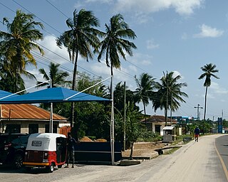
Kigamboni is an administrative ward of Kigamboni District in the Dar es Salaam Region of Tanzania. The Indian Ocean borders the ward to the east, Tungi borders it to the south, and Dar es Salaam harbor borders it to the west. The Kivukoni Ward in Ilala District, which is across the harbor mouth, borders the ward to the north. According to the 2012 census, the ward has a total population of 30,496.


