Radar is a system that uses radio waves to determine the distance (ranging), direction, and radial velocity of objects relative to the site. It is a radiodetermination method used to detect and track aircraft, ships, spacecraft, guided missiles, motor vehicles, map weather formations, and terrain.

A Doppler radar is a specialized radar that uses the Doppler effect to produce velocity data about objects at a distance. It does this by bouncing a microwave signal off a desired target and analyzing how the object's motion has altered the frequency of the returned signal. This variation gives direct and highly accurate measurements of the radial component of a target's velocity relative to the radar. The term applies to radar systems in many domains like aviation, police radar detectors, navigation, meteorology, etc.

Millimeter-wave cloud radars, also denominated cloud radars, are radar systems designed to monitor clouds with operating frequencies between 24 and 110 GHz. Accordingly, their wavelengths range from 1 mm to 1.11 cm, about ten times shorter than those used in conventional S band radars such as NEXRAD.

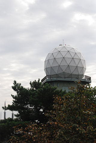
NEXRAD or Nexrad is a network of 159 high-resolution S-band Doppler weather radars operated by the National Weather Service (NWS), an agency of the National Oceanic and Atmospheric Administration (NOAA) within the United States Department of Commerce, the Federal Aviation Administration (FAA) within the Department of Transportation, and the U.S. Air Force within the Department of Defense. Its technical name is WSR-88D.

Weather radar, also called weather surveillance radar (WSR) and Doppler weather radar, is a type of radar used to locate precipitation, calculate its motion, and estimate its type. Modern weather radars are mostly pulse-Doppler radars, capable of detecting the motion of rain droplets in addition to the intensity of the precipitation. Both types of data can be analyzed to determine the structure of storms and their potential to cause severe weather.

The history of radar started with experiments by Heinrich Hertz in the late 19th century that showed that radio waves were reflected by metallic objects. This possibility was suggested in James Clerk Maxwell's seminal work on electromagnetism. However, it was not until the early 20th century that systems able to use these principles were becoming widely available, and it was German inventor Christian Hülsmeyer who first used them to build a simple ship detection device intended to help avoid collisions in fog. True radar, such as the British Chain Home early warning system provided directional information to objects over short ranges, were developed over the next two decades.
A pulse-Doppler radar is a radar system that determines the range to a target using pulse-timing techniques, and uses the Doppler effect of the returned signal to determine the target object's velocity. It combines the features of pulse radars and continuous-wave radars, which were formerly separate due to the complexity of the electronics.
The National Severe Storms Laboratory (NSSL) is a National Oceanic and Atmospheric Administration (NOAA) weather research laboratory under the Office of Oceanic and Atmospheric Research. It is one of seven NOAA Research Laboratories (RLs).

The Aggie Doppler Radar (ADRAD) is a Doppler weather radar located on the roof of the Eller Oceanography & Meteorology Building on the Texas A&M University campus in College Station, Texas.
The J.S. Marshall Radar Observatory is a McGill University facility in Sainte-Anne-de-Bellevue, Quebec, Canada housing several weather radars and other meteorological sensors, many of them running around the clock. It is one of the components of the McGill Atmospheric and Oceanic Sciences department where students in remote sensing perform their research. The main radar was part of the Canadian weather radar network, on contract with the Meteorological Service of Canada, as well as a research device, up to October 3, 2018.

The Canadian weather radar network consists of 33 weather radars spanning Canada's most populated regions. Their primary purpose is the early detection of precipitation, its motion and the threat it poses to life and property.

ARMOR Doppler weather radar is a C-Band, Dual-Polarimetric Doppler Weather Radar, located at the Huntsville International Airport in Huntsville, Alabama. The radar is a collaborative effort between WHNT-TV and the University of Alabama in Huntsville. Live data for the radar is only available to a limited audience, such as UAH employees and NWS meteorologists. All ARMOR data is archived at the National Space Science and Technology Center located on the UAH campus.
A radar system uses a radio-frequency electromagnetic signal reflected from a target to determine information about that target. In any radar system, the signal transmitted and received will exhibit many of the characteristics described below.
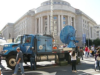
Doppler on Wheels is a fleet of X-band and C-band mobile and quickly-deployable truck-borne radars which are the core instrumentation of the Flexible Array of Radars and Mesonets affiliated with the University of Illinois and led by Joshua Wurman, with the funding partially provided by the National Science Foundation (NSF), as part of the "Community Instruments and Facilities," (CIF) program. The DOW fleet and its associated Mobile Mesonets and deployable weather stations have been used throughout the United States since 1995, as well as occasionally in Europe and Southern America. The Doppler on Wheels network has deployed itself through hazardous and challenging weather to gather data and information that may be missed by conventional stationary radar systems.

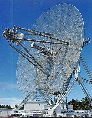
The AN/FPS-16 is a highly accurate ground-based monopulse single object tracking radar (SOTR), used extensively by the NASA crewed space program, the U.S. Air Force and the U.S. Army. The accuracy of Radar Set AN/FPS-16 is such that the position data obtained from point-source targets has azimuth and elevation angular errors of less than 0.1 milliradian and range errors of less than 5 yards (5 m) with a signal-to-noise ratio of 20 decibels or greater.
Radar engineering is the design of technical aspects pertaining to the components of a radar and their ability to detect the return energy from moving scatterers — determining an object's position or obstruction in the environment. This includes field of view in terms of solid angle and maximum unambiguous range and velocity, as well as angular, range and velocity resolution. Radar sensors are classified by application, architecture, radar mode, platform, and propagation window.

A tornadic vortex signature, abbreviated TVS, is a Pulse-Doppler radar weather radar detected rotation algorithm that indicates the likely presence of a strong mesocyclone that is in some stage of tornadogenesis. It may give meteorologists the ability to pinpoint and track the location of tornadic rotation within a larger storm, and is one component of the National Weather Service's warning operations.

OU-PRIME was an advanced Doppler weather radar. It was completed in January 2009 after a ten-month construction period and commissioned on April 4, 2009. It was operated by the Advanced Radar Research Center (ARRC) at the University of Oklahoma (OU). The radar was manufactured by Enterprise Electronics Corporation to provide OU students and faculty a platform for research and education in the field of radar meteorology. This C-band polarimetric radar has some of the highest resolution data of any C-band weather radar in the United States.
The Korea Meteorological Administration is the national meteorological service of the Republic of Korea. The service started in 1904 joining the WMO in 1956. Numerical Weather Prediction is performed using the Unified Model software suite.

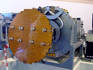
Multifunction Phased Array Radar (MPAR) was an experimental Doppler radar system that utilized phased array technology. MPAR could scan at angles as high as 60 degrees in elevation, and simultaneously track meteorological phenomena, biological flyers, non-cooperative aircraft, and air traffic. From 2003 through 2016, there was one operational MPAR within the mainland United States—a repurposed AN/SPY-1A radar set loaned to NOAA by the U.S. Navy. The MPAR was decommissioned and removed in 2016.

