
Los Angeles County, officially the County of Los Angeles, and sometimes abbreviated as L.A. County, is the most populous county in the United States, with 9,861,224 residents estimated in 2022. Its population is greater than that of 40 individual U.S. states. Comprising 88 incorporated cities and many unincorporated areas within a total area of 4,083 square miles (10,570 km2), it is home to more than a quarter of Californians and is one of the most ethnically diverse U.S. counties. The county's seat, Los Angeles, is the second most populous city in the United States, with about 3.9 million residents. Being the home of the U.S. motion-picture industry, since its inception in the early 20th century, has given the county global prominence.
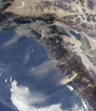
The Santa Ana winds are strong, extremely dry downslope winds that originate inland and affect coastal Southern California and northern Baja California. They originate from cool, dry high-pressure air masses in the Great Basin.

Pasadena is a city in Los Angeles County, California, United States, 11 miles (18 km) northeast of downtown Los Angeles. It is the most populous city and the primary cultural center of the San Gabriel Valley. Old Pasadena is the city's original commercial district.

Altadena is an unincorporated area and census-designated place in the Verdugo Mountains region of Los Angeles County, California, approximately 14 miles (23 km) from the downtown Los Angeles Civic Center, and directly north of the city of Pasadena, California. The population was 42,777 at the 2010 census, up from 42,610 at the 2000 census.

Sierra Madre is a city in Los Angeles County, California, whose population was 10,917 at the 2010 U.S. Census, up from 10,580 at the time of the 2000 U.S. Census. The city is in the foothills of the San Gabriel Valley below the southern edge of the Angeles National Forest. Pasadena and Altadena are to its west, with Arcadia to its south and east. Sierra Madre is known as "Wisteria City", and its city seal is decorated with a drawing of the now widely known 500-foot (150 m) vine. It is also called the "Village of the Foothills" and was an All-America City in 2007.
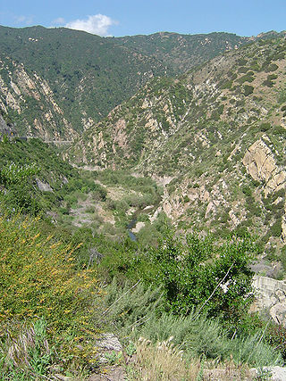
The Santa Monica Mountains is a coastal mountain range in Southern California, next to the Pacific Ocean. It is part of the Transverse Ranges. The Santa Monica Mountains National Recreation Area encompasses this mountain range. Because of its proximity to densely populated regions, it is one of the most visited natural areas in California.
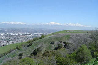
The San Gabriel Valley, often referred to by its initials as SGV, is one of the principal valleys of Southern California, lying immediately to the east of the eastern limits of the city of Los Angeles and occupying the vast majority of the southeastern part of Los Angeles County. Surrounding landforms and other features include the following:
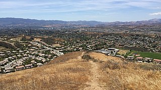
The Santa Clarita Valley (SCV) is part of the upper watershed of the Santa Clara River in Southern California. The valley was part of the 48,612-acre (19,673 ha) Rancho San Francisco Mexican land grant. Located in Los Angeles County, its main population center is the city of Santa Clarita which includes the communities of Canyon Country, Newhall, Saugus, and Valencia. Adjacent unincorporated communities include Castaic, Stevenson Ranch, Val Verde, and the unincorporated parts of Valencia.

The Arroyo Seco, meaning "dry stream" in Spanish, is a 24.9-mile-long (40.1 km) seasonal river, canyon, watershed, and cultural area in Los Angeles County, California. The area was explored by Gaspar de Portolà who named the stream Arroyo Seco as this canyon had the least water of any he had seen. During this exploration he met the Chief Hahamog-na (Hahamonga) of the Tongva Indians.

The Verdugo Mountains, also known as the Verdugo Hills or simply The Verdugos, are a small, rugged mountain range of the Transverse Ranges system in Los Angeles County, California. Located just south of the western San Gabriel Mountains, the Verdugo Mountains region incorporates the cities of Burbank, Glendale, Pasadena, and La Cañada Flintridge; the unincorporated communities of Altadena and La Crescenta-Montrose; as well as the City of Los Angeles neighborhood of Sunland-Tujunga.
Foothill Boulevard is a major road in the city and county of Los Angeles, as well as an arterial road in the city and county of San Bernardino, stretching well over 60 miles (97 km) in length, with some notable breaks along the route. Like its name implies, Foothill Boulevard runs across the foothills of the San Gabriel and San Bernardino Mountains.
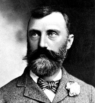
Abbot Kinney was an American developer, conservationist, water supply expert and tree expert. Kinney is best known for his "Venice of America" development in Los Angeles.

Eaton Canyon is a major canyon beginning at the Eaton Saddle near Mount Markham and San Gabriel Peak in the San Gabriel Mountains in the Angeles National Forest, United States. Its drainage flows into the Rio Hondo river and then into the Los Angeles River. It is named after Judge Benjamin S. Eaton, who lived in the Fair Oaks Ranch House in 1865 not far from Eaton Creek.
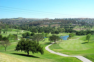
Anaheim Hills is a planned community encompassing the eastern portions of the city of Anaheim, in Orange County, California.
The Southern California Association of Governments (SCAG) is the Metropolitan Planning Organization (MPO) of six of the ten counties in Southern California, serving Imperial County, Los Angeles County, Orange County, Riverside County, San Bernardino County, and Ventura County. San Diego County's MPO is the San Diego Association of Governments, which is an unrelated agency.
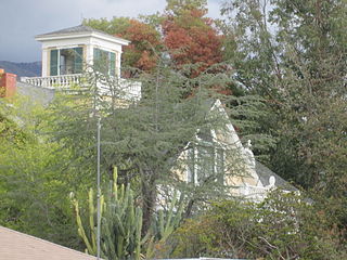
Crank House, also known as Fair Oaks Ranch, is an 1882 Victorian style residence in Altadena, Los Angeles County, California. The house was placed on the National Register of Historic Places in 1997 for its association with the early settlement of Altadena. (site #97000751). The house has notably featured in films such as Hocus Pocus, Matilda, Scream 2 and Catch Me If You Can.

Pasadena is a city in Los Angeles County, California, United States. Founded in 1874 and incorporated in 1886, the city is famous for its colorful history and for the hosting of both the Tournament of Roses Parade and the annual Rose Bowl game football game. It is also the home of the world-renowned California Institute of Technology (Caltech) and Jet Propulsion Laboratory (JPL)

The Tick Fire was a wildfire that burned in Los Angeles County, California. The fire broke out on October 24, 2019, and burned several thousand acres. The fire forced the mass evacuation of 40,000 people from the Santa Clarita Valley.
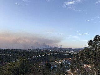
The Silverado Fire was a wildfire that burned in October and November 2020 in southern Orange County, California northeast of Irvine. The fire started on October 26 around 6:47 AM near Orange County Route S-18 and Silverado Canyon Road, fueled by strong Santa Ana winds gusting up to 80 miles per hour (130 km/h) and low humidity. Orange County Fire Authority Chief Brian Fennessy stated, "The winds were extraordinary even by Santa Ana standards. Fire spread is exceeding more than anything I've seen in my 44 years." The fire initially moved south from Loma Ridge toward the Orchard Hills, Northwood and Portola Springs communities of Irvine before moving southeast through Limestone Canyon and toward the communities of Foothill Ranch and Lake Forest. The fire burned in a path similar to that taken by the 2007 Santiago Fire, mostly through terrain that had not seen significant burning in the 13 years since that fire. 100% containment was announced on November 7, 2020.

The Kinneloa Fire was a destructive wildfire in October 1993 in Los Angeles County, California. The fire burned 196 structures in the San Gabriel Mountains foothill communities of Altadena, Kinneloa Mesa, and Sierra Madre. At the time, it was the 12th most destructive wildfire in recorded California history, and though it has since fallen well out of the top 20 statewide, it remains one of the most destructive wildfires in the history of Los Angeles County. The fire resulted in one fatality and a multitude of minor injuries: one person died of pneumonia complicated by smoke inhalation, and two indirect deaths resulted from debris flows in the burn area more than four months later.


