Kitty Hawk, North Carolina

Last updated

Kitty Hawk, North Carolina
Wright Brothers National Memorial, Kitty Hawk, North Carolina, USA.jpg
Kitty Hawk, NC Town Flag.gif
Kitty Hawk, NC Town Seal.png
Motto: 
"First in Flight"
Dare County North Carolina incorporated and unincorporated areas Kitty Hawk highlighted.svg
Location in Dare County and the state of North Carolina.
Coordinates: 36°4′37″N75°42′17″W / 36.07694°N 75.70472°W / 36.07694; -75.70472
Country United States
State North Carolina
County Dare
Incorporated1981 [1]
Named for Chickehauk
Area
[2]
  Total8.29 sq mi (21.46 km2)
  Land8.12 sq mi (21.03 km2)
  Water0.17 sq mi (0.43 km2)
Elevation
[3]
7 ft (2 m)
Population
 (2020)
  Total3,689
  Density454.37/sq mi (175.44/km2)
Time zone UTC-5 (Eastern (EST))
  Summer (DST) UTC-4 (EDT)
ZIP code
27949
Area code 252
FIPS code 37-36060 [4]
GNIS feature ID1021059 [3]
Website www.kittyhawknc.gov
Historical population
CensusPop.Note
1990 1,937
2000 2,99154.4%
2010 3,2729.4%
2020 3,70813.3%
2021 (est.)3,761 [5] 1.4%
sources: [6] [7]

Kitty Hawk is a town in Dare County, North Carolina, on Bodie Island, part of what is known as the state's Outer Banks. [8] The population was 3,708 at the 2020 census. [5] It was established in the early 18th century as Chickahawk.

Contents

History

The name Kitty Hawk is derived from the native Algonquin Native American language word Chickahawk, meaning "a place to hunt geese". [9]

Kitty Hawk became world-famous after the Wright brothers made the first controlled powered airplane flights at Kill Devil Hills, four miles (6.4 km) south of the town, on December 17, 1903. After the four flights in their Wright Flyer , the brothers walked back to Kitty Hawk. Here, they sent a telegram from the Weather Bureau office to their father informing him of their success. [10] Kitty Hawk is usually credited as the site of the powered flights because it was the nearest named settlement at the time of the flight; the modern town of Kill Devil Hills did not exist until 50 years after the flights. The Wrights chose the area because its frequent winds and soft sandy surfaces were suitable for their glider experiments, which they conducted over three years before they made the powered flights.

The Old Currituck Sound Bridge was completed in 1930, which connected the mainland to the Outer Banks across Albemarle Sound, prompting the paving of a road between the two existing bridges (the other in Manteo) and connecting the Outer Banks to the outside world by road for the first time. [11]

The aircraft carrier USS Kitty Hawk (CV-63), the B-2 Spirit stealth bomber AV-19 with an aircraft number of 93–1086, P-40D Kittyhawk fighter aircraft, the aircraft transport ship USS Kitty Hawk (AKV-1), and the Apollo 14 command module have been named for the town, which incorporated in 1981. [8]

The Kitty Hawk Life-Saving Station was listed on the National Register of Historic Places in 1984. [12]

Geography

Kitty Hawk is located at 36°06′N75°42′W / 36.1°N 75.7°W / 36.1; -75.7 at an elevation of 7 feet (2 m) above sea level.

According to the United States Census Bureau, the town has a complete area of 8.23 square miles (21.3 km2), of which 8.18 square miles (21.2 km2) is land and 0.0476 square miles (0.123 km2) (0.579%) is water. [13]

Kitty Hawk is served by U.S. Route 158 and Highway 12, which parallel each other in the city. US 158 can be used to go west, while the barrier islands extend north and south.

Demographics

2000 census

As of the census [4] of 2000, there were 2,991 people, 1,265 households, and 866 families residing in the town. The population density was 365.8 people per square mile (141.2 people/km2). There were 2,618 housing units at an average density of 320.1 per square mile (123.6/km2). The racial makeup of the town was 98.13% White, 0.64% African American, 0.23% Native American, 0.27% Asian, 0.03% Pacific Islander, 0.20% from other races, and 0.50% from two or more races. 0.94% of the population were Hispanic or Latino of any race.

There were 1,265 households, out of which 27.9% had children under the age of 18 years living with them, 58.7% were married couples living together, 7.3% had a female householder with no husband present, and 31.5% were non-families. 23.8% of all tribes were made up of individuals, and 8.0% had someone living alone who was 65 years of age or older. The average household size was 2.35 and the average family size was 2.79.

In the town, the population was spread out, with 21.5% under the age of 18, 5.7% from 18 to 24, 31.6% from 25 to 44, 28.3% from 45 to 64, and 13.0% who were 65 years of age or older. The median age was 41 years. For every 100 girls, there were 103.7 boys. For every 100 girls age 18 and over, there were 97.6 boys.

The median income for a household in the town was $42,813, and the median income for a family was $48,676. Males had a median income of $31,250 versus $25,744 for females. The per capita income for the town was $22,960. About 4.3% of families and 6.5% of the population were below the poverty line, including 7.9% of people under age 18 and 4.6% of people age 65 or over.

2020 census

Kitty Hawk racial composition [14]
RaceNumberPercentage
White (non-Hispanic)3,32490.11%
Black or African American (non-Hispanic)180.49%
Native American 40.11%
Asian 250.68%
Pacific Islander 30.08%
Other/Mixed 1343.63%
Hispanic or Latino 1814.91%

As of the 2020 United States census, there were 3,689 people, 1,532 households, and 1,073 families residing in the town.

Politics

Federally, Kitty Hawk is part of North Carolina's 3rd congressional district, represented by Republican Greg Murphy since 2019.

Sister city

Climate

According to the Trewartha climate classification system, Kitty Hawk, North Carolina has a humid subtropical climate with hot and humid summers, cool winters and year-around precipitation (Cfak). Cfak climates are characterized by all months having an average mean temperature > 32.0 °F (> 0.0 °C), at least eight months with an average mean temperature ≥ 50.0 °F (≥ 10.0 °C), at least one month with an average mean temperature ≥ 71.6 °F (≥ 22.0 °C) and no significant precipitation difference between seasons. During the summer months in Kitty Hawk, a cooling afternoon sea breeze is present on most days, but episodes of extreme heat and humidity can occur with heat index values ≥ 100 °F (≥ 38 °C). Kitty Hawk is prone to hurricane strikes, particularly during the Atlantic hurricane season which extends from June 1 through November 30, sharply peaking from late August through September. During the winter months, episodes of cold and wind can occur with wind chill values < 10 °F (< -12 °C). The plant hardiness zone in Kitty Hawk is 8b with an average annual extreme minimum air temperature of 16.6 °F (−8.6 °C). [15] The average seasonal (Dec–Mar) snowfall total is < 2 inches (< 5 cm), and the average annual peak in nor'easter activity is in February.

Climate data for Kitty Hawk, NC (1981-2010 Averages)
MonthJanFebMarAprMayJunJulAugSepOctNovDecYear
Mean daily maximum °F (°C)50.2
(10.1)
51.9
(11.1)
57.3
(14.1)
65.5
(18.6)
73.0
(22.8)
80.4
(26.9)
84.3
(29.1)
83.0
(28.3)
78.3
(25.7)
70.3
(21.3)
62.3
(16.8)
54.0
(12.2)
67.6
(19.8)
Daily mean °F (°C)43.8
(6.6)
45.4
(7.4)
50.3
(10.2)
58.5
(14.7)
66.5
(19.2)
74.9
(23.8)
79.2
(26.2)
78.4
(25.8)
73.8
(23.2)
64.9
(18.3)
56.3
(13.5)
47.6
(8.7)
61.7
(16.5)
Mean daily minimum °F (°C)37.4
(3.0)
38.8
(3.8)
43.4
(6.3)
51.5
(10.8)
60.1
(15.6)
69.4
(20.8)
74.1
(23.4)
73.8
(23.2)
69.2
(20.7)
59.5
(15.3)
50.3
(10.2)
41.2
(5.1)
55.8
(13.2)
Average precipitation inches (mm)4.23
(107)
3.50
(89)
3.86
(98)
3.41
(87)
3.73
(95)
4.29
(109)
4.97
(126)
5.94
(151)
5.26
(134)
3.79
(96)
3.68
(93)
3.71
(94)
50.37
(1,279)
Average relative humidity (%)69.969.567.467.670.273.975.374.773.571.172.071.771.4
Average dew point °F (°C)34.6
(1.4)
36.0
(2.2)
39.9
(4.4)
47.8
(8.8)
56.5
(13.6)
66.0
(18.9)
70.7
(21.5)
69.7
(20.9)
64.8
(18.2)
55.3
(12.9)
47.4
(8.6)
38.9
(3.8)
52.4
(11.3)
Source: PRISM [16]


Climate data for Duck, NC Ocean Water Temperature (8 N Kitty Hawk)
MonthJanFebMarAprMayJunJulAugSepOctNovDecYear
Daily mean °F (°C)45
(7)
44
(7)
46
(8)
59
(15)
67
(19)
74
(23)
71
(22)
74
(23)
75
(24)
69
(21)
59
(15)
52
(11)
61
(16)
Source: NOAA [17]

Ecology

According to the A. W. Kuchler U.S. potential natural vegetation types, Kitty Hawk, North Carolina would have a dominant vegetation type of Live oak/Sea Oats Uniola paniculata (90) with a dominant vegetation form of Coastal Prairie (20). [18]

Education

Dare County Schools operates public schools serving the area. Kitty Hawk Elementary School is in the city. [19]

The zoned secondary schools are First Flight Middle School and First Flight High School. [20] Prior to 2004 First Flight High zoned students were zoned to Manteo High School. [21]

Related Research Articles

<span class="mw-page-title-main">Dare County, North Carolina</span> County in North Carolina, United States

Dare County is the easternmost county in the U.S. state of North Carolina. As of the 2020 census, the population was 36,915. Its county seat is Manteo.

<span class="mw-page-title-main">Lake View, Iowa</span> City in Iowa, United States

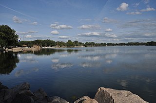
Lake View is a city in Sac County, Iowa, United States. The population was 1,113 in the 2020 census, a decline from the 1,278 population in 2000.

<span class="mw-page-title-main">Kill Devil Hills, North Carolina</span> Town in North Carolina, United States

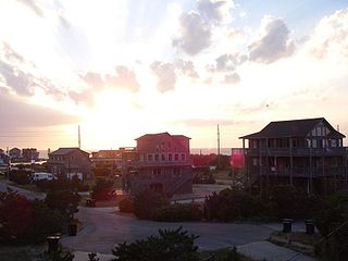
Kill Devil Hills is a town in Dare County, North Carolina, United States. The population was 7,633 at the 2020 census, up from 6,683 in 2010. It is the most populous settlement in both Dare County and on the Outer Banks of North Carolina. The Kill Devil Hills Micropolitan Statistical Area is part of the larger Virginia Beach-Norfolk, VA-NC Combined Statistical Area.

<span class="mw-page-title-main">Nags Head, North Carolina</span> Town in North Carolina, United States

Nags Head is a town in Dare County, North Carolina, United States. It is a busy vacation spot because of its beaches and sand dunes of Jockey's Ridge. The population was 3,146 at the 2020 census.

<span class="mw-page-title-main">Southern Shores, North Carolina</span> Town in North Carolina, United States

Southern Shores is a town in Dare County, North Carolina, United States. It is located on the Outer Banks and the population was 3,107 at the 2020 census.

<span class="mw-page-title-main">Clayton, North Carolina</span> Town in North Carolina, United States

Clayton is a town in Johnston County, North Carolina, United States, and is considered a satellite town of Raleigh. As of 2010, Clayton's population was 16,116, up from 6,973 at the 2000 census. By 2019 the town's estimated population was 24,887. Much of that growth can be attributed to the town's proximity to the Research Triangle area and access to major highways such as I-40 and US 70.

<span class="mw-page-title-main">Langhorne Manor, Pennsylvania</span> Borough in Pennsylvania, United States

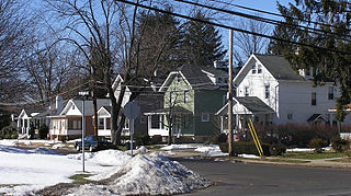
Langhorne Manor is a borough in Bucks County, Pennsylvania, United States. The population was 1,422 at the 2010 census, a 55.6% increase from the 2000 census. The mayor of Langhorne Manor is Bob Byrne.

<span class="mw-page-title-main">Riegelsville, Pennsylvania</span> Borough in Pennsylvania, United States

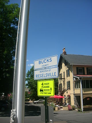
Riegelsville is a borough in Bucks County, Pennsylvania, United States. The population was 868 at the 2010 census. It is included in the Philadelphia–Wilmington–Camden metropolitan statistical area, despite being so closely connected to the Lehigh Valley.

<span class="mw-page-title-main">Coolbaugh Township, Pennsylvania</span> Place in Pennsylvania, United States

Coolbaugh Township is a township in Monroe County, Pennsylvania, United States. The population was 20,805 at the 2020 census. Tobyhanna State Park is in Coolbaugh Township. Tobyhanna, an unincorporated community, is also located in Coolbaugh Township rather than Tobyhanna Township.

<span class="mw-page-title-main">Eldred Township, Monroe County, Pennsylvania</span> Township in Pennsylvania, United States

Eldred Township is a township in Monroe County, Pennsylvania, United States. The population was 2,594 at the 2020 census.

<span class="mw-page-title-main">Hamilton Township, Monroe County, Pennsylvania</span> Place in Pennsylvania, United States

Hamilton Township is a township in Monroe County, Pennsylvania, United States. The population was 8,635 at the 2020 census.

<span class="mw-page-title-main">Jackson Township, Monroe County, Pennsylvania</span> Township in Pennsylvania, United States

Jackson Township is a township in Monroe County, Pennsylvania, United States. The population was 6,578 at the 2020 census. A portion of Big Pocono State Park, a Pennsylvania state park, is on Camelback Mountain in Jackson Township.

<span class="mw-page-title-main">Middle Smithfield Township, Pennsylvania</span> Place in Pennsylvania, United States

Middle Smithfield Township is a township in Monroe County, Pennsylvania, United States. The population was 16,014 at the 2020 census.

<span class="mw-page-title-main">Paradise Township, Monroe County, Pennsylvania</span> Place in Pennsylvania, United States

Paradise Township is a township in Monroe County, Pennsylvania in the Pocono Mountains. The population was 2,898 at the 2020 census.

<span class="mw-page-title-main">Price Township, Pennsylvania</span> Place in Pennsylvania, United States

Price Township is a township in Monroe County, Pennsylvania, United States. The population was 3,675 at the 2020 census.

<span class="mw-page-title-main">Smithfield Township, Monroe County, Pennsylvania</span> Place in Pennsylvania, United States

Smithfield Township is a township in Monroe County, Pennsylvania, United States. The population was 8,001 at the 2020 census.

<span class="mw-page-title-main">Stroud Township, Pennsylvania</span> Place in Pennsylvania, United States

Stroud Township is a township in Monroe County, Pennsylvania, United States. As of 2020, the township had an estimated population of 19,812.

<span class="mw-page-title-main">Avon, North Carolina</span> Census-designated place in North Carolina, United States

Avon is an unincorporated community and census-designated place (CDP) in Dare County in the U.S. state of North Carolina. As of the 2010 census, it had a permanent population of 776.

<span class="mw-page-title-main">Duck, North Carolina</span> Town in North Carolina, United States

Duck is a town in Dare County, North Carolina, United States. As of the 2020 census, the population was 746. During the peak vacation season, starting after Memorial Day, the population increases to over 20,000. Duck is the northernmost incorporated town in Dare County and the Outer Banks' newest town, incorporated on May 1, 2002. Duck offers visitors outdoor recreational activities, summer events and concerts, watersports, fine dining, shopping, art galleries, and a nationally known jazz festival, as well as the 11-acre (4.5 ha) Town Park and soundside boardwalk.

<span class="mw-page-title-main">Waves, North Carolina</span> Census-designated place in North Carolina, United States

Waves is an unincorporated community and census-designated place (CDP) in Dare County, North Carolina, United States. It is on Hatteras Island, part of North Carolina's Outer Banks. As of the 2010 census it had a population of 134. Waves, along with Rodanthe and Salvo, are part of the settlement of Chicamacomico.

References

  1. "North Carolina Gazetteer" . Retrieved March 27, 2021.
  2. "ArcGIS REST Services Directory". United States Census Bureau. Retrieved September 20, 2022.
  3. 1 2 U.S. Geological Survey Geographic Names Information System: Kitty Hawk, North Carolina
  4. 1 2 "U.S. Census website". United States Census Bureau . Retrieved January 31, 2008.
  5. 1 2 "City and Town Population Totals: 2020-2021". Census.gov. US Census Bureau. Retrieved July 9, 2022.
  6. "Census of Population and Housing". U.S. Census Bureau. Retrieved April 5, 2013.
  7. "Census of Population and Housing". Census.gov. Retrieved June 4, 2016.
  8. 1 2 "Kitty Hawk". Outer Banks Visitors Bureau. Retrieved April 5, 2013.
  9. https://www.melanieday.com/areas/kitty-hawk Archived November 17, 2021, at the Wayback Machine , https://www.outerbanks.com/kitty-hawk.html
  10. "Telegram from Orville Wright in Kitty Hawk, North Carolina, to His Father Announcing Four Successful Flights, 1903 December 17". World Digital Library . December 17, 1903. Retrieved July 21, 2013.
  11. "Page 31". digital.ncdcr.gov. Retrieved January 26, 2022.
  12. "National Register Information System". National Register of Historic Places . National Park Service. July 9, 2010.
  13. Census 2000 Gazetteer Files: Places Archived October 24, 2006, at the Wayback Machine . Retrieved on May 18, 2009.
  14. "Explore Census Data". data.census.gov. Retrieved December 21, 2021.
  15. "USDA Interactive Plant Hardiness Map". United States Department of Agriculture. Archived from the original on June 18, 2021. Retrieved August 6, 2019.
  16. "PRISM Climate Group, Oregon State University" . Retrieved August 6, 2019.
  17. "Water Temperature Table of All Coastal Regions" . Retrieved August 6, 2019.
  18. "U.S. Potential Natural Vegetation, Original Kuchler Types, v2.0 (Spatially Adjusted to Correct Geometric Distortions)" . Retrieved August 6, 2019.
  19. "Home". Kitty Hawk Elementary School. Retrieved April 12, 2021. 16 S. Dogwood Trail, Kitty Hawk, NC 27949
  20. "Attendance Zone Information". Dare County Schools . Retrieved April 12, 2021. First Flight Middle School/First Flight High School All areas north of Nags Head/Kill Devil Hills Town Line - North Beaches Elementary Schools map
  21. Freeman, Darren (August 18, 2004). "NO LINES, NO CROWDS, JUST MORE SPACE". The Virginian-Pilot. Archived from the original on September 11, 2004. Retrieved October 25, 2009. - Entry at NewsBank
Preceded by Beaches of The Outer Banks Succeeded by