Laikipia County

Last updated

Laikipia County
Flag of Laikipia County.png
Coat of Arms of Laikipia County.png
Laikipia County in Kenya.svg
Location in Kenya
CountryFlag of Kenya.svg  Kenya
Formed4 March 2013
Capital Rumuruti
Government
   Governor Joshua Irungu
Area
  Total8,696.1 km2 (3,357.6 sq mi)
Population
 (2019)
  Total518,560 [1]
Time zone UTC+3 (EAT)
Website laikipia.go.ke

Laikipia County is one of the 47 Counties of Kenya, located on the Equator in the former Rift Valley Province of the Country. Laikipia is a cosmopolitan County and is Listed as County number 31. The county has two major urban centres: Nanyuki to the southeast, and Nyahururu to the southwest. Its County government headquarters town is Rumuruti. [2] The County lies between latitudes 0° 18" South and 0° 51" North and between longitudes 36° 11" and 37° 24' East. It borders Samburu County to the North, Isiolo County to the North East, Meru County to the East, Nyeri County to the South East, Nyandarua County to the South, Nakuru County to the South West and Baringo County to the West. [3]

Contents

Economic activities in the county consist mainly of tourism and agriculture, chiefly grain crops, ranching and greenhouse horticulture.

The county encompasses the high, dry Laikipia Plateau, and has a cool, temperate climate with both rainy and dry seasons. [4]

Demographics

Laikipia county has a total population of 518,560 of which 259,440 are males, 259,102 females and 18 intersex persons. There are 149,271 household with an average household size of 3.4 persons per household and a population density 54 people per square kilometre. [5]

Religion

Religion in Laikipia County [6]

Religion (2019 Census)Number
Catholicism 147,752
Protestant 152,699
Evangelical Churches 108,701
African instituted Churches 35,236
Orthodox 1,648
Other Cristian 27,854
Islam 8,475
Hindu 205
Traditionists7,127
Other7,238
No ReligionAtheists 15,695
Don't Know1,221
Not Stated28

Administrative and political units

Administrative units

There are five sub counties, fifteen county assembly wards, fifty two locations. [7]

Sub-Counties

  • Laikipia Central
  • Laikipia East
  • Laikipia North
  • Laikipia West
  • Nyahururu
  • Kirima (newly created)

Source [8]

Electoral constituencies

Source [9]

Political leadership

Joshua Irungu is the current governor, serving his second and final term as governor. He returned after governor Ndiritu Muriithi had defeated him in the 2017 general elections Joshua Irungu, [10] [11] He is deputised by Reuben Kamuri, the current Deputy Governor, after Joshua Irungu did not run a second time with his previous deputy governor Gitonga Kabugi. John Kinyua Nderitu is the senator. He has been in office since 2017, replacing the first senator Godfrey Gitahi Kariuki. [12] [13] Jane Kagiri was elected women representative for the county in 2022. For Laikipia County, the County Executive Committee comprises:-

County Executive Committee
Number
The Governor1
The Deputy Governor1
The County Secretary1
The CEC Members6
Total9

Source [14]

Members of Parliament 2022-2027 (Laikipia County)

Education

There are 600 ECD centres 304 primary schools and 99 secondary schools. The county has also 4 teachers training colleges, 9 Youth Polytechnics, 94 adult training institutions and 2 universities. [17] [18]

Health

There are a total of 100 health facilities in the county with one county referral hospital. County has 883 health personnel of different cadre. [19] The HIV prevalence rate stands at 3.2 per cent. [20]

Transport and communication

The county is covered by 1112.2 km of road network. of this 77.0 km is covered by earth surface, 705.5 km is murram surface and 319.7 km is covered by bitumen. [21] [22]

There are 19 Post Offices with 2,299 installed letter boxes, 2,079 rented letter boxes and 220 vacant letter boxes. [8]

Administrative divisions

Urban Areas
AuthorityTypePopulation*
Nanyuki Municipality56,421
Nyahururu Municipality58,943
Rumuruti Town37,810
Kinamba County2,658
Total-155,832
* Laikipia CIDP 2015 projections. Source:
Administrative divisions
DivisionPopulation*Urban pop.*Headquarters
Central77,47828,489 Nanyuki
Lamuria38,5170Lamuria
Mukogondo13,176624Dol Dol
Ngarua65,5452,813Kinamba
Nyahururu37,41222,459 Nyahururu
Olmoran11,0690
Rumuruti78,8944,061Rumuruti
Total322,18758,466-
* 1999 census. Sources: , ,

The county has three constituencies:

Population

Historical population
YearPop.±%
1979 134,524    
1989 218,957+62.8%
1999 322,187+47.1%
2009 399,227+23.9%
2019 518,560+29.9%
source: [23]

See also

Related Research Articles

<span class="mw-page-title-main">Nyahururu</span> Town in Laikipia County, Kenya

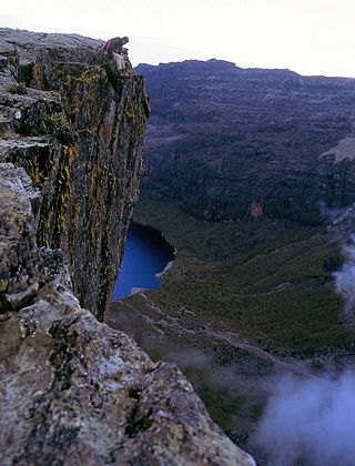
Nyahururu is a town in Kenya, lying north east of Nakuru. The town derives its name from the Maasai word e-naiwurruwurr, meaning waterfall and/or windy or place of storms. It is allegedly located in Laikipia County. Despite this, Nyahururu formerly functioned as the administrative capital of Nyandarua District, before it became a county, until the headquarters was shifted to Ol Kalou. There have been calls for a reversal. The town has an urban population of 36,450. The town still continues to be a central economic power of the immediate former district of Nyandarua. For that reason, the town has strong economic ties to the two counties.

<span class="mw-page-title-main">Nakuru County</span> County in Kenya

Nakuru County is a county in Kenya. It is county number 32 out of the 47 Kenyan counties. Nakuru County is a host to Kenya's Fourth City – Nakuru City. On 1 December 2021, President Uhuru Kenyatta awarded a City Charter status to Nakuru, ranking it with Nairobi, Mombasa, and Kisumu as the cities in Kenya. With a population of 2,162,202, it is the third most populous county in Kenya after Nairobi County and Kiambu County, in that order. With an area of 7,496.5 km2, it is Kenya's 19th largest county in size. Until 21 August 2010, it formed part of Rift Valley Province.

<span class="mw-page-title-main">Meru County</span> County in Kenya

Meru County is one of the 47 counties of Kenya. It borders Isiolo County to the north, Tharaka-Nithi County to the South, Nyeri County to the southwest and Laikipia County to the west. The home of the Meru people, Meru County has a population of 1.35 million people.

<span class="mw-page-title-main">Kericho County</span> County in Kenya

Kericho County is one of the 47 counties in Kenya. The county seats between longitude 35°02' and 35°40' East and between the equator and latitude 0°23' South with an altitude of about 2002m above sea level. It borders Uasin Gishu County to the North West, Baringo County to the North-East, Nandi County to the North-West, Nakuru County to the East and Bomet County to the South, Kisumu County to the Northwest and Nyamira County to the West. It has a population of 901,777 and an area of 2,111 km². Its capital and largest town is Kericho.

<span class="mw-page-title-main">Kakamega County</span> County in Kenya

Kakamega County is a county in the former Western Province of Kenya. It borders Vihiga County to the South, Siaya County to the West, Bungoma and Trans Nzoia counties to the North and Nandi and Uasin Gishu counties to the East. Its capital and largest town is Kakamega. The county has a population of 1,867,579 and an area of 3,033.8 km2.

<span class="mw-page-title-main">Lamu County</span> County in Kenya

Lamu County is a county in Kenya located along the North Coast of the country and is one of the six Coastal Counties in Kenya. Its capital is the town of Lamu. It borders Tana River County to the southwest, Garissa County to the north, Somalia to the northeast, and the Indian Ocean to the South.

<span class="mw-page-title-main">Kilifi County</span> Coastal county in Kenya

Kilifi County was formed in 2010 as a result of a merger of Kilifi District and Malindi District, Kenya. Its capital is Kilifi and its largest town is Malindi. Kilifi county is one of the five counties that make up the Kenyan Coast. The county has a population of 1,453,787 people following the 2019 census which covers an area of 12,245.90 km2 (4,728.17 sq mi).

<span class="mw-page-title-main">Marsabit County</span> County in Kenya

Marsabit County is a county in Kenya. Covering a surface area of 66,923.1 square kilometres. Marsabit is the second largest county by size in Kenya after Turkana county which has an area of 71,597.8 km2. Its capital is Marsabit and its largest town is Moyale. According to the 2019 census, the county has a population of 459,785. It is bordered to the North by Ethiopia, to the West by Turkana County to the South by Samburu County and Isiolo County, and to the East by Wajir County.

<span class="mw-page-title-main">Nyamira County</span> County in Kenya

Nyamira County is a county in the former Nyanza Province of Kenya. Formally a district, Nyamira was hived off Kisii District in 1989, and it shares common boundaries with what was known as Nyamira District. The main cash crops grown are bananas and tea. The county has a population of 605,576. Its capital and largest town is Nyamira, with an urban population of around 41,668 The county is also referred to as North Kisii.

<span class="mw-page-title-main">Nyandarua County</span> County in Kenya

Nyandarua County is a County in the former Central Province of Kenya with its capital and largest town being Ol Kalou. Formerly the capital was Nyahururu, which is now part of Laikipia County. Nyandarua County had a population of 596,268 by 2009 and 638,289 by 2019 and an area of 3,304 km2. The county is located on the northwestern part of the old Central Province, and contains the Aberdare Ranges.

<span class="mw-page-title-main">Makueni County</span> County in Kenya

Makueni County is a county in the former Eastern Province of Kenya. Its capital and largest town is Wote. The county has a population of 987,653. The county lies between Latitude 1° 35' and 2° 59' South and Longitude 37° 10' and 38° 30' East. It borders Machakos to the North, Kitui to the East, Taita Taveta to the South and Kajiado to the West and covers an area of 8,008.9 km2.

<span class="mw-page-title-main">Kitui County</span> County in Kenya

Kitui County is a county in the former Eastern Province of Kenya with its capital and largest town being Kitui, although Mwingi is also another major urban centre. The county has a population of 1,136,187. and an area of 30,496 km2. It lies between latitudes 0°10 South and 3°0 South and longitudes 37°50 East and 39°0 East.

<span class="mw-page-title-main">Garissa County</span> County in Kenya

Garissa County is an administrative county in Kenya. It is located in Eastern Kenya bordering Somalia to the East, Wajir County and Isiolo County to the North, Tana River County to the West and Lamu County to the South. Its capital and largest urban area is Garissa.

<span class="mw-page-title-main">Mandera County</span> County in Kenya

Mandera County is one of the counties in Kenya. Its capital and largest town is Mandera. The county is bordered by Ethiopia to the north, Somalia to the east and Wajir County to the southwest. According to the 2019 census, the county has a population of 1,200,890 and an area of 25,939.8 square kilometres (10,015.4 sq mi). The main economic activity in the county is pastoralism, while others include cross-border trade with Ethiopia, artisanal mining, beekeeping, and agriculture along the Dawa River.

Ndiritu Muriithi is a Kenyan politician and former Governor of Laikipia County. He was elected in the August 2017 general elections as an Independent Candidate after he failed to clinch the Jubilee Alliance Party nominations ticket. He was elected as the second governor of Laikipia County through an independent ticket

<span class="mw-page-title-main">Kisii County</span> County in Kenya

Kisii County is a county in the former Nyanza Province in southwestern Kenya. Its capital and largest town is Kisii. The county has a population of 1,266,860 people. It borders Nyamira County to the North East, Narok County to the South, and Homa bay and Migori Counties to the West. The county covers an area of 1,318 km2.

Rumuruti is a town in Laikipia County in Kenya's former Rift Valley Province. It is approximately 40 kilometers due north of Nyahururu, on the Nyahururu-Maralal road (A4). Despite being smaller than either Nanyuki or Nyahururu, which are on the Southeastern and Southwestern corners of Laikipia respectively, its central location meant that it was selected as the administrative headquarters of the new County government in 2013. In 2013 a local business launched a plan to build a 200 million Kenya shilling meat processing facility in the town.

Local elections were held in Laikipia County on 4 March 2013. Under the new constitution, which was passed in a 2010 referendum, the 2013 general election was to be the first where there would be election of county governors and their deputies for the 47 newly created counties. They were also the first general elections run by the Independent Electoral and Boundaries Commission(IEBC) which released the official list of candidates.

Joshua Wakahora Irungu is a Kenyan politician and community development specialist. He was appointed to the position of Chairperson of Water Services Regulatory Board (WASREB) in Feb 2019. He is the first and third governor of the County of Laikipia first serving from 2013 to 2017, representing the Jubilee Coalition party TNA and securing a return running on a UDA ticket in 2022.

John Nderitu is a Kenyan politician. He is the current senator for Laikipia County.

References

  1. "Kenya Census 2009 | PDF | Census | Waste Management".
  2. MUNYEKI, JAMES. "Laikipia county headquaters[sic] to be moved to Rumuruti". The Standard. Retrieved 28 May 2020.
  3. Laikipia County Integrated Development Plan CIDP 2018-2022. Laikipia County Government. 2018. p. 13.
  4. Laikipia, County Government of. "Living in Laikipia". County Government of Laikipia. Retrieved 28 May 2020.
  5. 2019 Kenya Population and House Census: Volume 1- Population by County and Sub-county. Kenya National Bureau of Statistics. 2019. pp. 17, 19, 20. ISBN   9789966102096.
  6. "2019 Kenya Population and Housing Census Volume IV: Distribution of Population by Socio-Economic Characteristics" (PDF). Kenya National Bureau of Statistics. Retrieved 2 May 2021.
  7. interior_admin. "Ministry of Interior and Coordination of National Government". interior.go.ke. Retrieved 29 May 2020.
  8. 1 2 "Publications". Kenya National Bureau of Statistics. Retrieved 29 May 2020.
  9. "The Report of the Interim Independent Boundaries Review Commission (IIBRC): Delimitation of Constituencies and Recommendations on Local Authority Electoral Units and Administrative Boundaries for Districts and Other Units" (PDF). IEBC. 2010. Retrieved 29 May 2020.
  10. "Governors & Deputy Governors". cog.go.ke. Archived from the original on 27 July 2020. Retrieved 29 May 2020.
  11. "Ndiritu Muriithi". Mzalendo. Retrieved 29 May 2020.
  12. "Members of the Senate | The Kenyan Parliament Website". parliament.go.ke. Retrieved 29 May 2020.
  13. "John Kinyua Nderitu". Mzalendo. Retrieved 29 May 2020.
  14. "179. County executive committees – Kenya Law Reform Commission (KLRC)". klrc.go.ke. Retrieved 29 May 2020.
  15. "Sara Paulata Korere". Mzalendo. Retrieved 30 May 2020.
  16. "Hon. Korere, Sarah Paulata | The Kenyan Parliament Website". parliament.go.ke. Retrieved 30 May 2020.
  17. Laikipia, County Government of. "Education & Social Development". County Government of Laikipia. Retrieved 29 May 2020.
  18. County Statistical Abstract Laikipia County 2015. Kenya National Bureau of Statistics. 2015. pp. 26, 27, 28, 29.
  19. "Second County Integrated Development Plan 2018-2022" (PDF). Laikipia County Government. 2018. Retrieved 29 May 2020.
  20. "Kenya HIV Estimates Report 2018" (PDF). National AIDS Control Council. 2018. Retrieved 29 May 2020.
  21. "Kenya Rural Roads Authority". kerra.go.ke. Retrieved 29 May 2020.
  22. "Kenya Urban Roads Authority". kura.go.ke. Retrieved 29 May 2020.
  23. KENYA: Administrative Division population statistics

0°5′N36°40′E / 0.083°N 36.667°E / 0.083; 36.667