Largest cities in the Americas

Last updated

This is a list of the 50 largest cities in the Americas by population residing within city limits as of 2015, the most recent year for which official population census results, estimates, or short-term projections are available for most of these cities. These figures do not reflect the population of the urban agglomeration or metropolitan area which typically do not coincide with the administrative boundaries of the city. For a list of the latter, see List of metropolitan areas in the Americas by population . These figures refer to mid-2015 populations with the following exceptions:

  1. Mexican cities, whose figures derive from the 2015 Intercensal Survey conducted by INEGI with a reference date of 15 March 2015; [1]
  2. Calgary, whose 2015 municipal census had a reference date of April 1. [2]
  3. Brazilian cities, whose figures originate from the 2021 estimate given by the IBGE, with a reference date of July 1, 2021. [3]
CityImageCountryPopulationYear
1 São Paulo Skyline of Sao Paulo at dusk (318298).jpg Flag of Brazil.svg  Brazil 12,396,372 [4] 2021
2 Mexico City Ciudad.de.Mexico.City.- Paseo.Reforma.Skyline CDMX 2016.jpg Flag of Mexico.svg Mexico 9,209,944 [lower-alpha 1] [5] [6] 2020 [lower-alpha 2]
3 New York City Luchtfoto van Lower Manhattan.jpg Flag of the United States (23px).png  United States 8,992,908 [7] 2022
4 Lima Lima, Peru Sunset Skyline & Cityscape.png Flag of Peru.svg  Peru 8,894,412 [lower-alpha 3] [8] 2015
5 Bogotá Centro internacional.JPG Flag of Colombia.svg  Colombia 7,862,277 [lower-alpha 4] [10] 2015
6 Rio de Janeiro Mirante Dona Marta para Pao de Acucar e Baia de Guanabara.JPG Flag of Brazil.svg  Brazil 6,775,561 [11] 2021
7 Santiago CostaneraCenter2016.jpg Flag of Chile.svg  Chile 5,507,282 [lower-alpha 5] [12] 2015
8 Los Angeles Los Angeles with Mount Baldy.jpg Flag of the United States (23px).png  United States 3,971,883 [7] 2015
9 Caracas Skyline Caracas.jpg Flag of Venezuela.svg  Venezuela 3,289,886 [lower-alpha 6] [13] 2015
10 Brasília Brasilia aerea setorbancariosul.jpg Flag of Brazil.svg  Brazil 3,094,325 [14] 2021
11 Buenos Aires Puerto Madero, Buenos Aires (40689219792).jpg Flag of Argentina.svg  Argentina 3,054,267 [15] 2015
12 Guatemala City Ciudad de Guatemala, CA.jpg Flag of Guatemala.svg  Guatemala 2,934,841 [16] 2020
13 Salvador Salvador BA (cropped).jpg Flag of Brazil.svg  Brazil 2,900,319 [17] 2021
14 Toronto Toronto Skyline 2015.JPG Flag of Canada (Pantone).svg Canada 2,826,498 [lower-alpha 7] [19] 2015
15 Chicago Chicago-00.jpg Flag of the United States (23px).png  United States 2,720,546 [7] 2015
16 Fortaleza Fortaleza, Brazil (4).jpg Flag of Brazil.svg  Brazil 2,703,391 [20] 2021
17 Guayaquil Guayas from Santa Ana.JPG Flag of Ecuador.svg  Ecuador 2,589,229 [21] 2015
18 Quito Quitopanoramica.jpg Flag of Ecuador.svg  Ecuador 2,551,721 [21] 2015
19 Belo Horizonte Panorama Mineirao Pampulha (cropped).jpg Flag of Brazil.svg  Brazil 2,530,701 [22] 2021
20 Medellín MEDELLIN - ATARDECER 2014 (15410162855).jpg Flag of Colombia.svg  Colombia 2,434,647 [lower-alpha 4] [10] 2015
21 Cali North downtown.JPG Flag of Colombia.svg  Colombia 2,333,203 [lower-alpha 4] [10] 2015
22 Houston Panoramic Houston skyline.jpg Flag of the United States (23px).png  United States 2,296,224 [7] 2015
23 Manaus Praia da Ponta Negra (Manaus).jpg Flag of Brazil.svg  Brazil 2,255,903 [23] 2021
24 Havana Bahia Habana Entrada.jpg Flag of Cuba.svg Cuba 2,117,625 [24] 2015
25 Curitiba Curitiba Trinario e densidade 77 02 2006.JPG Flag of Brazil.svg  Brazil 1,963,726 [25] 2021
26 Panama City Panama City financial district.jpg Flag of Panama.svg  Panama 1,938,000 [26] 2016
27 Tijuana TijuanaCulturalCenter.jpg Flag of Mexico.svg Mexico 1,922,5232020 [lower-alpha 2]
28 Montreal Montreal - QC - Skyline.jpg Flag of Canada (Pantone).svg Canada 1,753,034 [27] 2015
29 Ecatepec de Morelos Autopista Mexico Pachuca vista desde Lomas de San Carlos.JPG Flag of Mexico.svg Mexico 1,677,678 [lower-alpha 8] [5] [6] 2015 [lower-alpha 2]
30 Recife Praia do Pina - Recife, Pernambuco, Brasil.jpg Flag of Brazil.svg  Brazil 1,661,017 [28] 2021
31 Maracaibo Maracaibo bella vista.jpg Flag of Venezuela.svg  Venezuela 1,653,211 [13] 2015
32 Santa Cruz de la Sierra Santa cruz skyline 48.jpg Bandera de Bolivia (Estado).svg  Bolivia 1,614,224 [29] 2015
33 Phoenix Downtown Phoenix Aerial Looking Northeast.jpg Flag of the United States (23px).png  United States 1,644,409 [30] 2022
34 Philadelphia Philadelphia skyline from South Street Bridge January 2020.jpeg Flag of the United States (23px).png  United States 1,567,442 [7] 2015
35 Goiânia Parque Vaca Brava.jpg Flag of Brazil.svg  Brazil 1,555,626 [31] 2021
36 Belém Teatro da Paz em Belem visto de cima.jpg Flag of Brazil.svg  Brazil 1,506,420 [32] 2021
37 Porto Alegre Porto Alegre - Brazil Landscape-Night.jpg Flag of Brazil.svg  Brazil 1,492,530 [33] 2021
38 San Antonio Gfp-texas-san-antonio-skyscrapers-of-san-antonio.jpg Flag of the United States (23px).png  United States 1,469,845 [7] 2015
39 Guadalajara Skyline Guadalajara.jpg Flag of Mexico.svg Mexico 1,460,148 [lower-alpha 8] [5] [6] 2015 [lower-alpha 2]
40 Puebla Puebla- Hotel Radisson.jpg Flag of Mexico.svg Mexico 1,437,939 [lower-alpha 9] [34] 2015 [lower-alpha 2]
41 Córdoba Panorama del centro de Cordoba desde Parque de las naciones 2011-02-06.jpg Flag of Argentina.svg  Argentina 1,414,201 [35] 2015
42 Guarulhos Vista da cidade de Guarulhos (SP).JPG Flag of Brazil.svg  Brazil 1,404,694 [36] 2021
43 San Diego FA18CHornetOverSanDiegoNov08.jpg Flag of the United States (23px).png  United States 1,394,928 [7] 2015
44 Ciudad Juárez Juarez Cathedrale et mission 24-02-2007.jpg Flag of Mexico.svg Mexico 1,382,753 [lower-alpha 9] [34] 2015 [lower-alpha 2]
45 Montevideo Piscinas Trouville.jpg Flag of Uruguay.svg  Uruguay 1,379,560 [lower-alpha 10] [37] 2015
46 León Leon10 guanajuato.jpg Flag of Mexico.svg Mexico 1,349,224 [lower-alpha 9] [34] 2015 [lower-alpha 2]
47 Dallas Dallas Skyline - Eric Statzer.jpg Flag of the United States (23px).png  United States 1,300,092 [7] 2015
48 Calgary Calgary Skyline May 2018 (cropped).jpg Flag of Canada (Pantone).svg Canada 1,230,915 [2] 2015 [lower-alpha 11]
49 Campinas 250717 Fotos Centro de Campinas foto Carlos Bassan 004 (36029962481).jpg Flag of Brazil.svg  Brazil 1,223,237 [39] 2021
50 Barranquilla Barranquillaandriomagdalena.png Flag of Colombia.svg  Colombia 1,214,253 [lower-alpha 4] [10] 2015

Notes

  1. Population estimate is that of the federal entity known since 2016 as Ciudad de México and previously as the Distrito Federal. [1]
  2. 1 2 3 4 5 6 7 Population estimate has a reference date of March 15, 2015. [1]
  3. Population projection is that of Lima Province and not the Lima Metropolitan Area.
  4. 1 2 3 4 Population projections for Colombian cities are that of the cabecera municipal (municipal seat). [9]
  5. Population projection is that of Santiago Province.
  6. Population projection is that of the Metropolitan District of Caracas, which comprises the municipalities of Libertador, Chacao, Baruta, Sucre and El Hatillo.
  7. Population estimate is that of the Toronto census division, which consists solely of the City of Toronto. [18]
  8. 1 2 Population estimate is that of the entire municipio .
  9. 1 2 3 Population estimate is that of the cabecera municipal (municipal seat).
  10. Population projection is that of Montevideo Department.
  11. Population from municipal census based on a census date of 1 April 2015. [2] In April 2016 Calgary's annual municipal census reported a population of 1,235,171. [38]

Related Research Articles

<span class="mw-page-title-main">Camaná</span> Town in Arequipa, Peru

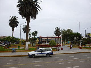
Camaná is the district capital of the homonymous province, located in the Department of Arequipa, Peru. In 2015, it had an estimate of 39,026 inhabitants.

<span class="mw-page-title-main">Sechura</span> Town in Piura, Peru

Sechura is a town in northwestern Peru, 50 km (31 mi) south of Piura. It is the capital of Sechura Province in the Piura Region. The city lends its name to the Sechura Desert, which extends south along most of coastal Peru. Crescent dunes lie south of the city, between the sea and the highway.

<span class="mw-page-title-main">Talara</span> City in Piura, Peru

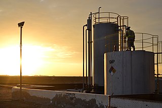
Talara is a city in the Talara Province of the Piura Region, in northwestern Peru. It is a port city on the Pacific Ocean with a population of 91,444 as of 2017. Its climate is hot and dry. Due to its oil reserves, and ability to produce aviation fuel, Talara hosted a United States air base during World War II. It was also one of two refueling stations for the Pacific Fleet. There were naval guns on the hills, and submarine nets in the harbor. The Ajax, Achilles and Exeter, three British destroyers, were refuelled there on their way around the Horn to catch the Graf Spee in Rio de la Plata. Talara is also home to a large fishing fleet. The city is served by the Cap. FAP Víctor Montes Arias Airport.

<span class="mw-page-title-main">Andahuaylas</span> Place in Apurímac, Peru

Andahuaylas, founded in 1533 as San Pedro de Andahuaylas «La Grande de la Corona», is a Peruvian city. It is the capital of the Andahuaylas Province in the Apurímac Region. It is known as the pradera de los celajes. Its approximate population of 42,268 inhabitants makes it the largest city in the region.

<span class="mw-page-title-main">Trujillo Province, Peru</span> Province in La Libertad, Peru

Trujillo Province is one of twelve provinces in La Libertad Region in Peru.

<span class="mw-page-title-main">Barranca, Lima</span> Place in Lima, Peru

Barranca is a city in coastal Peru, capital of the Barranca Province in the Department of Lima.

<span class="mw-page-title-main">Huanta</span> Town in Ayacucho, Peru

Huanta is a town in Central Peru, capital of the province Huanta in the region Ayacucho.

<span class="mw-page-title-main">Ilave</span> Town in Puno, Peru

Ilave, also known as Illawi, is the capital city of the Ilave District in El Collao Province, in the Puno Region of Peru. According to the projection of the 2012 census, it has 57,366 inhabitants. It is located on the Ilave River and west from Lake Titicaca.

<span class="mw-page-title-main">Arequipa metropolitan area</span> Place in Peru

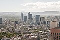
The Arequipa Metropolitan Area is the name used to refer to the metropolitan area whose principal city is Arequipa, according to Metropolitan Development Plan of Arequipa According to population statistics of INEI It is the second most populous metropolitan area of Peru in year 2017.

<span class="mw-page-title-main">Iquitos metropolitan area</span> Place in Peru

The Iquitos Metropolitan Area is the name used to refer to the Peruvian metropolitan area whose principal city is Iquitos, according to Municipality of Iquitos. According to population statistics of INEI It is the sixth most populous metropolitan area of Peru in year 2015.

References

  1. 1 2 3 "Encuesta Intercensal 2015: Presentación de resultados" (PDF). INEGI. p. 5. Retrieved 2016-11-08.
  2. 1 2 3 2015 Municipal Affairs Population List (PDF). Alberta Municipal Affairs. ISBN   978-1-4601-2630-1 . Retrieved 2016-07-17.
  3. "Estimates on population explanation" (in Portuguese). 2021-09-23.
  4. "IBGE – São Paulo, SP" (in Portuguese). 2021-09-23.
  5. 1 2 3 "Información de México para niños-Ciudad de Méxcico-Número de Habitantes". INEGI. 2024-05-26. Archived from the original on 2024-01-13. Retrieved 2024-05-26.
  6. 1 2 3 Brinkhoff, Thomas. "Mexico: Administrative Division". City Population. Retrieved 2016-11-08.
  7. 1 2 3 4 5 6 7 8 "Annual Estimates of the Resident Population for Incorporated Places of 50,000 or More, Ranked by July 1, 2015 Population: April 1, 2010 to July 1, 2015". United States Census Bureau, Population Division. May 2016. Archived from the original on 2020-02-13. Retrieved 2016-05-19.
  8. "Cuadro Nº 11. Perú: Población total al 30 de junio, por grupos quinquenales de edad, según departamento y provincia, 2015". Perú: Estimaciones y Proyecciones de Población total y edades quinquenales, según Departamento, Provincia y Distrito, 2005–2015. INEI. November 2010. Retrieved 2016-04-23.
  9. "Conceptos básicos" (PDF). DANE. 2011-05-12. Retrieved 2015-06-11.
  10. 1 2 3 4 "ESTIMACIONES DE POBLACIÓN 1985 – 2005 Y PROYECCIONES DE POBLACIÓN 2005 – 2020 TOTAL MUNICIPAL POR ÁREA". DANE. 2011-05-12. Retrieved 2016-04-23.
  11. "IBGE – Rio de Janeiro, RJ" (in Portuguese). 2021-09-23.
  12. "Comunas: Actualización Población 2002-2012 y Proyecciones 2013-2020". Instituto Nacional de Estadísticas . Retrieved 2016-04-23.
  13. 1 2 "Proyección de la población al 30 de junio con base al censo 2011, según entidad federal y municipios, 2000-2050". Instituto Nacional de Estadística. Retrieved 2016-04-23.
  14. "IBGE – Brasilia, DF" (in Portuguese). 2021-09-23.
  15. "Población estimada al 1 de julio de cada año calendario por sexo, según comuna. Ciudad Autónoma de Buenos Aires. Años 2010-2025". INDEC. Archived from the original on 2015-06-12. Retrieved 2016-04-23.
  16. Guatemala: Estimaciones de la Población total. Año 2020.
  17. "IBGE – Salvador, BA" (in Portuguese). 2021-09-23.
  18. "Standard Geographical Classification (SGC) 2006: Economic Regions (3520 – Toronto, census subdivisions)". Statistics Canada. 2014-04-01. Archived from the original on 2015-05-30. Retrieved 2015-06-11.
  19. "Table 3.5: Population and demographic factors of growth by census division, provinces and territories". Statistics Canada. 2016-02-10. Retrieved 2016-04-24.
  20. "IBGE – Fortaleza, CE" (in Portuguese). 2021-09-23.
  21. 1 2 "Proyección de la Población Ecuatoriana, por años calenario, según cantones 2010-2020". Instituto Nacional de Estadística y Censos. Retrieved 2016-04-23.
  22. "IBGE – Belo Horizonte, MG" (in Portuguese). 2021-09-23.
  23. "IBGE – Manaus, AM" (in Portuguese). 2021-09-23.
  24. "3. Población Proyectada al 30 de junio, por edades simples y años simples. AMBOS SEXOS. Período 2015 – 2050" (PDF). Proyecciones de la Población de Cuba 2015 – 2050. Oficina Nacional de Estadísticas. Retrieved 2016-04-24.
  25. "IBGE – Curitiba, PR" (in Portuguese). 2021-09-23.
  26. "Cuadro 11. Superficie, población y densidad de población en la República, según Provincia, Comarca indígena, Distrito y Corregimiento: Censos de 1990, 2000 y 2010". Instituto Nacional de Estadística y Censo, Contraloría General de la República de Panamá. Archived from the original on 26 March 2016. Retrieved 2 July 2023.
  27. Population des municipalités du Québec, décret 2016 (Report). Institut de la statistique du Québec. 2015-12-30. Retrieved 2016-04-24.
  28. "IBGE – Recife, PE" (in Portuguese). 2021-09-23.
  29. "CUADRO Nº 3. BOLIVIA: PROYECCIONES DE POBLACIÓN, SEGÚN DEPARTAMENTO Y MUNICIPIO, 2012–2020". PROYECCIONES DE POBLACIÓN E INDICADORES DEMOGRÁFICOS, POR AÑOS CALENDARIO, 2012-2020. INE. 2014. Archived from the original on 2016-10-09. Retrieved 2016-04-25.
  30. "U.S. Census Bureau QuickFacts: Phoenix city, Arizona". census.gov. Retrieved 2023-06-15.
  31. "IBGE – Goiânia, GO" (in Portuguese). 2021-09-23.
  32. "IBGE – Belém, PA" (in Portuguese). 2021-09-23.
  33. "IBGE – Porto Alegre, RS" (in Portuguese). 2021-09-23.
  34. 1 2 3 "Mexico: Main cities". GeoHive. Archived from the original on 2016-10-28. Retrieved 2016-12-15.
  35. "Población estimada al 1 de julio de cada año calendario por sexo, según departamento. Provincia de Córdoba. Años 2010-2025". INDEC. Archived from the original on 2015-09-24. Retrieved 2016-04-23.
  36. "IBGE – Guarulhos, SP" (in Portuguese). 2021-09-23.
  37. "Poblaciones Estimadas y Proyectadas por Sexo y Edad según Departamentos: Período 1996-2025". Instituto Nacional de Estadística. Retrieved 2016-04-23.
  38. "2016 Civic Census Results" (PDF). City of Calgary. Retrieved 2016-08-06.
  39. "IBGE – Campinas, SP" (in Portuguese). 2021-09-23.