The Lee Navigation is named by Acts of Parliament and is so marked on Ordnance Survey maps. Constructed elements and human features are spelled Lee, such as the canal system and Lee Valley Park. The un-canalized river is spelled Lea, along with other natural features such as Lower Lea Valley.
History
The River Lea is a major tributary of the River Thames. It has a long association with navigation, as the marshes of Walthamstow have produced a dugout canoe from the Bronze Age and parts of a Saxon barge. According to the Anglo-Saxon Chronicle, the river was used by Viking raiders, and King Alfred changed the level of the river to strand Guthrum and his fleet.[1] In more peaceful times, it became important for the transport of grain from Hertfordshire, but navigation of its southernmost tidal reaches of Bow Creek were difficult due to its tortuous meanders.
The chancellor of England may grant his commission to certain persons to scour, and amend the river Ley in the counties of Essex, Hertford, and Middlesex.
There is documentary evidence that the river was altered by the Abbot of Waltham to improve navigation in 1190, and in 1221, a pipe was laid across the river, which had to be protected from "the oars or poles of the watermen."[2] The first Act of Parliament for improvement of the river was granted in 1425 (3 Hen. 6. c. 5),[3] this also being the first Act granted for navigational improvement in England. A second Act was passed in 1430 (9 Hen. 6. c. 9), and both authorised local landowners to act as commissioners, who could make improvements to the river including scouring or dredging, and could recoup the cost of the work by levying tolls.[2]
By 1571, the river was an important route for the carriage of grain to London, and the City of London obtained another act, the River Lee Navigation Act 1571 (13 Eliz. 1. c. 18) to authorise improvements. This included making new cuts, and creating towpaths on both sides of the river. Shoals were removed, and a cut, probably the section which is now called Bow River from Old Ford Locks to Bow Locks, was excavated, which was not subject to any tolls. The plan for a branch from the river to the north of London was not implemented.[4] One innovation was the construction of a pound lock at Waltham Abbey, Essex, in 1577. This had mitred gates at each end,[5] and was probably the second lock to be built in England, although it was the first to be built on a river. It inspired Vallens to write a poem entitled "A tale of Two Swannes" about it in 1590. It was 70 by 24 feet (21.3 by 7.3m), with wooden sides.[6] The remainder of the control of levels was carried out by "staunches" or "turnpikes", consisting of a single vertically lifting gate in a weir, through which boats were pulled against the current.
The New River was an attempt to supply clean water from near Ware to the citizens of London, which was completed in 1633. However, the springs at Great Amwell soon proved to be inadequate, and water was drawn from the Lea. The increased extraction of water had a detrimental effect on milling and navigation, and by the early 1700s it had become clear that major work would be needed to produce a solution.[7]
Smeaton's design
A petition was presented to Parliament resulting in a further Act of 1739.[3] While recognising the right of the New River Company to extract water, it also enshrined the rights of the millers and bargemen. To resolve a problem where the New River works had blocked the Manifold Ditch, and boats had been forced to use the mill stream to Ware Mill, the mill was bought by the company, and the associated lock became an official right of way. The previous administration by commissioners was replaced by a body of trustees, which it was hoped would be better able to manage the navigation. Although at least two flash locks were built, including one to assist passage past the mill at Broxbourne, there was still friction between the bargemen and the millers, since the use of a flash lock tended to lower the water level above it, to the detriment of the mill. In 1765, the trustees therefore asked John Smeaton to assess the navigation and make recommendations for its improvement.[8]
Smeaton made a survey of the river and produced a report in 1766, in which he recorded that there were 18 staunches at the time, with a lock at Ware and tidal gates at Bow. He recommended that the staunches should be replaced by pound locks, and that several new cuts should be made. These recommendations formed the basis for a Parliamentary bill, which was opposed by the owners of the Shoreditch to Enfield turnpike road, the West Ham waterworks and the Waltham Abbey Royal Gunpowder Mills, who were all concerned that their rights would be affected. However, the trustees were granted an Act on 29 June 1767 and appointed Thomas Yeoman to oversee the work at their first meeting held two days later.[9]
The Act authorised the construction of several new stretches of canal, including the Edmonton Cut from Flanders Weir at Chingford to the mill stream at Walthamstow, the Hackney Cut from Lea Bridge to Old Ford, and the Limehouse Cut to bypass the tight bends of Bow Creek near the River Thames. Yeoman was also responsible for setting out towing paths, designing 35 roving bridges, and construction of lock gates. For the Limehouse Cut, Yeoman proposed a cut from Bow tidal gates to Dingley's Wharf at Limehouse, which would shorten the distance to London considerably, since it would avoid the long passage around the Isle of Dogs. Mr Dingley, owner of the wharf and a trustee, was awarded part of the contract, and the cut was expected to open on 2 July 1770, but some brickwork failed and had to be repaired. A bridge collapsed in December, but traffic soon developed, and the cut had to be widened to allow barges to pass one another along its entire length. The widening was completed on 1 September 1777.[10]
The trustees decided to finance the work with a loan, and advertisements appeared in the London Gazette and other newspapers, indicating that they wished to raise £35,000. The response was huge, with £161,500 being offered, and subscribers were chosen by ballot. Yeoman was overworked, and Edward Rubie was appointed to assist him in February 1769. New cuts and pound locks were opened at Waltham Abbey, Edmonton and Hackney in 1769. In total, 11 miles (18km) of new cuts were constructed, with 12 new locks. Some on the locks, such as Homerton Lock and Pickett's Lock, were built on new sections, while others, such as Stanstead Lock, replaced an existing flash-lock. The works were completed to a tight schedule, and with most of it finished, Yeoman resigned in July 1771, although the reasons for his resignation were not recorded.[11]
Development
There were further improvements throughout the 19th century, including an Act in 1850 to authorise new lock cuts at Hoddesdon, Carthagena Lock (Broxbourne), Waltham Marsh, Tottenham, Walthamstow, Hackney, Leyton and Bromley-by-Bow and new locks at Hunter's Gate (Bow Bridge) and Old Ford. The River Lee Water Act of 1855 authorised a new lock at Amwell Marsh and the removal of Stanstead Lock. Edmonton Lock was to be removed and Pickett's Lock rebuilt. In 1868 the Lee Conservancy Board was formed to take over control of the river from the former trustees. They established the Lee Conservancy Police, who policed the Lee until merged with the British Transport Police in 1948.[12]
The Lee Navigation bought the Stort Navigation in 1911,[5] and instituted further improvements, including reconstruction of the locks between Enfield and Hertford, the width being increased from 13 to 16 feet (4.0 to 4.9m): by the 1930s, 130-ton barges could reach Enfield, and 100-ton barges to Ware and Hertford.[5]
During the 1950s horse-drawn lighters were still journeying as far as Hertford. By 1980 commercial traffic extended no higher than the Enfield Rolling Mills at Brimsdown, with just one tug, the Vassal, regularly at work on the river. Powered by a 120hpGardner diesel engine, she would typically tow a train of two lighters loaded with timber from Bow to Hahn's Wharf at Edmonton. There are efforts currently underway to revive commercial traffic on the canal with a plan to transport rubbish for incineration at the Edmonton Incinerator.[13]
Governance
With the passing of the Land Drainage Act 1930, the Lee Conservancy area was treated as a special case, with details laid out in section 80 of that act. The Lee Conservancy Catchment Board was created, which inherited some of the powers conferred by the Lee Conservancy Acts, dating from 1870 to 1921, and gave it additional powers in common with other Catchment Boards, the most important of which was that they could levy rates on county councils and county borough councils throughout their catchment area, to fund drainage works.[14] The members of the Catchment Board consisted of all the members of the Lee Conservancy Board, together with six additional members.[15] The Board were given additional powers, enabling them to hold land without a licence in mortmain, as a result of the Lee Conservancy Catchment Board Act 1936. Further change occurred on 1 January 1948, as a result of the Transport Act 1947. Some of the functions of the Conservancy Board were taken over by the British Transport Commission, when most of the operational canals and waterways were nationalised, and the board was then disbanded. However, where the board had responsibilities for water supply, fisheries, the control of pollution and land drainage, these functions were transferred to the Lee Conservancy Catchment Board. This was authorised by the Lee Conservancy Catchment Board (Additional Functions) Regulations 1947.[16]
The River Boards Act 1948 saw the formation of river boards to replace catchment boards throughout England and Wales, but the Lee Conservancy Catchment Board, together with the Thames Conservancy Catchment Board, were excluded from this.[17] River boards were replaced by river authorities as a result of the Water Resources Act 1963, but again the Lee Conservancy was treated as a special case. It made provision that the responsibilities for water conservation outlined in that Act could be given to the Lee Conservancy Catchment Board by the joint decision of the Minister of Housing and Local Government, the Minister of Agriculture, Fisheries and Food, and the Minister of Transport. Those provisions, somewhat modified for the special circumstances of the catchment area, were conferred by the Lee Conservancy Catchment Board (New Functions of River Authorities) Order 1965.[16]
The transport functions of the waterway were transferred to the British Waterways Board, subsequently known as British Waterways, from 1 January 1963, as part of the breakup of the British Transport Commission authorised by the Transport Act 1962. These functions are now managed by the Canal and River Trust, a charitable organisation that took over the role of British Waterways from 2 July 2012. There have been three further changes in the environmental management of the waterway. The Water Act 1973 abolished river authorities, and created ten regional water authorities. The Lee Conservancy was no longer a special case, and became part of the Thames Water Authority. This structure lasted until the passing of the Water Act 1989, which split the water authorities apart, privatising the water supply, sewerage and sewage disposal functions, and transferring the environmental management of river systems including the Lee to the National Rivers Authority. The final change was a result of the Environment Act 1995, which abolished the National Rivers Authority and replaced it by the Environment Agency.[15]
Wisdom, A S (1966). Land Drainage. London: Sweet & Maxwell.
Related Research Articles
The River Great Ouse is a river in England, the longest of several British rivers called "Ouse". From Syresham in Northamptonshire, the Great Ouse flows through Buckinghamshire, Bedfordshire, Cambridgeshire and Norfolk to drain into the Wash and the North Sea near Kings Lynn. Authorities disagree both on the river's source and its length with one quoting 160 mi (260 km) and another 143 mi (230 km). Mostly flowing north and east, it is the fifth longest river in the United Kingdom. The Great Ouse has been historically important for commercial navigation, and for draining the low-lying region through which it flows; its best-known tributary is the Cam, which runs through Cambridge. Its lower course passes through drained wetlands and fens and has been extensively modified, or channelised, to relieve flooding and provide a better route for barge traffic. The unmodified river would have changed course regularly after floods.
The River Gipping is the source river for the River Orwell in the county of Suffolk in East Anglia, England, which is named from the village of Gipping, and which gave its name to the former Gipping Rural District. It rises near Mendlesham Green and flows in a south-westerly direction to reach Stowmarket. From there it flows towards the south or south east, passing through Needham Market then Baylham. The river continues to flow south between Great Blakenham and Claydon, and through Bramford and Sproughton until it flows into Ipswich, where it becomes the Orwell at Stoke Bridge. The river has supplied power to a number of watermills, several of which are still standing. None are operational, although the mill at Baylham retains most of its machinery, and is the only complete mill on the river.
The Chelmer and Blackwater Navigation is the canalisation of the Rivers Chelmer and Blackwater in Essex, in the east of England. The navigation runs for 13.75 miles (22.13 km) from Springfield Basin in Chelmsford to the sea lock at Heybridge Basin near Maldon. Initial plans faced spirited opposition from Maldon, which were overcome by avoiding the town and terminating at Heybridge, and the navigation opened in 1797. There were some teething problems, and the engineer John Rennie was called back on two occasions to recommend improvements. The impact of the railways was less severe than on many canals, as there was never a direct line between Chelmsford and Maldon. The sea lock at Heybridge was enlarged after the Second World War, but trade gradually declined and ceased in 1972.
The River Lea is in the East of England and Greater London. It originates in Bedfordshire, in the Chiltern Hills, and flows southeast through Hertfordshire, along the Essex border and into Greater London, to meet the River Thames at Bow Creek. It is one of the largest rivers in London and the easternmost major tributary of the Thames.
The Limehouse Cut is a largely straight, broad canal in the East End of London which links the lower reaches of the Lee Navigation to the River Thames. Opening on 17 September 1770, and widened for two-way traffic by 1777, it is the oldest canal in the London area. Although short, it has a diverse social and industrial history. Formerly discharging directly into the Thames, since 1968 it has done so indirectly by a connection through Limehouse Basin.
The Hertford Union Canal or Duckett's Cut, just over 1 mile (1.6 km) long, connects the Regent's Canal to the Lee Navigation in the London Borough of Tower Hamlets in East London. It was opened in 1830 but quickly proved to be a commercial failure. It was acquired by the Regents Canal Company in 1857, and became part of the Grand Union Canal in 1927.
Bow Creek is a 2.25-mile (3.6 km) long tidal estuary of the English River Lea and is part of the Bow Back Rivers. Below Bow Locks the creek forms the boundary between the London Boroughs of Newham and Tower Hamlets, in East London.
Bow Back Rivers or Stratford Back Rivers is a complex of waterways between Bow and Stratford in east London, England, which connect the River Lea to the River Thames. Starting in the twelfth century, works were carried out to drain Stratford Marshes and several of the waterways were constructed to power watermills. Bow Creek provided the final outfall to the Thames, and the other channels were called Abbey Creek, Channelsea River, City Mill River, Prescott Channel, Pudding Mill River, Saint Thomas Creek, Three Mills Back River, Three Mills Wall River and Waterworks River.
The Stort Navigation is the canalised section of the River Stort running 22 kilometres (14 mi) from the town of Bishop's Stortford, Hertfordshire, downstream to its confluence with the Lee Navigation at Feildes Weir near Rye House, Hoddesdon, Hertfordshire.
City Mill River is part of the Bow Back Rivers in London, England. It formerly fed City Mill, used for the production of chemicals in the late nineteenth and early twentieth centuries. In the 1930s, the mill was removed and the river was isolated from the tides by the construction of locks at both ends. City Mill Lock, at the southern end, has been refurbished and reopened in 2010.
The Prescott Channel was built in 1930–35 as part of a flood relief scheme for the River Lee Navigation in the East End of London, England, and was named after Sir William Prescott, the then chairman of the Lee Conservancy Board. Rubble from the demolished Euston Arch was used in 1962 to improve the channel, which forms part of the Bow Back Rivers.
Stamford Canal, now disused, is one of the earliest post-Roman canals in England. It opened in 1670, around 100 years before the start of the Industrial Revolution which brought about the "golden age" for canals in Britain. Parts of the route can be traced on the ground, though only one lock survives intact. It was part of the Welland Navigation in Lincolnshire. First authorised in 1571, during the reign of Elizabeth I, construction did not start until 1664, under powers granted in 1620 and ratified by James I. It ran for 9.5 miles (15.3 km) from Stamford to Market Deeping and had 12 locks, two of which were on the river section at Deeping St James. No plans of its construction survive, although one of the locks was documented by a visiting water engineer in 1699. It contributed to the wealth of Stamford, allowing barley to be transported to the town for malting.
Bow Locks No. 20 is a set of bi-directional locks in Bromley-by-Bow in the London Borough of Tower Hamlets and Newham. The locks link the tidal Bow Creek to the River Lee Navigation, which is a canalised river. These locks were first built in 1850 and then rebuilt in 1930, at the same time as the Prescott Channel was cut nearby. At high tide, the tide from Bow Creek formerly flowed through Bow Locks, to raise the level of the canals, such as the Limehouse Cut. In 2000, these locks were modified to keep the tide out, to reduce silting in the canal system.
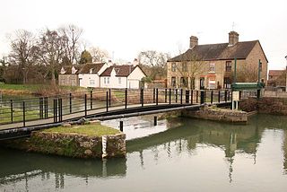
Old Ford Lock is a paired lock and weir on the River Lee Navigation, in the London Borough of Tower Hamlets, England. It is at Fish Island in Old Ford and takes its name from the natural ford which used to cross the River Lea.
The Sleaford Navigation was a 12.5-mile (20.1 km) canalisation of the River Slea in Lincolnshire, England, which opened in 1794. It ran from a junction with the River Witham, near Chapel Hill to the town of Sleaford through seven locks, most of which were adjacent to mills. Lack of finance meant that it stopped short of its intended terminus, but it gradually grew to be successful financially. The coming of the railways in 1857 led to a rapid decline, and it was officially abandoned by an act of Parliament in 1878, but remained open for a further three years. The lower part of it remained navigable until the 1940s, when it was blocked by a sluice.
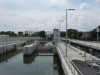
Three Mills Lock, also known as Prescott Lock, is a lock on the Prescott Channel on the River Lea in London. The current structure was constructed by British Waterways and officially opened on 5 June 2009.
Three Mills Wall River Weir is a weir on the Bow Back Rivers, in Mill Meads in the London Borough of Newham, England, near to Three Mills. It was built in 2009, when the Bow Back Rivers were refurbished to make them a key feature of the Queen Elizabeth Olympic Park, and maintains water levels through much of the park in conjunction with the Three Mills Lock and sluice on the Prescott Channel.
The Hackney Cut is an artificial channel of the Lee Navigation built in England in 1769 by the River Lea Trustees to straighten and improve the Navigation. It begins at the Middlesex Filter Beds Weir, below Lea Bridge, and is situated in the (modern) London Borough of Hackney. When built it contained two pound locks and a half-lock, but was rebuilt to handle larger barges in the 1850s, and now only Old Ford Lock, which is actually a duplicated pair, remains.
Carpenter's Road Lock is a rising radial lock in the London Borough of Newham, near Marshgate Lane in Stratford, England. It is located on the Bow Back Rivers and was constructed in 1933/34. It is the only lock in Britain with rising radial gates at both ends. British Waterways were hoping to restore it as part of the upgrade to Bow Back Rivers which took place for the 2012 Summer Olympics, but the gantries which enabled the gates to be raised were demolished to accommodate a wide bridge giving access to the main stadium. After the Games, most of the overbridge was removed. Funding for the restoration of the lock was in place by early 2016, and it is expected to be brought back into use in 2017.
The Lee Conservancy Police was the name given to a body of constables who policed the Lee Navigation, and were maintained by the Lee Conservancy Board, from at least 1871 until the canal system was nationalised in 1948, when they became part of the British Transport Police.
↑ Major, Graham (29 July 2013). "Canal Policing after 1948". Website of the British Transport Police History Group. British Transport Police History Group. Retrieved 26 April 2014.
Notes: 1 Contains canalised river. 2 Partly or mostly navigable, and/or under restoration. 3 A system of canals. Canals which form part of this system are not listed here individually.
This page is based on this Wikipedia article Text is available under the CC BY-SA 4.0 license; additional terms may apply. Images, videos and audio are available under their respective licenses.